

TRIP DETAILS
TRAIL MAP
OVERVIEW
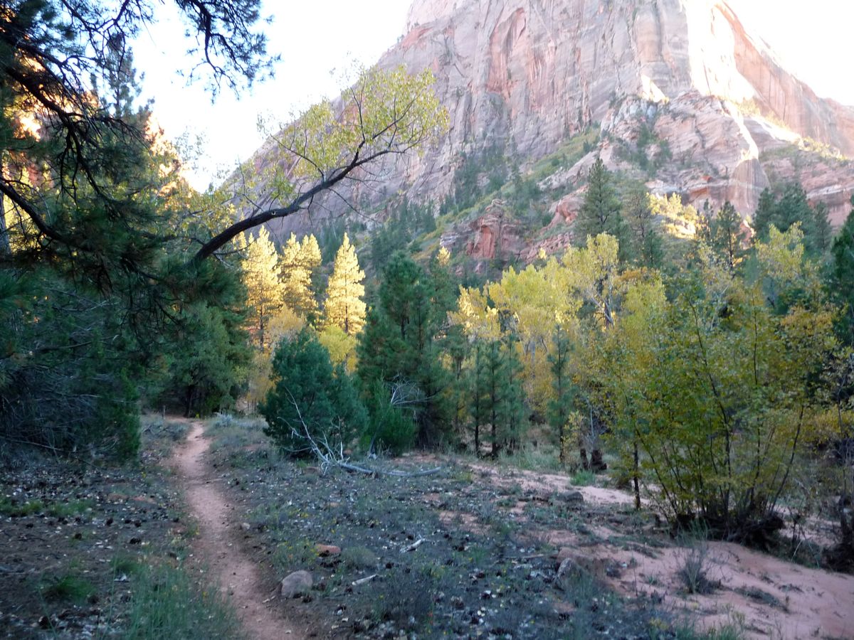
This is the perfect trip to do if you are looking for a nice, mellow time hanging out with your buddies. Just a few miles from the trailhead without any big ups or downs and you'll be in some prime territory for setting up camp. And the greatest part of all is that almost all of the campsites in the La Verkin Creek area are right next to a beautifully clean and nicely flowing body of water, which is a rarity in the Zion backcountry. Most of the campsites provide great access for day hikes to Hop Valley, Bear Trap Canyon, and the Kolob Arch as well.
I should also mention that we could have not picked a more perfect time of year to do this trip. The nighttime and morning temperatures were a bit cool, but the variation in color from tree to tree was so spectacular that it more than made up for it. If you are just getting into backpacking, remember to bring appropriate clothing. One of the guys in our party decided not to bring a jacket, gloves, hat, or change of socks and he was constantly shivering and asking to borrow our gear. So please learn from his mistake.
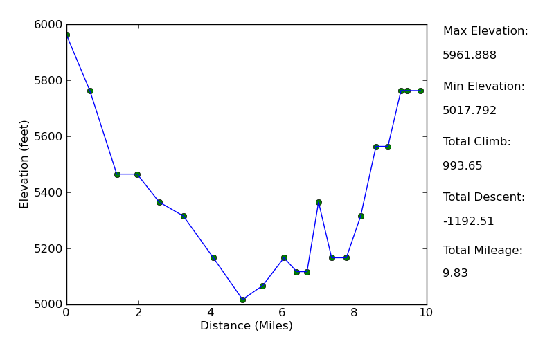
Elevation Profile (One Way)
TRIP LOG
This trip was actually the prelude to my bachelor party. I had hiked The Narrows by myself the year before, and when I was standing in the Virgin River staring at the towering canyon walls surrounding me, all I could think about was how I wanted all my friends to see the same thing. So The Narrows is the destination we chose for the bachelor party. And since everyone was traveling long distances from California and Illinois to get to Zion, some of us decided we'd rather extend the trip with a short backpacking excursion to start it out.
I had originally wanted to do a challenging trip through Dixie National Forest or Bryce, but as the trip approached I could tell that the attitude of the three guys I was going with was geared more toward finding a nice campsite to eat and drink. So the first place that popped into my head was La Verkin Creek. It was the biggest highlight of the Trans-Zion Trek I had done the year before. With nice, isolated campsites, close proximity to a trailhead, and easy terrain, I figured it would be the perfect spot for us to hold up and enjoy the beauty of Zion.
Everyone chose to fly into Las Vegas. Brad, Eric, and Jason flew in the day before so they could do a little gambling. They managed to get a few hours of sleep before picking me up early in the morning at the airport, which was absolutely dead, surprisingly. After a quick stop at McDonalds for some breakfast, we were off on our way North to Utah. It took about 2.5 hours to make it to the Kolob Canyon Ranger Station, where we had to pick up our permit. I had reserved campsite #4 since it was the only one that was open for our nights. But I knew that there were better ones from my earlier trip and the NPS description, and luckily we were able to get #9, a first-come first-serve site. This ended up being the perfect site for us.
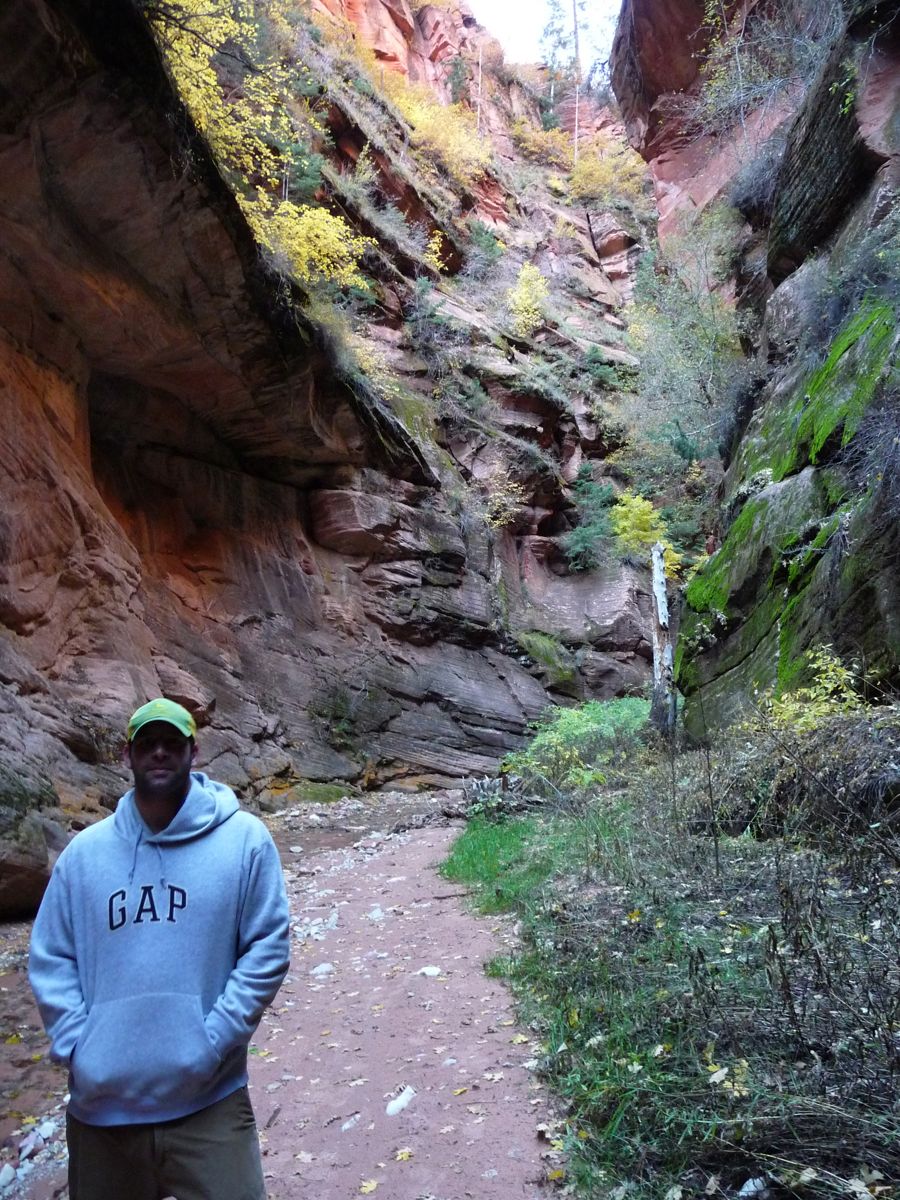
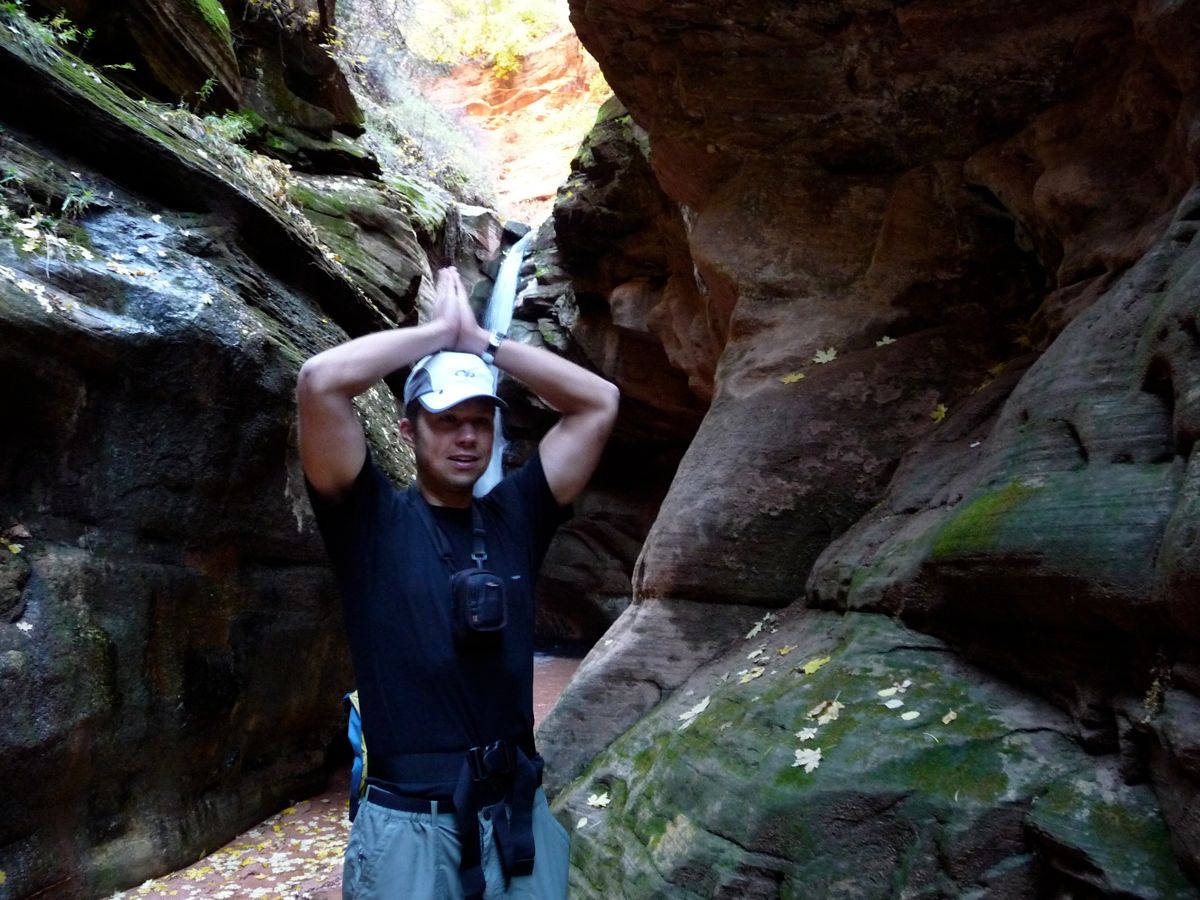
We made it to the Lee Pass Trailhead around noon, where the first order of business was to take the obligatory

pre-trip photo. The trail starts off with a downhill slope and
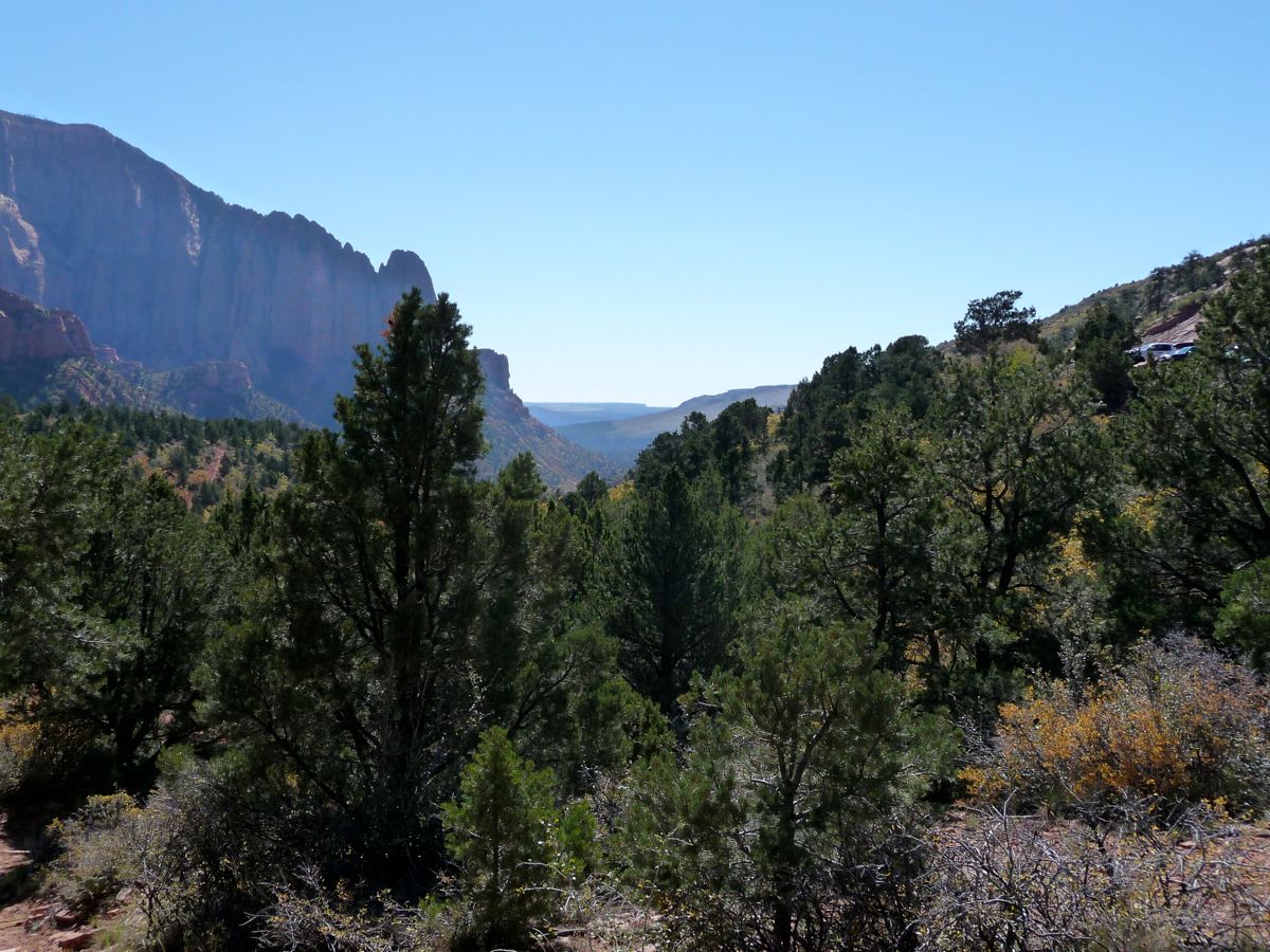
lovely views to the south. Everyone was feeling pretty peppy at this point, despite the lack of sleep and strong partying that had been done in Vegas the night before. We had been a little concerned that we would miss the fall colors coming this late, but all our concerns were ill-founded. They were
phenomenal.
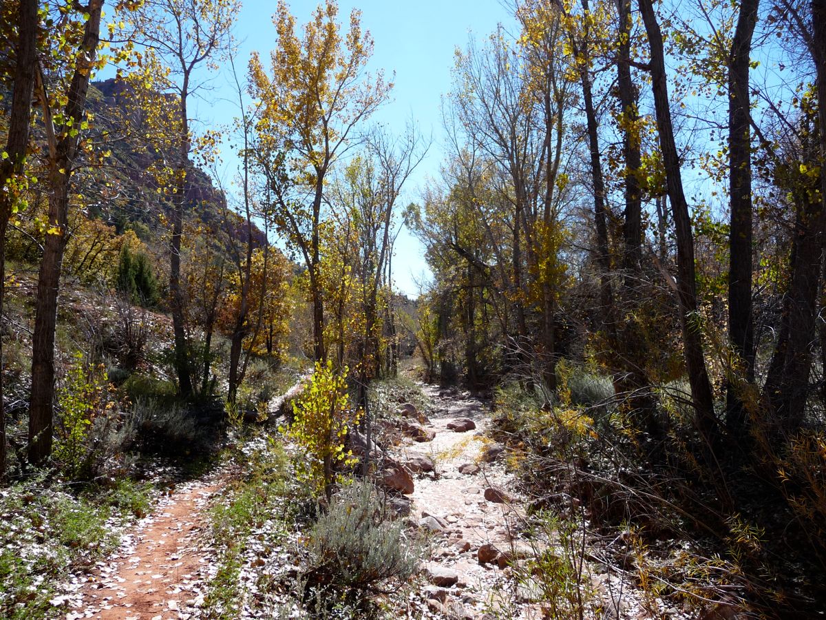
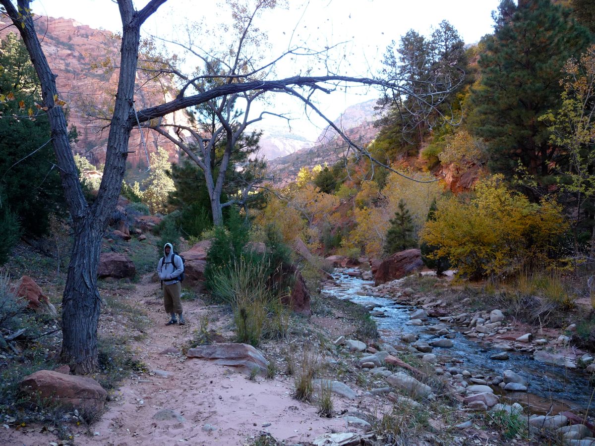
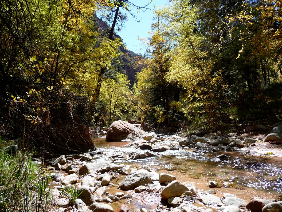
Over the next two hours, we probably took a good four or five breaks to eat. It was slow going, but there was no need to rush with all of the brilliant reds and yellows greeting us at every bend. At about the 3 mile mark, we arrived at the beautiful
waters of La Verkin Creek. We took yet another break to enjoy the serenity offered by the clear water. There was a pool not far from where we were posted up that looked like it would be good for a nice dip, but nobody bit when I offered money to jump in. Just a little too cold for that.
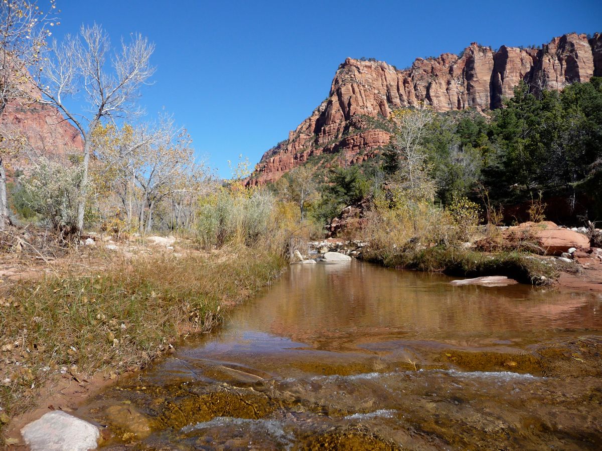
The journey from our first intersection with the river to campsite 9 was similarly slow, but again, the
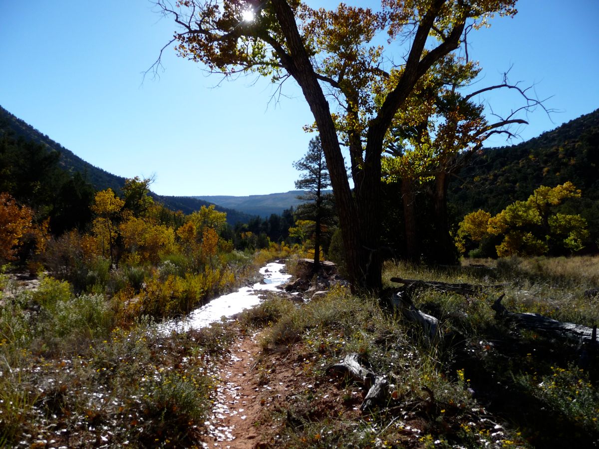
colors were just too gorgeous to let pass by unnoticed. The trail along this section is very easy to follow and there is almost no elevation gain, but there are parts composed almost entirely of sand, so it's difficult to walk fast even if you're in a hurry.
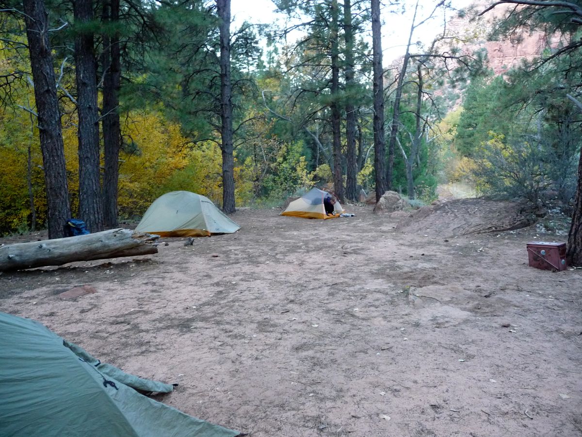
At about 4 o'clock, we came to the sign for campsite 9. The river crossing to get there is not trivial. Of course, it's not that big of a deal since there is virtually no current and the worst that could happen is a pair of wet socks. But with 50 degree temperatures, we didn't want to have that happen. I mean, the bachelor shouldn't have cold feet, right? We set up our tents in the lovely confines of
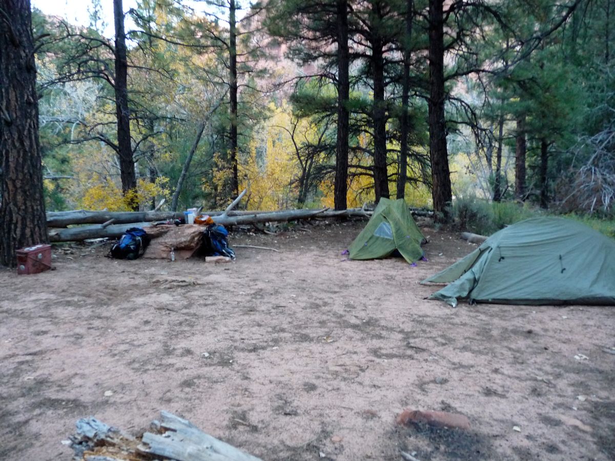
campsite 9, and within minutes Brad was eating again. I can't say I've ever backpacked with someone that goes through rations so fast. It was quite entertaining.
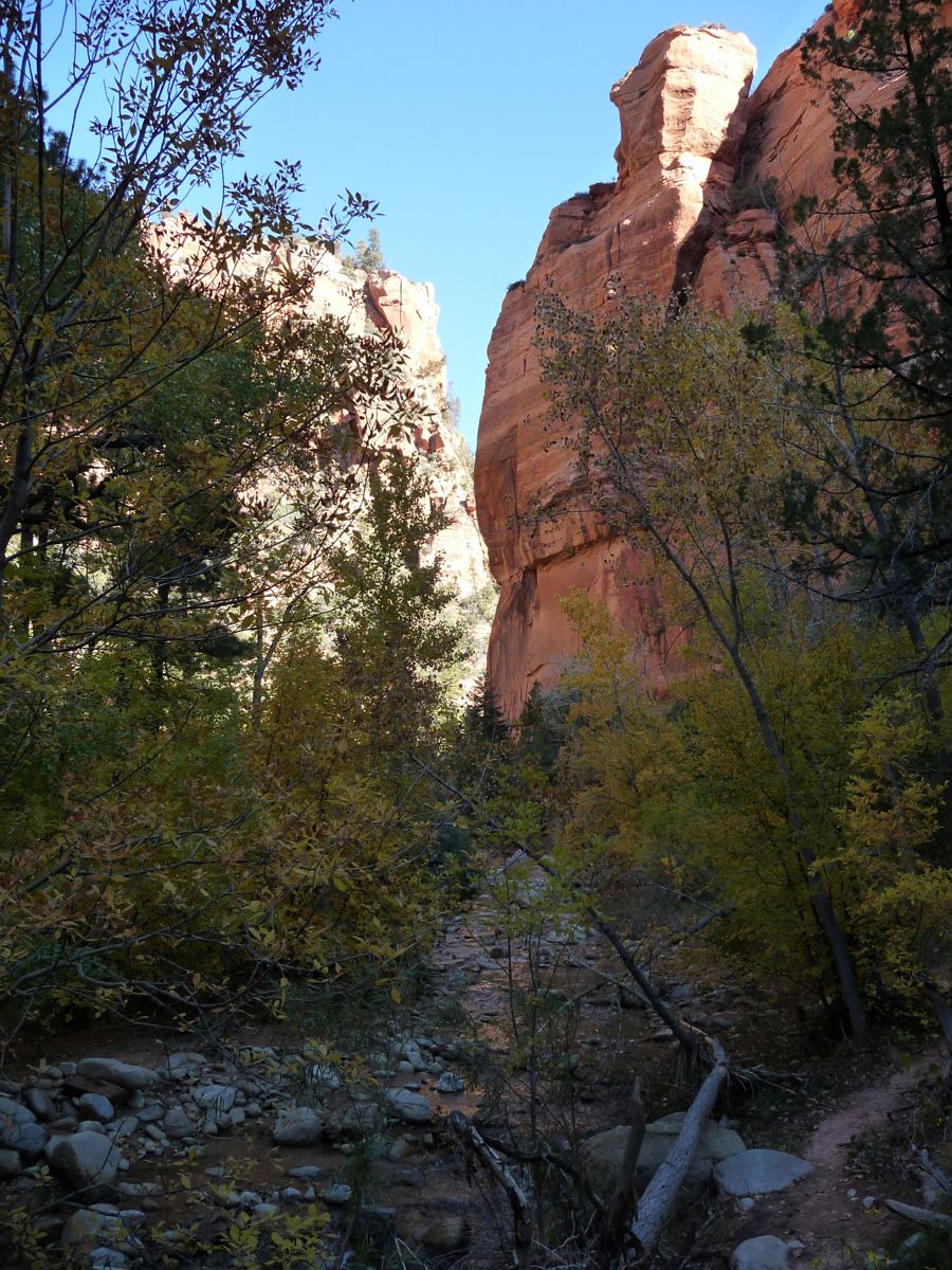
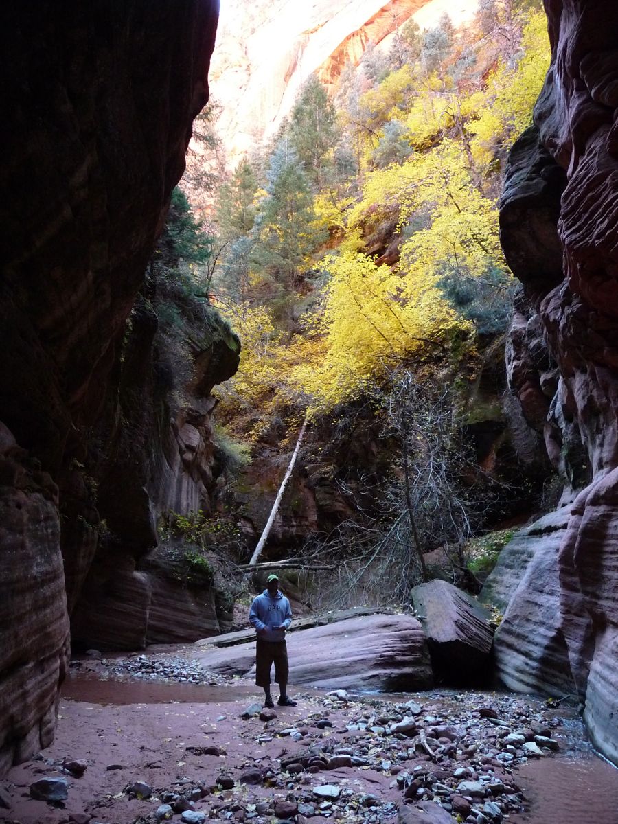
The sun was starting to set behind the canyon walls, but Eric, Jason, and I still had a hankering to see Kolob Arch. So we struck out across the river and started down the Kolob Arch trail. I have to say this trail is pretty sweet in itself. It follows a narrow gully that has some very cool
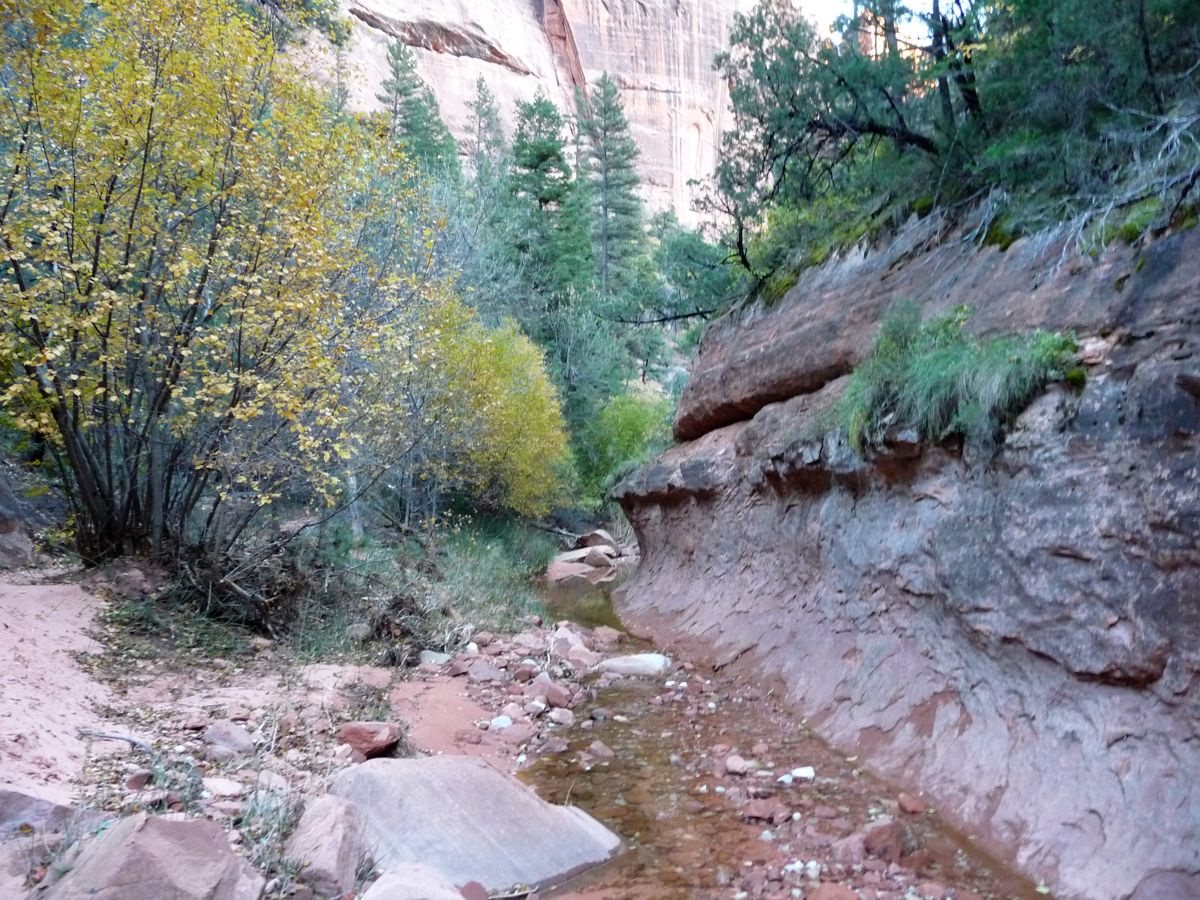
rock features. Several creek crossings are necessary along the first mile or so, but there are always ways to avoid the water. We didn't venture very far past the first point where we could see the
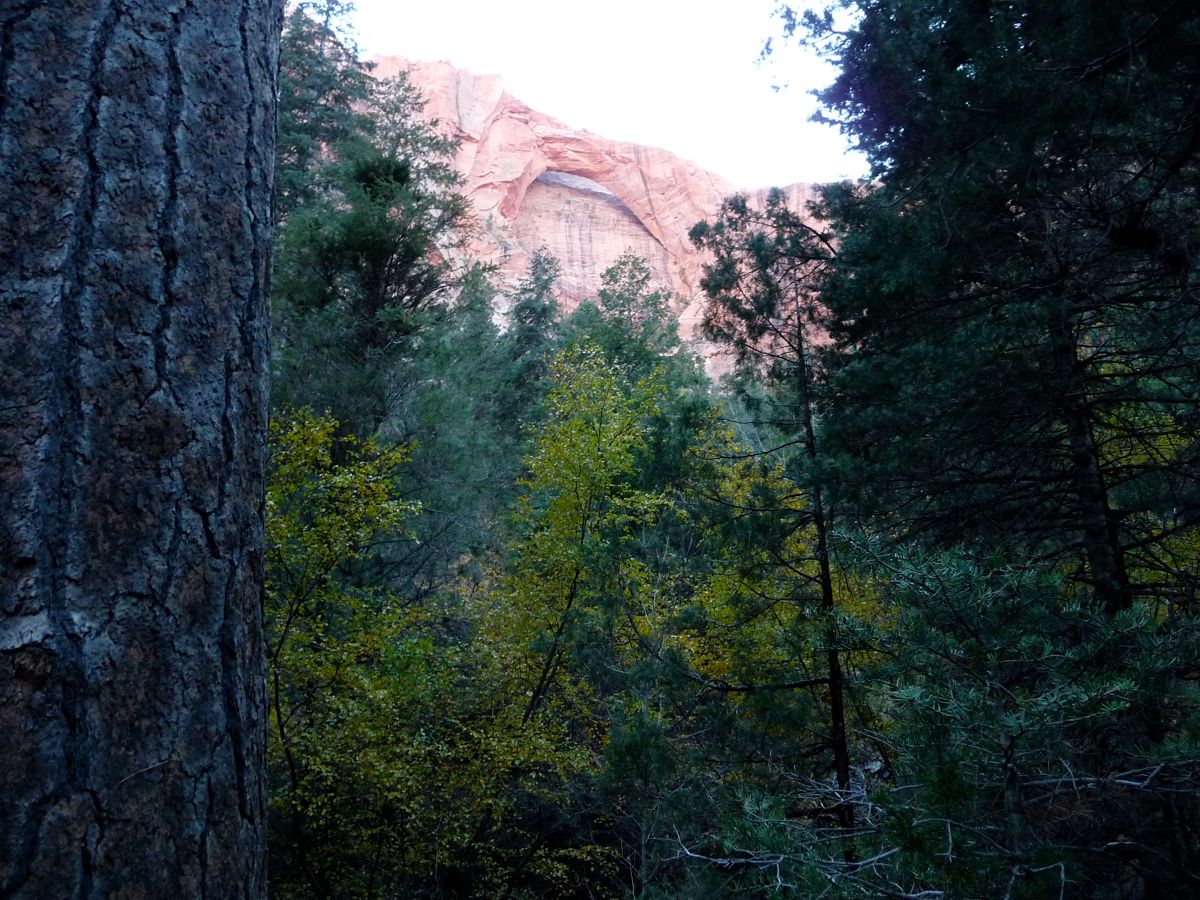
arch, but it looks like there are plenty of possibilities to get closer. In fact, after looking at the topo map, it looks like one could get an even better view by ascending the sub-canyon directly to the west of it.
On the way back to camp, the sun was playing marvelous illumination games with the
trees, making them look as if they were about to burst in flames. It continued with a wonderful display of alpenglow on the canyon walls; a view which we enjoyed as we prepared dinner. The temperature dropped quickly after the sun set fully. We managed to rally against the cold with a little walk along the river later that night. What lured us was the brilliant glow of the moon on the canyon walls. That, and a bit of numbness from drinking a good bit of whiskey. When we reached a clearing, for just a second, I thought I was hallucinating. I was convinced the rock was covered with snow. After I got my senses back, I realized that it was just an even more powerful reflection of the moon. The powder white color of that moonlight on the sandstone was something I will never forget.
There really is nothing better than waking up in the backcountry on a completely cloudless sky with the knowledge that you don't have to pack up your tent. It makes it easy to see why nomadic people decided to build villages back in the day. Even more so, it make me appreciate having a house to live in.
Today would be one of those days. I woke up before everyone else and took some time to enjoy the fresh air before watching guys
crawl out of their tents. After filling up water bottles and eating a nice, long breakfast, we set out on a day hike to Bear Trap Canyon.
The morning was quite nippy, but most of us decided to pack light and leave behind our heavy gear at camp. Brad was decked out in his
capris pants and his sweathshirt: the only thick layer he had brought on the trip. Yes, I am making fun of him for both of those things. But to be fair, the guys could all make fun of me for being a huge dipshit and forgetting the trail map in the rental car. What do I tell people is one of the most imporant things to remember on a backpacking trip? That's right. A map. To add insult to injury, I had deleted the topo maps for the Zion area on my GPS, so it was basically useless for navigation (I did use it to collect the waypoints shown above, though).
Jason had the good idea of trying to snap a picture of someone else's map. The first several groups we had come across the day before didn't have one. But after about a half an hour on today's hike, we came upon a guy who let us take a
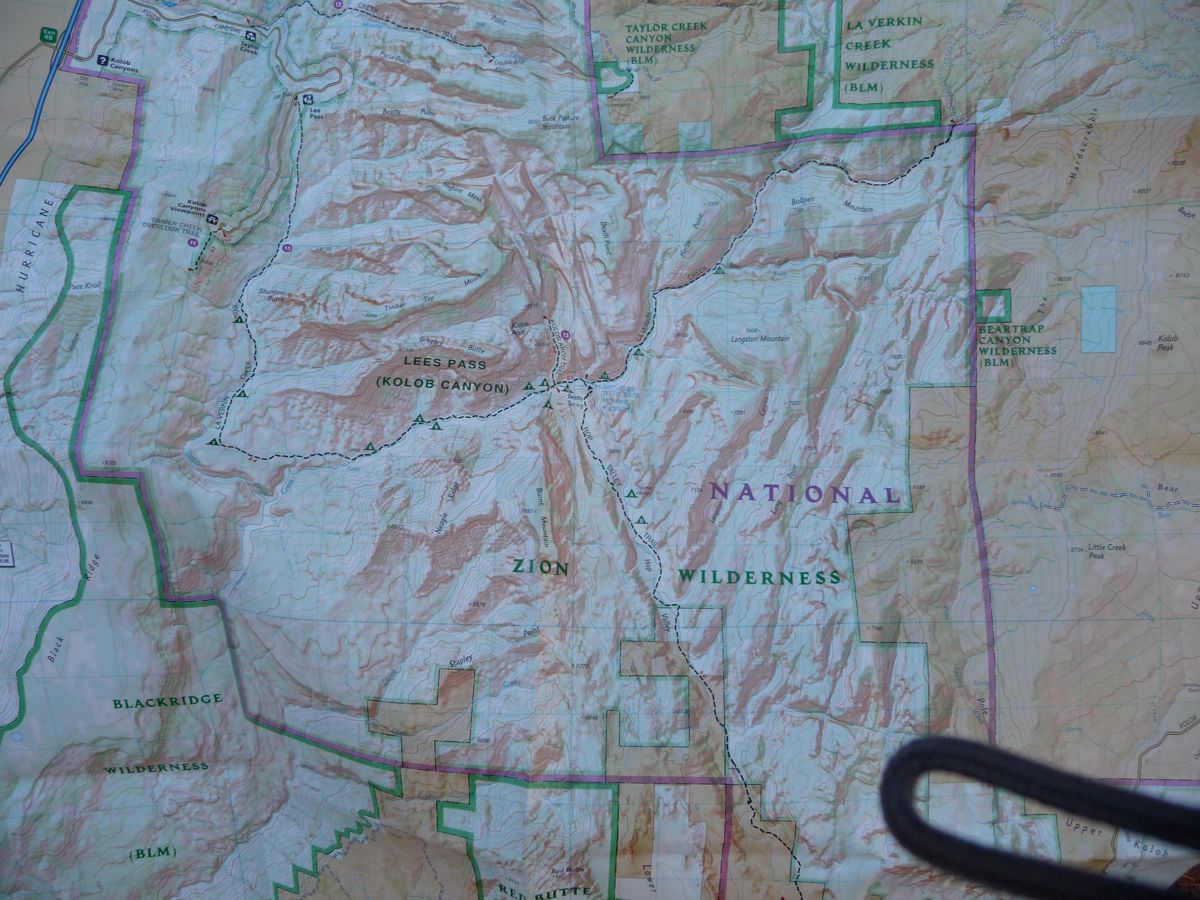
picture of his.
What's funny is that the first time we got lost was right after we had consulted the map. And I should say it's actually a bit easy to lose the trail right before the junction with the Hop Valley Trail. There is a semi-beaten patch of ground that continues along the north side of the creek, but this is not the way to go. Instead, the real trail crosses to the south and climbs about a hundred feet above the water. We only followed the creek for about a quarter of a mile before we realized that something was wrong. However, I don't see any reason why one couldn't follow the creek all the way east. We just didn't want to get our shoes wet with the cold water this early in the day.
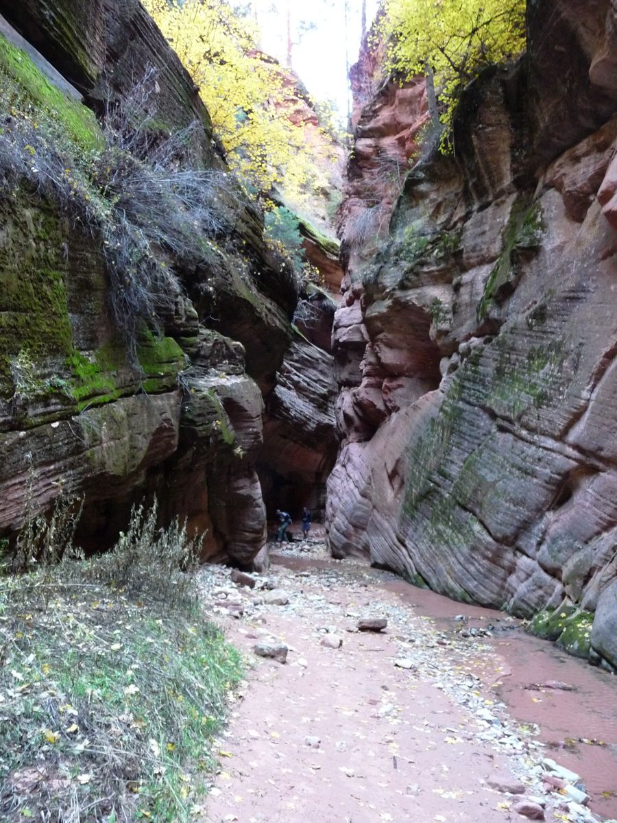
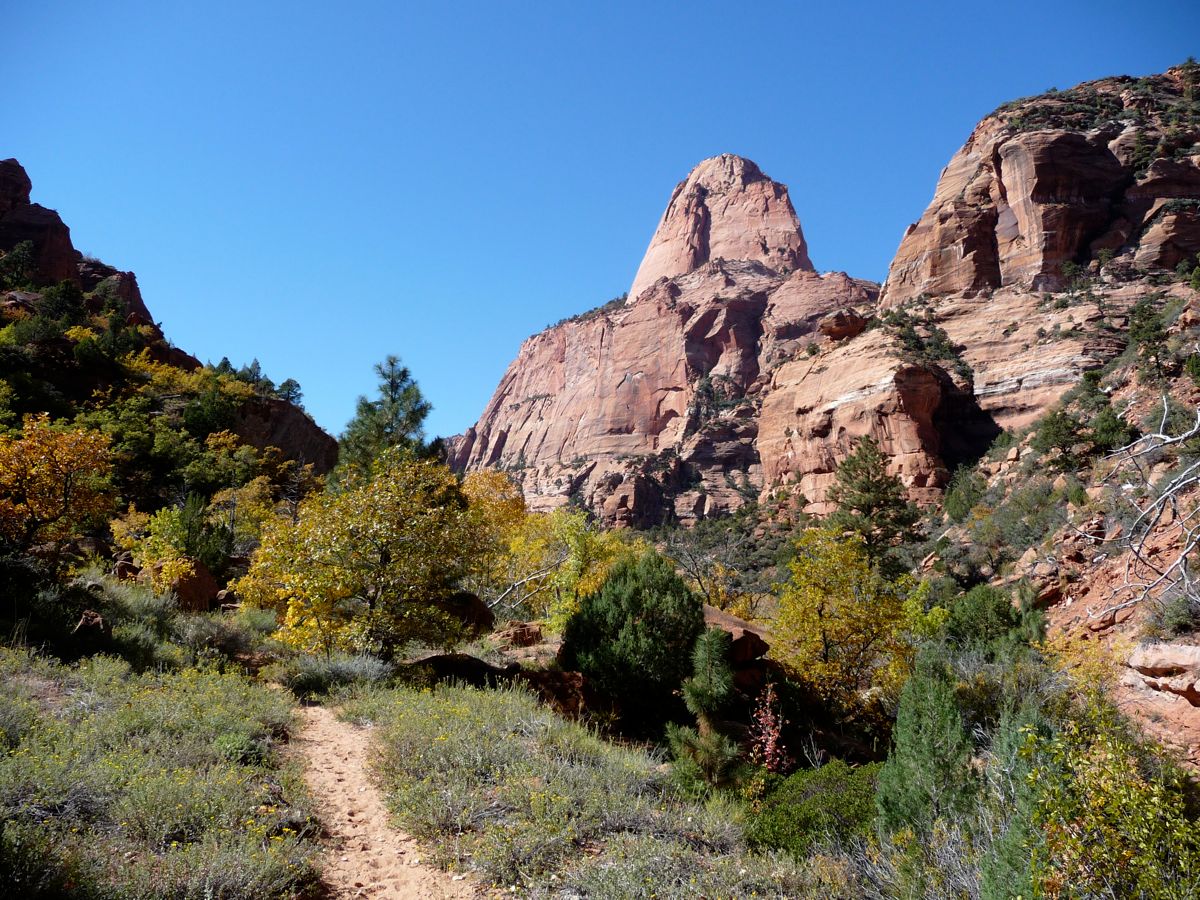
The trail east of the junction is exquisite. It crosses the creek on several occasions, meandering through
open fields and stretches of
open canyon. At each turn, you are greeted with what feels like a completely new landscape. And again, I may be slightly biased because of the incredible
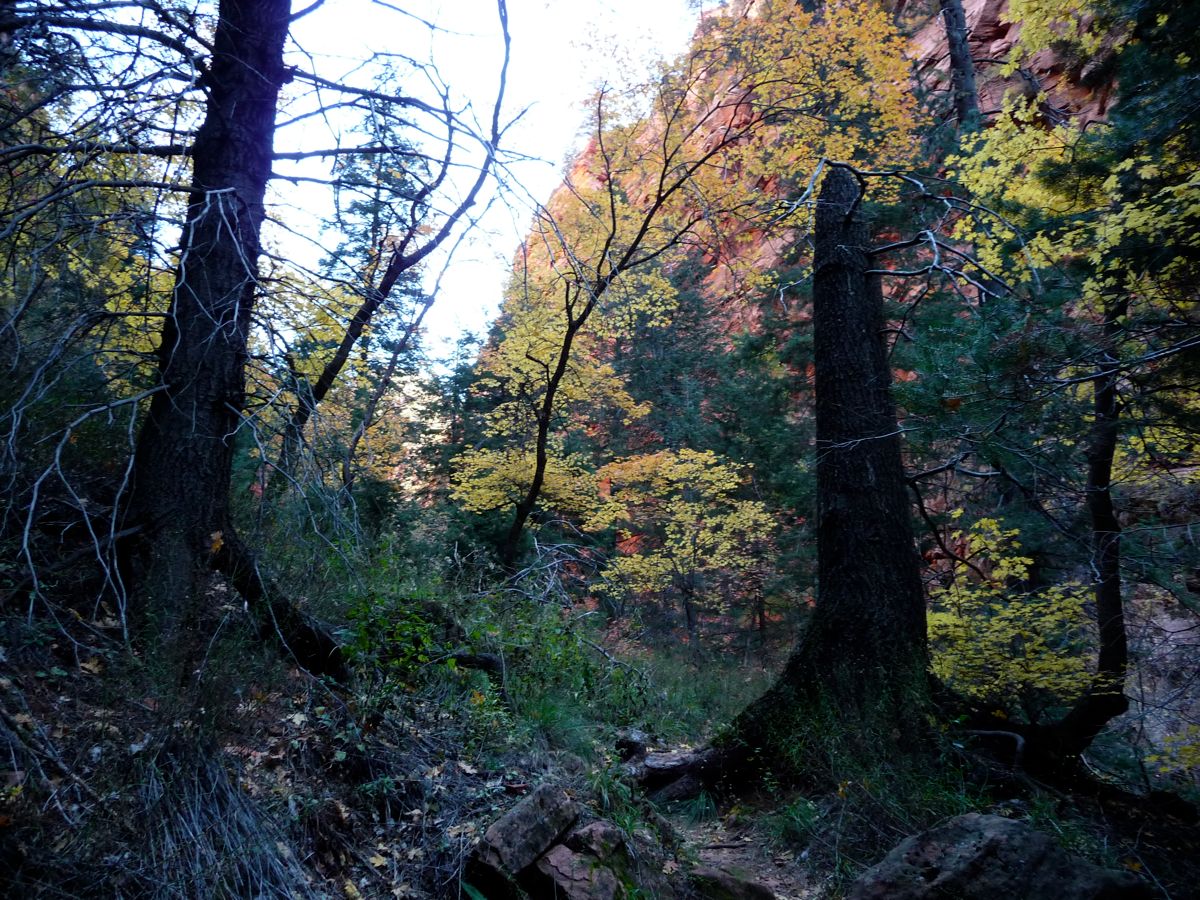
yellows and oranges that surrounded us.
Part of the reason we had been so eager to find somebody with a map was because we were worried we would miss the entrace to Bear Trap Canyon. Our worries were not really warranted, though. The
entrace to the canyon is fairly obvious. It is the only really easy turn-off one would want to take (there may be a few areas where you could venture off to the east, but they would all require some serious scrambling). It is also the only one that requires no elevation gain.
The temperature in Bear Trap Canyon was signifcantly colder than it was along the main canyon. Luckily, the water level was extremely low throughout the
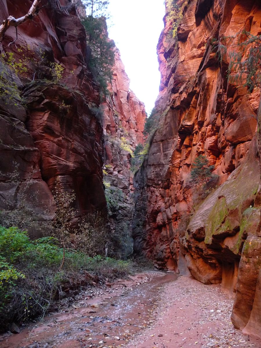
first few hundred meters. It never got really deep, but getting our feet wet was pretty much unavoidable. The canyon is absolutely beautiful, with
flora growing out of almost every possible orifice of the sandstone. I especially like
this shot.
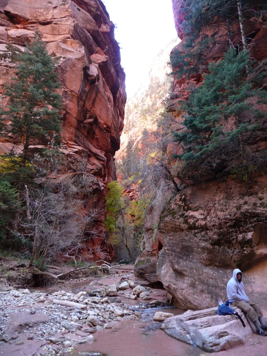
It didn't take long for Brad and I to reach the "unpassable"
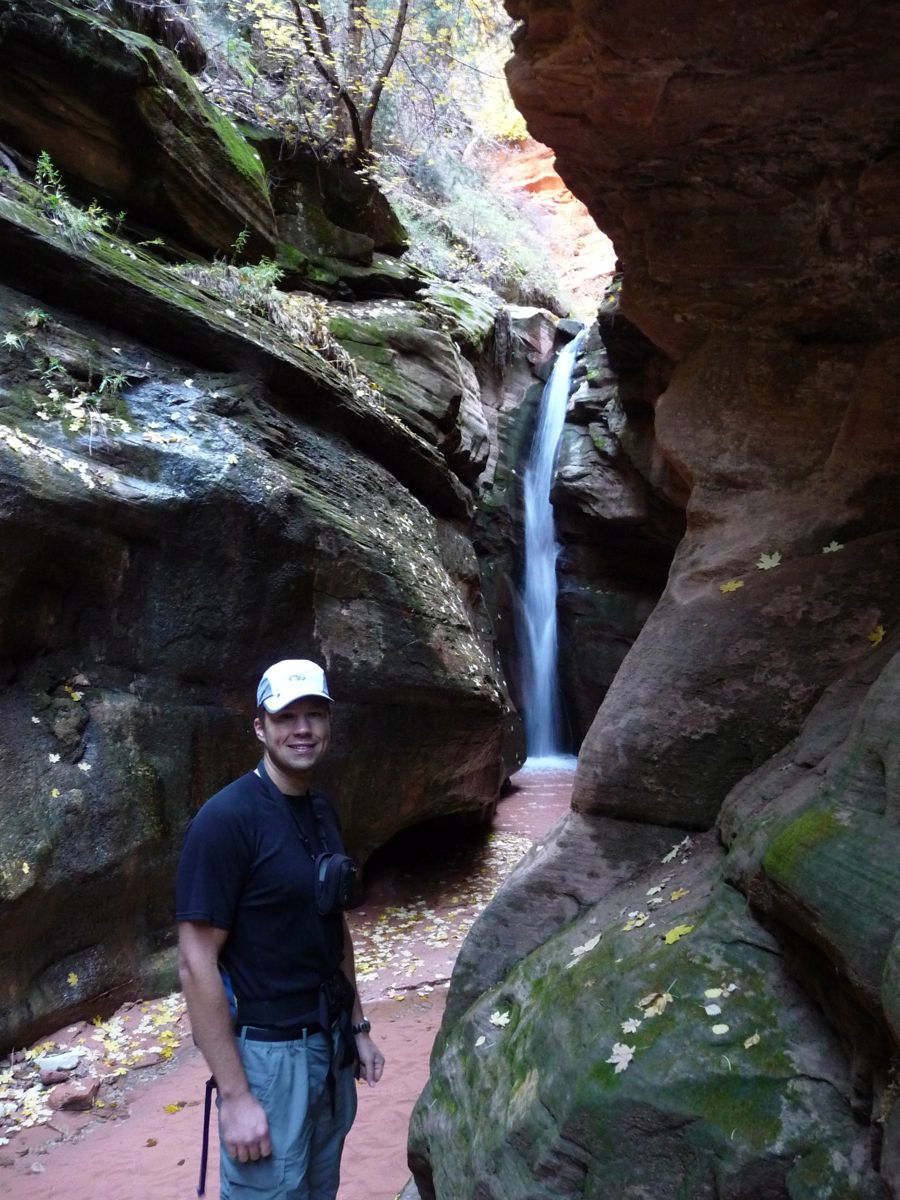
waterfall that serves as the turnaround point. Jason and Eric weren't
far behind. When we were all gathered around the pool at the bottom of the falls, there were some dares about jumping in the waist high water, but no takers. And there was plenty of talk about whose head was like a
shark's fin. If you don't know what I'm talking about, just watch this video. You'll have a great ongoing joke for any backpacking trip just like we did.
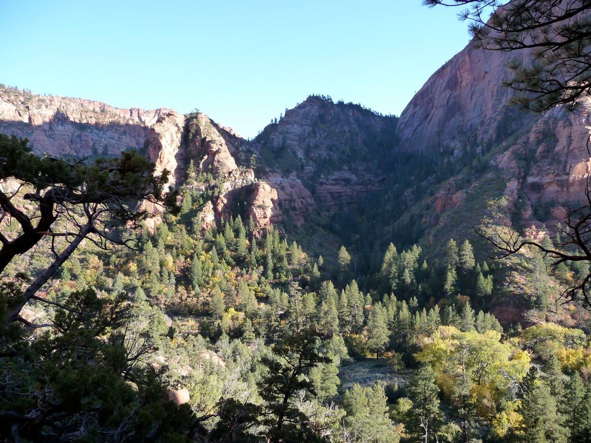
We hung around the falls for a little while and then started the trek back to our campsite. Along the way, we took time to enjoy the
warmth of the sun for pretty much the first time during the day. The combination of our northern latitude, the late time of year, and the canyon walls had kept the sun out of our business for almost the whole morning. After passing campsite 11, we were greeted with a splendid view of
Gregory Butte, which also looks like a shark's fin.
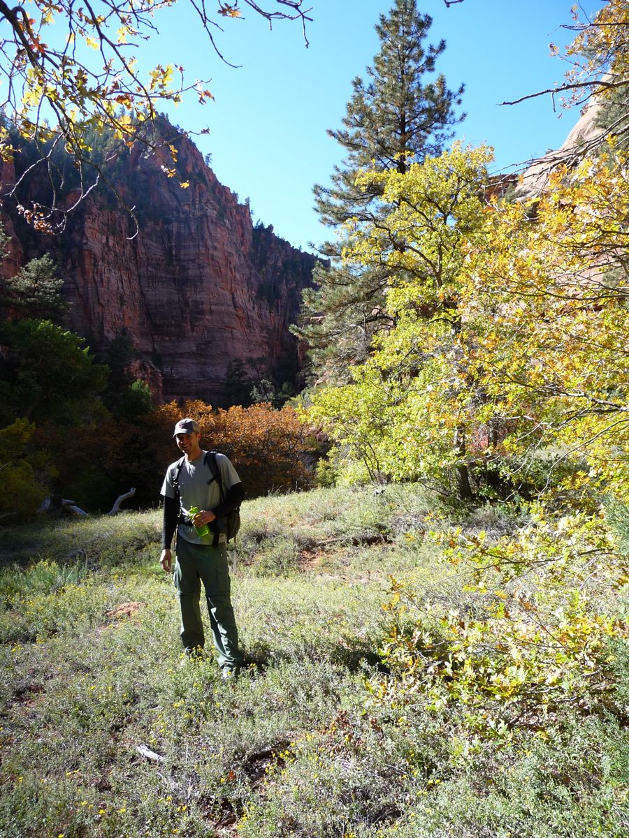
The initial plan for the day had been to explore a little bit of Hop Valley after we were done with Bear Trap Canyon. But by the time we got to the trail junciton, the guys were pretty beat, so we decided to head back to camp. Once I sat down, I realized it was a pretty good time for a nap, so I laid down in my tent for about a half-hour. When I woke up, I tried to convince the guys to go on a short trip to Hop Valley or explore the canyon immediately to the north, but I had no takers. So I decided to go solo.
I had been eyeing the little gully immediately to the north for awhile, and from where I was sitting, it looked like I could get up pretty high before I ran into really troublesome terrain. My spectulation was well-founded. I had to do some moderate buswhacking and navigate through a few scree fields, but eventually, I managed to get up pretty high. It seemed a lot higher in real life than it does in the
photo, though.
When I got back to camp, I spent about twenty minutes picking little spines out of my clothes and skin. They hurt like a son-of-a-bitch. What's really funny is that I ended up picking one out of my stomach three days later after it had inflamed the skin around it. That's just the nature of bushwhacking, I guess.
The night was very relaxing. We cooked some dinner and sat around telling stories by the campfire (yes, campfires are not allowed in the Zion backcountry, but since Brad hadn't brought any warm clothing, we thought it was justified). The stars were once again phenomenal. We called it a night pretty early since we were planning an early exit. Jason wanted to do Angels Landing before he left for his flight at 1400, which meant we had to be back at Lee Pass no later than 1000.
There is not much to tell about our exit that would be useful to anyone planning a trip. We got up at 0500, packed up our tents, and booked it toward Lee Pass under the guidance of our headlamps. The
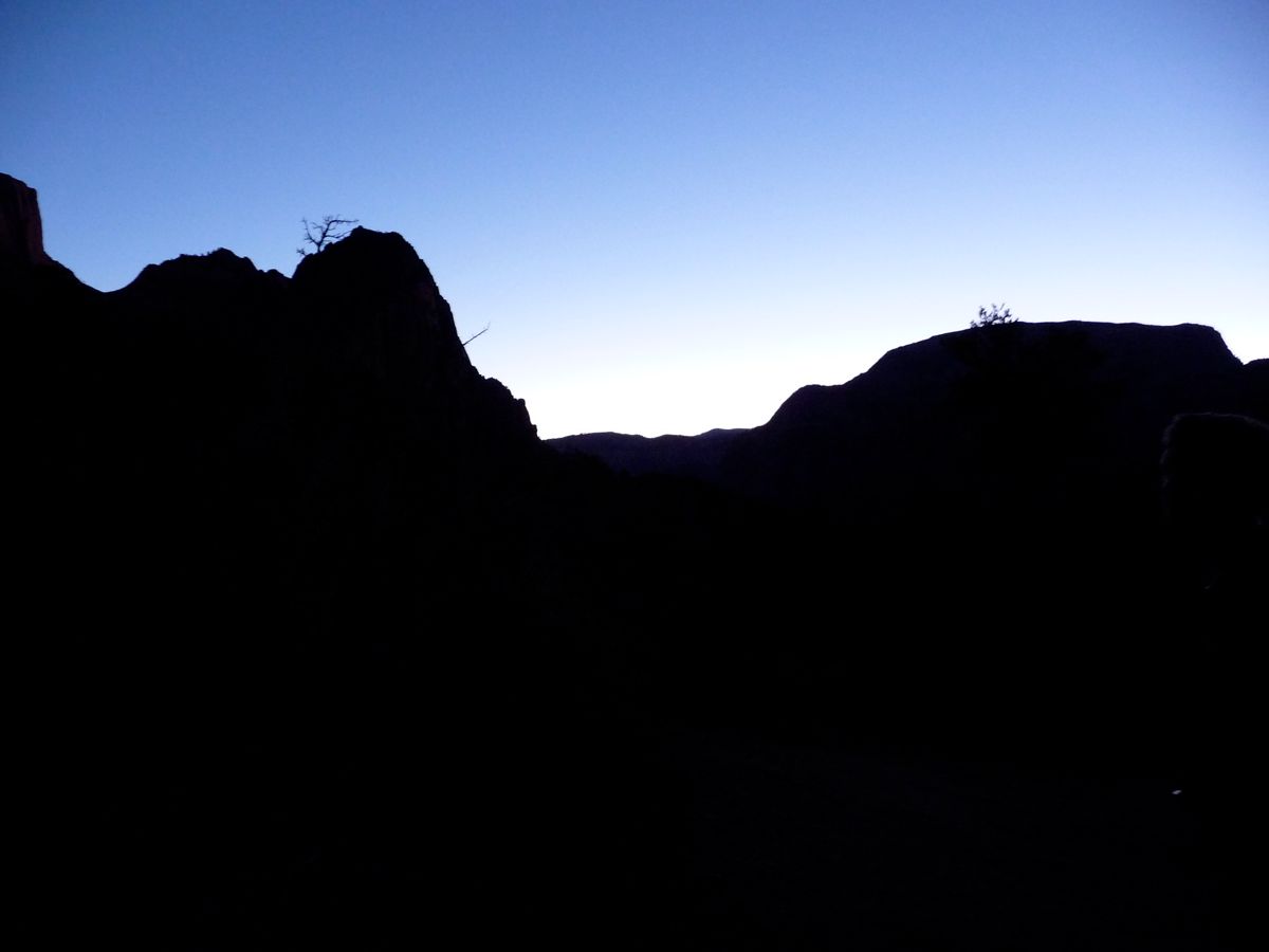
color of the sky during sunrise was spectacular. We managed to make it to the trailhead around 0900, and Jason and I completed Angels Landing well before he needed to get to the airport.
Our two nights of camping along La Verkin Creek were followed by two nights of some crazy bachelor party madness. Karaoke at Wildcat Willies, a frigid hike through the Narrows, and boozing at Casa De Amigos. I'd recommend either of these places if you're looking for some fun in Springdale.