


TRIP DETAILS
TRAIL MAP
OVERVIEW
Mosquitos, Mosquitos, Mosquitos. Wait, did I mention mosquitos? Ok, one more time for good measure...mosquitos. That would be the defining memory of this trip for me. Me constantly swatting them away from my nose so as to inhale the minimum amount I could. Me trying to get into my tent and zip it up with record speed and yet still killing the 36 that somehow managed to get inside with me. Wherever I went they inexhaustibly orbited me like I was some sort of gravitational well. Of course, I applied a full coat of Deet every time I rested, but still they managed to find that one molecule of skin that was lacking a drop.
It's for this reason that June and July are my least favorite months to visit the Sierras. I'd rather endure ravenous storms or freezing cold than mosquitos in all honesty. Yet somehow, I still subject myself to their wrath. I guess the good memories from the trips during these month seize hold of my brain when I'm contemplating doing another one. And there were certainly plenty of good memories from this trip up Copper Creek. Plus, there was a ton of elevation gain over a short distance, which I always love. If you're looking for a good way to gain elevation fast then this might be for you.
One important thing to note about the route I show above is that the trail between Granite Lake and Kennedy Canyon is no longer maintained. It's still shown on most maps of Sequoia/Kings Canyon as a nice red dashed-line hiking trail, but from the looks of the ground it hasn't been maintained in over a decade. Shortly after you pass lake 9850, the trail starts to disappear, and by the time you approach Dead Pine Ridge it's completely gone. Likewise, I couldn't pick up the trail on my way south in Kennedy Canyon. Luckily, the terrain is extremely easy to deal with throughout these sections. Just be prepared to do a little navigating.
This route makes for a perfect two and a half day trip. If you live in the Bay Area and can manage to get out of work Friday or Monday, it's possible to do all the driving and hiking and still get home with time to unpack and rest a bit. The only caveat is that it's not a bona fide round trip. You enter at the Copper Creek Trailhead and get popped out at the Lewis Creek Trailhead, with around a 6 mile stretch connecting the two via the 180 highway. Of course, you can always park a car at the latter trailhead or suck it up and walk the 6 miles. But at the very end of a moderately tough trip, it's not really that fun to have to walk 6 miles on pavement to get to your car. I had some good success hitch-hiking, so that's an option, too.
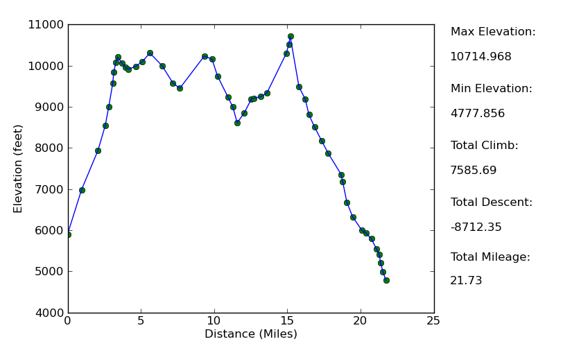
Elevation Profile
TRIP LOG
While driving to the Road's End trailhead, one question continuously plagued my mind: would I get elevation sickness if I hiked all the way from 5000 feet to 10,000 feet in one day and slept there? I know the general rule of 3 miles per hour on flat ground or 1000 feet of ascent per hour apply to me, and I didn't have any worries that I wasn't in good enough shape to make it up there. But I couldn't recall a trip where I gained that much elevation and slept above 10,000 feet on the first night. "Well, only one way to figure out" is what I told myself as I started up Copper Creek.
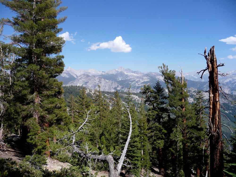
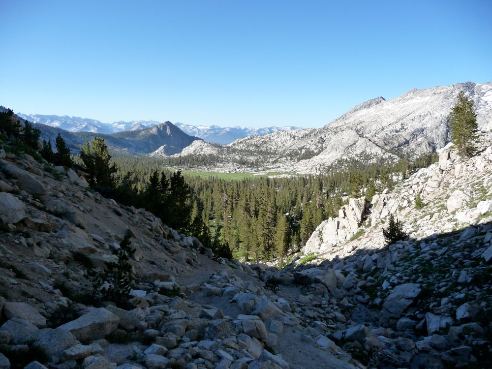
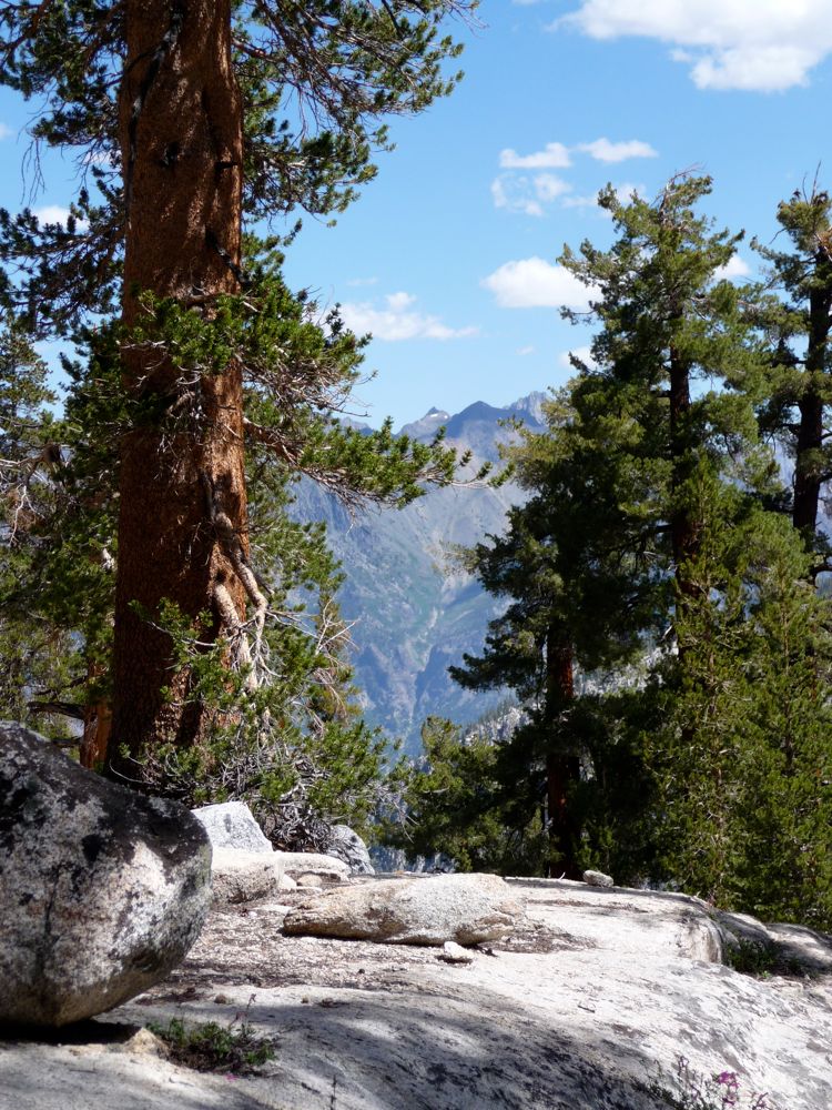
Within less than an hour of leaving the trailhead I had some clear views
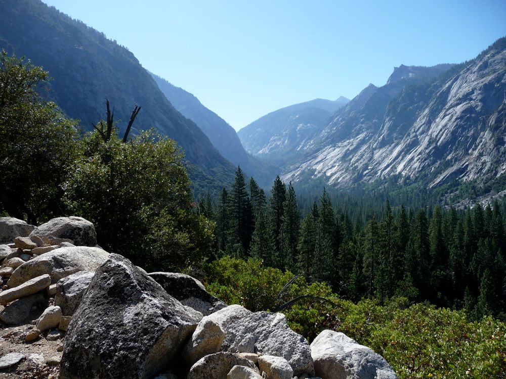
east and
south, and I was finding the first stages of the ascent to be pretty awesome.
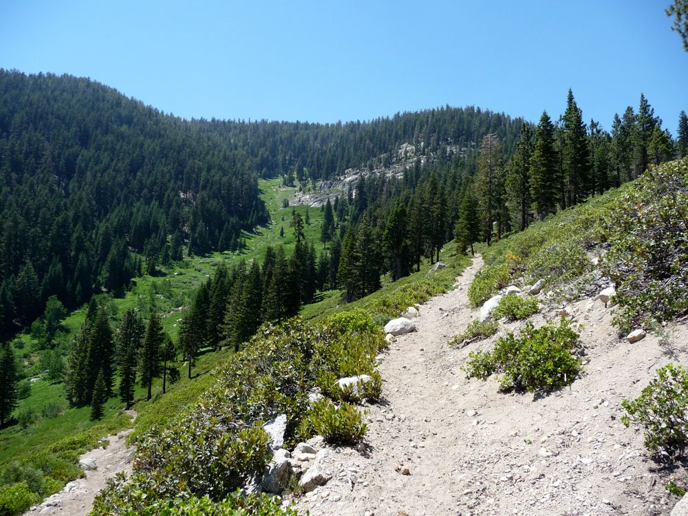
Fields of manzanita speckled with tall
Jeffrey pines surround the
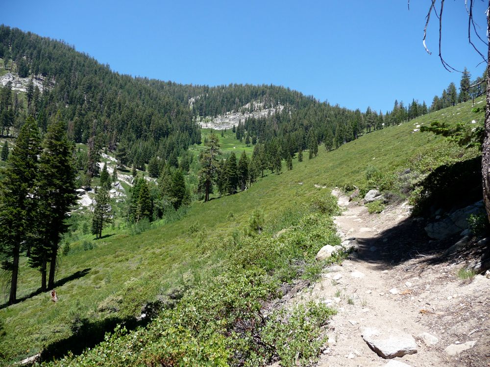
trail as it makes its way up to
Big Tent Meadow. The views to the
south become increasingly more
excellent, revealing a whole slough of peaks and cool patterns in their faces. Around one o'clock I stopped for lunch near Big Tent Meadow, at a little section where an off-shoot of the trail breaks into some pretty thick bush and makes its way down to Copper Creek. So far the mosquitos weren't too bad; gigantic horseflies seemed to have established dominance of the area.
After a nice spot of instant coffee, I was feeling pretty energized-ready to tackle the remaining 2500 feet of aggressive switchback climbing. My energy carried me pretty well up to 9000 feet with minimal resting, but then the going got a little tougher. I started to feel mildly dizzy when I ran short of breath, but it would pass if I took a nice two minute break. And when I finally got up to 10,500 feet, the spell had passed completely so I was feeling tip-top as I took in the views
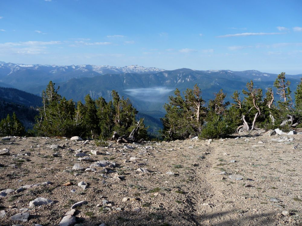
to the east. Once over the little notch at 10,347 feet, I had a good view down into
Granite Basin and the lakes at the
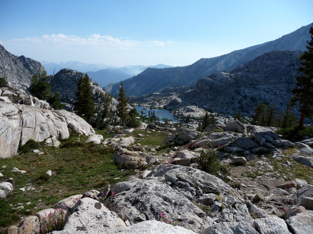
south and
north ends. Unfortunately, the mosquitos seemed to enjoy this view just as much as I did. They began appearing by the dozens, which prompted me to apply mad amounts of Uncle Bens repellent.
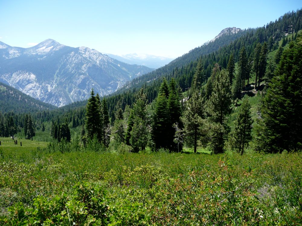
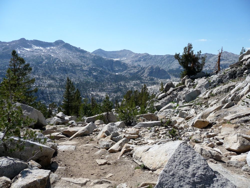
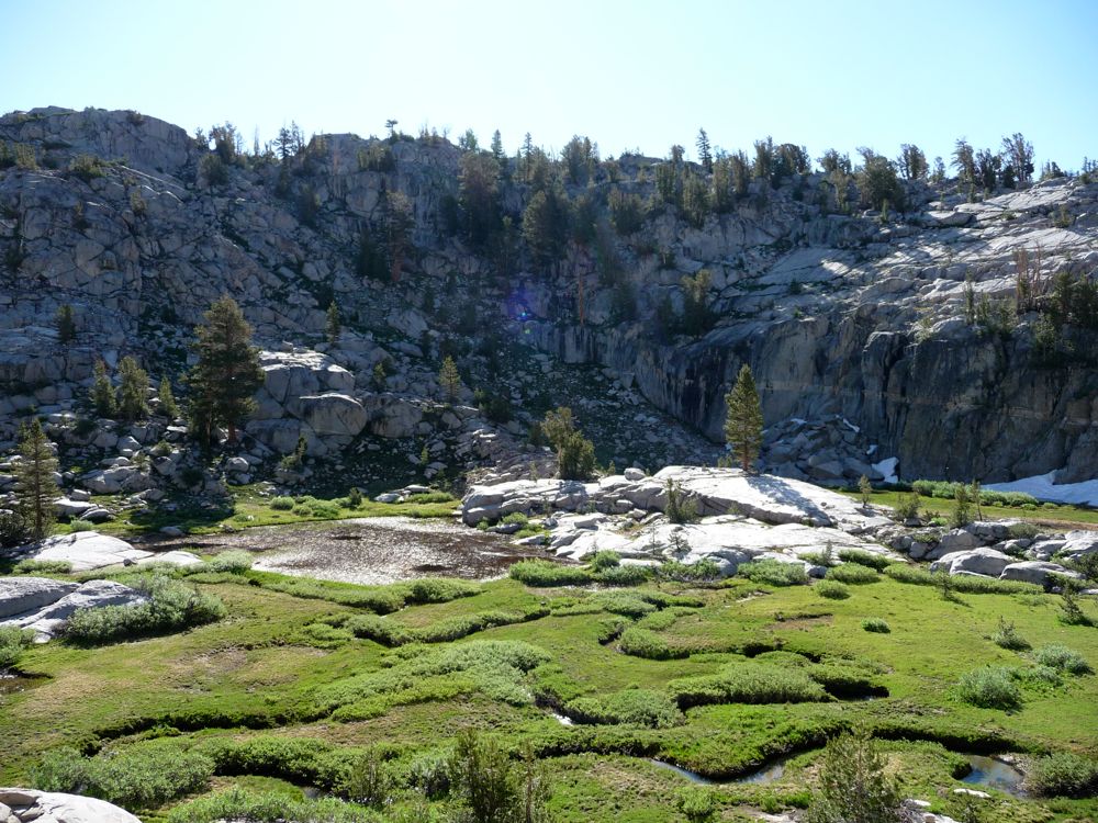
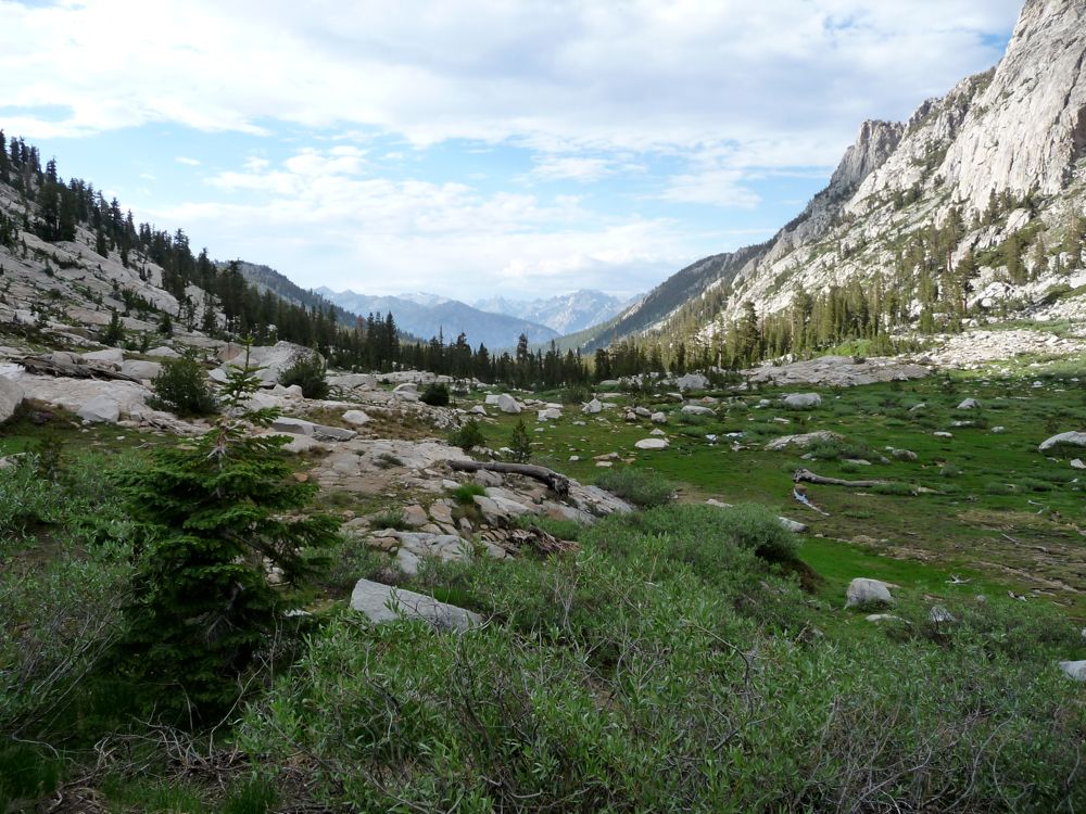
At this point the trail gradually descends a few hundred feet as it makes its way through some sparse forest. After about a half a mile things open up again and you can see the
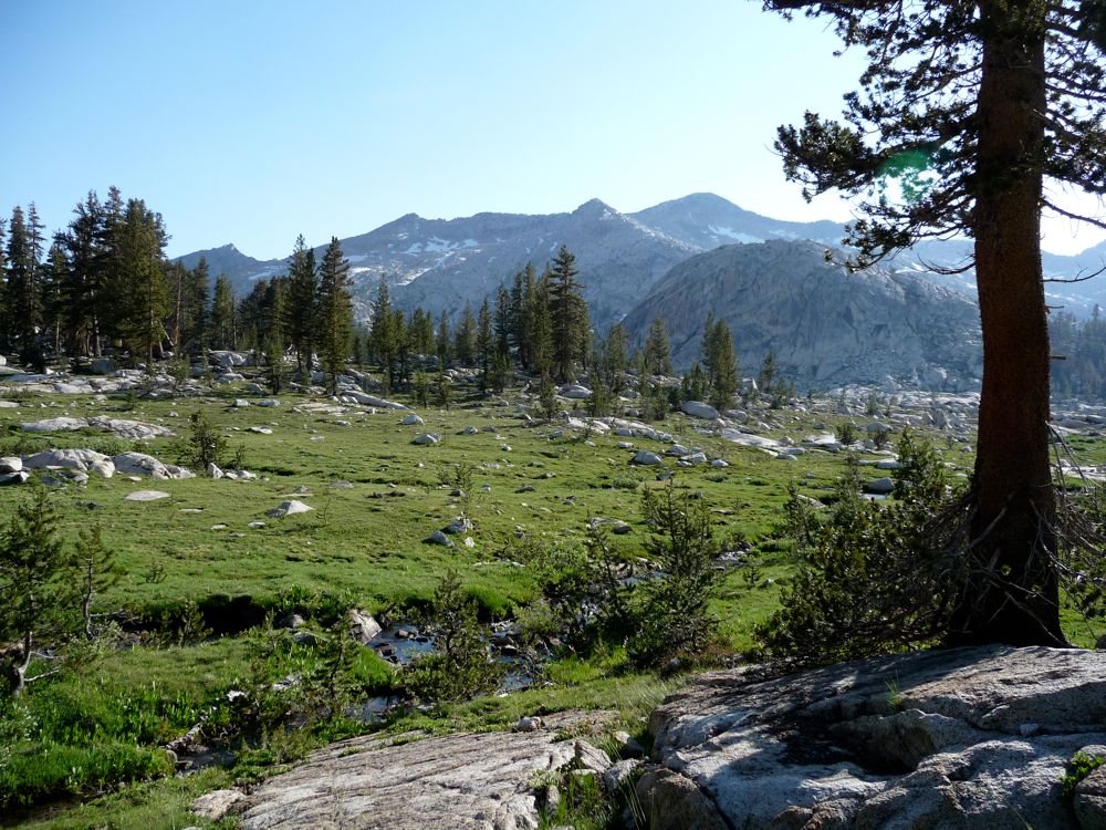
meadow you have to cross to get to Granite Lake. As beautiful as this last picture looks to me, I can't help but think of the hundreds of mosquitos that were keeping me company. "What a perfect breeding ground for these little creatures" is what I thought while I stared at scenes like this
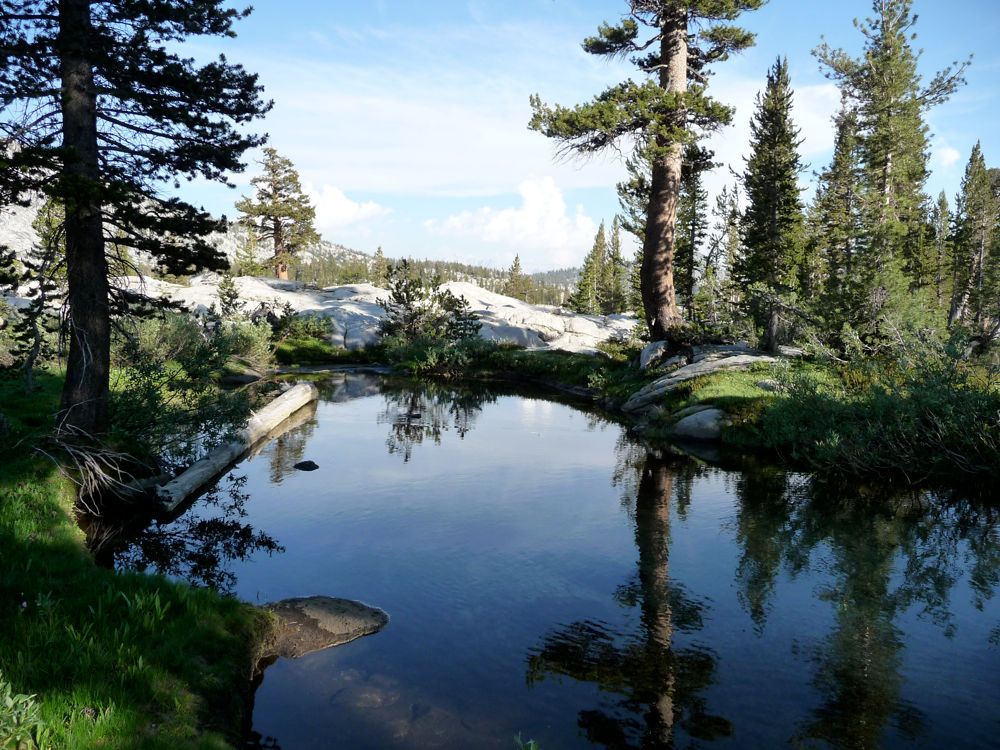
pond.
With a few hours of daylight left I found a spot along
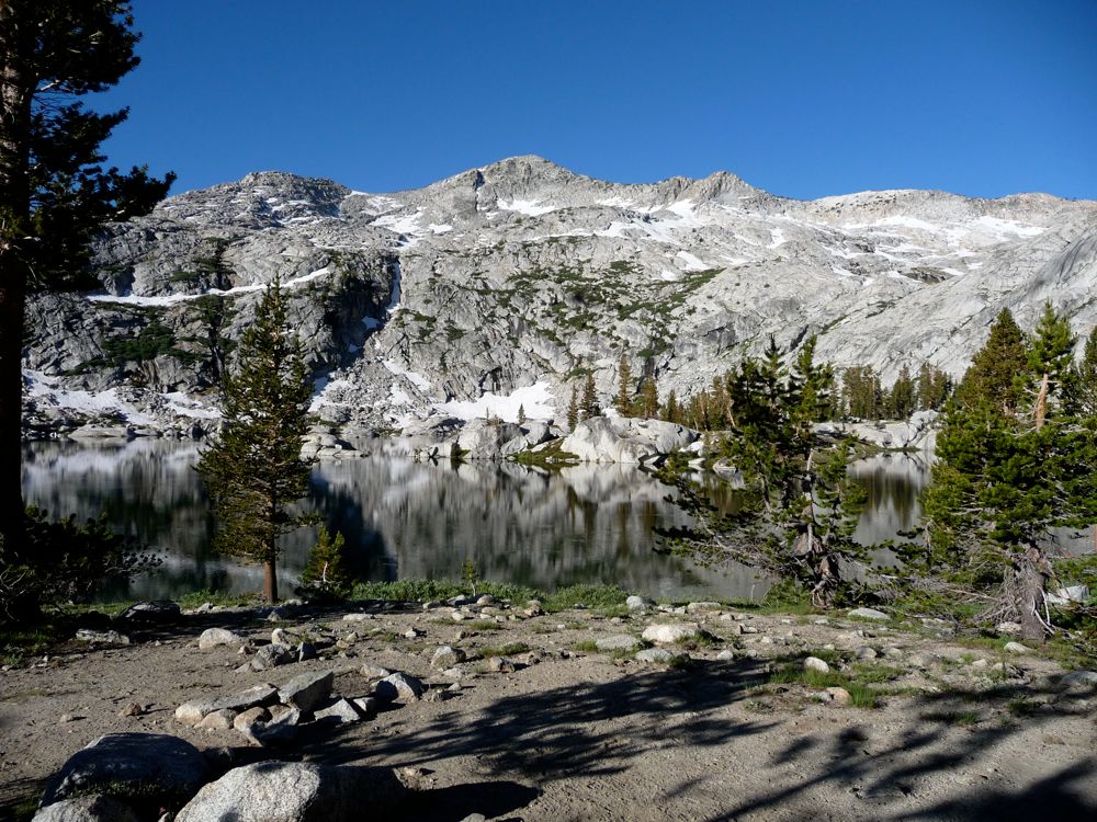
Granite Lake to park at. After sucking several mosquitos down my nostrils, I decided it would be preferable to have dinner in my tent. So like a mouse trying to dodge a cat I jumped into my tent and sealed it up as quickly possible. When I rolled around on my back and looked up there were some 30 mosquitos hovering at the top of my tent. Somehow they had managed to get in during those few seconds the tent was open. So I spent the next ten minutes killing them one by one. What a fun way to pass the time, right? I couldn't help but wonder as the night wore on how there was such a dramatic difference in the mosquito populations north and south of that little pseudo pass separating Granite Basin from Copper Creek Canyon. I can think of a few possible reasons, but if you know the right one please email me and let me know. It'd be great to figure out how to avoid the bastards.
I woke up determined to ignore the mosquito bites and incredibly bad blisters that had formed on my heels from the previous day, and make the most out of the beautiful day ahead. As an asisde, the blisters I'm speaking of started forming pretty much right at the start of my hike. I was using a pair of Asolo hiking boots that were very broken in, but somehow never stopped giving me bad blisters. At first I tried Moleskin to cover the silver dollar sized blisters up, but that was proving pretty ineffective. So I switched over to duct tape and that actually did the trick pretty well. Still, they were probalby the worst
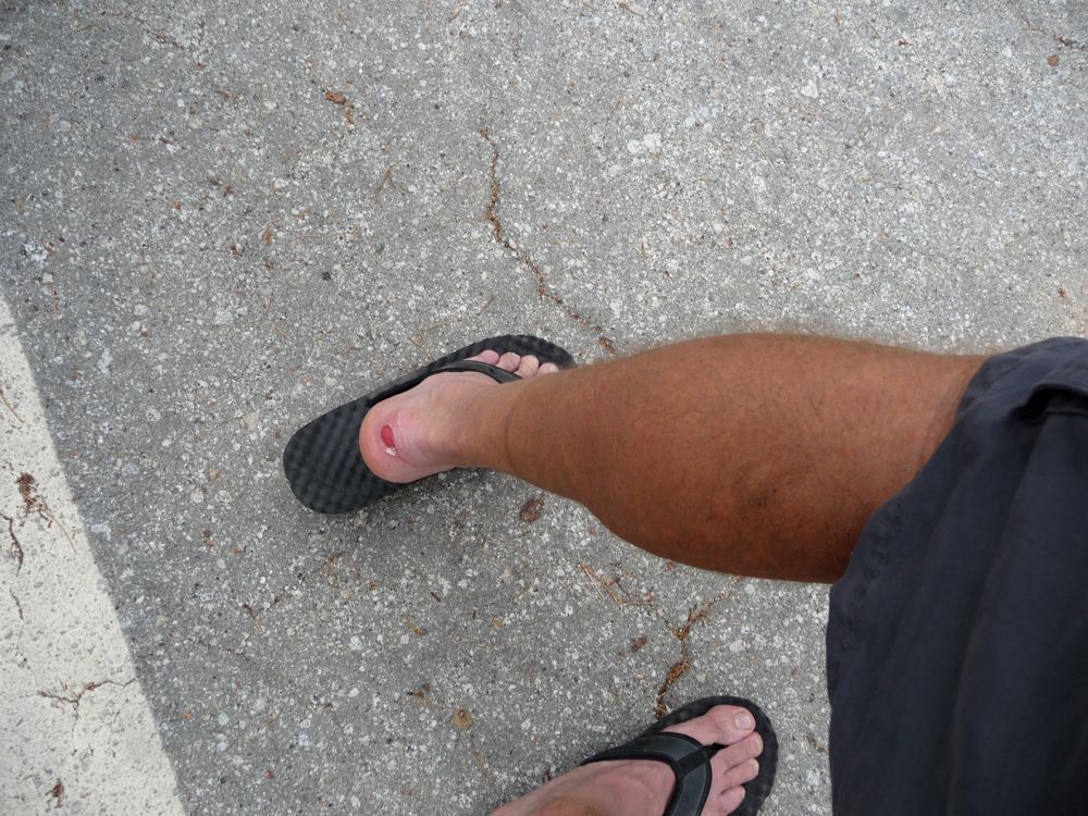
blisters I've ever had. I tossed the boots in the trash as soon as I got back to my car. I don't necessarily think Asolo makes a bad boot, but I'm not a huge fan of really high top boots. It seems like the more a boot grabs on to your ankle, the more the back of it tends to rub up against your heel. With a low top pair of shoes like the Merrell Chameleons I've never had this problem. I guess the trade off is you lose ankle support.
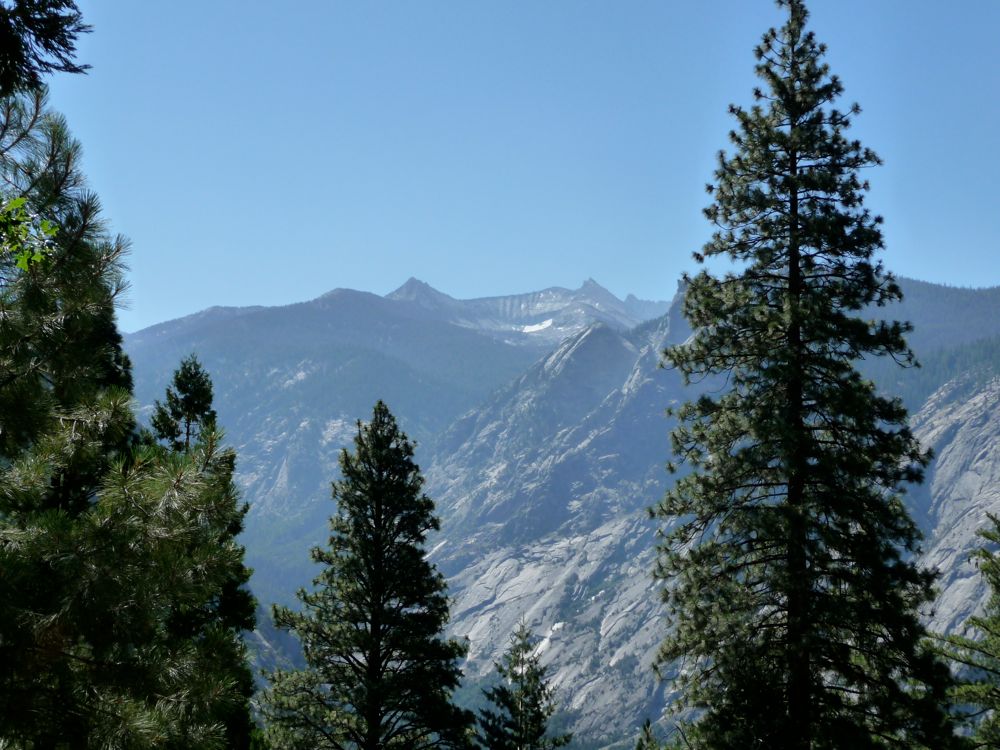
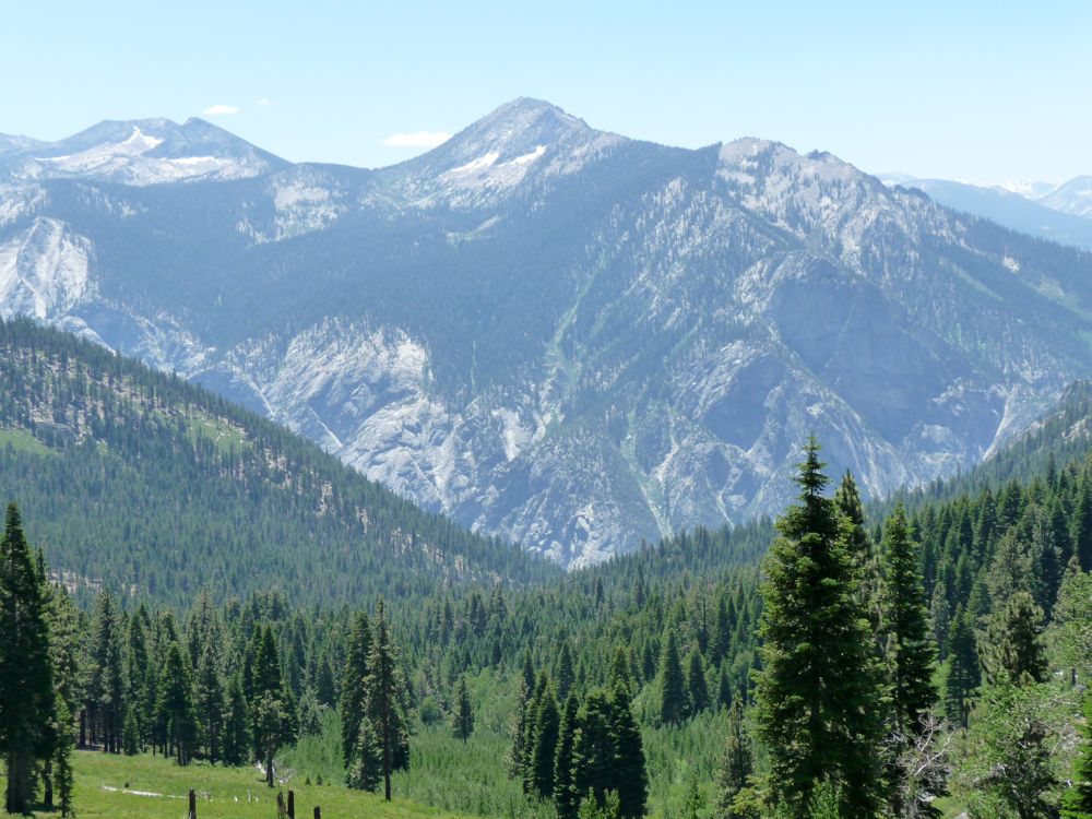
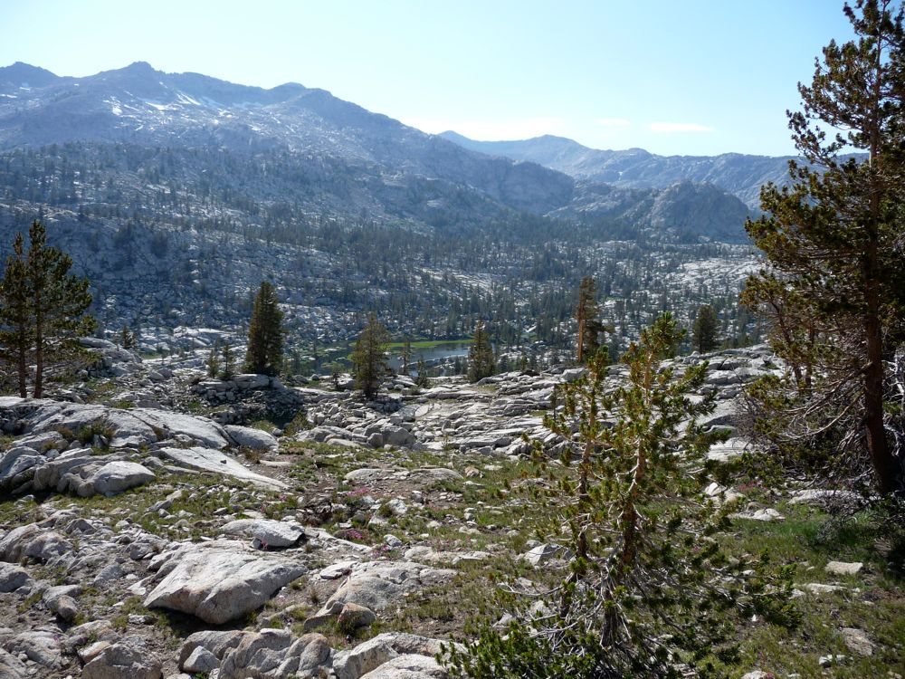
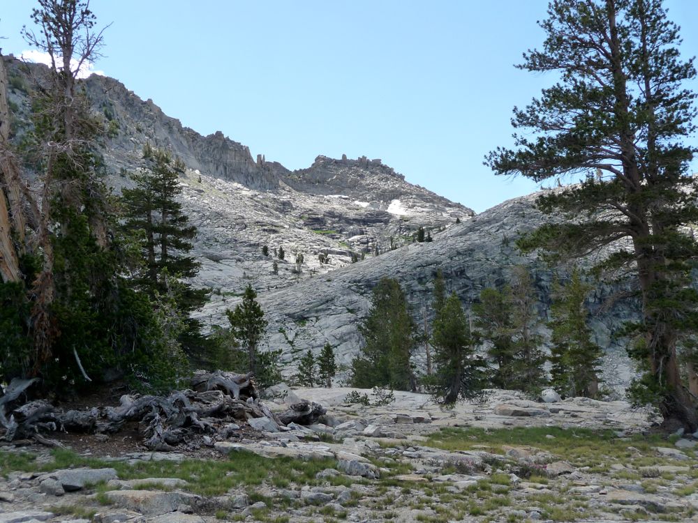
When I made it to the top of
Granite Pass I was blown away by the
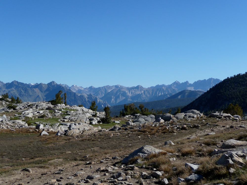
view to the north. It's not the most sweeping vista or anything, but right away I recognized Goddard Canyon, which brought back fond memories of the trip to the Enchanted Gorge I had done a few years ago. On the north side of Granite Pass is a nice open area with grass that looks more like
spongy coral than it does grass. The trail was easily to follow as it made its way along the Middle Fork of Dougherty Creek and then split off to head west up to a small
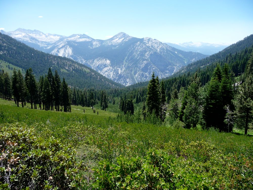
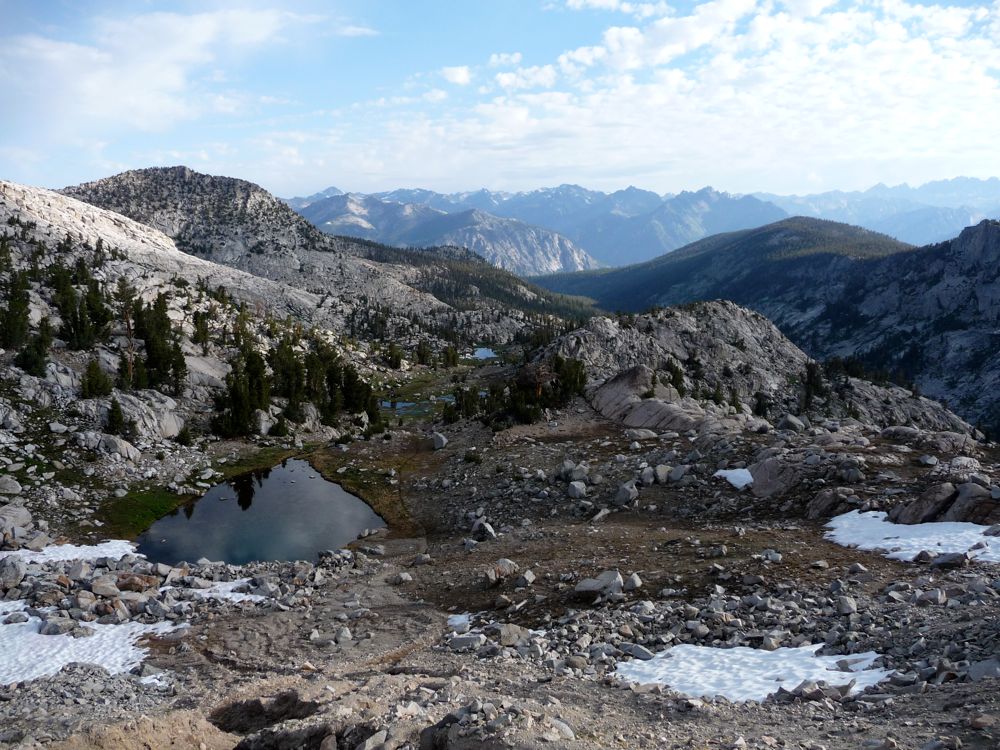
lake at 9800 feet. Here you have an even more impressive
view of the sharpness of Goddard Canyon. God, I love that canyon.
At the lake you have to cross the West Fork of Dougherty Creek, and this is where I lost the trail trying to find a suitable place to cross. I figured I'd easily pick it up on the other side, but no such luck. If you look at the contour map, though, it's fairly easy to see that the terrain dictates where you should head for the easiest ascent. And the brush isn't very thick, making it easy to do so.
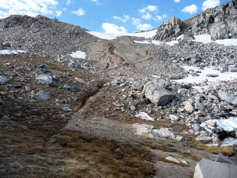
When I finally made it up to Dead Pine Ridge I was pretty well convinced that if there was no real trail, I might as well just veer to the west side of the peak at 10,537 and start my descent to Kennedy Creek as soon as I could. From my low resolution map, it didn't look that steep. But looking at the contour map above (click on "Topo"), you can see that this was a bad choice. The grade is probably class two and even class three at certain points. So I basically had to keep climbing higher to the northeast before I could start my descent to the southwest. If I could do it again I'd just circle around the east side of the peak before doing the descent and save some breath.
Before making the full descent to Kennedy Creek I stopped for some lunch and enjoyed the nice cool rain that had started to fall. The first hour of hiking afterwards was really pleasant; just a smooth downgrade through sweetly scented, open pine forests. When I finally got down to about 8000 feet I had to do some careful route finding as the way ahead becomes progressively more steep. It was really slippy from the rain that had fallen and I was clinging to rocks and roots and I tried to secure my footing as I moved down. As long as you're patient and willing to backtrack a bit, this section shouldn't be too tough, though.
When I reached the creekside I found my mosquito friends had multiplied by a factor of 50 or so. I tried to stop as infrequently as possible as I headed sout to avoid giving them a chance to find any patches of my body unprotected by repellent. I maintained a course to the west of Kennedy Creek that consisted mostly of flat granite embankments, which were occassionally broken up by marsh. There didn't seem to be any way to avoid getting my boots nice and muddy, but with the warm temperatures I didn't mind.
When I reached the
wall at the south end of the canyon I was greeted by four hikers that were probably in their mid 50 to 60s. I was pretty impressed by their physical condition for that age, and even more blown away by the sight of the mosquito clouds around them. It's one thing to see a few dozen hovering around your legs or your arms, but now I could see the enormity of it all. There must have been two or three hundred of the things assigning themselves to each person. I asked them if there was any trail going over Kennedy Pass, and one of them told me that their was a lovely set of stairs that picked up a few hundred feet north of where we were standing. "It's like one of those Japanese Gardens", one of them told me. That got me pretty excited. It was getting late and I could use the aid of a trail to pick up my pace a bit to get me right under Kennedy Pass before nightfall.
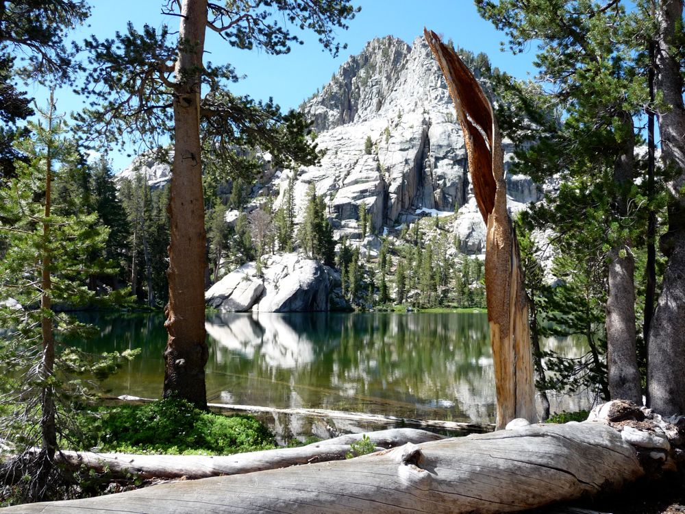
Sure enough, the trail picked up where they said it would. There were some good views down
Kennedy Canyon, and a little higher up I could see
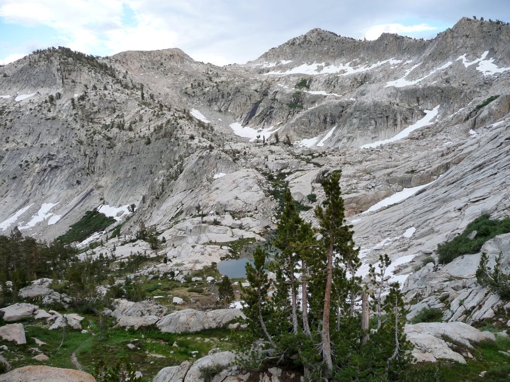
Kennedy Lake. I didn't quite have the drive to get over Kennedy Pass that night, so I stopped short and set up camp at the little ponds around 10,300 feet just north of there. I enjoyed some lovely
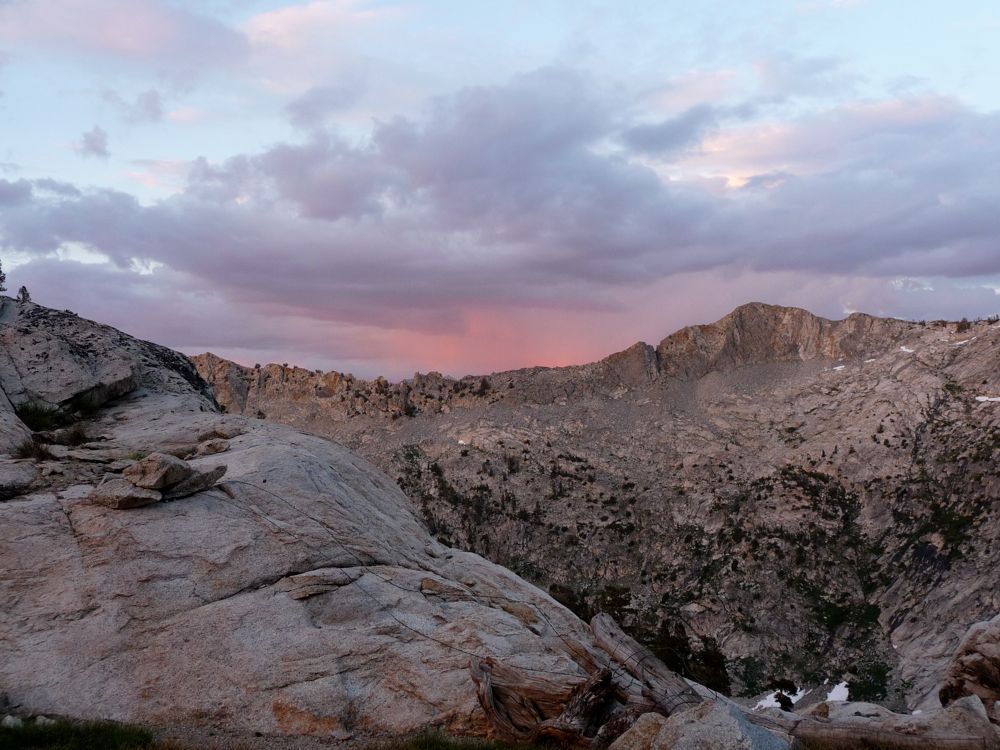
orange-red hues to the east as I ate dinner and relished the warm company of my tiny mosquito friends.
As much as I love being in the backcountry, I have to say that on this particular morning I was so damned excited to take get back to my car, take a shower and get inside of any mosquito-free enclosure I could find. Even then, I'd have to deal with a week of resisting the urge to itch my bites and a month of letting my blisters heal. But at least I wouldn't have to accidentally inhale two mosquitos per day.
Getting up
Kennedy Pass was pretty fun. I always like it when there are a bunch of
zig-zagging trails to choose from. Again, the views from the top weren't the most spectacular, but the view
south was pretty awesome. To the
north I could see a layer of smoke nestled into a valley ahead. I'm not entirely sure of this, but I think that might have been the start of the sheep fire that continuously burned through the summer of 2010. I'd be back in September to get a full blast of it when I did a trip down the Muro Blanco.
The first two thousand feet of descent after Kennedy Pass was through easy dirt switchbacks. The mosquito population had subsided vastly on the south side of the pass, which kept me ruminating as I made my way forward. Was it a North/South thing having to do with the amount of sunlight received during the spring or something? I feel like the horseflies dominated the southern face and the mosquitos had the northern face covered...maybe they've got a contract or something.
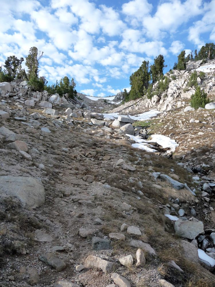
The easy going along the trail was too good to be true. Right about where the trail joins up with the East Fork of Lewis Creek, the weeds and trees begin to take
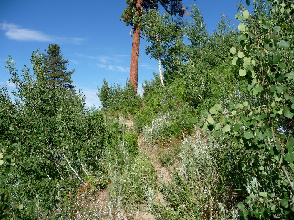
an agressive hold on the trail. You don't necessarily have to bushwhack, but you should be prepared for some gnarly thorns and a few slaps in the face from tree branches between about 9000 and 7000 feet elevation. Once the trail gets past Frypan Meadow (which was a pretty cool place, but yet another breeding ground for mosquitos) things clear up quite a bit.
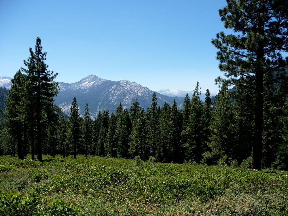
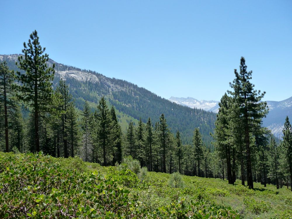
The rest of the trail is pretty straightforward. There are some nice crossings of Lewis Creek where you can pick up some water (you'll need plenty to stave off the summer heat) and the views to the south are open. When I finally got to the Lewis Creek trailhead my blisters were screaming at me to stop walking, but I still had another six miles to go. I decided I was willing to take the chance of being abducted by some crazy rednecks and put out my thumb to hitch-hike. I got super lucky and was picked up by these two awesome students from UCSB that were about to embark on the Rae Lakes Loop. Thus, proving my point, Gauchos are wicked awesome.