


TRIP DETAILS
TRAIL MAP
OVERVIEW
This is a trip report for a winter hike I did through the Grand Canyon. Without a doubt, it was one of the most enjoyable backpacking trips I've ever been on. Although the trail is so worn and the people so numerous that you never really feel like you're in the wilderness, the spectacular scenery more than makes up for it.
My initial plan was to make it all the way from the South Rim up to the North Rim, which is closed during the winter months due to snow. I made it close to reaching 7000 feet on the North Rim, but a lack of snowshoes kept me from making it all the way up. If I was to do the trip again I would bring a pair along. Crampons were definitely necessary. If I hadn't had them on the descent of the initial 1000 feet of the South Kaibab trail, I'm pretty sure I would have eaten it a couple of times.
Prologue: My trip began with a flight from Midway into Phoenix. I made the mistake of not booking a rental car in advance, so the rate I got on a crappy Ford sedan at one of the airport rental agencies was hefty. I took it anyway, and started my drive towards Flagstaff. I stopped for coffee and food supplies at a grocery store just north of the airport and got pretty much everything I needed for four days on the trail. And since traffic was non-existent, I was at the park at about 4:00 pm, four hours after I started driving.
I hadn't decided whether I was going to camp out on the South Rim or stay in one of the lodges yet, but when I stepped outside of the car the decision was made for me. It was cold; I mean, friggin cold. One of the thermometers I saw read 20 degrees. Sure, I would survive in my sleeping bag, but every ounce of my body wanted to get inside a heated room. The way I see it, camping should have some sort of reasonable motivation. For instance, there aren't any shelters within 50 miles, so I'm going to camp. Or, it's a damned fine night to sleep outside, so I'm going to camp. But not, I'm so cheap that I'd rather freeze my ass off than spend $100 on a room.
So I made my way into the Thunderbird Lodge and asked if they had any availability. I was a little frightened when the lady at the reception desk told me no, but she was able to check all the other lodges in the park and find me a room at the Kachina Lodge. After I had booked things there, I went to the backcountry office just down the road and requested a permit for four days (two nights at Cottonwood camp and one night at Indian Garden). Again, I hadn't made a reservation, but I was fairly certain there weren't a hell of a lot of people wanting to endure sub-zero temperatures and twelve hours of darkness at the bottom of the canyon. Luckily, I was right. With a permit in hand, I got some dinner at one of the convenience stores in the park and then turned in for the night.
TRIP LOG
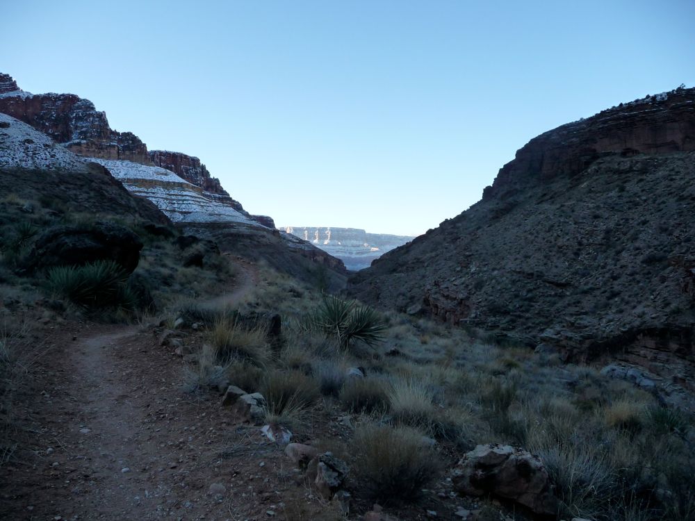
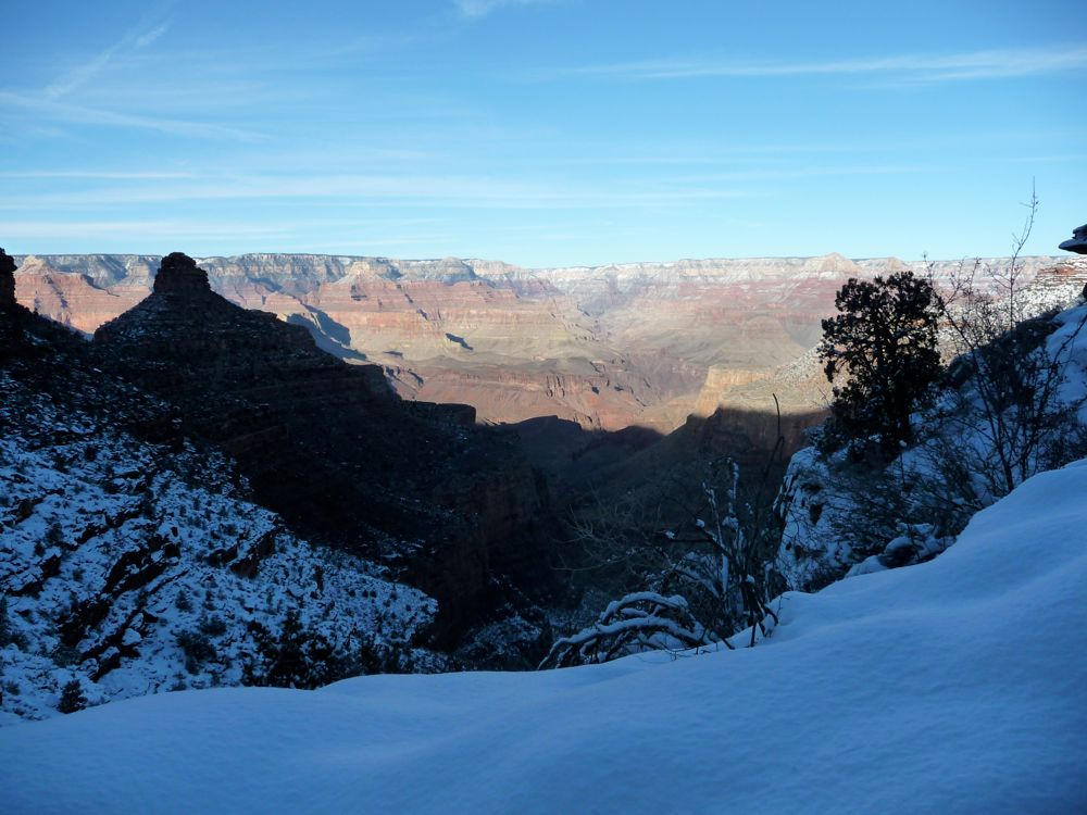
When I woke up I downed a quick bowl of oatmeal, packed up my things, and drove back to the Backcountry office to park my car and pick up the shuttle that would take me to the South Kaibab Trailhead. The driver was right on time, and he delivered us to the trailhead right around 8:00 am. It felt a good bit warmer than it had the night before, but I was still bundled up with a ski cap and gloves on. As soon as I had a look down at the trail I could tell it would be best to have my crampons on, so I got them all tied up and began the descent.
The
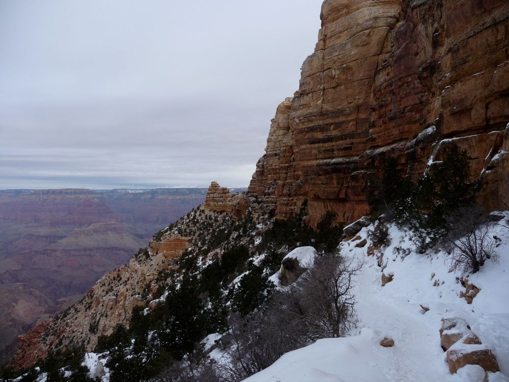
snow on the trail was icy and thick, so the crampons were perfect for it. The
snow lining the canyon walls, on the other hand, was thin and powdery, and it reminded me of a huge pound cake covered with powdered sugar. Once I got down about 500 feet, I took a moment to just stare at
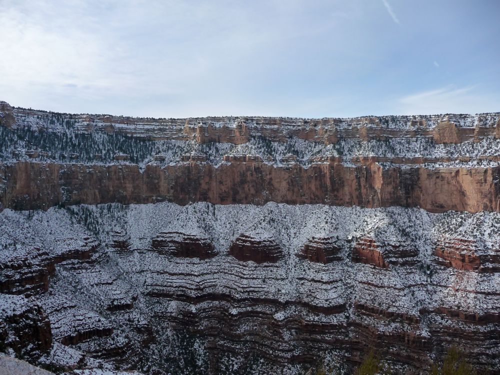
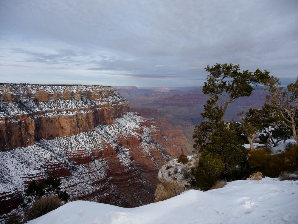
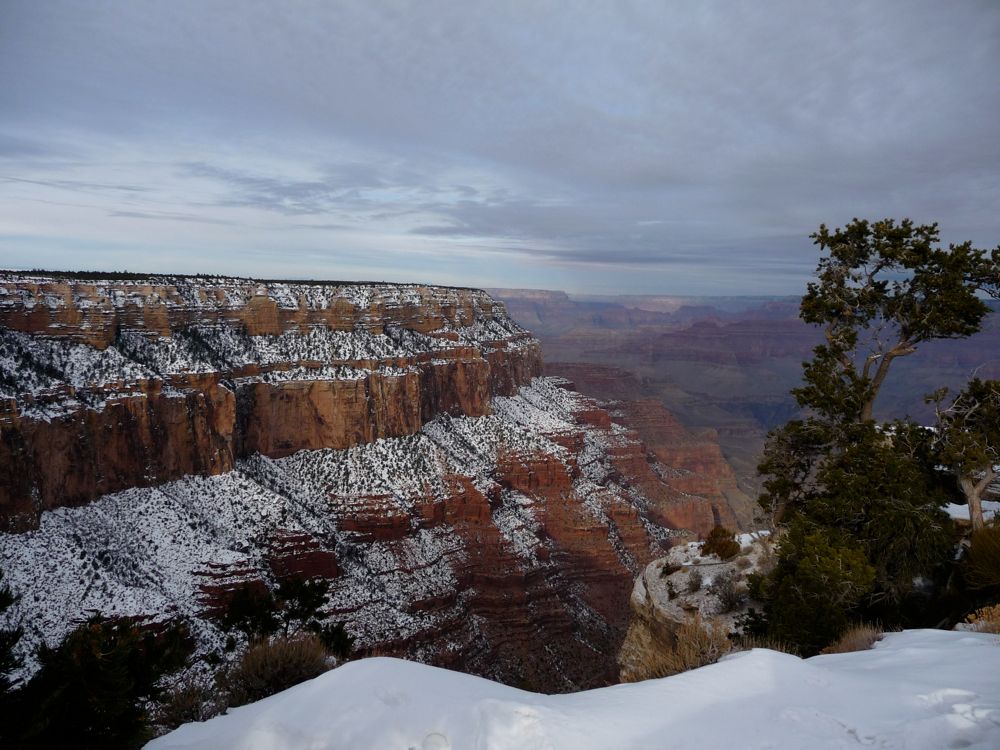
the canyon edge. It was really amazing to me to see such a steep grade topped off with a completely flat edge. I was relieved to see that, indeed, there was
no snow further down in the canyon, which meant warmer temperatures (sure, I trust the laws of physics and the average of 3.5 degrees F per 1000 feet of elevation, but it's always nice to have proof).
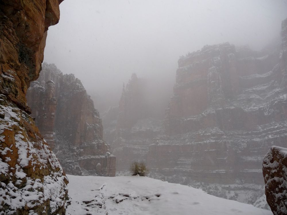
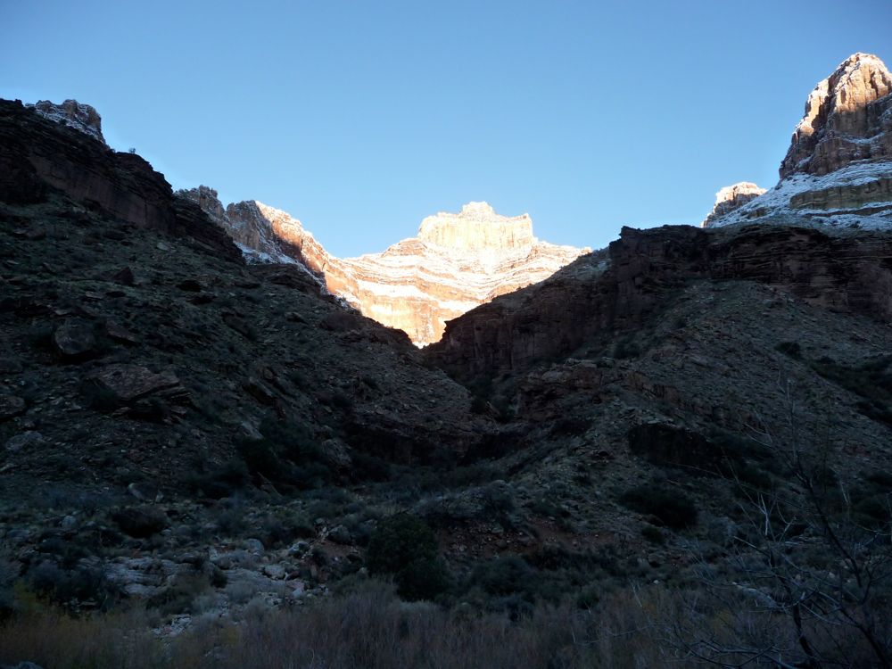
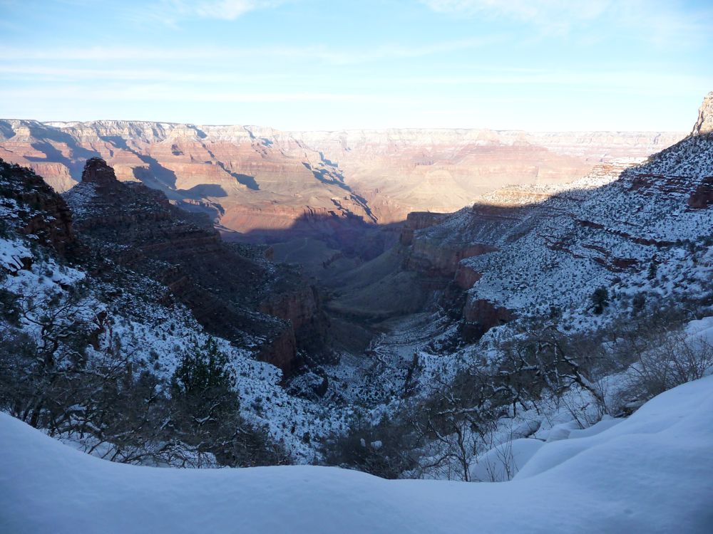
The sky was rather overcast, but every once in a while the clouds would break and
light the canyon up in magnificent ways. The
shadows in general were simply amazing. At
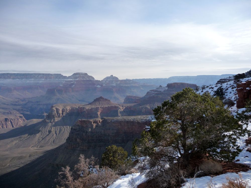
Cedar Ridge I stopped for a breath and some photos. There are bathrooms at Cedar Ridge, but no water. This was no problem for me, of course, since I could melt snow if I wanted. But I kept thinking about how brutal this must be during the summer months, especially on the hike out of the canyon. There is no water anywhere on the South Kaibab trail.
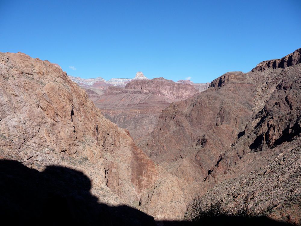
After Cedar Ridge, the trail
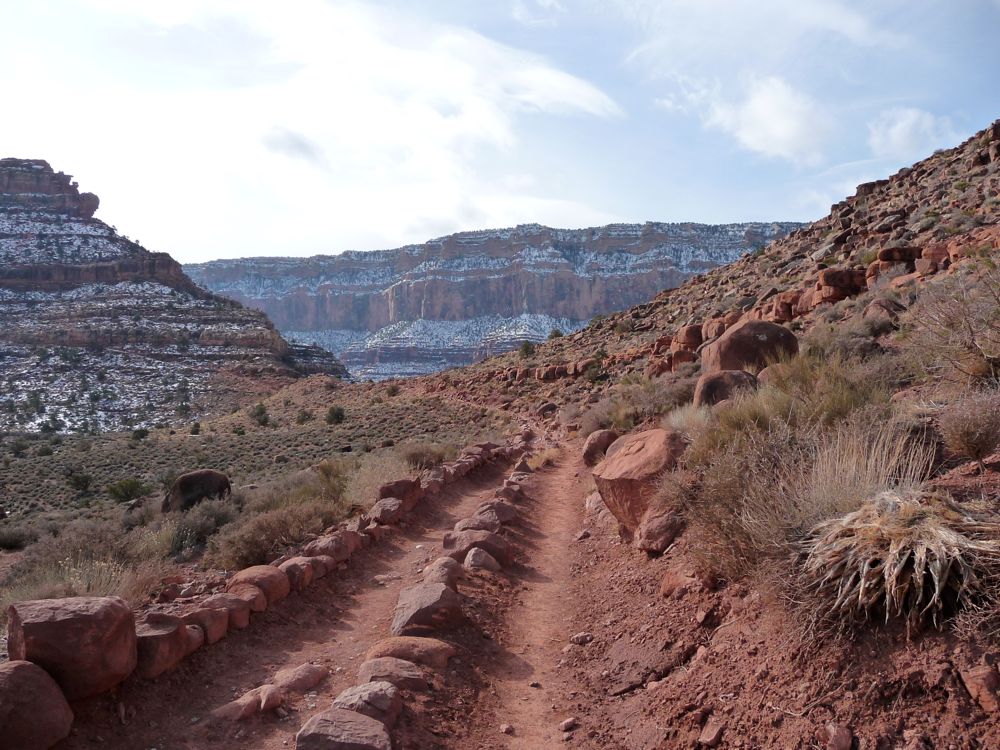
opens up quite a bit and you can see
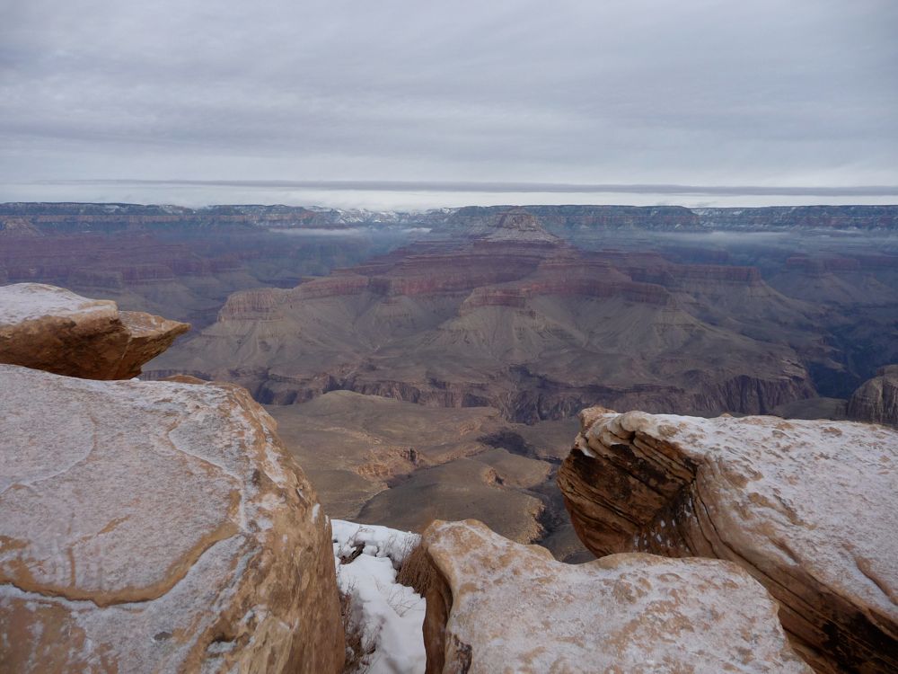
where it's taking you. You descend about 500 feet, and then follow a ridge for several hundred meters to Skeleton Point, where you have your first view of
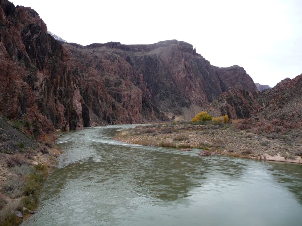
the Colorado River. The second time I did this trail, I stopped here for a good long while. It's is a great place to stop and soak in the view, and give yourself a rest before the switchbacks coming up (or a rest after climbing up them).
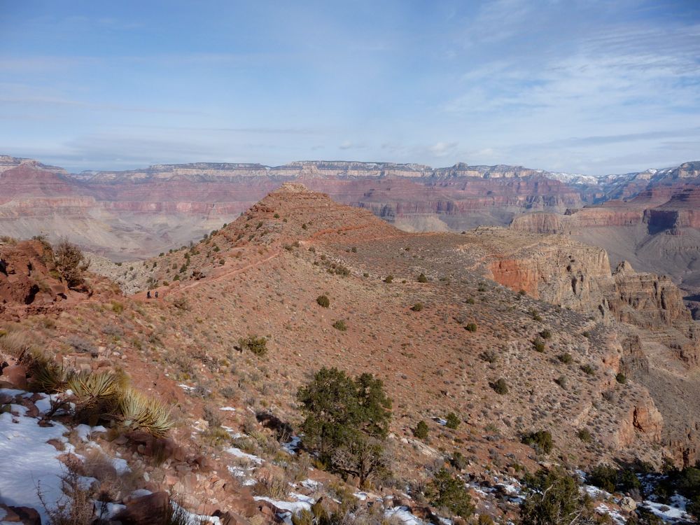
The switchbacks drop you down to about 4200 feet and offer good views to the east. When the trail finally
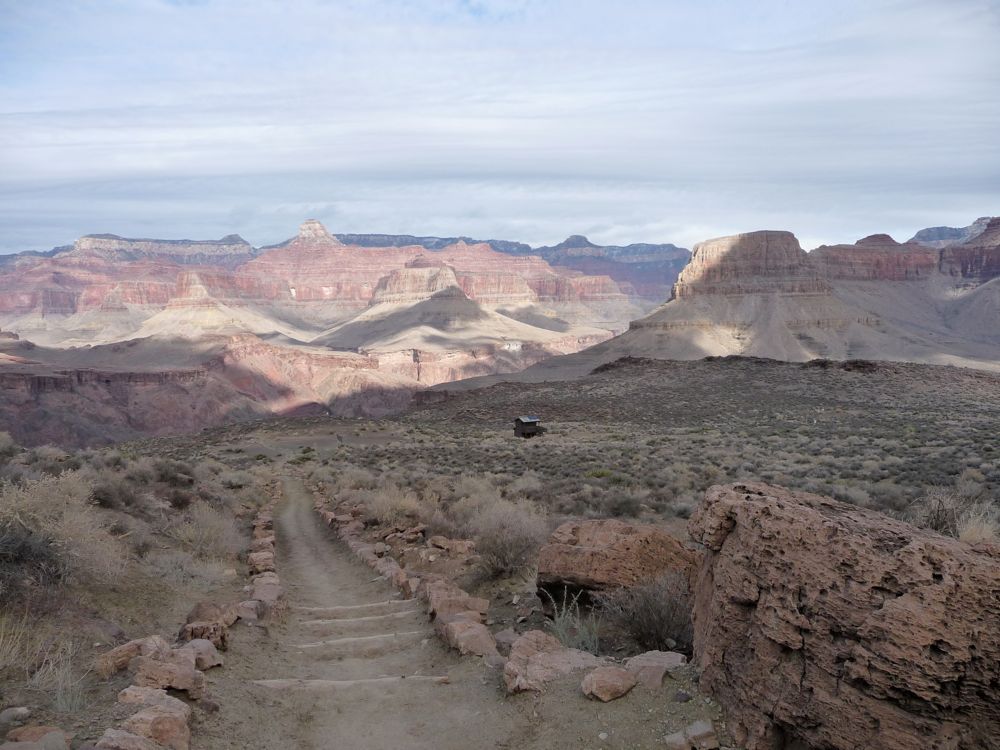
flattens out, you can see the little hut just beyond the
junction with the Tonto Trail. When I opened up the map at this point, I was blown away by the possibilities I'd have if I followed this east or west. Someday I'd like to do a hike for a few dozen miles on the Tonto and follow the Colorado.
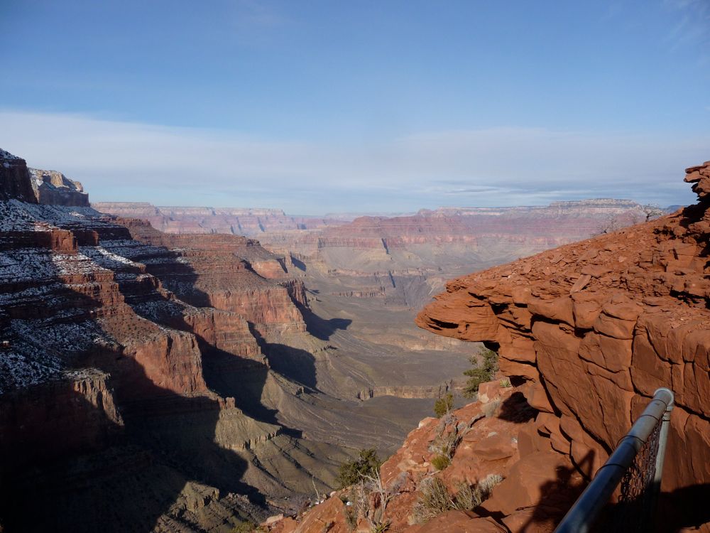
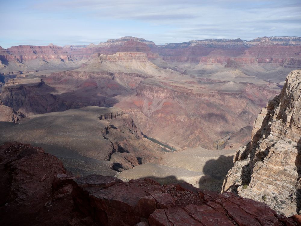
Now, if the trip ended at this moment, I would have been content with the superb views I'd already taken in. It was pretty much a 10/10. But what came next basically made the scale go up to 11. Rounding the corner just below the hut in the previous picture, I felt like I had stepped onto the surface of Mars. The trail arcs along a crescent drop-off, through
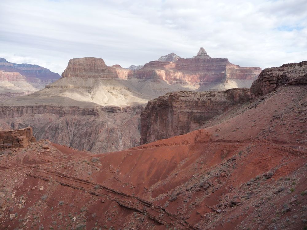
a thick red clay beset with green-stained rock, making one of the most vibrant palettes of colors I've ever seen in nature. I'm not a poet, so I can't really do it justice. But it's one of the places where I wish every one of my family and friends could be there just once to behold its glory. And in the middle of the crescent, you can see
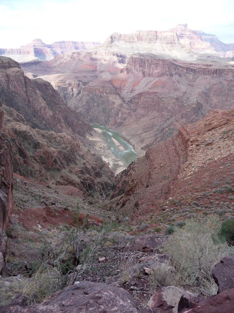
rapids in the Colorado waiting for your arrival.
Just past the crescent, I stopped for lunch at around noon. After that, I made it quickly down the switchbacks and crossed the
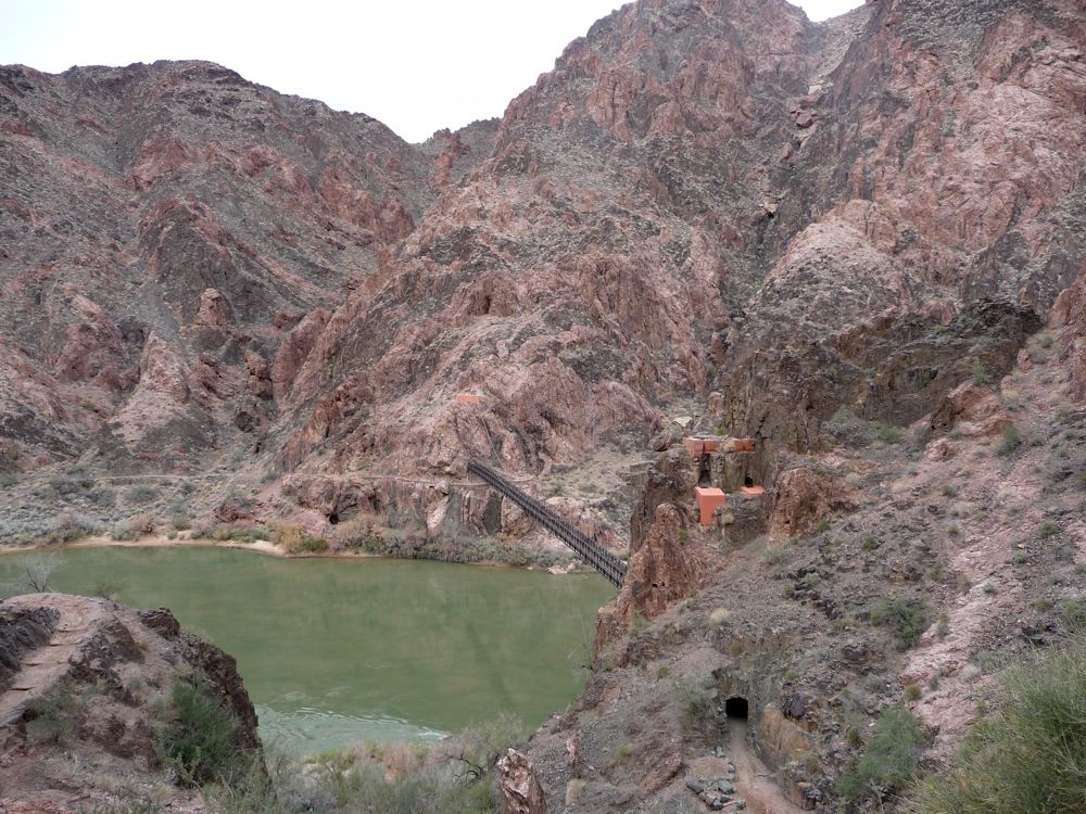
suspension bridge to flat, tree-filled beach at
Bright Angel. I stopped for awhile to fill up on water at the pump there and read the
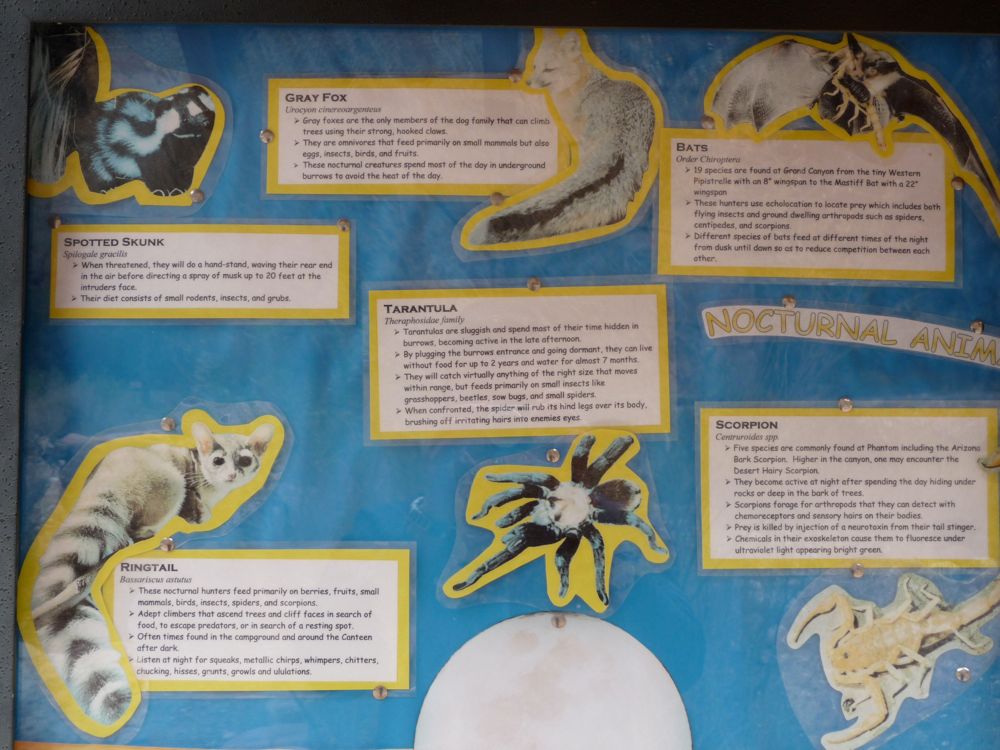
signs about local wildlife and the
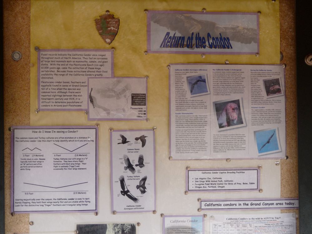
California Condor.
I was curious to see what
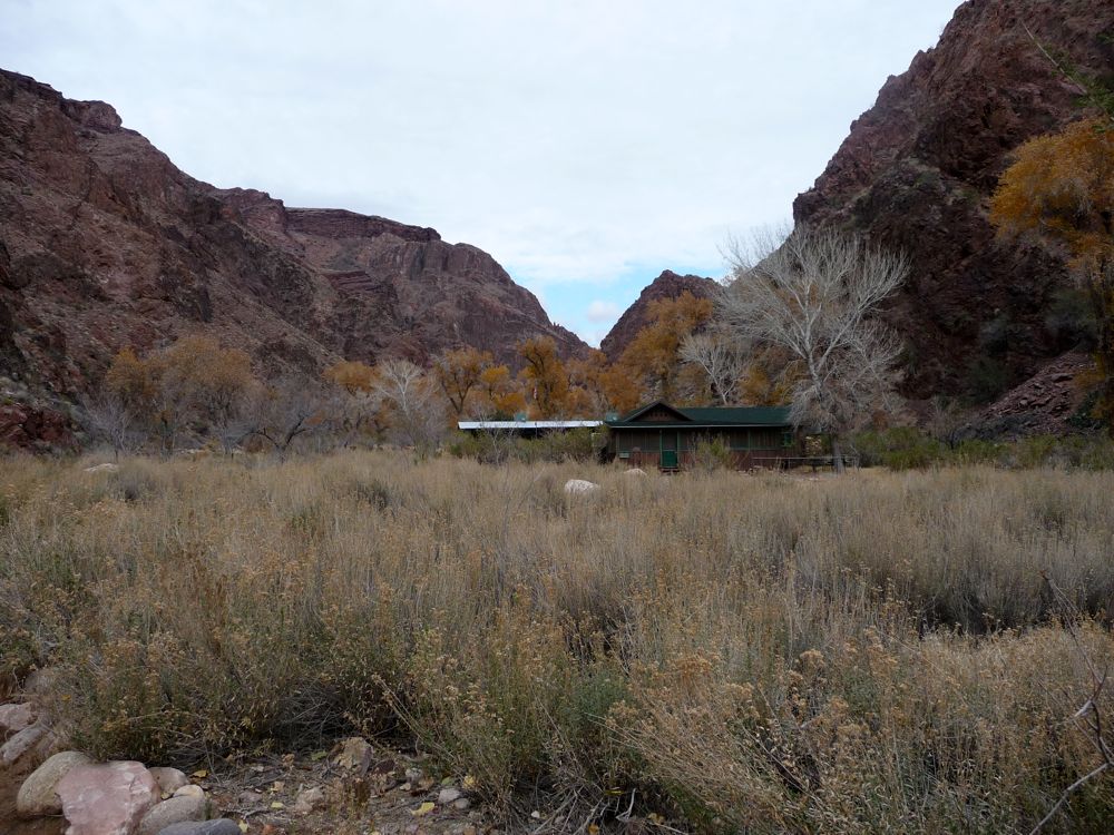
Phantom Ranch was like, so I wandered over to the cabins and checked them out. They look really nice; probably a better spot for a romantic getaway than a tent. Starting on my way toward Cottonwood Camp, I came along this
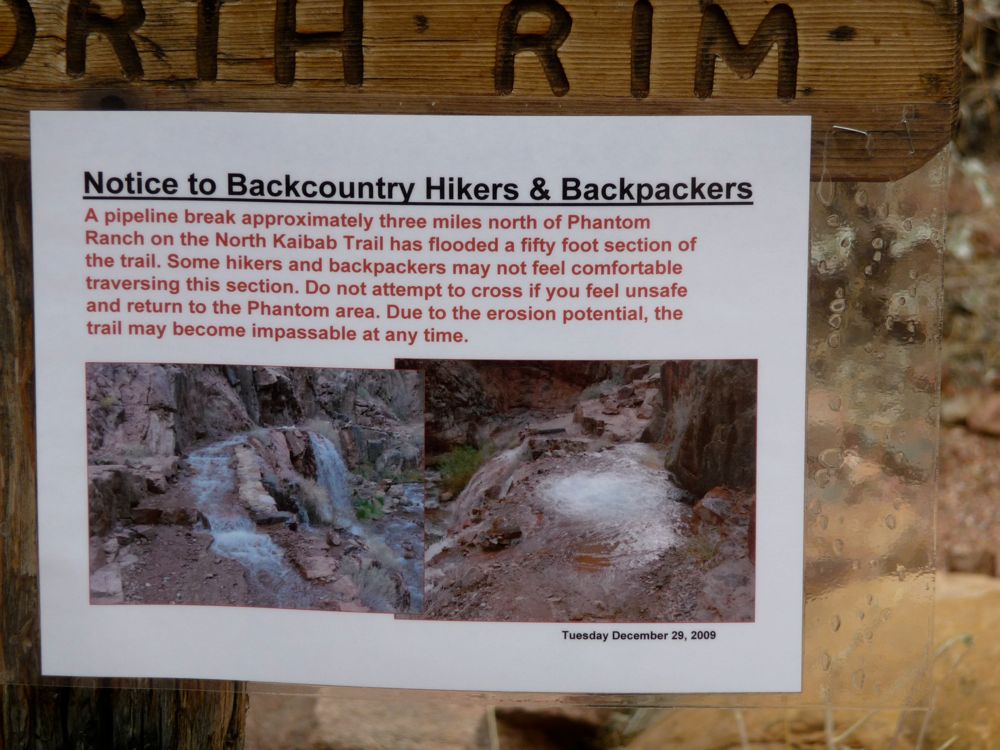
sign warning of the danger of a pipeline break on the trail ahead. The ranger at the backcountry office had also warned me about this. But looking at the pictures, I began to laugh a little. It's just funny to me how some park rangers blow things so far out of proportion. I'm not sure if they want to scare people away just to eliminate the possibility that they may have to actually get out there and save them, or if they really do consider these things dangerous. Either way it's comical to me.
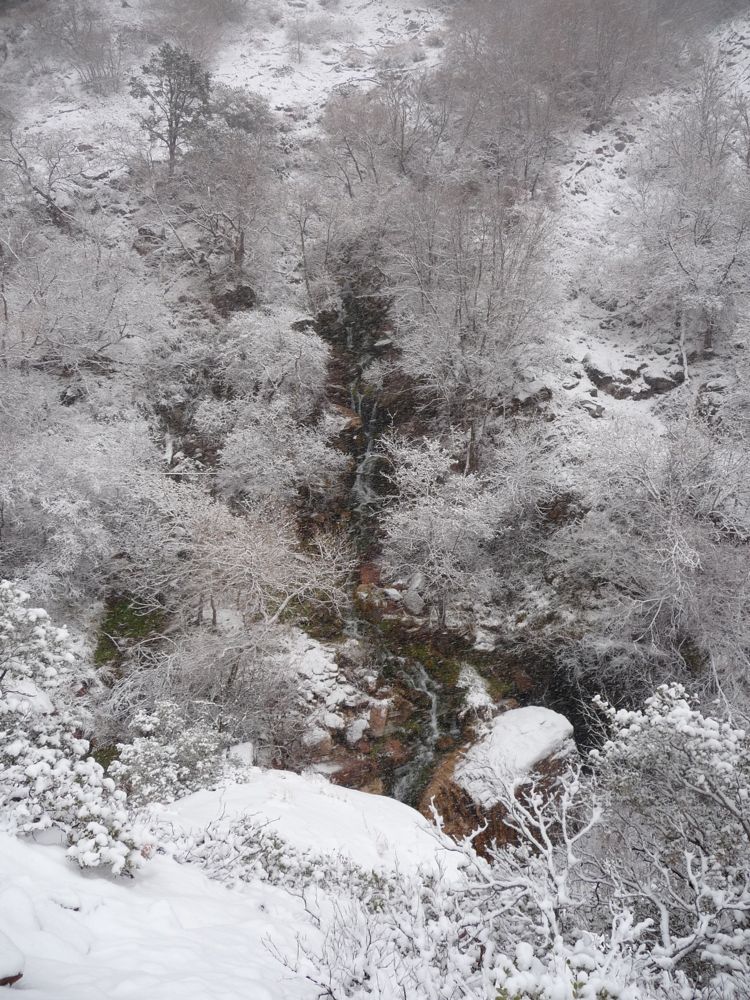
The next few miles of the
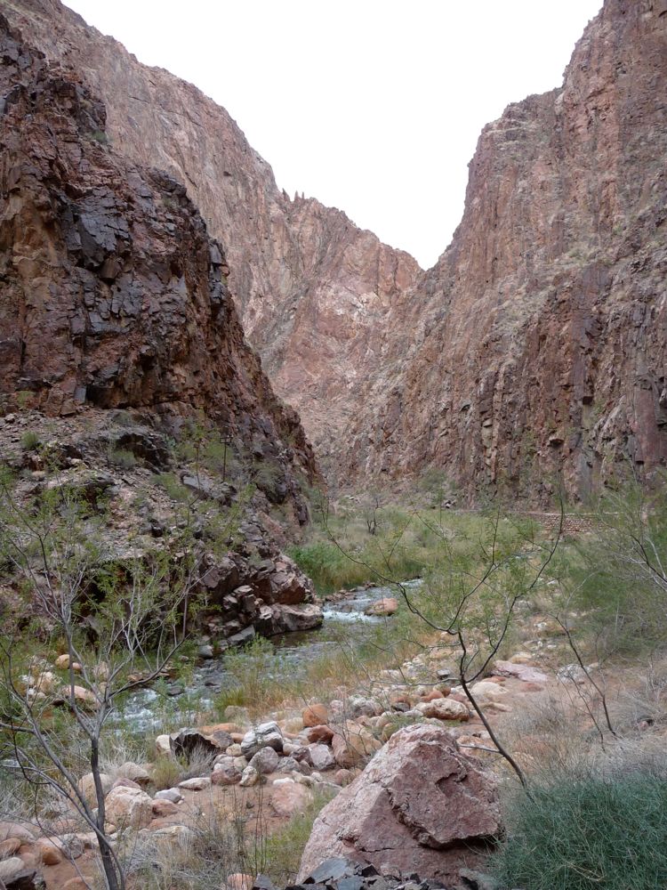
trail were really enjoyable. It follows a stream through a very steep
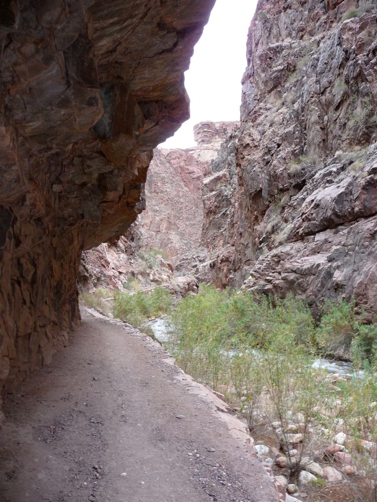
sub-canyon, and then
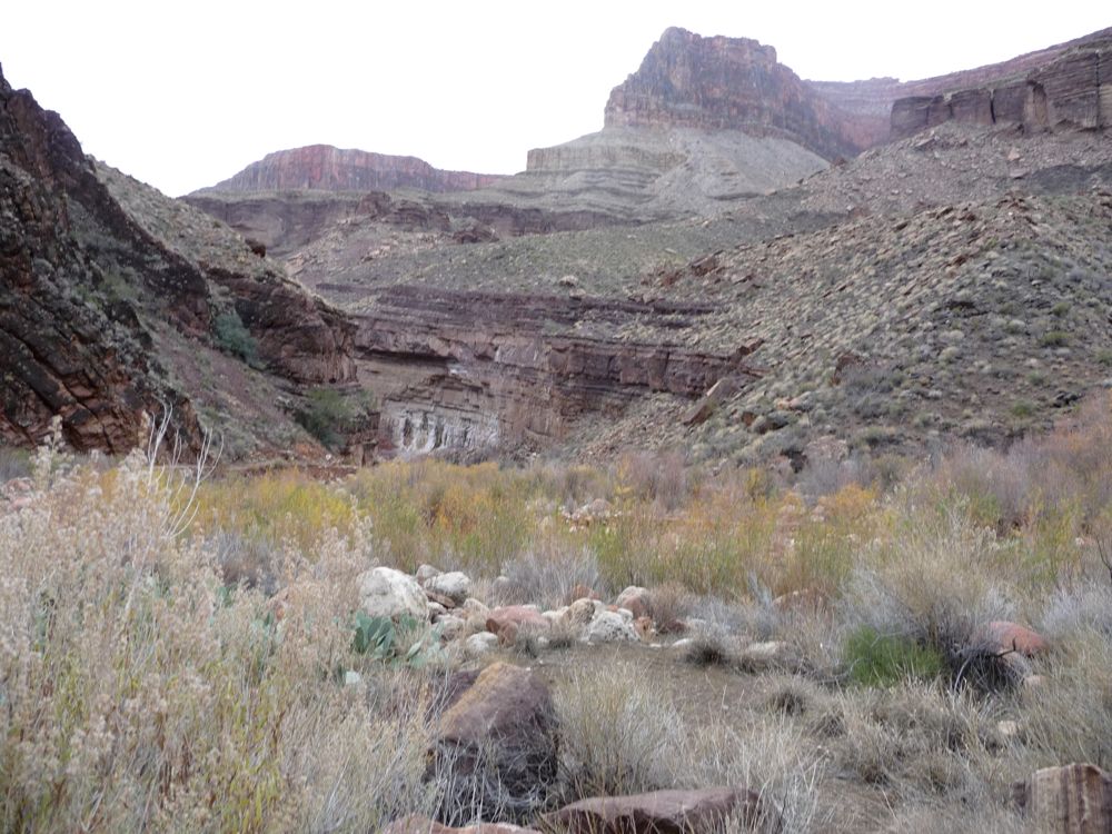
opens up as it starts to
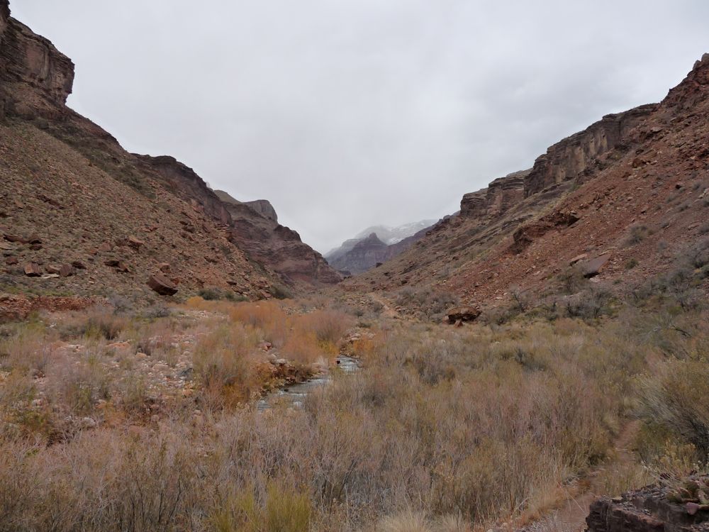
climb to the north. I would have liked to take a digression to
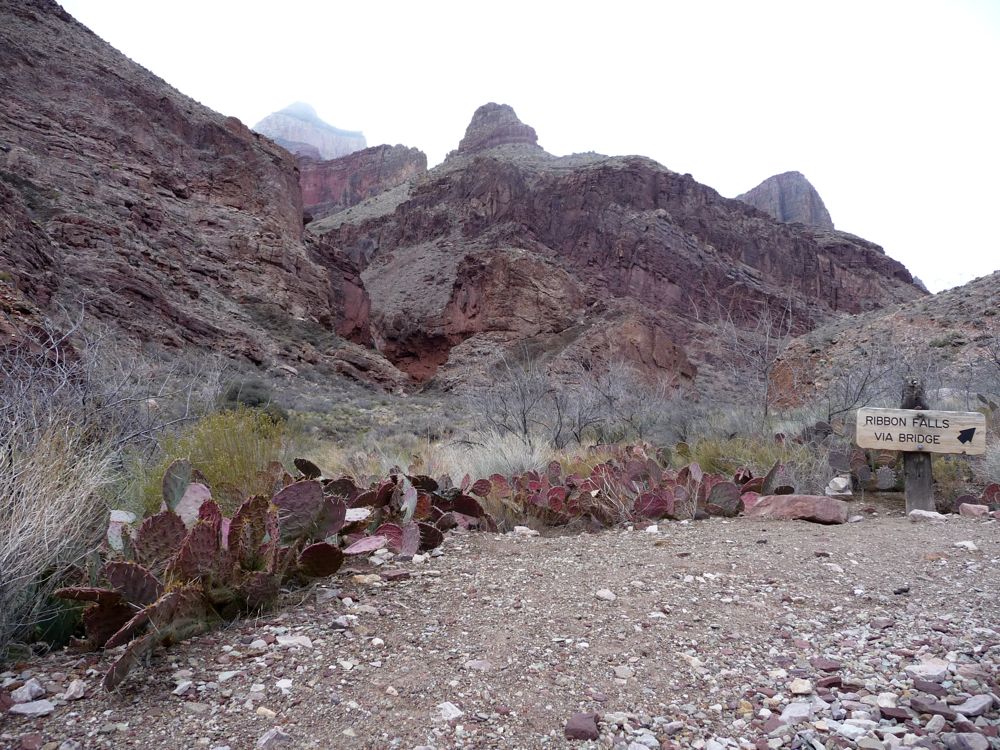
the Ribbon Falls trail, but I wanted to make camp before dark, so I kept chugging along. The views back
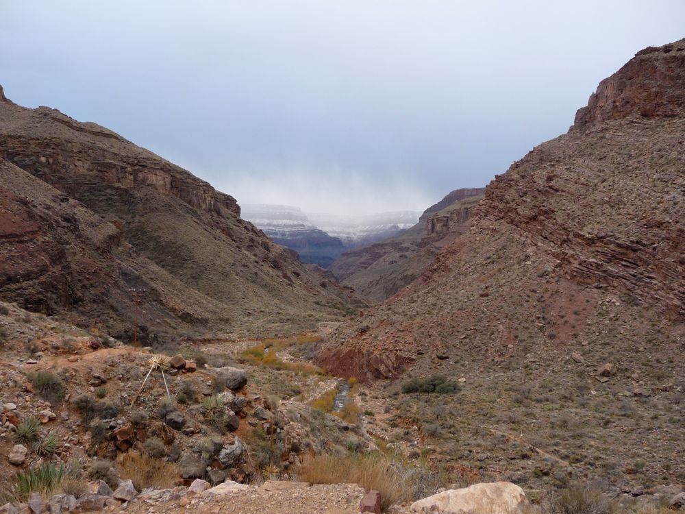
down to the Colorado were excellent, even with the
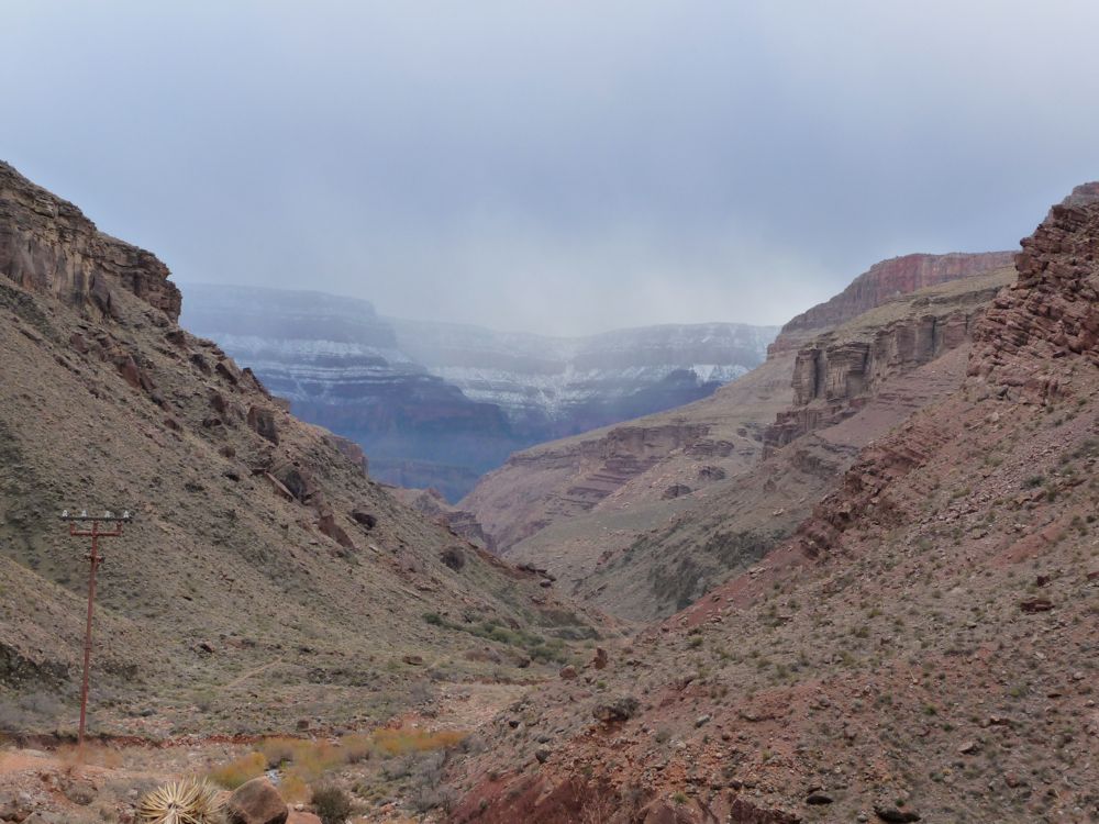
power lines taking center stage.
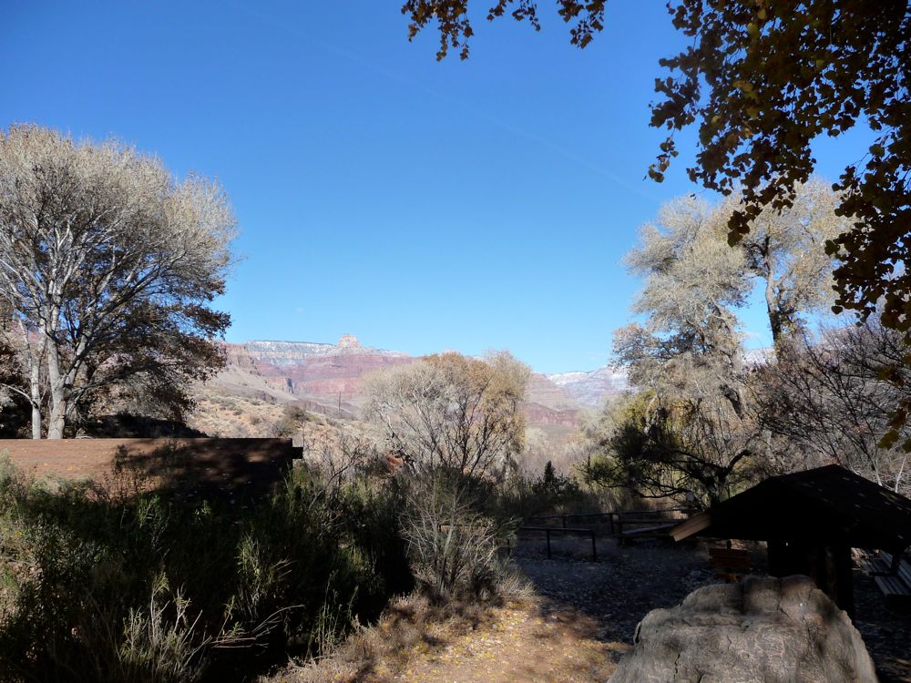
Before I knew it, I was at
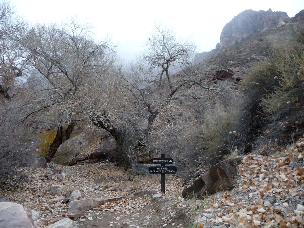
Cottonwood Camp, where I would hold up for the night. It took all the willpower I had not to light a fire. I abstained from doing so because I was almost 100% sure a ranger would ticket me if I did. The temperature plummeted below freezing pretty damned quickly, and when I took my last sip of water for the night, I got a few chunks of ice in there as well.
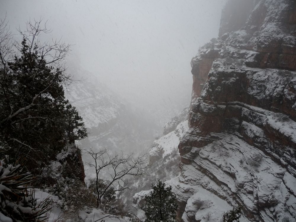
Let's see, how do I describe day 2 of this trip? Well, one word comes to mind: precipitation. Every second of the day, some form of moisture was falling on me. A light, soft rain, nice speckles of snowflakes, heavy downfalls of snow, complete white-outs...I pretty much got it all on this day.
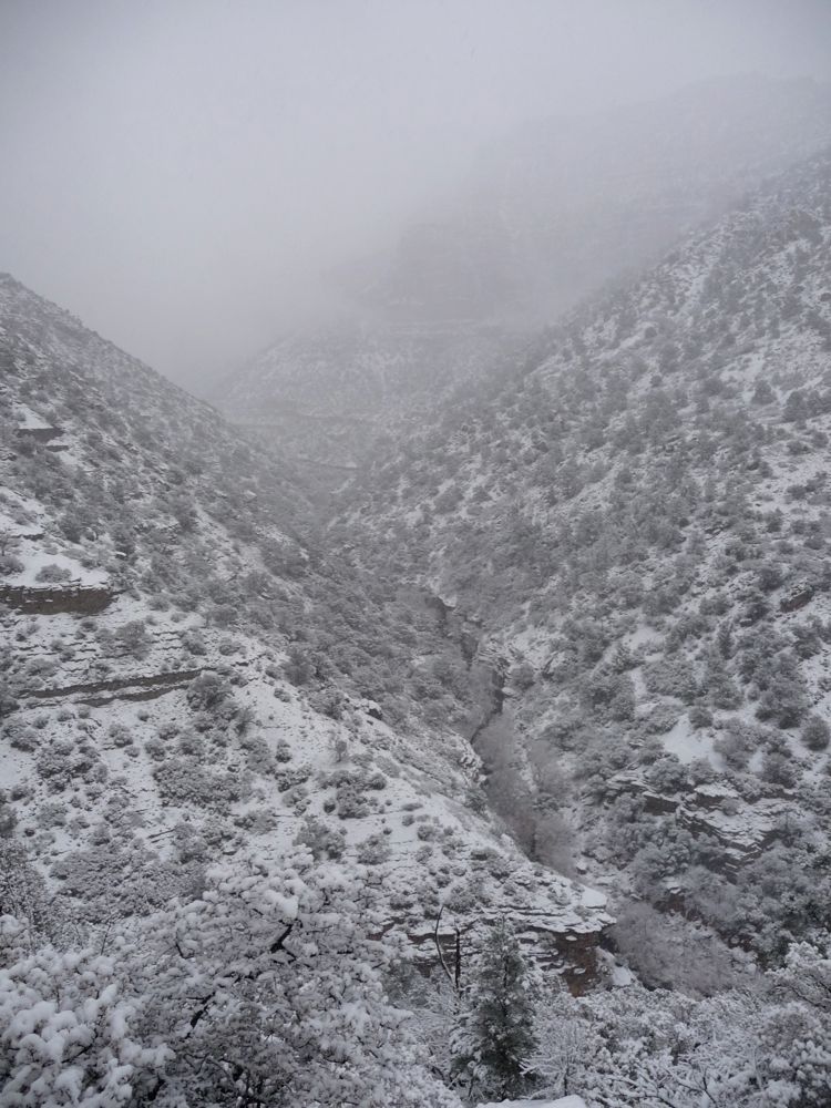
During breakfast, the rain was sparse enough to not notice if you weren't paying attention. But when I started up
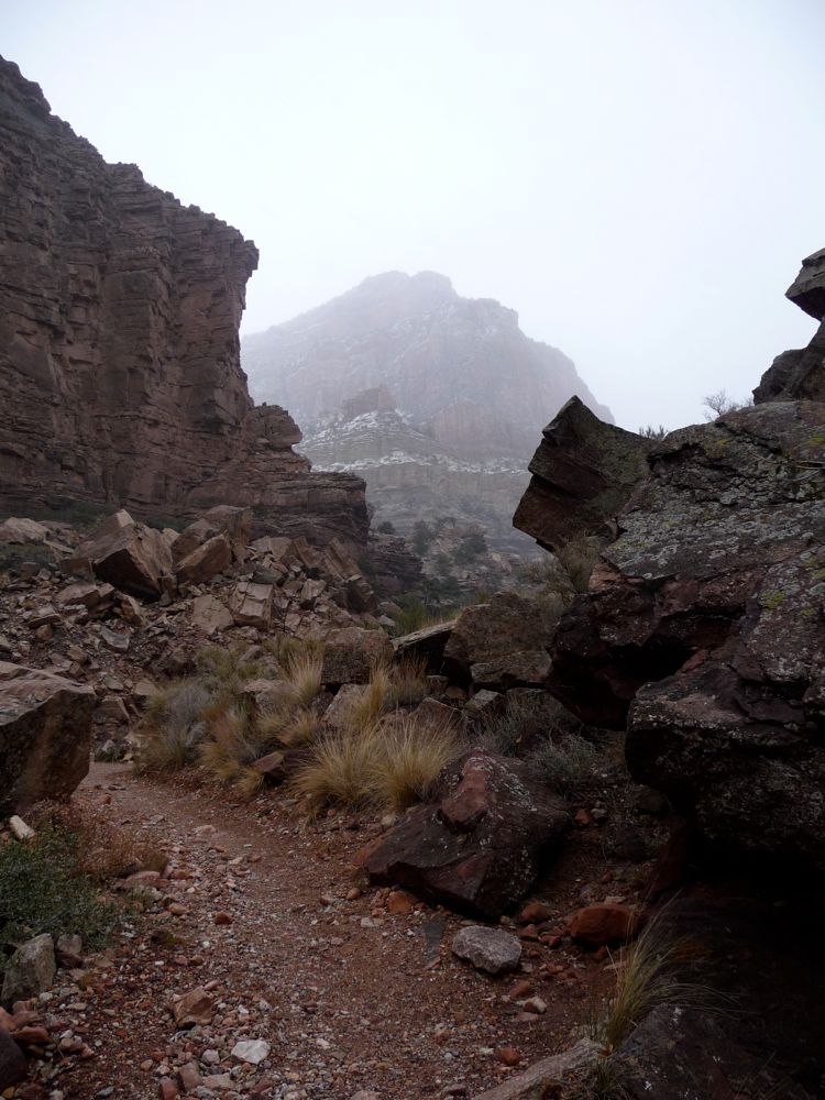
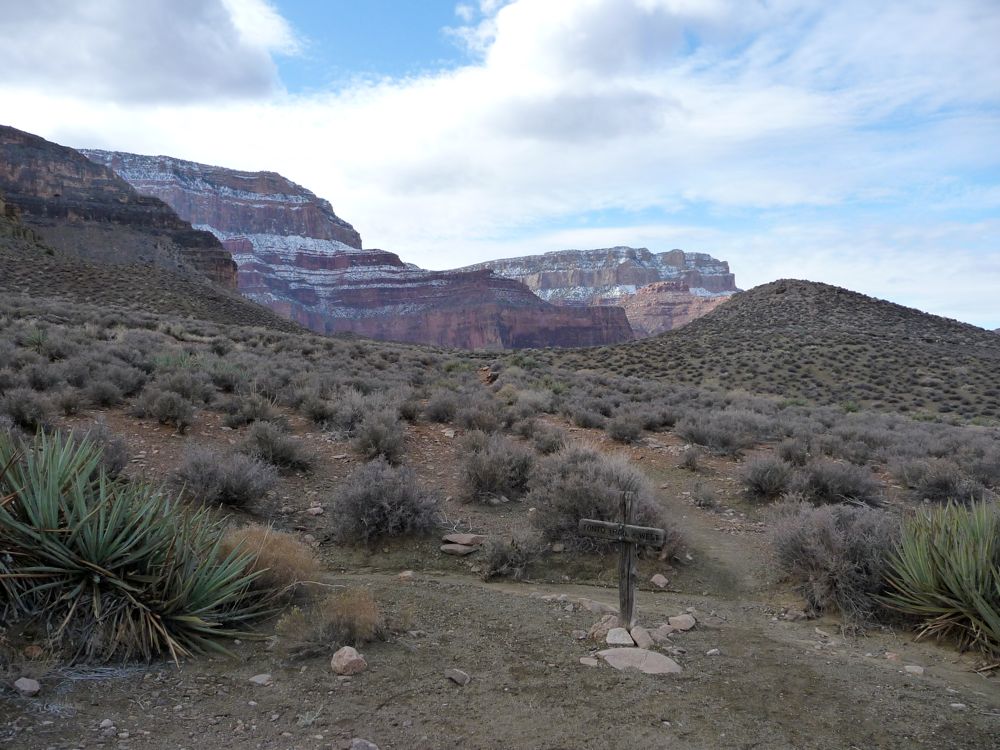
the canyon, it got quite a bit heavier. At the
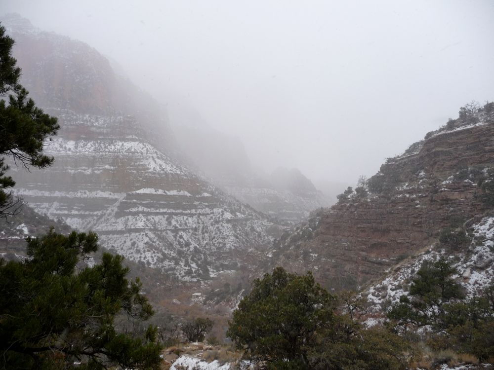
three way junction just before Roaring Springs, I could see that I was hiking right into the thick of it. The snow along the
trail wasn't too thick as I started up the switchbacks to the west of the spring. Visibility was
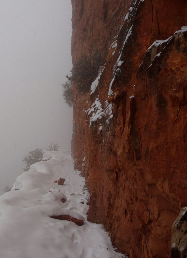
low, but it made for an almost surreal effect with the thin ledge of trail next to the canyon wall.
If it had kept up like this, I would have been able to make it up to the North Rim. But at around 6200 feet, the
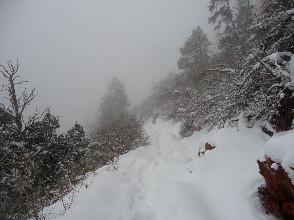
knee-deep snow and 30 degree air made me question whether or not I should continue. Without snowshoes, I was sinking all the way to the bottom with each step. And I hadn't brought my winter boots since I wasn't expecting such an accumulation, so my feet were pretty goddamned cold. I figured I could either continue up to the North Rim and depend on a nice, steady fire to warm me up or head back down to Cottonwood and have the extra 12 degrees of natural warmth and the shelter of the ranger station I had passed on the way up. I now regret making the decision of turning around, mainly because I'm sitting in a warm room in front of a computer screen, but at the time it seemed like the smarter thing to do.
On my descent, I noticed that the snow had
accumulated substantially in just the few hours I'd been hiking. When I got to the base of the switchbacks, I stopped at
Roaring Springs for lunch, and enjoyed the sound of the stream accompanied by the pitter-patter of falling snow. God, I love that sound. When I got back to the 5000 feet or so, the ferrous colored canyon I had passed by earlier had been seize by snow and transformed into a
winter wonderland. I tell ya, the fall of moisture was non-stop that day, my friends.
A few hundred feet below, the snow was overtaken by a heavy rain. By the time I got back to Cottonwood, somewhere around 3 pm, I was amply soaked. I had left my tent standing there, and when I looked inside it was nice and dry. But I had no desire to sit cooped up in there, so I went over to the ranger station to take shelter there. It looked like it hadn't been used in awhile, so I felt comfortable getting underneath the central overhang despite the signs telling me it was unacceptable to do so.
I spent the next few hours drying my stuff off with my stove and getting my core temperature up. Just before nightfall, two other guys arrived from the south and I told them they were welcome to join me. But they said they were gonna hold up in their tents, so I had the place all to myself for dinner and tea. When I got in my sleeping bag at around 8 pm, it felt damned good to get truly warm before falling asleep.
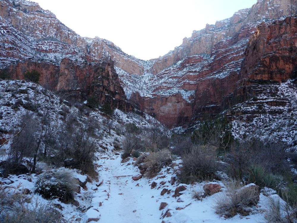
The night was a very unforgiving one. When I stepped out of my tent in the morning, my backpack was literally
frozen stiff. The water bottle I had left outside was a solid block of ice, and all of my food would need sufficient heat before it became edible. Luckily I had kept my water filter and one full bottle next to my crotch in my sleeping bag. After eating some oatmeal I broke down my tent, shouting profanities every few seconds while I tried to separate the poles, which were frozen at every joint. But no rain was falling. That was a huge plus.
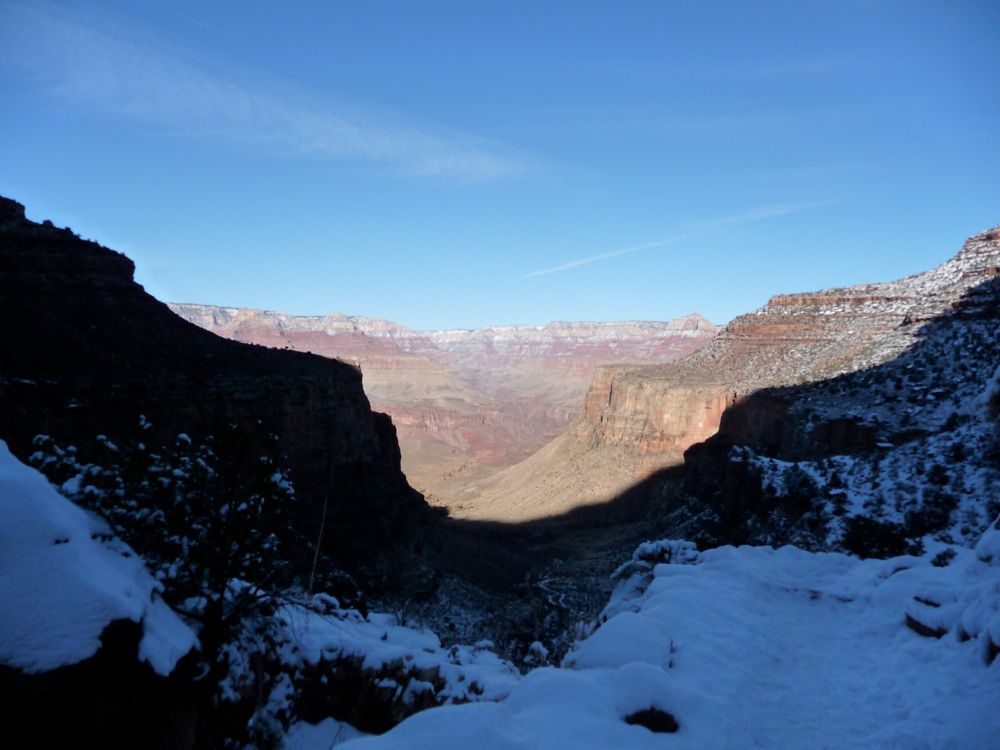
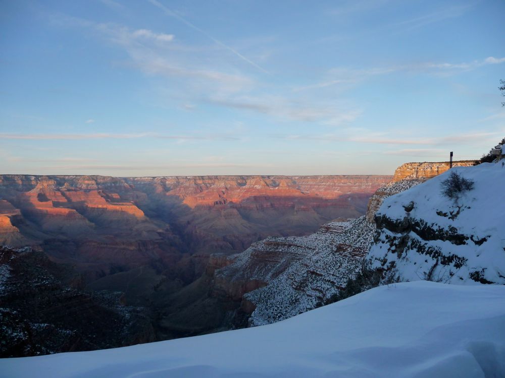
I was happy to get moving and warm up, especially since it was a
crystal clear day. Jealousy struck me, as I noticed had already bathed
the east facing walls of the surrounding canyons. The return to Bright Angel was still enjoyable, and when I finally got there I was greeted by a pack of
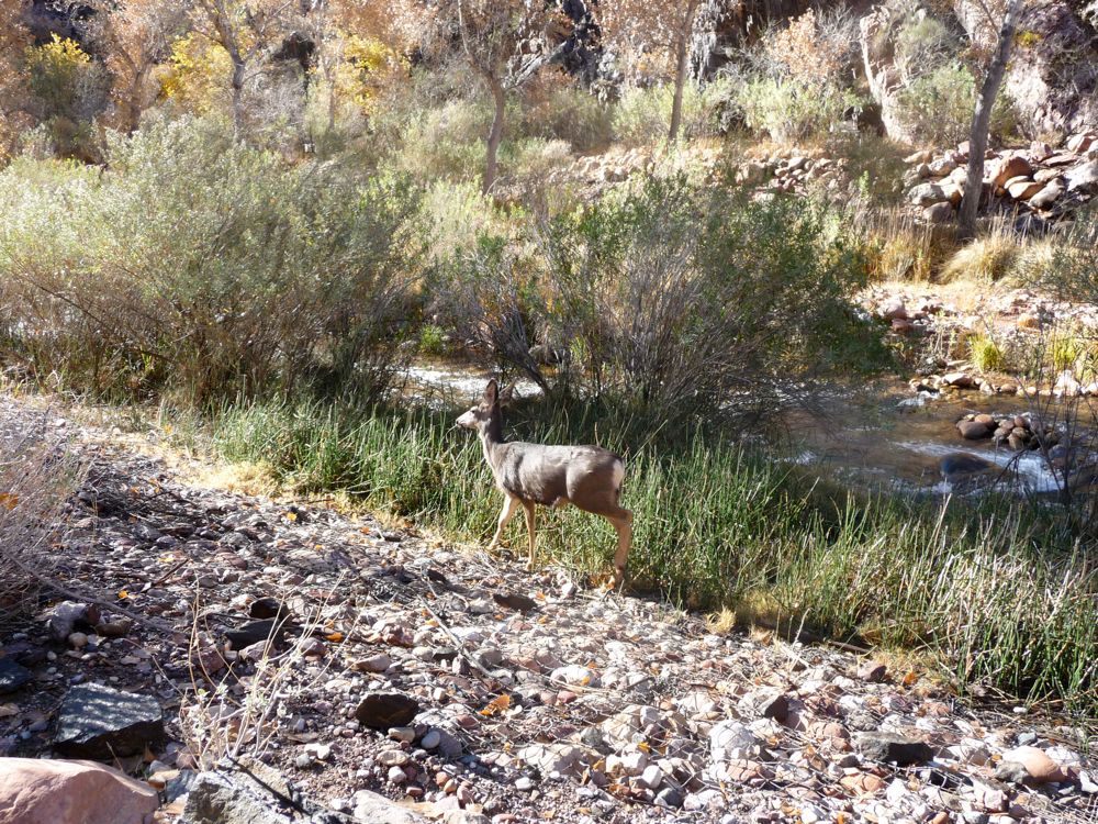
mule deer that didn't seem too scared of people.
When I got to the
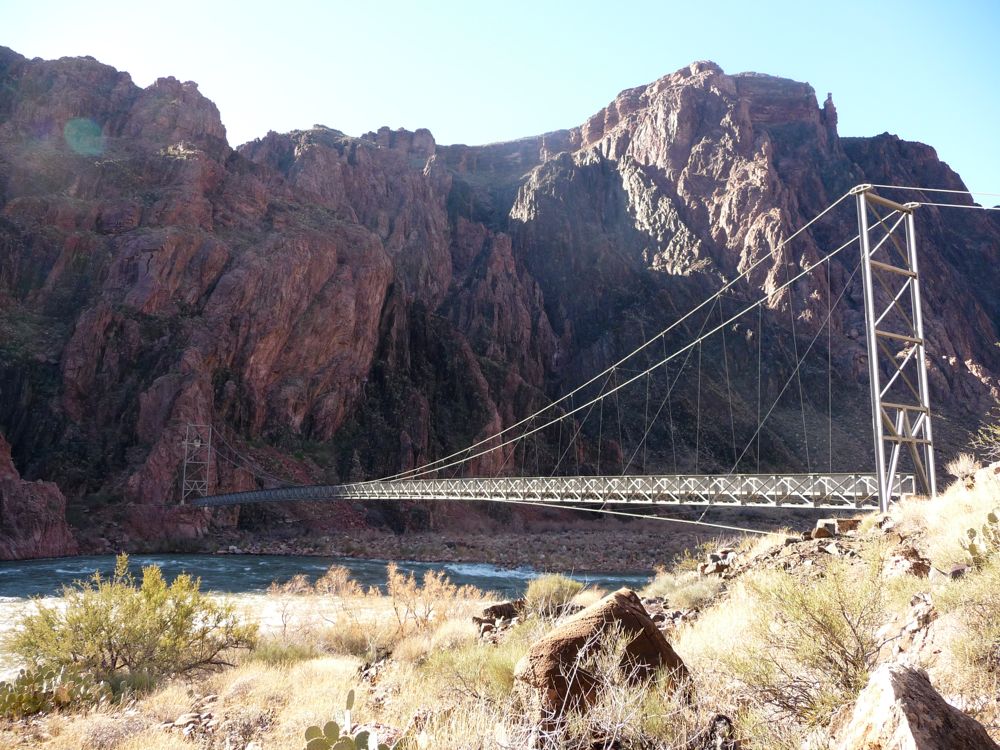
suspension bridge that crosses over to the Bright Angel trail, it was about 10 am. At the rate I was hiking, I would be up at Indian Garden by about 1 or 2 pm with plenty of time to relax after setting up camp. But I didn't really want to sit around for the whole day, so I decided I'd try to make it out of the canyon by nightfall.
After the bridge, the trail follows the
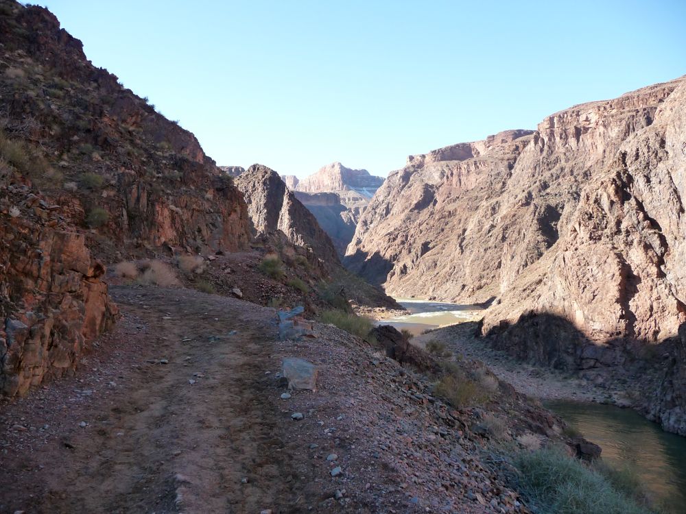
Colorado for a few hundred yards, dipping up and down. It then cuts up Garden Creek in a nice, gradual ascent. During this section, I was passed by a few parties riding on mules. I gotta be honest, the idea of being off my feet seemed nice, but not nicer than smelling a mule's ass for four hours. I passed a few hikers on the way up the switchbacks that raise up from 3100 feet to
3700 feet, and continued along the straight section of trail until I arrived at
Indian Garden.
It was only about 1 pm, so I took my sweet time eating lunch and drinking coffee at one of the picnic tables there. I figured I'd need some good energy for the climb out, and I was right. It was a little intimidating to look
3700 feet, I figured I'd need some good energy for the climb out, and I was right. When I got moving, I made it pretty quickly up the trail to the point where the canyon closes in on you. It was a little intimidating to look
up to the rim and know I'd have to snake my way up 2500 feet of switchbacks. But when the going gets tough, the tough get going, right?
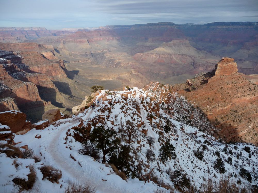
Getting up the first thousand feet was relatively easy. The snow wasn't too deep, and the
sweeping views gave me reason to stop and take pictures. Once the snow
deepened , moving got a little slower. But now the creeping dusk
shadows made the canyon look even more amazing, so my slow pace didn't bother me at all. I reached the
canyon rim somewhere around 4:30 pm. It was a lot of hiking and elevation change for one day, but I was still feeling pretty good. Of course, if I had tried that in July, my skeleton would probably be lying on the trail somewhere now.
I caught the next shuttle that came by, and was back to my car just before the sun set. Again, it was too friggin cold for me to choose a damp sleeping bag over a nice, cozy hotel room, so I stayed at Maswik Lodge that night. I still had one and a half days before my flight back to Chicago, so I decided I'd do the South Kaibab trail again when I woke up. I know, it sounds crazy. But that's how much I loved that trail. I figured I'd make it a little fun and see how fast I could do it, too. I've forgotten exactly how long it took, but it was somewhere around seven hours with a nice stop at the bottom for lunch. I'm not the fastest dude on Earht, so if you're in decent shape, you can probably use that as an estimate, too.
Epilogue: Due to the phenomenal nature of the South Kaibab Trail, I felt a strong lure to come back for another tasting. On this second trip (3/24/11-3/27/11), I brought my Dad, brother, sisters, sister-in-law, and cousins, so we had a total of eight people. We were extremely lucky to get the group permit that I applied for on the first hour of the first day of the month of November (the earliest you can book is four months in advance), which had us camping at Bright Angel campground on the first night and Indian Garden on the second night.
Three days to make it down and back up might sound like a lot of time since strong backpackers can likely do the full trip in a long day. But it's really nice to have the time to relax and explore the many nooks and crannies of the canyon. For instance, on the second day we only had to hike five miles and ~1400 vertical feet to get from Bright Angel to Indian Garden. And this gave us the entire afternoon to lounge around and do a day hike out to Plateau Point, which might be one of the coolest lookout points I've ever seen. If you have the chance to make it out to Plateau Point, do it.
The first day was easy for everybody: gravity does most of the work for you over the five mile downhill. The second day was equally easy. Everyone was apprehensive about the final day with five miles of hiking and 3000 feet elevation, but we made it in about four and a half hours with no muscle tears or anything awful like that. And even though we might not have looked "happy" on the way up, everybody felt exquisite once they reached the top. So I think this would be a pretty good route plan for any group in decent cardiovascular shape.