

TRIP DETAILS
Backpacking on the High Sierra Trail
Trip Members: Jay Blizzerg, ERock Sizzlims, LDog McSimminson
TRAIL MAP
OVERVIEW
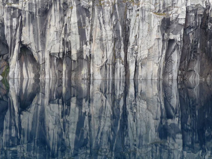
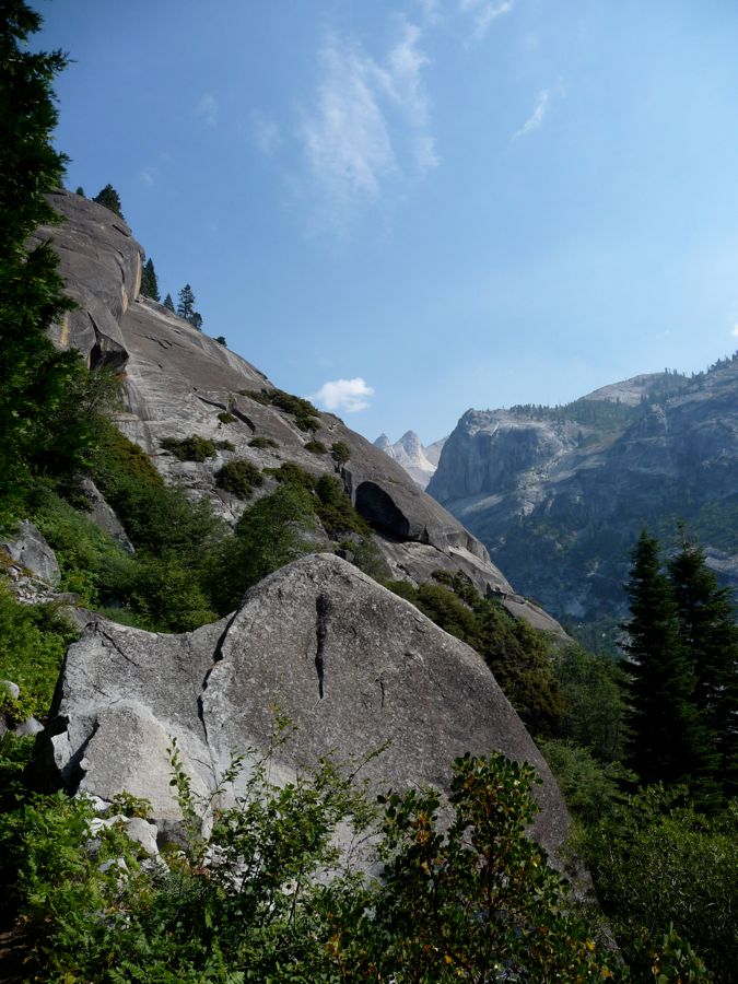
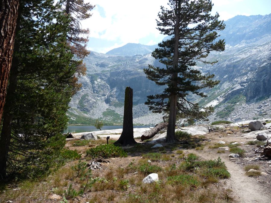
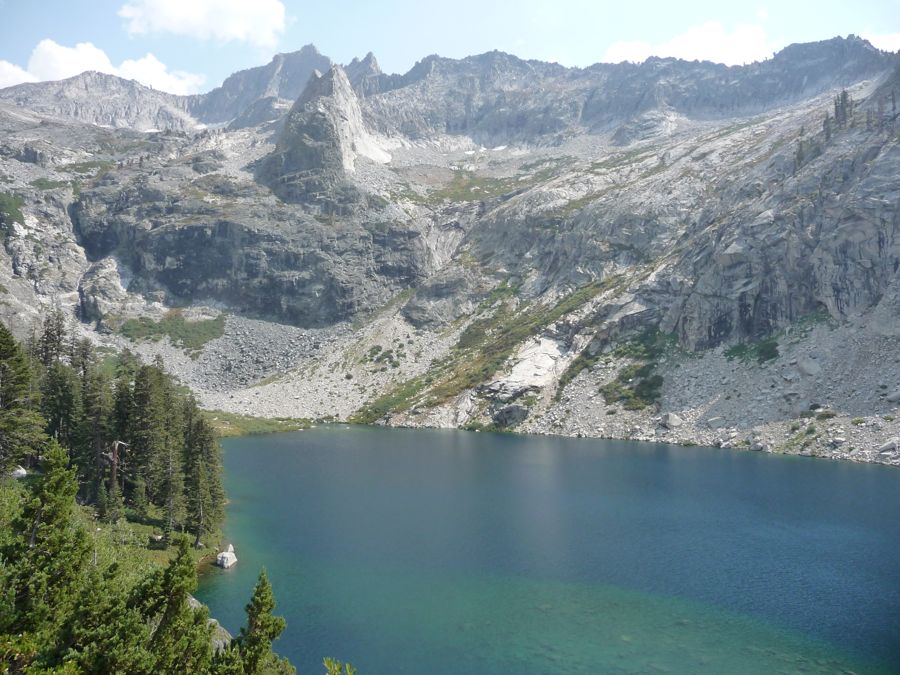
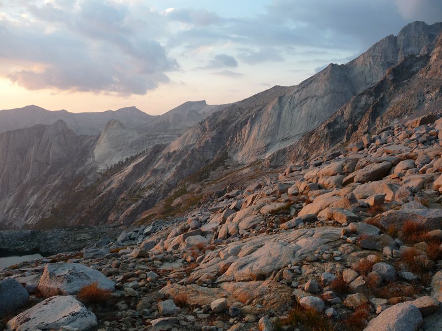
This trip is worth every single step. It ranks high in pretty much every backcountry cateogry you could conceive of. I'd like to do it once a year just to be able to see Upper Precipice Lake with some regularity. You can see it in the picture to the right (if you haven't hovered over any of the other picture links yet).
We had originally planned to explore Nine Lakes Basin during our excursion. Our party didn't quite have the pace to make it, though. For well conditioned backpackers, you should be able to make it all the way up to the basin and explore a bit on the second day. But if you're new to the whole "hiking with the kitchen sink on your back", it might be pretty difficult to meet the pace necessary to do this. In particular, the stretch from Hamilton Lake to Upper Precipice Lake is a pretty tough one.
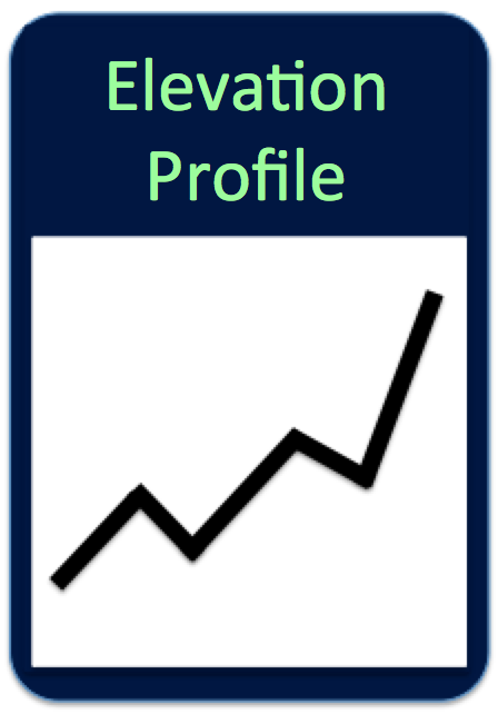
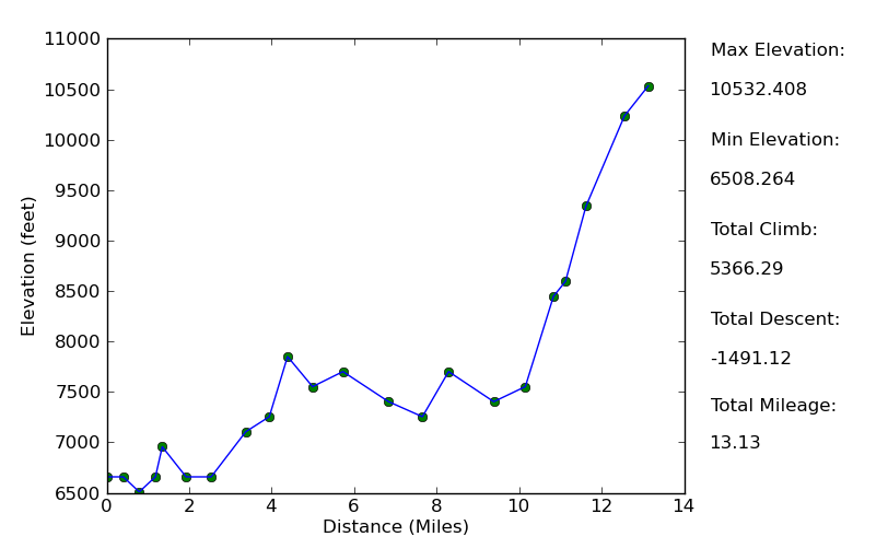
Elevation Profile (One Way)
TRIP LOG
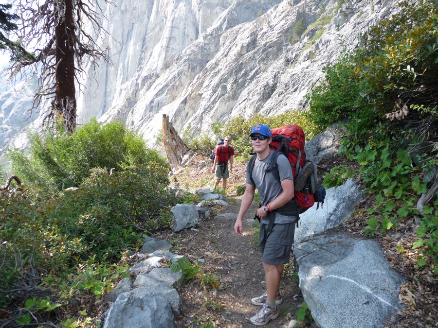
This was a trip I had been meaning to do for a long time, and when my brother (Eric) and cousin (Jason) told me they would be up for a backpacking trip in the Sierras, I thought this would be a fantastic, albeit somewhat strenuous route for us to do. I warned them that it would be a little difficult, especially for my cousin who had never carried a 40 pound pack for three days. But being the tough SOBs they are, they told me they were all about it.
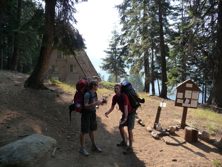
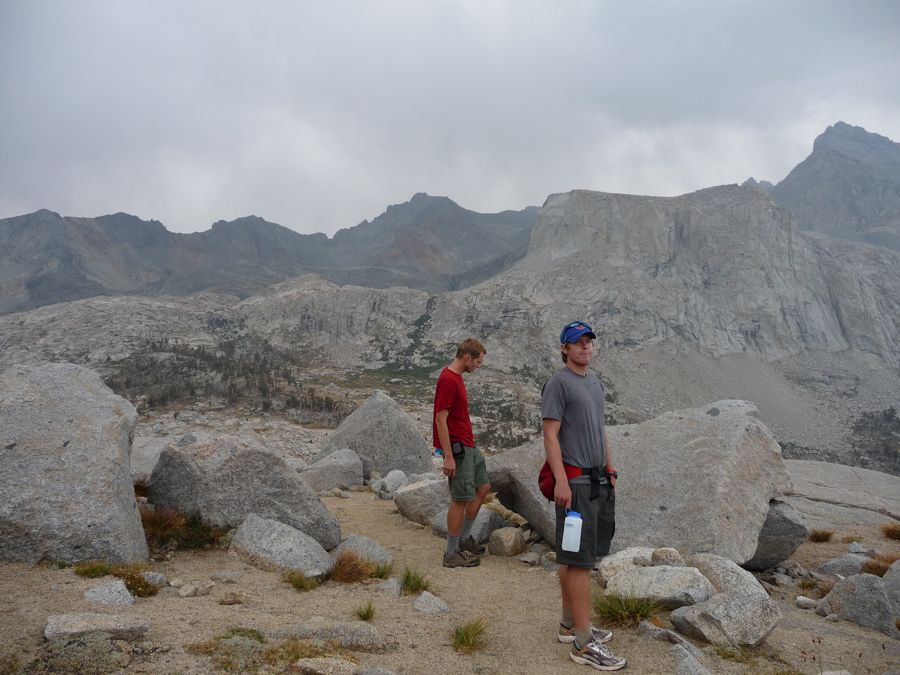
After a long amount of planning and waiting, they arrived from Chicago late on the night of September 1st and we drove from SFO to Visalia to hold up at a hotel. We got a bit of a late start on the road after a nice breakfast buffet and made it to the trailhead around 12:30. It was a little late to start out, but it would still give us enough time to make it to Bearpaw meadow by nightfall. A gear check and a nice
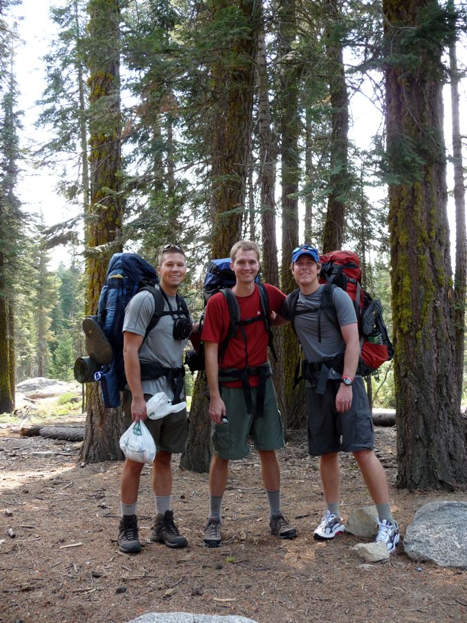
group photo later and we were on our way.
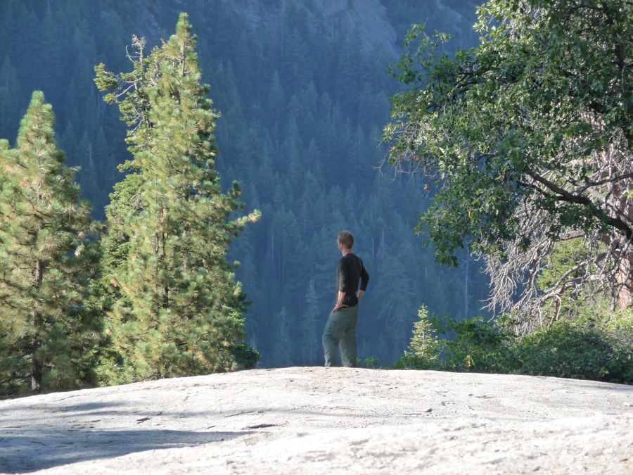
Right off the bat I was impressed by the magnificent view of the
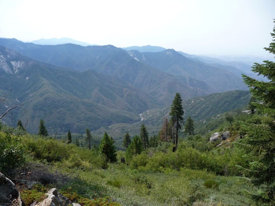
Middle Fork of the Kaweah River from
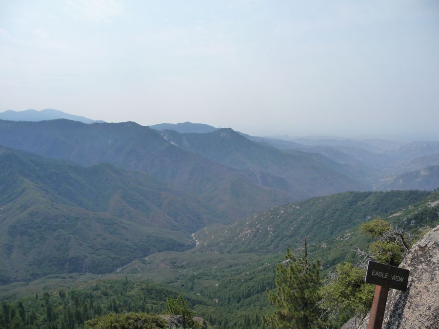
Eagle View. So were
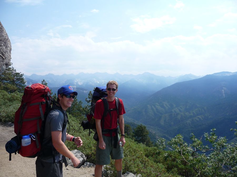
E and J. The trail quickly gave us a nice view to the
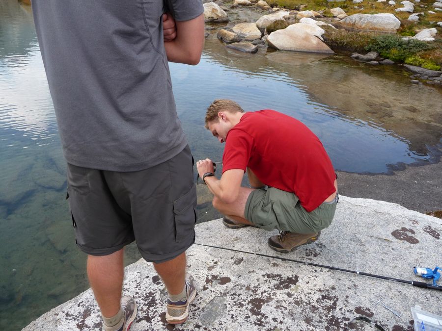
Northeast, where we'd be heading. After some up and down through forest populated with beautiful Sugar Pines and sweet smelling Incense Cedar, we stopped for lunch at Panther Creek. So far we were all feeling just great. It wasn't until we reached Mehrten Creek that Jason started
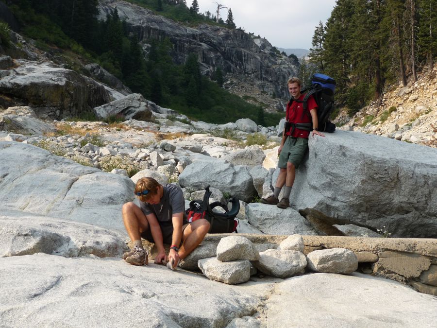
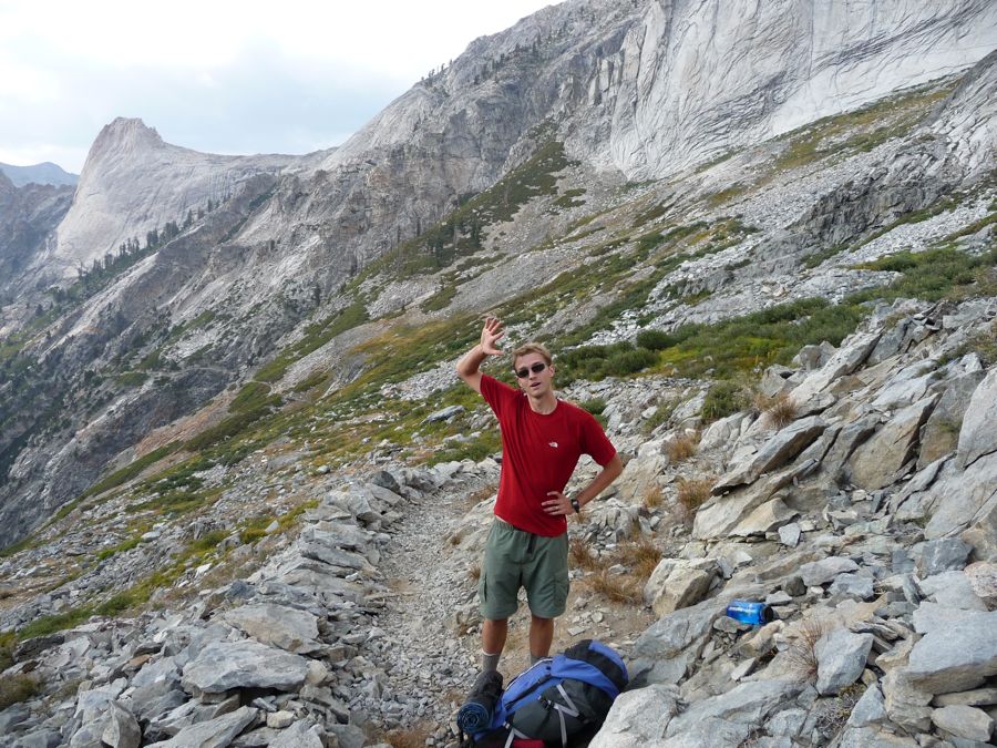
feeling a nasty little blister on the bottom of his feet. Here he is showing the
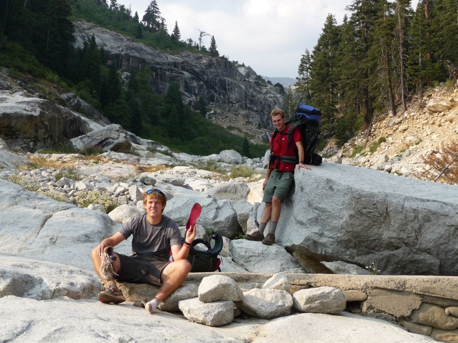
bastard of a shoe sole that would have him putting on moleskin for the rest of the hike. Eric would also start showin some nasty blisterage later on; I'm the only one that got really lucky and kept my skin closed up for the trip.
The next two miles went smoothly, and when we hit Buck Creek we were feeling pretty good. But the 800 foot switchback ascent from the Creek up to Bearpaw Meadow would be a challenge. Eric and Jason were huffing and puffing pretty hard on the way up. I'm not going to say I wasn't a little winded either--it's a damned steep ascent. But luckily we made it up to BearPaw with plenty of time to spare for setting up camp and lighting a really nice fire.
I was kind of surprised at the time to find that the water situation at Bearpaw Meadow was far from optimal. There's a trickle of a creek running through it, and pulling water from it got my filter got pretty clogged up. But the next morning we found out that there's a pump you can draw from next to one of the many campsites in the area.
Oh, and we also were awakened 2 am by a bunch of rustling that had me absolutely convinced a bear was creeping by our tents. But it turns out it was just the crazily bold deer that have no problem with making themselves at home in our campsite. Brave little buggers they are. I think if I was to do the trip over again I'd try to make it a little farther than Bearpaw on the first night. It's not like it's a bad campsite or anything. But the forest is dense enough that there aren't really any good views and the ground is all composed of thin dirt, which is probably pretty nasty if it's wet out. Plus, the lack of running water makes it so quiet that you can hear your thoughts and every little twig snapping while you try to fall asleep.
When looking back at these elevation numbers, I'm damned impressed by the feat my brother and cousin pulled off. There was a lot of elevation gain on this day for someone on their first High Sierra trip. Maybe it's our Scandinavian viking blood or something. Despite my brother having some nasty cramps in his calves and quads the night before and my cousin's blisters, they still looked
pretty chipper in the morning. Maybe it was the mound of oatmeal we had for breakfast. They bust my balls a bit about how much oatmeal I eat on these trips. But what can I say? I love my fiber.
With just a few hundred steps, we were at the
Bearpaw High Sierra Camp. Now, if you're not into sleeping on the ground or it's your last night of a long trip, this would be a great place to stay. It's got fantastic views and a nice little kitchen and foodstand to complement the comfort of a bed.
After passing the happy guests of the camp, we were on our merry way towards Hamilton Lakes. Over the next mile, the trail reveals the
beautiful sites ahead and down to the
Middle Fork of the Kaweah, but it also toys with your mind a bit as it descends nearly 800 feet when it's clearly obvious that you want to be ascending to get where you're going. After passing
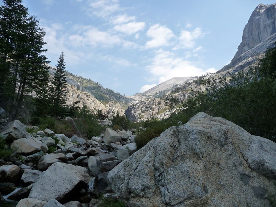
Lone Pine Creek, the trail skirts the south face of some
steep granite walls. And when you reach
Hamilton Creek you're finally finished with the pesky little drops in elevation.
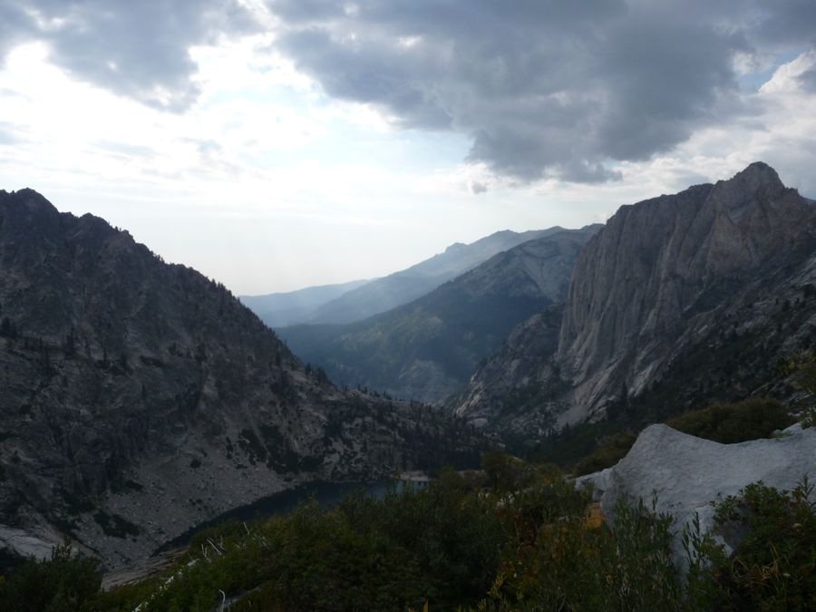
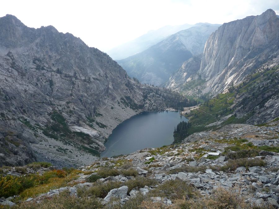
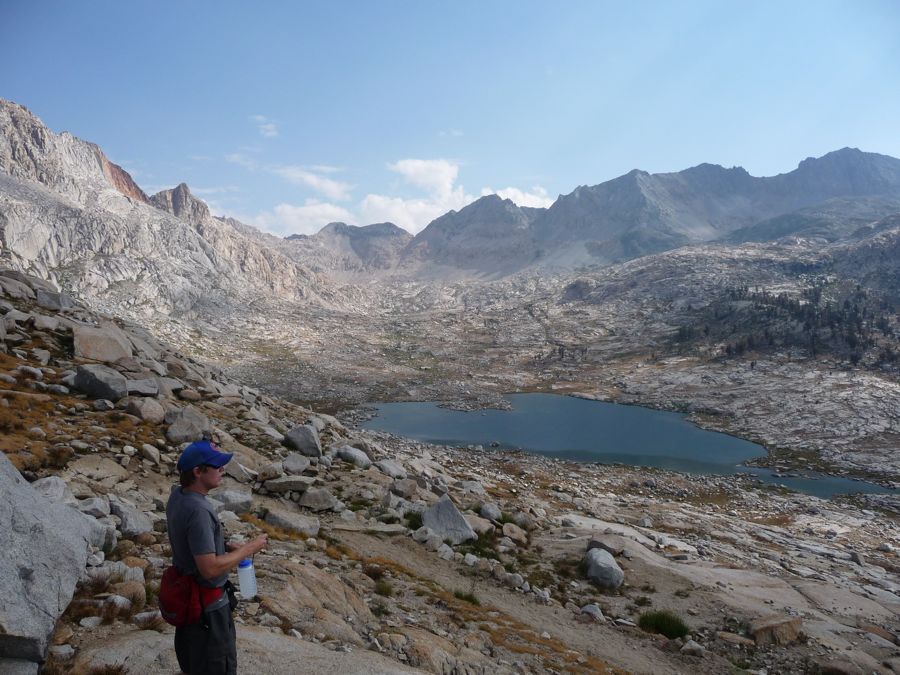
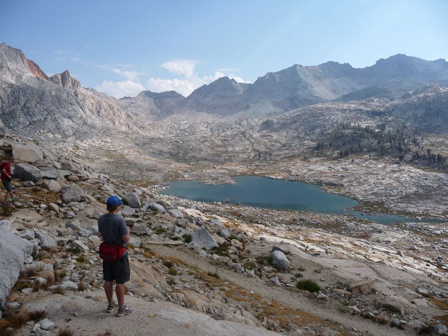
When we arrived at
Upper Hamilton Lake, I must say that I was truly blown away by its sheer
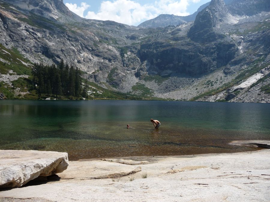
immensity and the grandeur of its
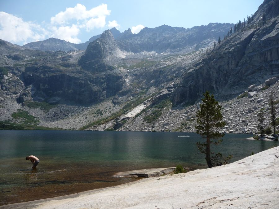
enclosing
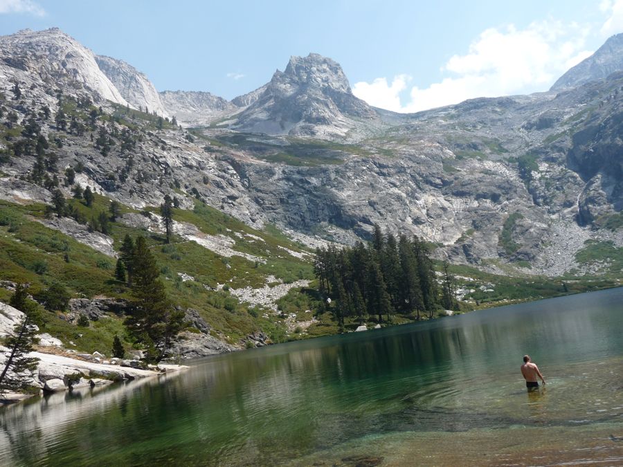
walls. The water was cold, but it felt incredibly good after the hot morning. And it felt even better roasting on a slab of granite to dry off while eating lunch. We took our time enjoying the lake and talking to another fellow and his son who had visited the area a number of times before. They told us the climb ahead would be hard, but that we could definitely pull it off with the remaining hours of daylight.
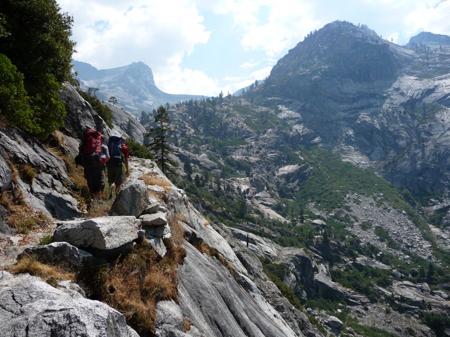
At about two o'clock we started on our way up the
northern wall of the cirque bowl that holds the lake in. The
trail is in excellent shape, and at no point is it excessively steep (it does get a little hot, though, and there's not a whole lot of shade, so it might have been better to do this early or late in the day). I was quite excited when we reached the
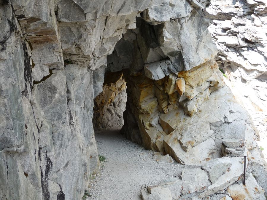
tunnel across
Hamilton
Gorge. I had read that "this 125-foot-wide avalanche chute posed the High Sierra Trail's greatest engineering obstacle" in the book Images of America: Sequoia National Park that my good friend Scott Davis had given to me a few months earlier. After reading it, I really had a much deeper appreciation for all the efforts that went into making the park what it is today. And I think it's safe to say that the trail we were on took a whole shit-ton of effort.
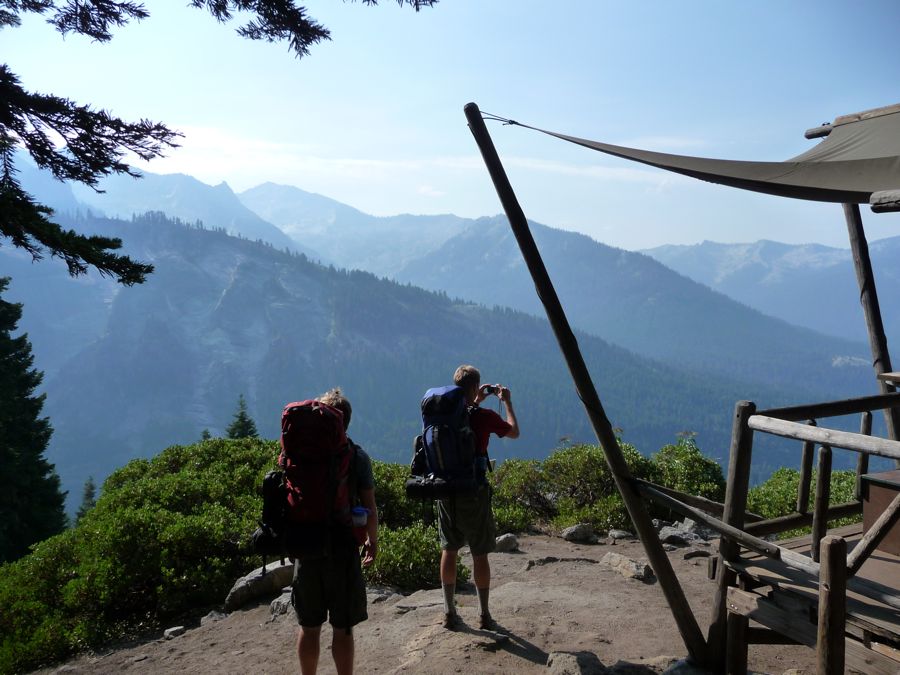
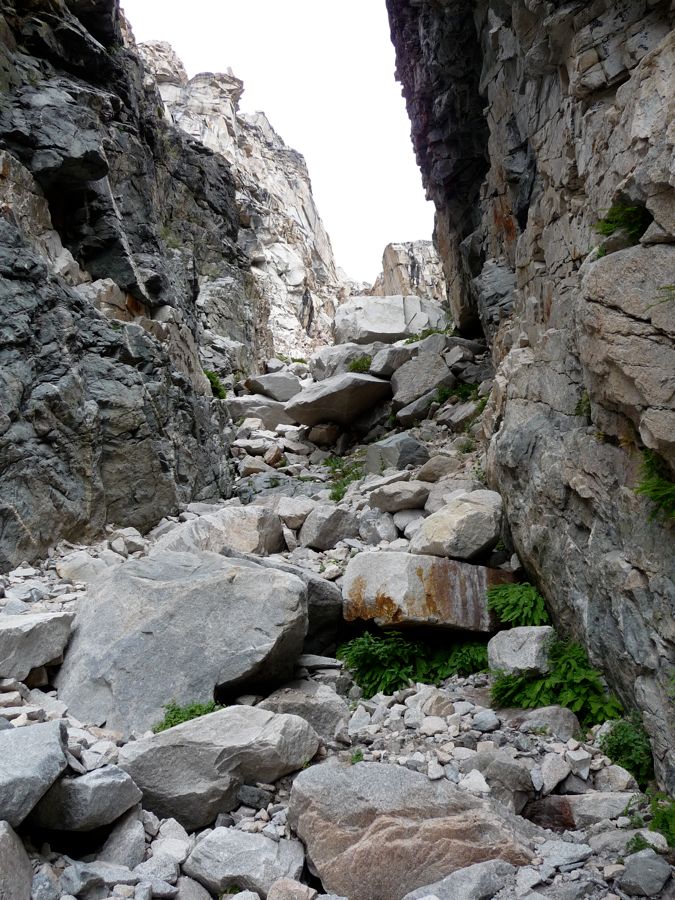
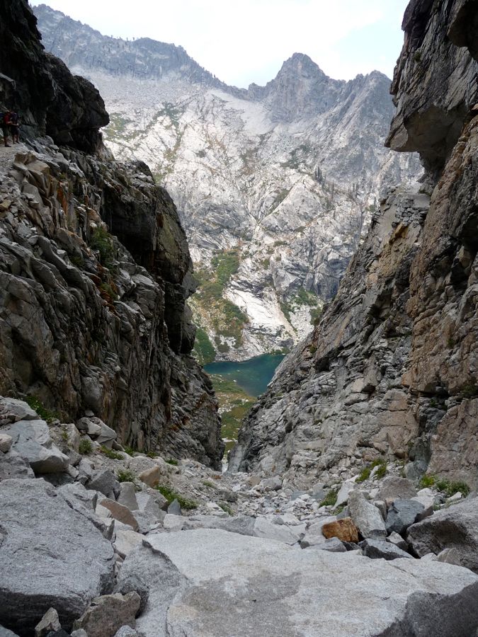
We were doing well so far. Plenty of daylight left, plenty of water, and some
clouds had moved in to give us some shade. But when we got to about 9000 feet, exhaustion and perhaps a bit of elevation sickness set in for Eric. I told him that I had no problem turning back and camping down at Hamilton Lake, but it seemed he didn't want to accept defeat. He took some Advil to deal with his headache and cramping, and once that kicked in he looked pretty
spritely. So we continued on our way up, taking breaks about every 50 feet in elevation gain. It was a slow pace, but I didn't mind as it gave us time to take in the phenomenal view of
Hamilton Lake.
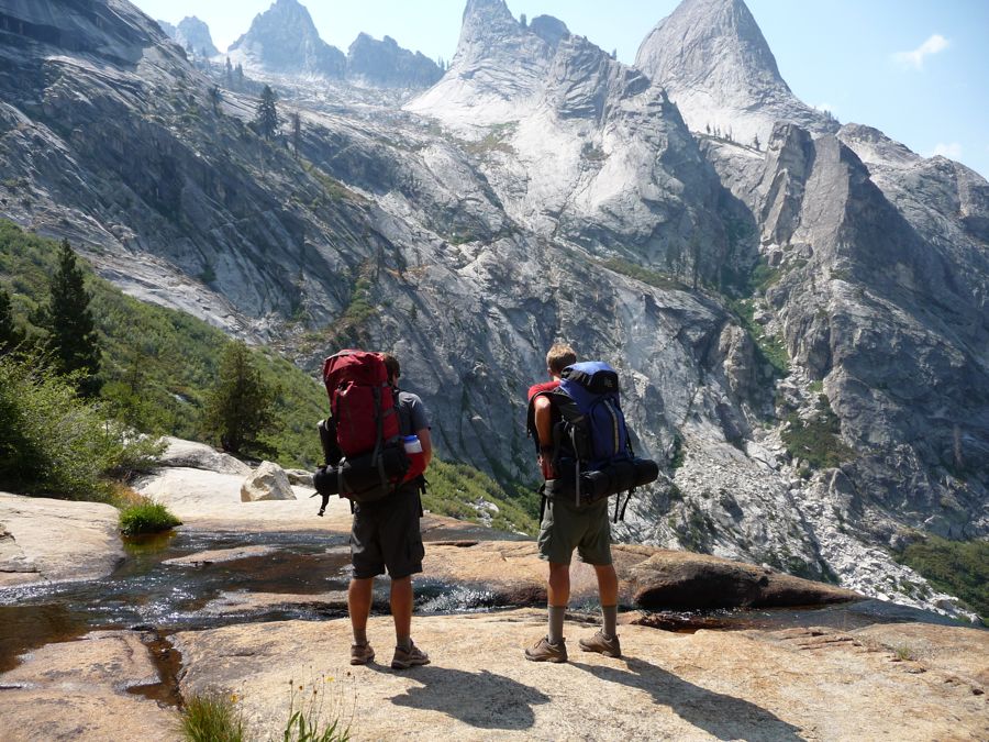
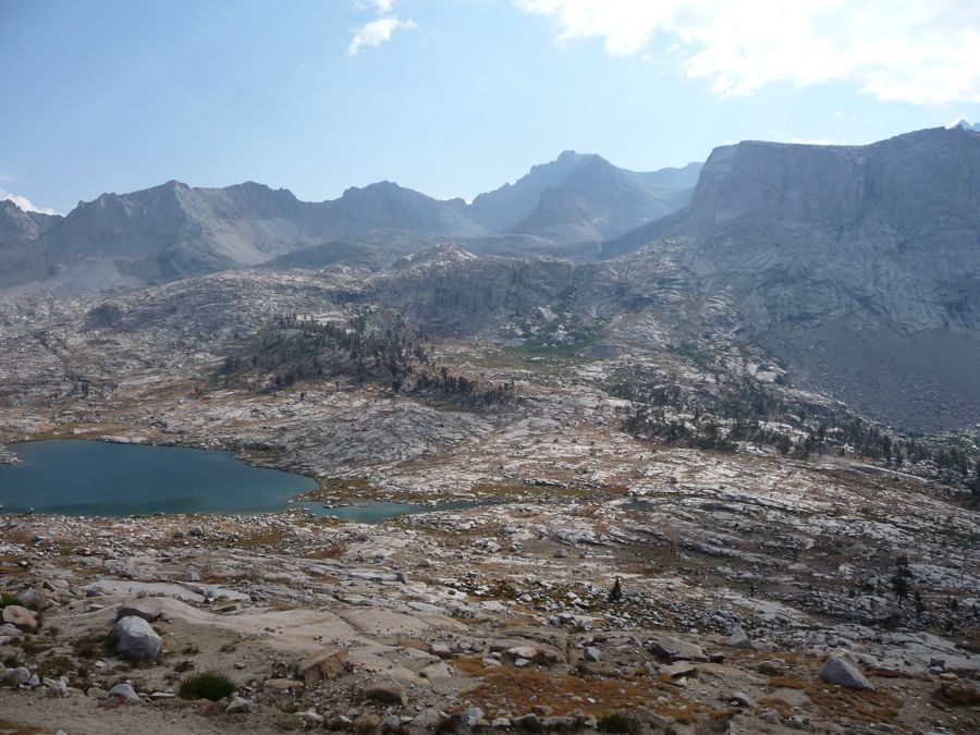
As I mentioned, our original hope was to make it to Nine Lakes Basin by nightfall. But when we came upon the brilliant reflections emanating from
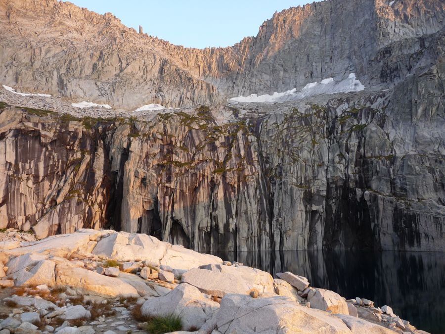
Upper Precipice Lake, all our planning flew out the window. Just one look at
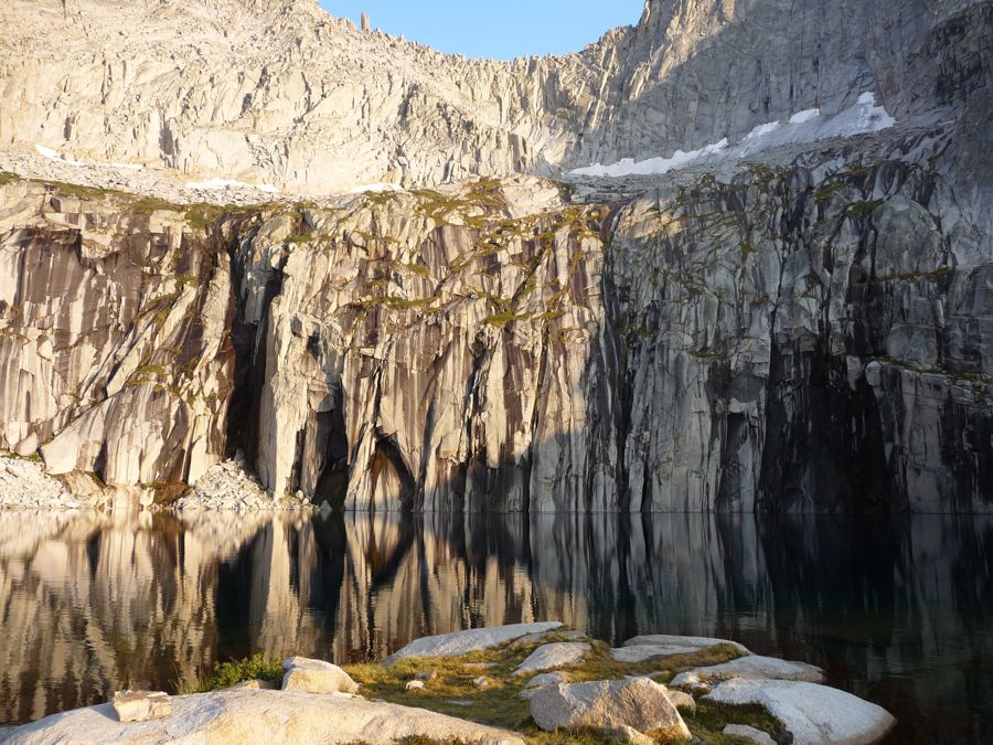
it and we all instantaneously agreed this would be the perfect place to camp. Plus, we had it all to ourselves! I had read the name of the lake on the map, but that was about it. Jason immediately recognized it as the centerpiece of an Ansel Adams poster he had on his wall for some years.
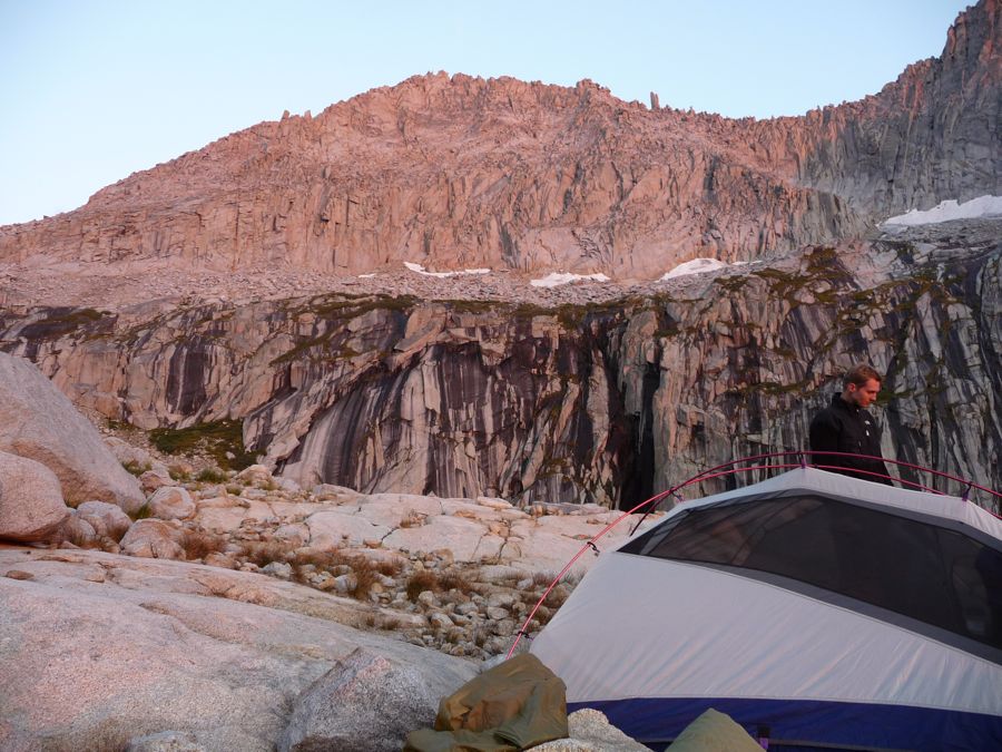
We found a great little spot to set up
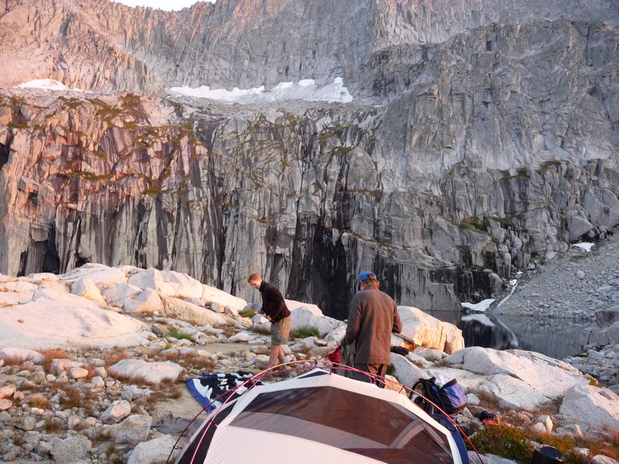
camp just north of the trail (
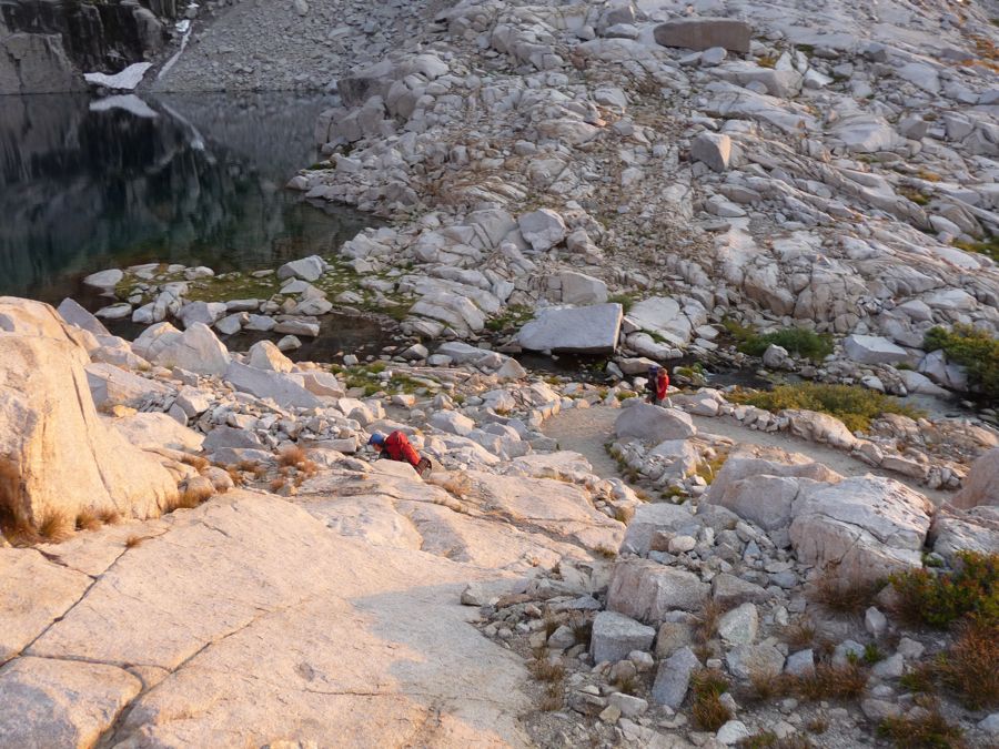
here's a view down at the lake from it) , took a nice stretch break, and
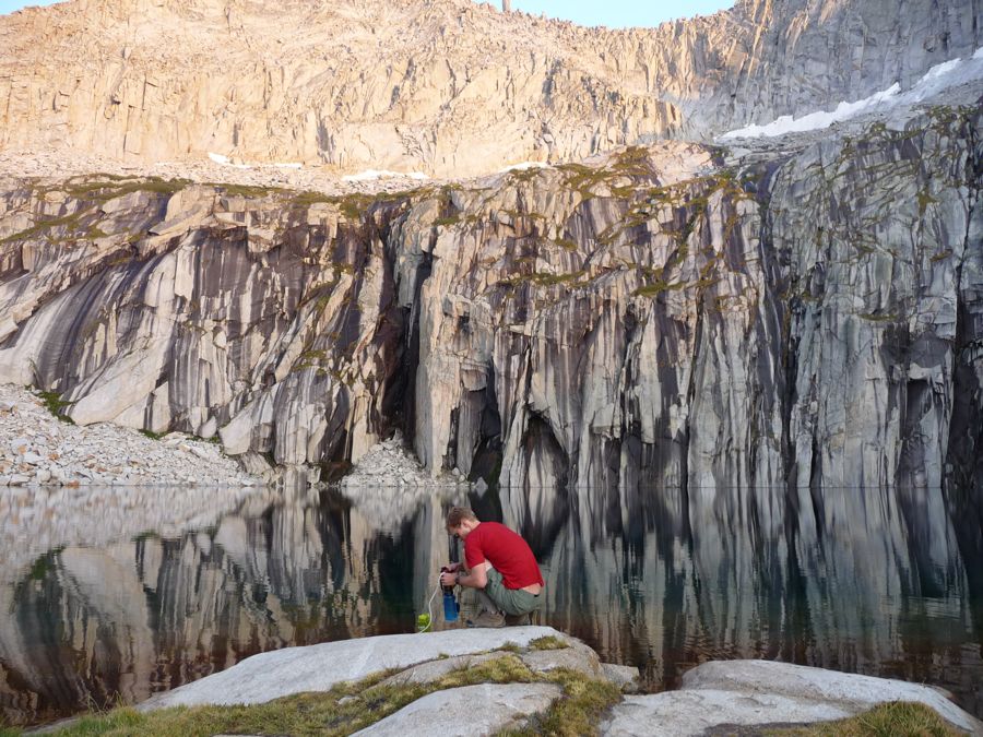
filled up our waterbottles. I was starting to drool over the
incredible alpenglow that was taking hold of the mountains. But it was hard to focus on just the eastern walls. The views to the
west and
north were just superb. Now, like any man, I have the tendency to exaggerate when I describe the places I've visited. But I have to say, this lake is at the very top of my favorite places in the Sierras. It's got it all.
After the sun
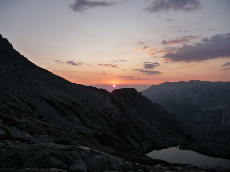
fell below the horizon, we had a nice feast on tuna and rice and trail mix. Eric was feeling just fine aside from some congestion (which he later surmised might have been West Nile Virus). I couldn't have asked for a more perfect evening or more perfect company. I think it was Jason who first noticed the cirque bowl along Hamilton Lake glowing, which led to speculation that somebody had an incredibly wicked LED lamp down there. But as the night progressed and the glow became stronger, we finally realized it was the full moon rising to our east that was the culprit. After basking in the moonglow for an hour or so we turned in.
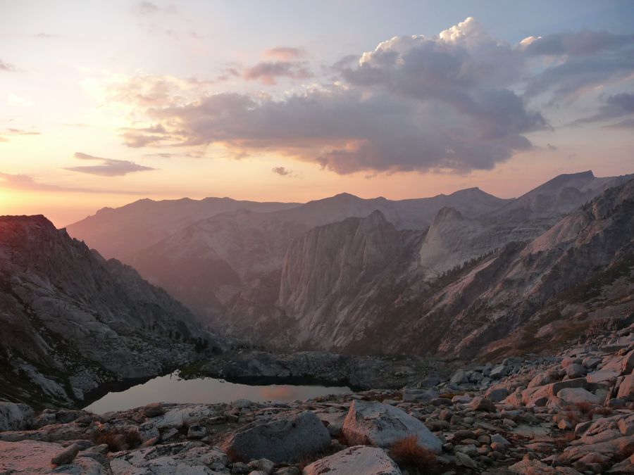
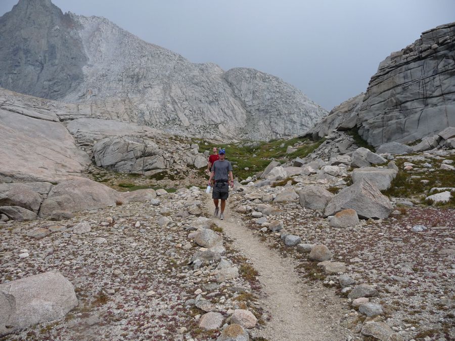
What a spectacular sight to wake up to: the
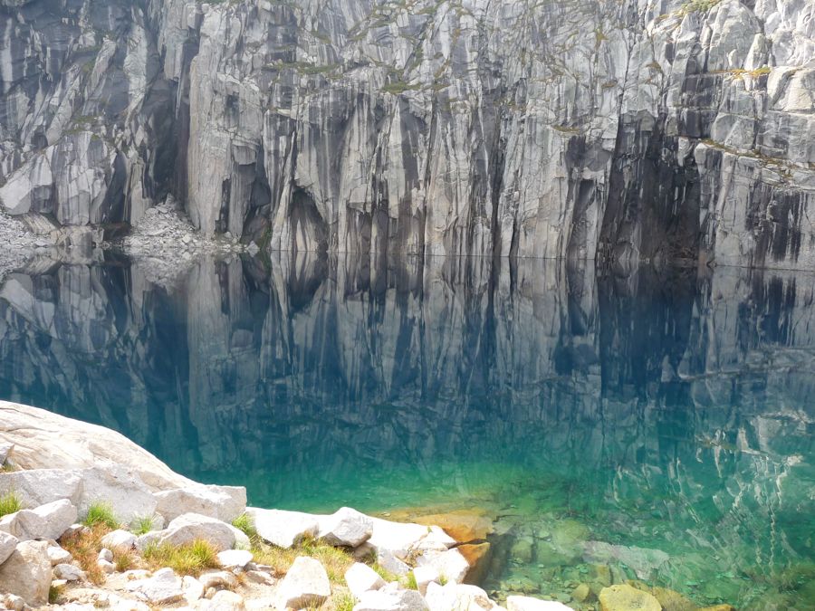
diverse colors of
Upper Precipice Lake. (there are plenty more pictures here if you're interested). We took our sweet time enjoying breakfast and came to a decision that we'd leave our packs at our campsite and make a quick day trip up to Nine Lakes Basin. The stretch between the former and the latter climbs a few hundred feet over some
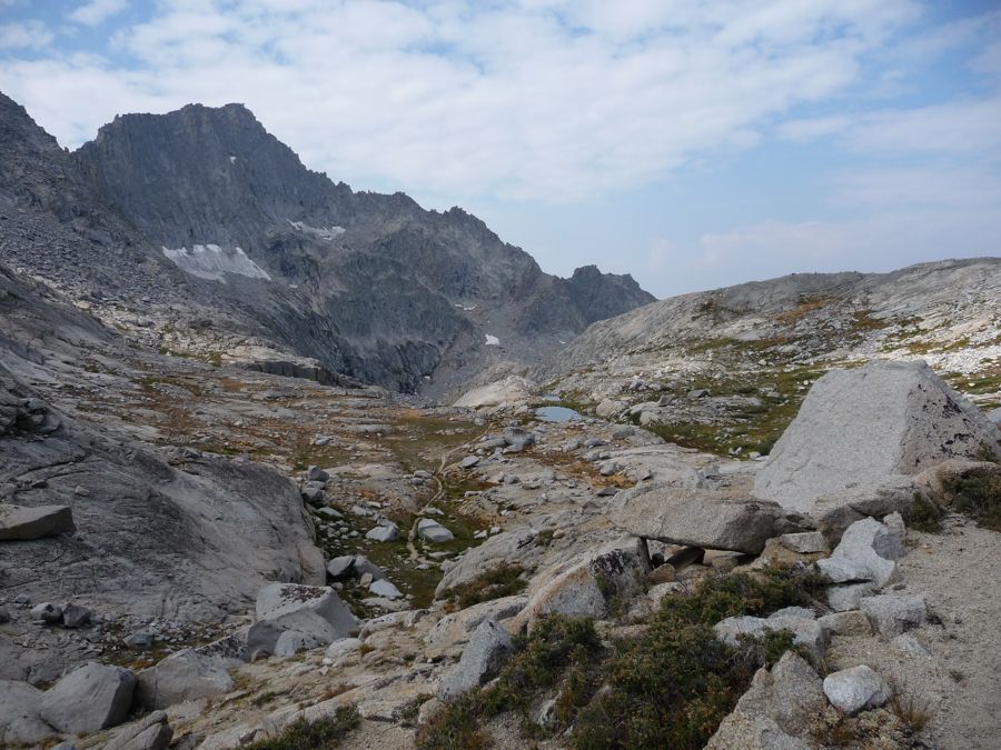
ponds surrounded by red heather and brings you over the
Kaweah Gap.
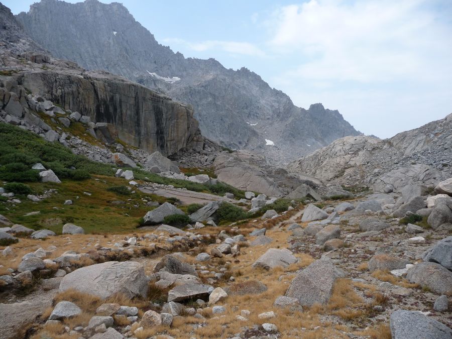
The
Big Arroyo was another Sierran delight I had read plenty about and was dying to see. It definitely lived up to my expectations. The view to the north showed us the
first of the nine lakes while still on the gap. It doesn't seem to have a proper name, but the guy we ran into at Hamilton Lakes was very adamant that people calling it "Horshoe Lake" were way off base. In his opinoin, it looked a lot more like a heart. While I don't care much about names, I'd have to agree with him on this one.
I must admit I felt a little frustrated at first, looking at all these incredible places for starting another journey when I knew I'd be turning back in a few hours. To the
north you can see the way up to Lion Pass. To the
east lies the route up to five of the other nine lakes. And of course, to the
south goes the Big Arroyo on its way to Kern Canyon. But I got over it pretty quickly as we descended down to the heart-shaped lake for some nice fishing. Eric caught
a couple and I caught one, but they were too tiny for eating. We fished for an hour or two before
the clouds above us started doing their job and precipitating.
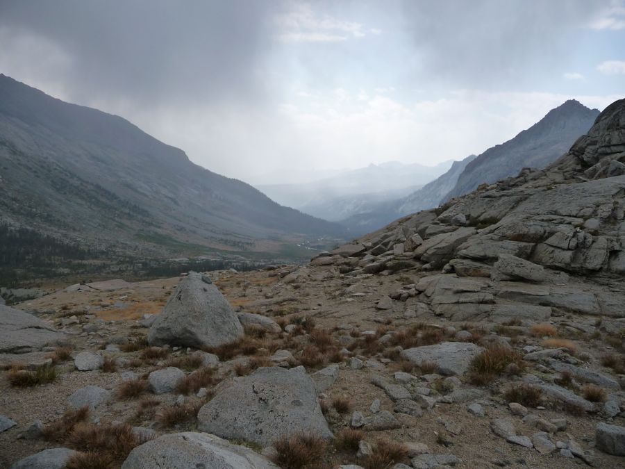
On our way back down to Upper Precipice Lake, it was funny to see how the area
east of Kaweah Gap was cloudy and raining, while
to the west there were blue skies ahead. I was pretty happy that this was the case, because that meant we could do some more swimming at Hamilton Lake. And that's just what we did after we collected our stuff from the previous night's campsite and descended down the switchbacks above the lake. Along the way my brother was entertaining us with stories about Teddy Roosevelt, Aaron Burr, and a whole bunch of other historical figures. I always love listening to him talk about history. He picks it up by listening to books on CD while he drives around the Chicagoland area, and boy does he have some good retention capacity. It was also entertaining just to look at him in
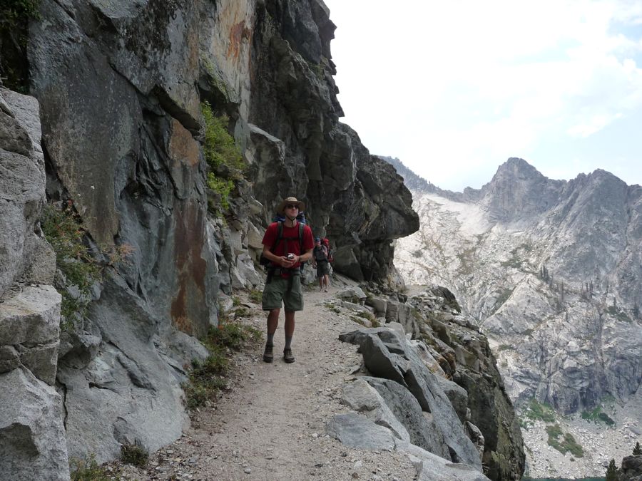
his outdoor hat.
This time we really milked it at Lake Hamilton, spending about two hours fishing and swimming and
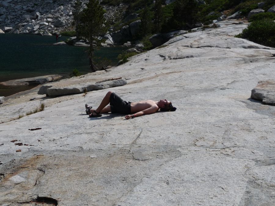
lying on the granite deck. At around four o'clock we started the long backtrack back to Bearpaw Meadow. Somehow we accidentally took a differnt route back, which ended up being pretty nice. It turns out there are two trails between Lone Pine Creek and Bearpaw Meadow you can take. So if you're doing the same trip you might want to consider doing both for a little change of pace.
When we passed Bearpaw Meadow and descended to Buck Creek, I figured we'd set up camp at the next camping area we found. Problem was that the next two "sites" were all filled up. So we ended up continuing west until there was basically no daylight left and choosing a little open spot just north of Little Blue Dome. It turned out to be a great campsite.
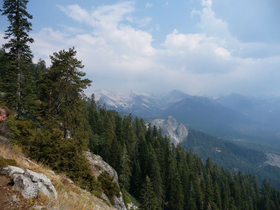
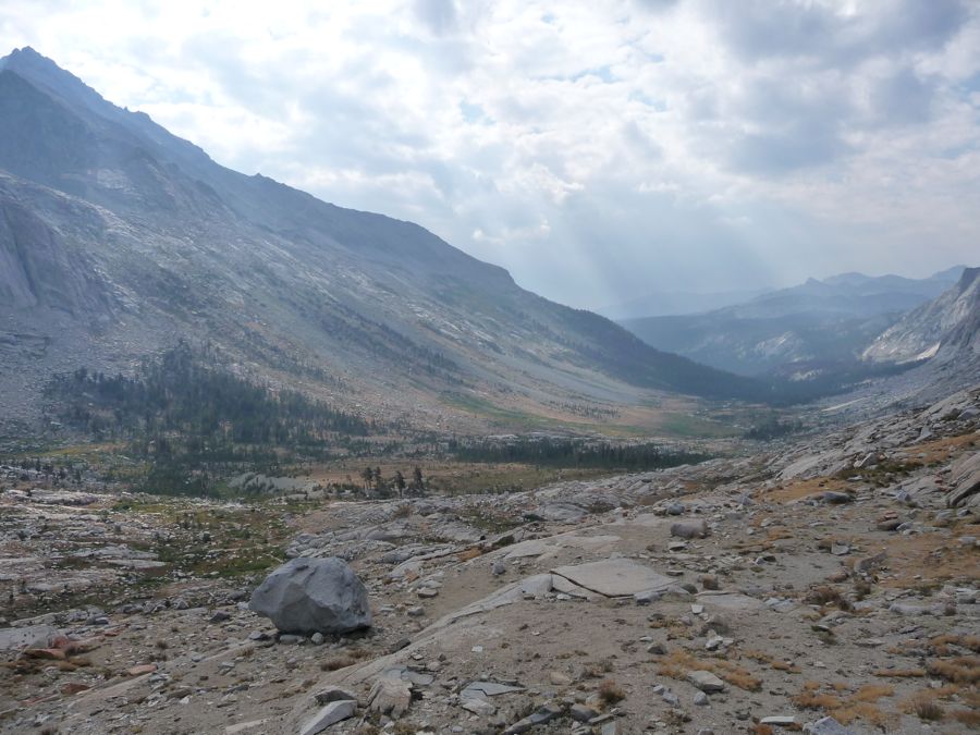
There's not much to tell about day 4. We enjoyed the
morning views of the Middle Fork Canyon as we
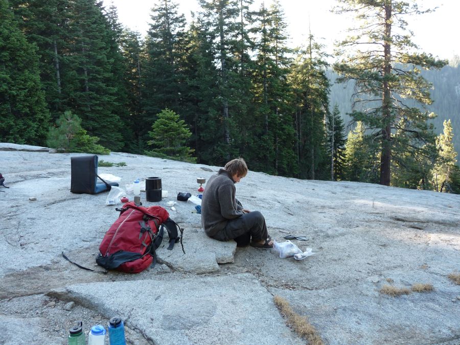
had breakfast. It's not easy to tell from the picture, but Jason's hair was so greasy he could maintain pretty much any hairstyle he chose, which was pretty entertaining to watch. We made our way slowly back to the trailhead, tending to wounded feet and taking in the
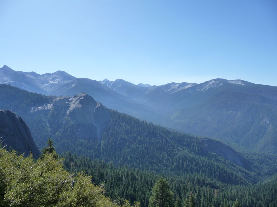
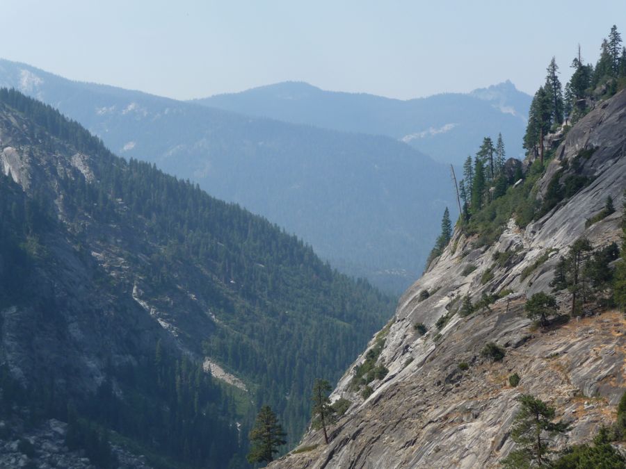
amazing clarity in the air.
When we finally got to Crescent Meadow I looked back at the
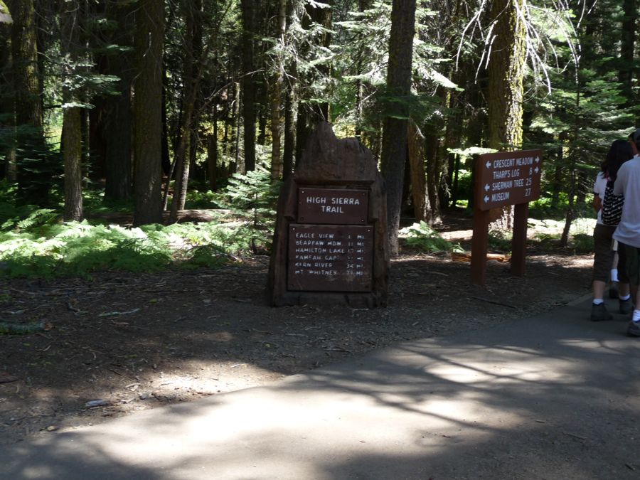
trailhead sign and knew I couldn't resist coming back to start a journey to Mt. Whitney. I'm just waiting to find the right time, which will either involve saving up a ton of vacation or telling my boss I have mono. Judging from how excellent of a time I had on this 4 day trip along the High Sierra Trail, I know it'll be worth the effort. And I'm glad to say Eric and Jason had just as good of a time as I did, and that my brother didn't die of West Nile Virus.