


TRIP DETAILS
TRAIL MAP
OVERVIEW
Olympic National Park is, in my opinion, one of the most underhyped parks in the United States. I must have told a dozen people I was going there and not one of them knew where it was or what it held in store. I can't say I was much better informed until about eight months before the trip when I was reading through a list of national parks and happened upon a description of it. The great thing about all this is that it means the crowds aren't overwhelming like they are in Grand Canyon or Yosemite. And for backpackers, that means that permits are much easier to come by.
One of the park's claims is that it is basically three parks in one. The western edge consists of coastal terrain with beautiful oceanside cliffs and tide pools. At the heart of the park is a team of jagged peaks and glaciers that intimidate even the bravest explorers. Surrounding these is a magnificent temperate rain forest that makes one feel like they are walking back in time.
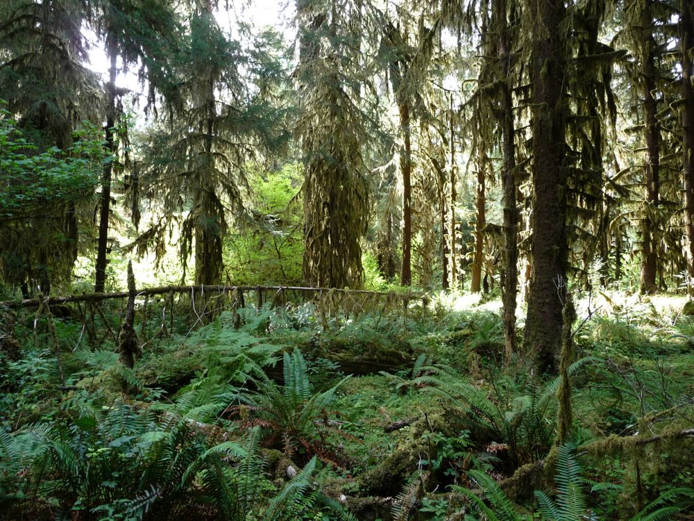
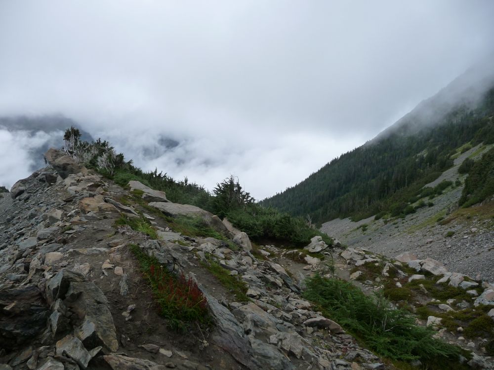
The trip described here covers the last two regions. The trail starts off amidst an overwhelming density of ferns, firs, spruces, and moss. Making its way east and up, it gradually brings you above this lower layer of vegetation into a rocky terrain covered with shrubs and huckleberries. It culuminates with an overlook of an enormous glacier that will make you feel incredibly small and fill your heart with trepidation. And to complement this beautiful terrain, there is an abundance of animal life at almost every turn.
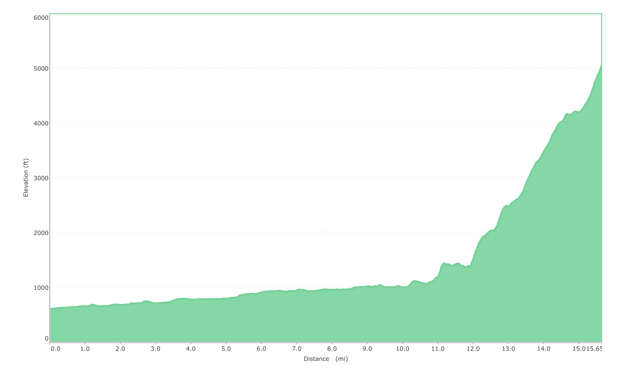
Elevation Profile (One Way)
TRIP LOG
The first day began with a lovely, hour and a half drive from Lake Quinault Lodge, where my we had stayed the previous night. If you're considering doing a backpacking trip in Olympic National Park, I'd highly recommend staying at the lodge before or after. It's definitely not the cheapest (about $300 for a room), but the money is well worth it.
For the overnight stays in the Hoh River Valley, we had obtained a permit the day before at the Lake Quinault Ranger station, which is right next to the lodge. I was so surprised at how much availability there was for the sites, especially being that it was Labor Day weekend. Again, I'd have to say this is one of the best aspects of Olympic National Park. No need to line up at 6 am outside of a wilderness office like there is at the Grand Canyon or Yosemite.
Another cool thing is that you don't need to walk more than a quarter mile from your car before you are smack dab in the middle of
dense forest.
The trail immediately places you under gigantic spruce and cedar trees covered in a world of
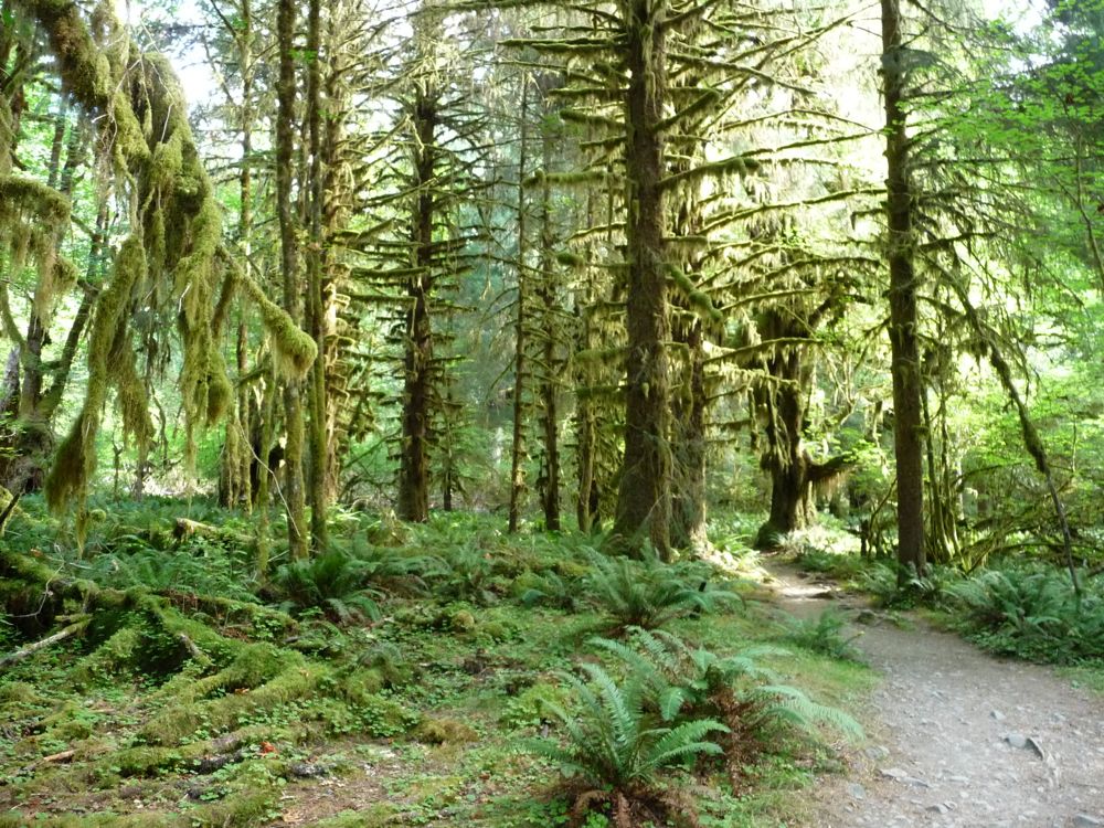
moss. I spent a while struggling to figure out how to capture the shear size of the the trees and the density of the forest, but then gave up and decided to be content with the idea that it's one of those things where you just have to be there to experience it.
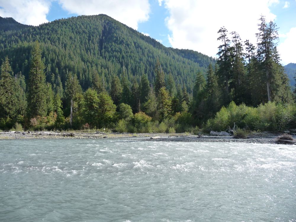
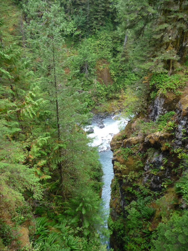
After a short stretch in this overgrowth, the trail opens up and take you near the
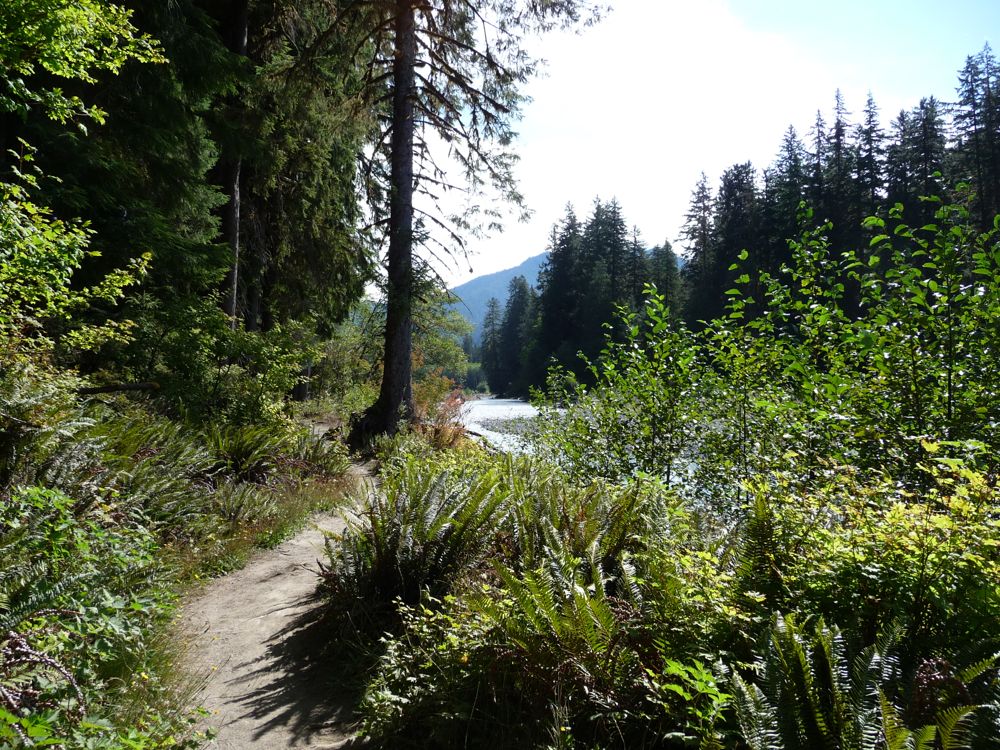
Hoh River for the first time. We both marveled at the diversity of
colors in the foliage and how they contrasted with the aqua-grey of the river.
At about the 1.5 or 2.0 mile mark we saw a gorgeous
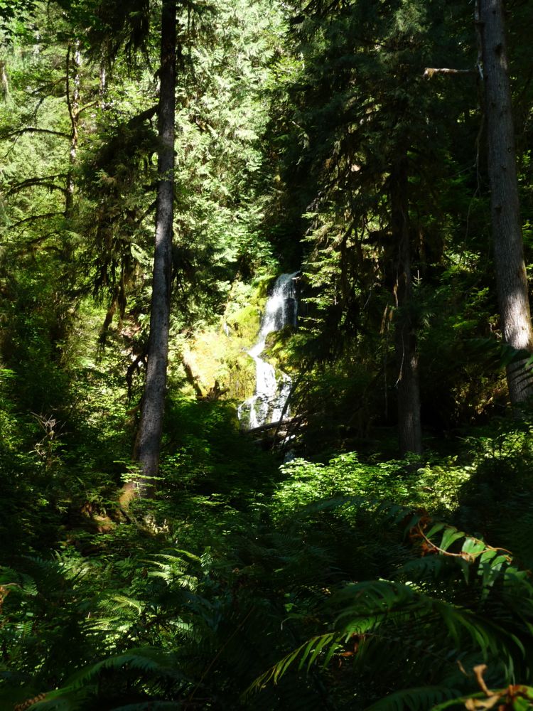
waterfall nestled in among the trees to the north of the trail. Be careful, because if you're paying too much attention to your footing or the river, you may just miss it entirely. Shortly after passing the waterfall, we were again completely covered by a canopy of moss.
Another thing worth mentioning is that there are no shortage of
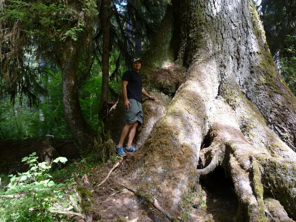
behemoth trees interspersed between the average ones. I'd say on average, it was 10 minutes between moments when I'd look up and say, "That is a damned big tree."
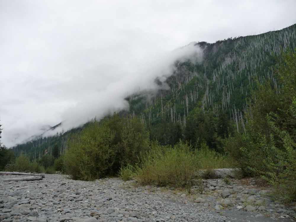
We kept a pretty slow pace for the first few miles as we enjoyed the magnificent forest we were walking through. Around the four mile mark or so, we hit the first clearing with a
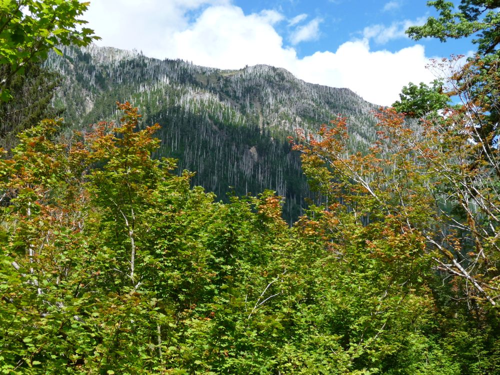
view of the rugged mountain range to the north of us. We stopped for lunch shortly after this point, and not long after sitting down for the first extended period of time, we realized the severity of the mosquitos in the forest. For some reason I assumed that in late August, they would have subsided, but this surely was not the case.
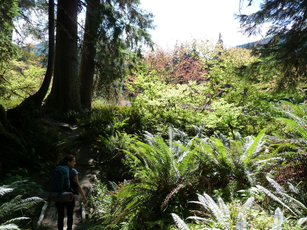
For the next three or four miles, the trail continued to dazzle us with mutant trees and pleasant meadows. About a mile before the Olympus Ranger Station, things take an interesting turn, however. The trail begins to ascend to a high shelf covered with beautiful red alders. At the time, I thought they were birch trees, which have always been one of my favorite sights on any hike. But later on I would read a pamphlet about the trees in Olympic NP and realize that this is one of the most common mistakes.
The rise to the shelf is only a few hundred feet, but that's still high enough to give some great views of the river. It doesn't last for long. You soon descend down to river level, where you're greeted by the Olympus Ranger Station. The really nice thing about the sites along the trail is that they have emergency rain shelters where you can eat or hang out if the weather is really bad. There are also some pit toilets that aren't half bad.
When we got to the actual ranger station, we found a little map of the sites that are available. It's a pretty confusing map, I have to say. Part of the problem is that the little mini-trails to each site aren't well defined. I spent about 20 or 30 minutes exploring the area and found that most of the campsites were empty, and that we basically had to choose between two distinct types of sites. About four of the seven sites are heavily covered by the canopy of the forest. These sites have the advantage that the wind and rain is well blocked, but it also means that the temperature doesn't get as low and the bugs are a lot worse. The other three sites are out in the open. The wind is stronger, which means the temperature is lower and the bugs aren't a problem. But there isn't any shelter from the rain.
Since the forecast was calling for a lot of rain over the next two days, we decided to go with the former option. We chose the site furthest to the north. It's got a little fire ring and a nice patch of flat ground for a tent. The only downside is that there is a well-trafficked trail running between the two that people use to get down to the river.
It was only about 16:00, and we had a decent amount of daylight left. So after setting up camp, we packed up some snacks and other gear and headed down to the
river. I wanted to see if I could catch some fish, but unfortunately, the river quickly proved itself to be a very poor place to fish. It's extremely shallow and rocky, so half of my casts required wading in the river to get my lure un-stuck. I really don't think that this section of the river, because of how shallow it is, is host to any fish at all. At least at this time of year.
Around 5:30 or so, a
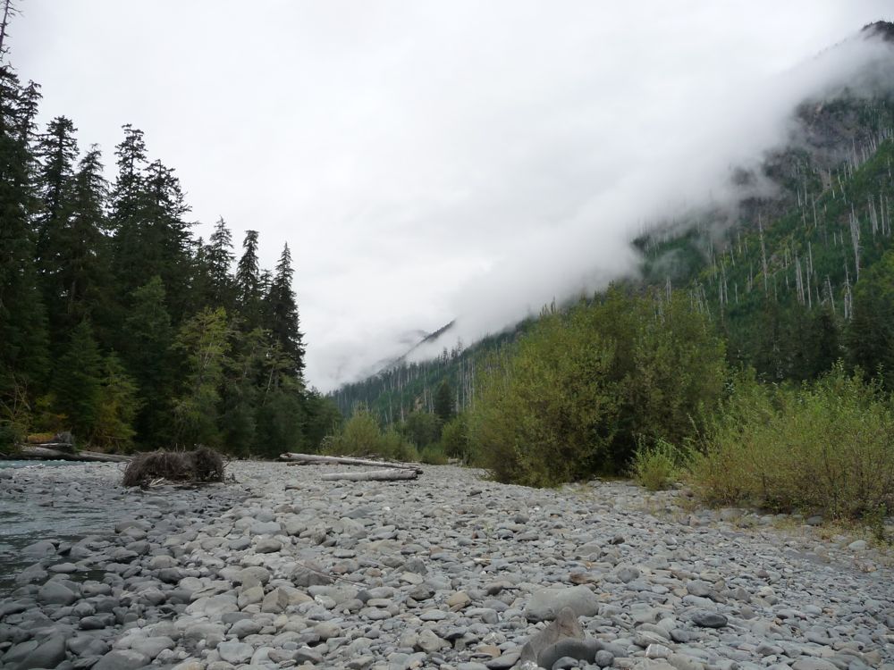
dense fog began to blanket the river. It was really fun to watch it
sweep down the hillside. We took care of the task of filling up our water bottles, cleaned off a bit, and then we headed back to camp.
Even though it was still a good 70 or 75 degrees at our campsite, we decided to light a fire in the hopes that it would keep some of the mosquitos at bay. Well, it didn't. While cooking dinner, we were constantly slapping and swatting, even after we applied repellent. As soon as we finished washing our dishes, we made the decision to head back to the riverside to have a cup of tea. There were hardly any bugs at all down there, and it was about 15 degrees cooler. Felt like the best decision we've ever made. Like I said, there is so much dense foliage in some of those campsites. With the lack of wind and the abundance of standing water, it's gotta be heaven for mosquitos.
We stayed down by the river, bug-free, for an hour or so. Around 8:30 we headed back up to the tent and prepped for bed. But while the day had been splendid, the night that lay before us would not be pleasant. I kept the fly on the tent because it had started drizzling, but this meant that the 75 degree weather was amplified by our two warm bodies. I really can't remember experiencing air as stuffy as that. On nights like those, I would rather be in a hotel.
When we woke up the next morning, the rain had ceased. Still no trace of blue sky, but it was nice to at least be able to enjoy a dry breakfast. We again headed down to the river to avoid the bug situation at our campsite. We were both eager to get a start on the day. With the round trip to Blue Glacier being just a little under 20 miles, it was going to be a long one.
The first few miles of the trail were nice, easy going. The only hard thing was avoiding the dozens of European Black Slugs on the trail. It is pretty cool if you pay attention to the array of fallen trees along the way. Having read the fantastic and informative pamphlets, I was able to recognize the tiny saplings growing directly out of the base of the rotting logs. Crazy how they do that. There were several times during this stretch of trail where I couldn't help but take my camera out and try to capture the essence of the forest.
The first really noticeable landmark aside from some campsites that we came to was a bridge that crosses the river about a hundred feet
above its surface. Looking down is very intimidating. I highly doubt you'd survive the fall if the bridge happened to malfunction.
With the bridge behind us, it was time to start the steady ascent to the north. There were no shortage of stunning rock outcroppings to accompany the ridiculously cool trees. The rain had really started to come down at this point, so we were starting to don our rain gear.
Part of me had been debating if we should stay at Elk Lake for one of the two nights of our trip, but when we passed it, I was glad we had chosen not to. The view from anywhere along the shore is hampered by the surrounding terrain, and I am pretty sure the bugs would have been crippling. The one upside is that it looks like it would be a great spot to fish.
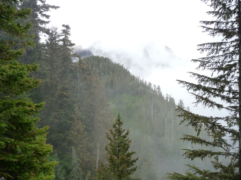
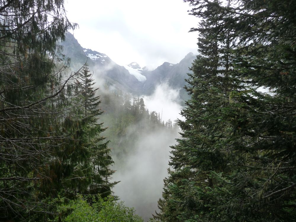
A few hundred feet above the lake, we got our first views of the
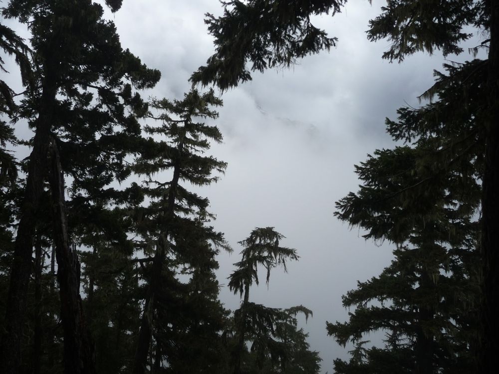
ridge to the east. The low cloud level created an awesome effect as the sunlight filtered through some patches and allowed us to see the
mountains beyond. Of course it would be nice to have clear skies and unhindered views of everything, but at the same time, the mist felt like it brought the forest to life in a way. Kind of put it in its element.
The trip up to this point had already been phenomenal. But the next three or four hours would surpass anything we had seen so far. The trail between Elk Lake and Blue Glacier feels like it's something taken from a storybook. At every turn there is a new view
across the valley below or down a steep
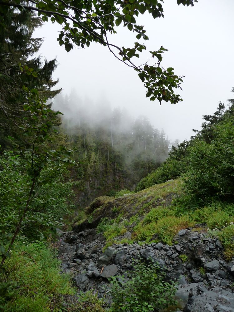
ravine. I just can't say enough about this portion of the trail.
I was starting to get a little concerned about the availability of water on the way up to the Glacier, but just as this thought was coming to mind, we encountered a pretty strong creek running across the trail. We filled up here and then continued on our way. If you've read other reports about this trail, you've probably heard about the precarious rope ladder just below the glacier. Well, there is no need to worry about this as they've made alterations to the trail so that it skirts along the side of the hillside instead of forcing you to ascend the rope ladder. It's not the safest path I've ever seen, but it's not the worst either. As long as you take it slow and steady, you should be fine.
The final stop before hitting Blue Glacier was Glacier Meadows. Again, these campsites did not have the greatest of appeal. I can see how if you were going to cross the glacier and attempt to climb one of the peaks beyond, it would be a necessary stopping point. But if not, you'd be better off camping a few thousand feet below by the Hoh River, in my opinion.
I have a good recollection of feeling like we were very close once we saw the signage at Glacier Meadows, but then immediately having this feeling shattered by the view ahead. There was quite a ways to go, it now looked like. I should also note that you have two options to get to the glacier: the lateral and terminal views. The terminal view is a shorter hike, but my guess is that the view isn't quite as good. The lateral view requires more climbing. That's the one we took.
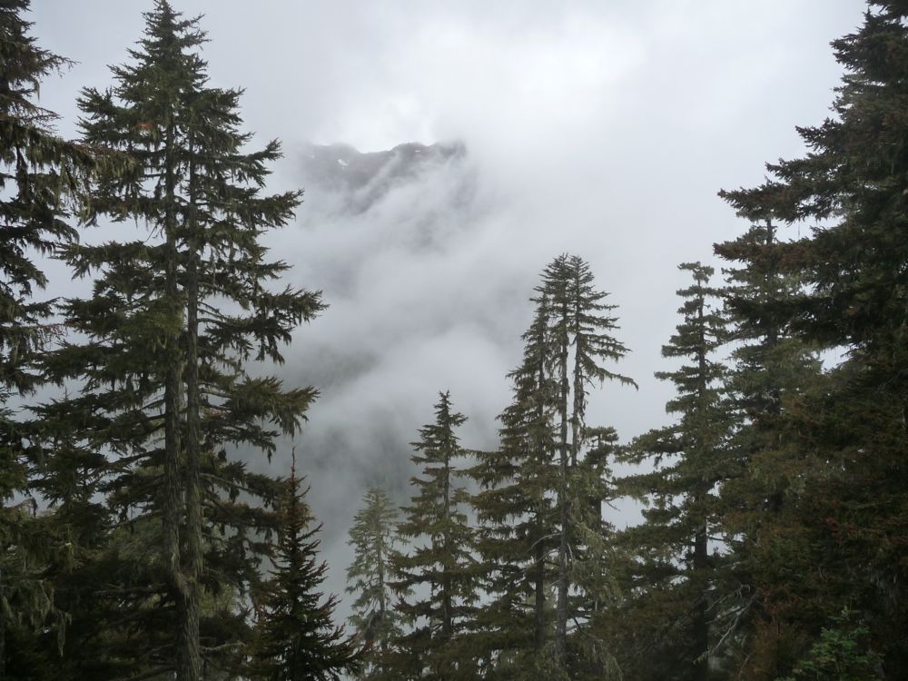
The section of the trail up to the lateral morraine is pretty phenomenal in itself. As the terrain crosses over from grass and brush to bare rock, you're treated to a plethora of wild blueberries. I must've ate a hundred or so while we slowly ascended. When the trail turned to stones, we could feel the temperature drop considerably. The view looking up the mountain was made a bit intimidating by the wall of fog that prevented us from seeing what lay beyond.
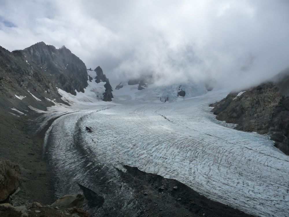
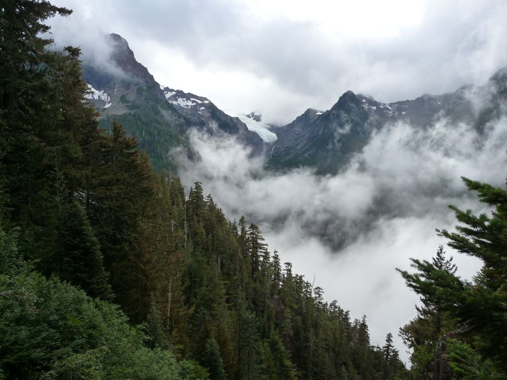
I'll never forget catching my first glimpse of that glacier. I hadn't seen any pictures, so I really didn't have an idea of what to expect. My jaw just dropped. The
glacier was far more
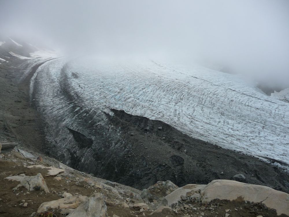
enormous than I had anticipated. Maybe it was just the lack of sunlight and the cold air and the strands of dark fog creeping across its icy surface, but I couldn't help but feel a degree of trepidation at the mere thought of trying to cross it. I've crossed several glaciers before, but something about this one was just more menacing.
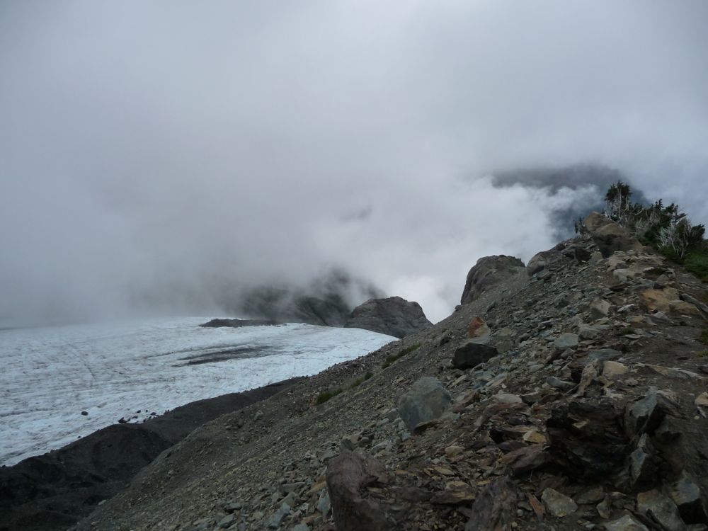
These
pictures give you a sense of what the ridge where we were taking this all in is like. It's wide and accommodating enough that you can relax and shelter yourself from the wind, and that's precisely what we did. We sat behind some large rocks and broke out our lunch, bundling up with every little bit of clothing we had in our packs. During the 20 or 30 minutes we took to eat, occasionally we saw a patch of blue sky. But for the most part, the distant peaks were obstructed by water vapor.
Even though we had bundled up well, sitting there in the ~50 degree weather quickly chilled our bodies. We decided to get moving to get some blood flow going. The hike back to Glacier Meadows was a slow one. Neither of us wanted to roll an ankle (which I had already done twice on the trip). Once there, we had warmed up significantly and we shed some layers.
The return hike was not all that eventful. However, the sky had cleared a bit more so that during our descent we had a much
better
range to our view. I would really like to return on a clear day and see what lies beyond those immediate ridges.
We were trying to make haste so that we weren't hiking in the dark on our way back. The sun was setting when we crossed the bridge across the Hoh River, and by the time we got back to camp, there was just enough light to unpack our bags and find our headlamps. The temperature at the campsite was about 20 degrees warmer than it was up at Blue Glacier, so we decided to repeat our gameplan from the previous night and eat dinner down by the river. It was a solid choice. Neither of us got a single mosquito bite while eating our Ramen and tuna.
That night we slept a little better from the sheer exhaustion of hiking 20 miles and gaining/losing 4000 feet. But still it was warm enough that I didn't need to fully zip my sleeping bag once.
Neither of us were surpised to find that it was raining when we stepped out of the tent in the morning. It was truly amazing how much shelter the trees provided, though. The tent and the ground around us was hardly even wet!
I immediately packed up the sleeping bags and the tent so that we could get going. We scarfed down a quick breakfast of pop tarts and dried bananas, and got going. The scenery on the way back was just as magnificent as it had been on the way in, but both of us were pretty excited to be back at the car and to get out of our soggy clothes.
It took us just a little bit over four hours to complete the 9 miles. When we finally opened the trunk, I felt a great sense of relief. I was eager to be dry. The restrooms near the parking lot are very nice and well kept, and I felt kind of bad dirtying them up with all the debris that had gotten stuck on my clothes. But man, did it ever feel good to get in some clean clothes.
If you asked me if I'd do this hike again, I'd say, "Yes. In a heartbeat." It's just a matter of time before I make it back to Olympic National Park.