


TRIP DETAILS
TRAIL MAP
OVERVIEW
If you're familiar with the map above, you might be wondering how I'm claiming that I did so much off-trail on this trip based upon the fact that my waypoints line up with the trail pretty consistently. Well, the answer to that is that there was enough snow above 7500 feet that I had no way to find the trail anywhere north of the Merced River (or thereabouts). I've learned to really love snow shoes because of this very fact. Usually the trail presents the easiest way to make progress. But when every rock and boulder is buried under six feet of snow, you can go any which way but lose on your way to your destination.
I did not keep detailed notes of this trip and I don't think it's partcularly exciting to talk about each individual section of the route since all of the concerned areas are extremely well documented in any trail guide for Yosemite. But still, there were a few surprises I found along the way, like the fact that they take down every single trace of the Sunrise High Sierra camp so that it's just an enormous open snow field during the winter and spring).
I should mention that this trip was the follow-up to a botched attempt I made the previous year to get from Happy Isles to Tuolumne Meadows. I had tried to make it without snowshoes, and quickly realized how stupid of a plan that was. At 8000 feet on my way up to Clouds Rest I was already knee-deep in snow. Not only is it annoying to have to step through that kind of muck; it's also pretty dangerous. You can cut your knees up or turn an ankle pretty darned quickly when your foot sinks 2 feet into snow that's covering sharp rocks. So if you try to do this trip during the spring or fall, I'd say snowshoes or skis are a must. But for the two passes I describe here, you shouldn't need crampons.
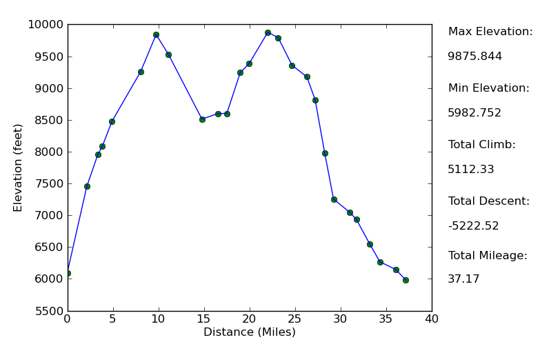
Elevation Profile
TRIP LOG
I don't think I could ever get sick of the hike out of Happy Isles, even with the hundreds of people blocking the way at the outset. While the number of people able to handle the uphill climb drops as you ascend, the spectacular views get better and beter, with
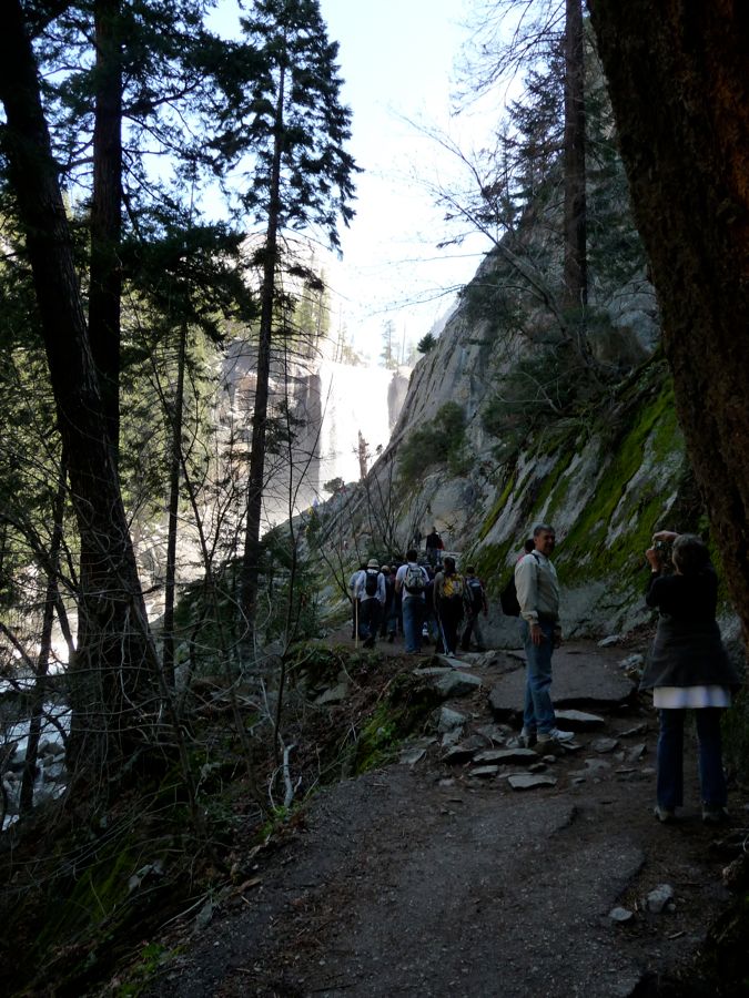
Vernal and
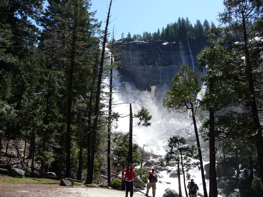
Nevada Falls serving as the culmination of it all. I've never gone along the John Muir Trail during this stretch, so I can't speak to that. But I highly recommend making the hike up to Little Yosemite Valley at some point if you have the opportunity.
With a heavy pack it usually takes me about 3-4 hours to make it up to Little Yosemite Valley, partly because I can't help but stop and stare at the rainbows forming in the mist of the falls. On this day I made it up in about 3.5 hours. Once in the little valley I stopped to eat lunch on a nice smooth log, and was joined shortly by a rather large
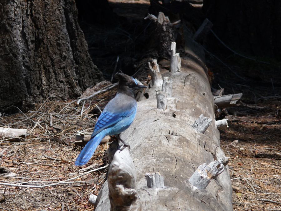
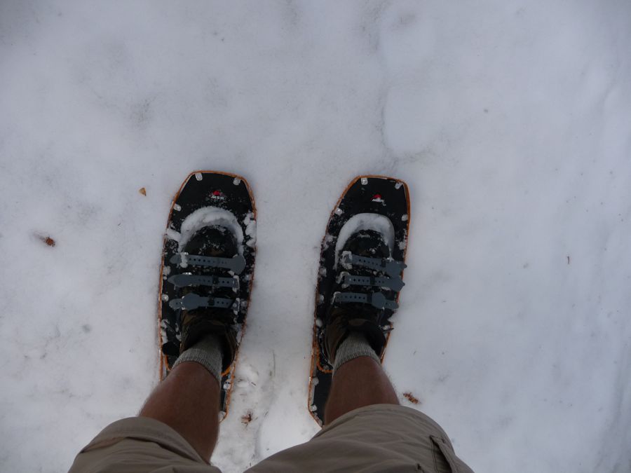
Stellar's Jay that was pretty sure I'd drop some crumbs. Unfortunately for him, when I eat food on a backpacking trip, you can bet that every last morsel is making it into my stomach. I was very happy to see how nicely my snowshoes and ice axe fit on my
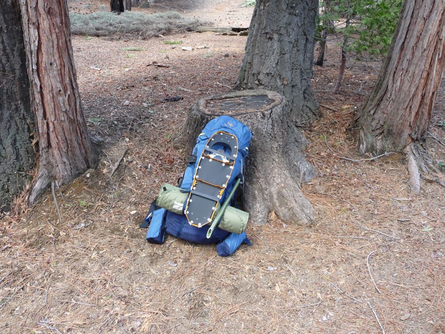
backpack. This was something that I was pretty leery about while planning for the trip. I thought my snowshoes would be clanging around while they dangled from some strap on my pack, but with the large rubber bands that came with them they were held nice and tightly.
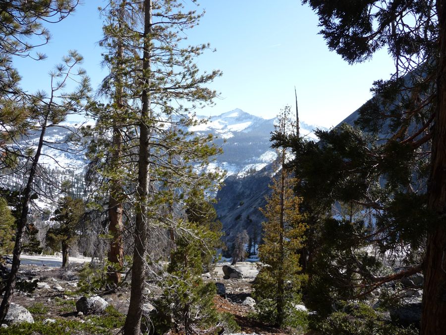
It wasn't much longer until the
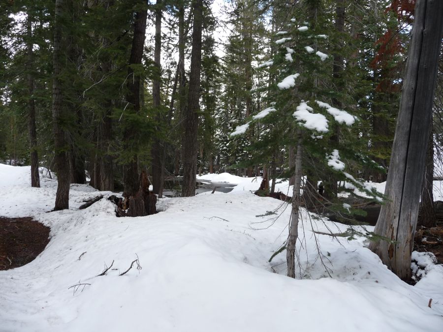
snow began to show itself and I made use of those very
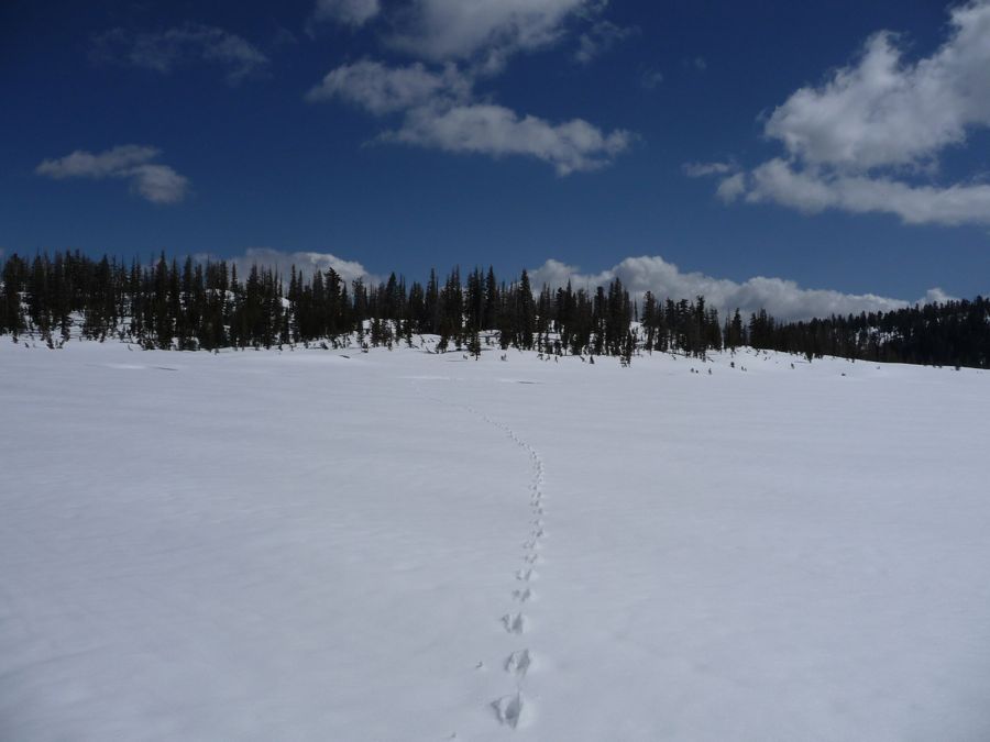
snowshoes. For a short while I could follow the
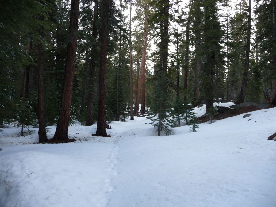
footsteps hovering over the trail. But it wasn't much longer until those vanished. I hiked another mile or so until I came upon an area with some
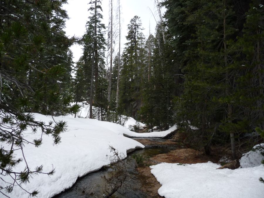
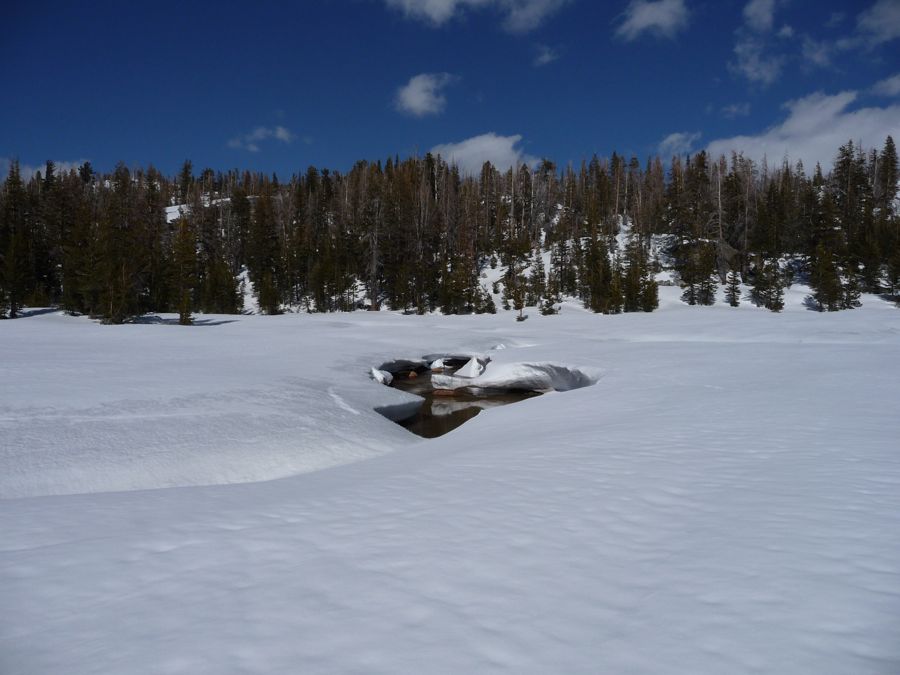
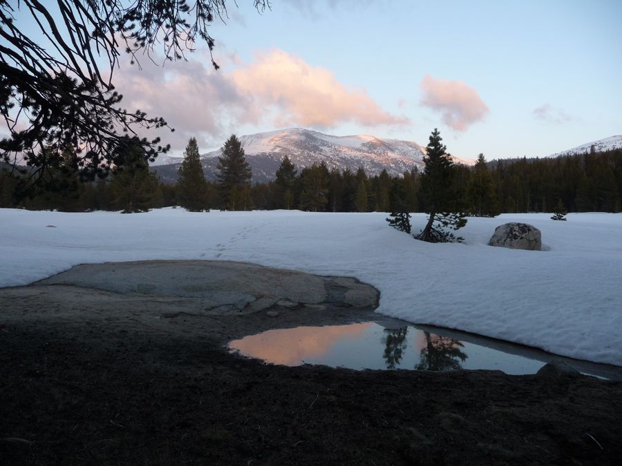
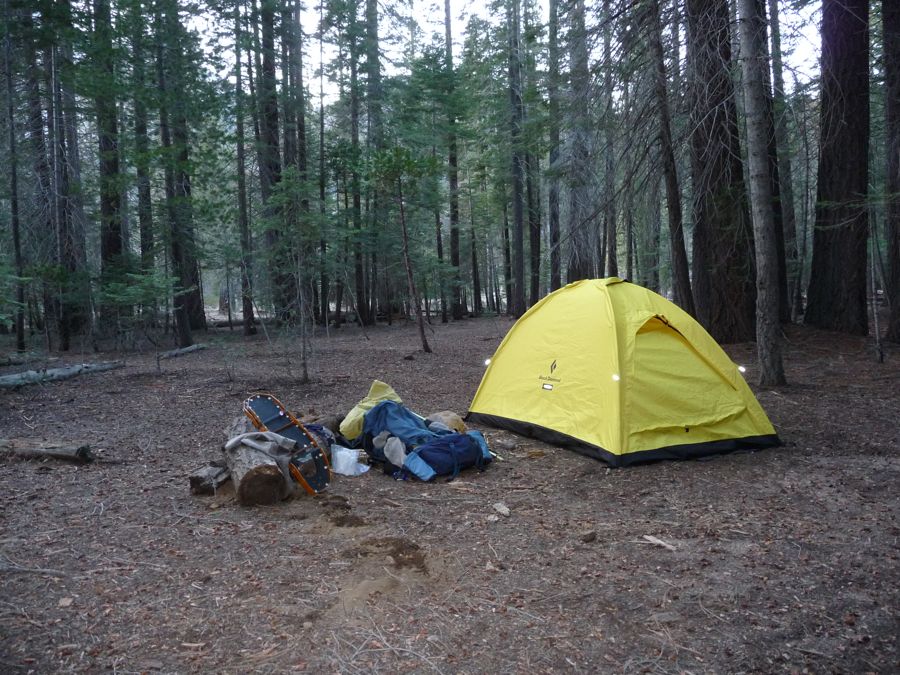
exposed streams and set up my
tent for the night. I decided I'd sleep over the snow just to make sure my new thermarest was up for the test before I got to higher elevations where I'd have no other choice. Luckily, it did the job as advertised and I slept like a baby.
On day 2 there would be lots and lots of snow. I took liberty making some
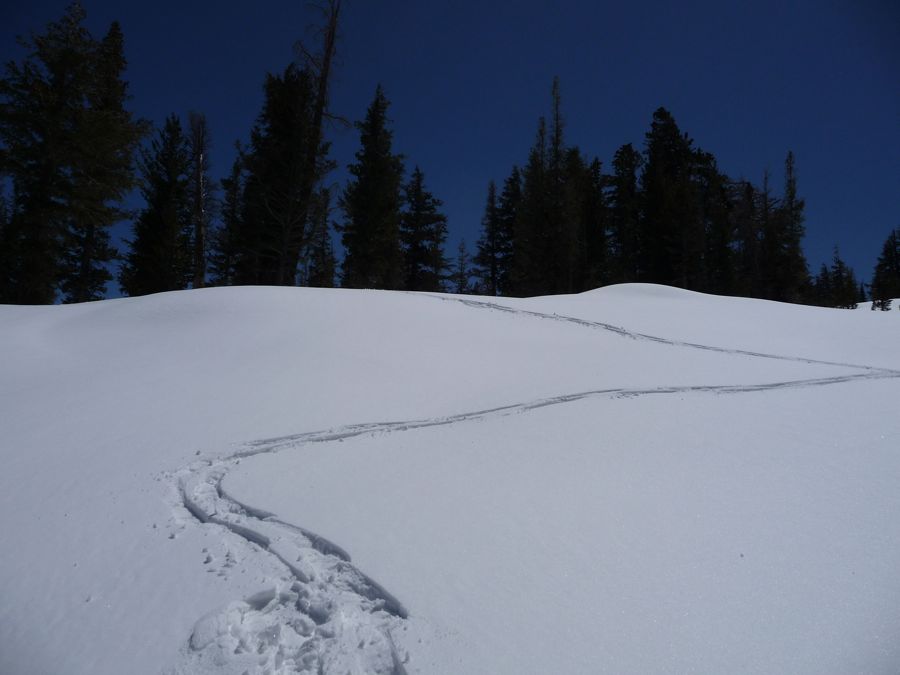
shortcuts on my way to
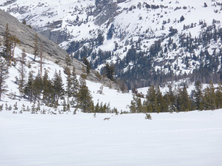
Sunrise High Sierra Camp, which wasn't very hard because of the snow paved trail. Once at the large meadow where the camp would have been had I gone a few months later, I noticed a huge amount of coyote tracks. And sure enough, while I was filling my water bottles in a small creek, I got to see
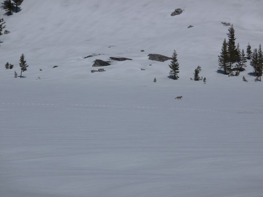
three
separate
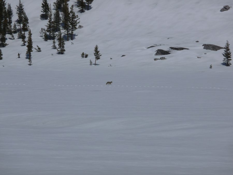
coyotes slowly making their way across the large open field.
About half the day had already passed, and I was definitely averaging a snowshoe pace of about 2 miles per hour.
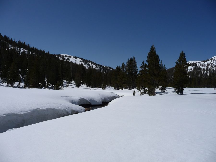
Long Meadow lay ahead of me, and I truly appreciated the name as it seemed to stretch forever into the distance. Although the snow was about 2 or 3 feet deep at points, the
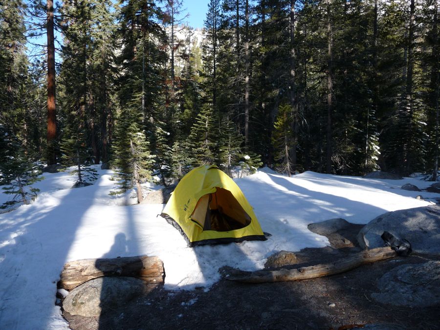
stream that runs through it was still exposed, making water easy to attain. When I reached the end of the meadow, just before the trail begins to climb toward Cathedral Pass, it was starting to get dark. So I set up my
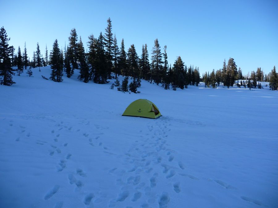
tent, got some water, and collected firewood. There was virtually no exposed fallen wood, so the latter consisted mostly of snapping off the dead wood at the base of the lodgepole pines in the area.
The fire I had that night was an incredibly fun thing to watch. As it burned it continually ate into the snow beneath it, digging its own sort of firepit that radiated the heat toward me quite nicely. At around 8 pm I got in my tent and spent the night cuddling my water filter so that it wouldn't be frozen in the morning.
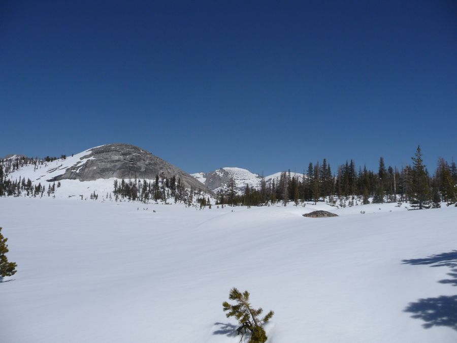
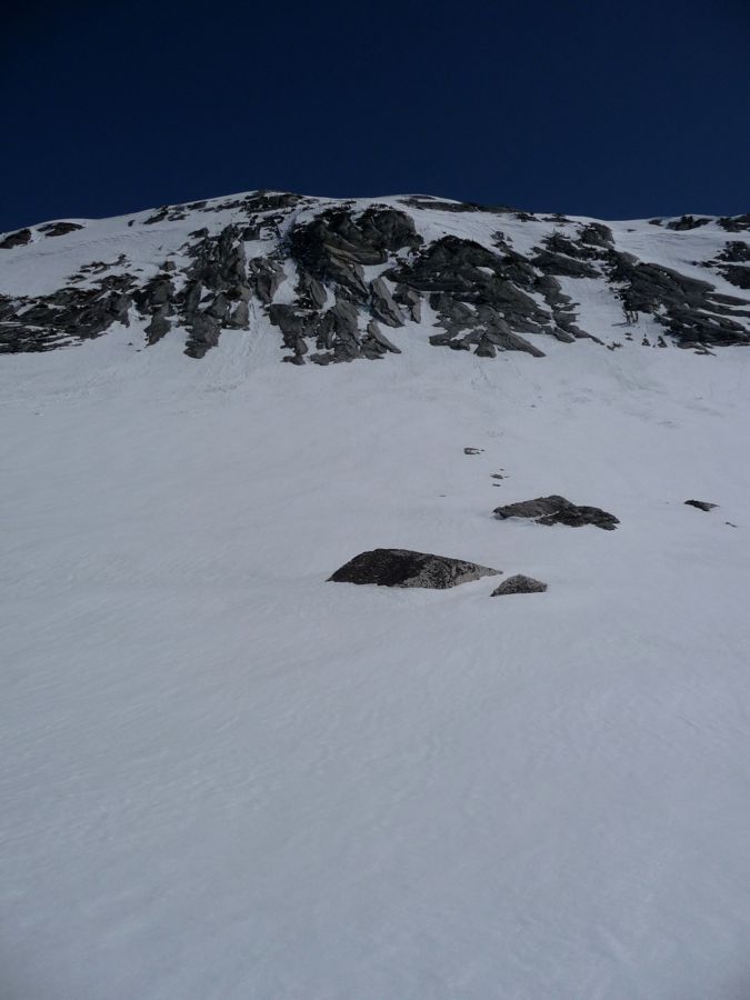
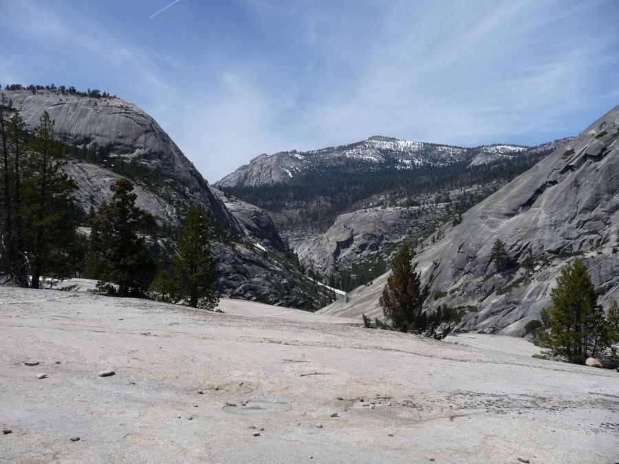
The climb up to
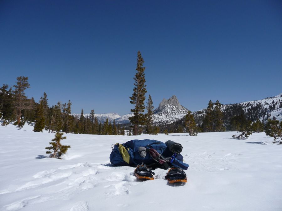
Cathedral Pass was surprisingly easy. As you can see from the photo, it's not the most spectacular pass around. But I was pretty psyched that I would be on my way to Tuolumne Meadows, so I was soaking in the view ahead. The Cathedral Lakes were completely buried under snow. But
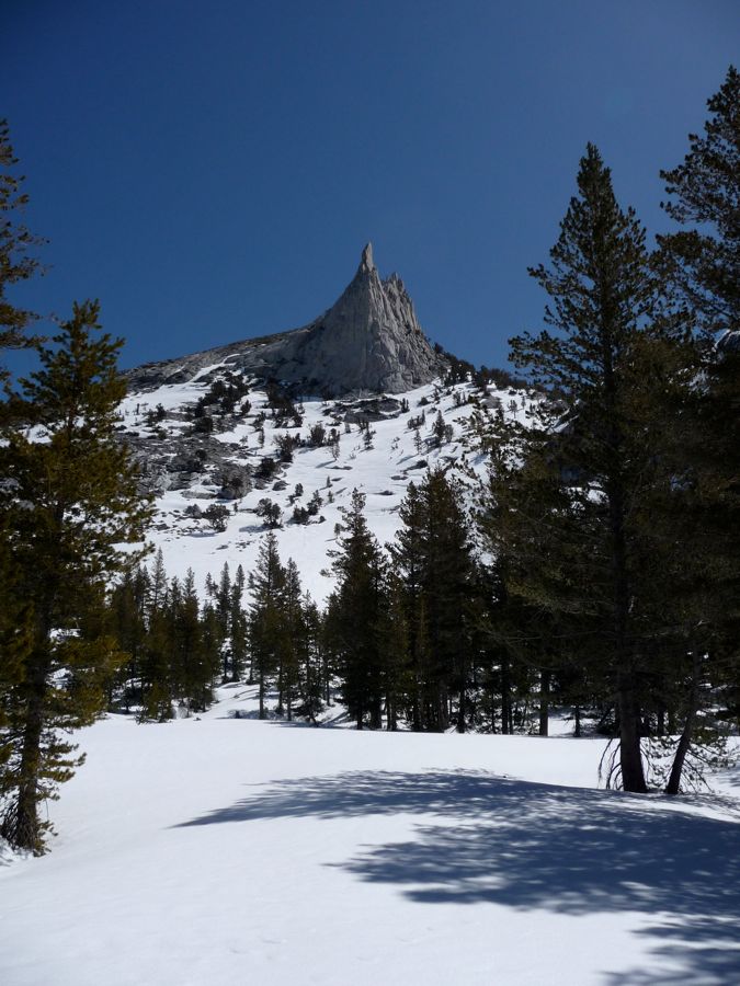
Cathedral Peak wasn't. And boy, oh boy, was I impressed by that soaring spike of granite; one of those things to which pictures just don't do justice.
The descent to Tuolumne Meadows was about as enjoyable as it could get, again, mainly because I could walk straight down the slopes without following a switchbacking trail. Near Tuolumne Meadows I came upon a
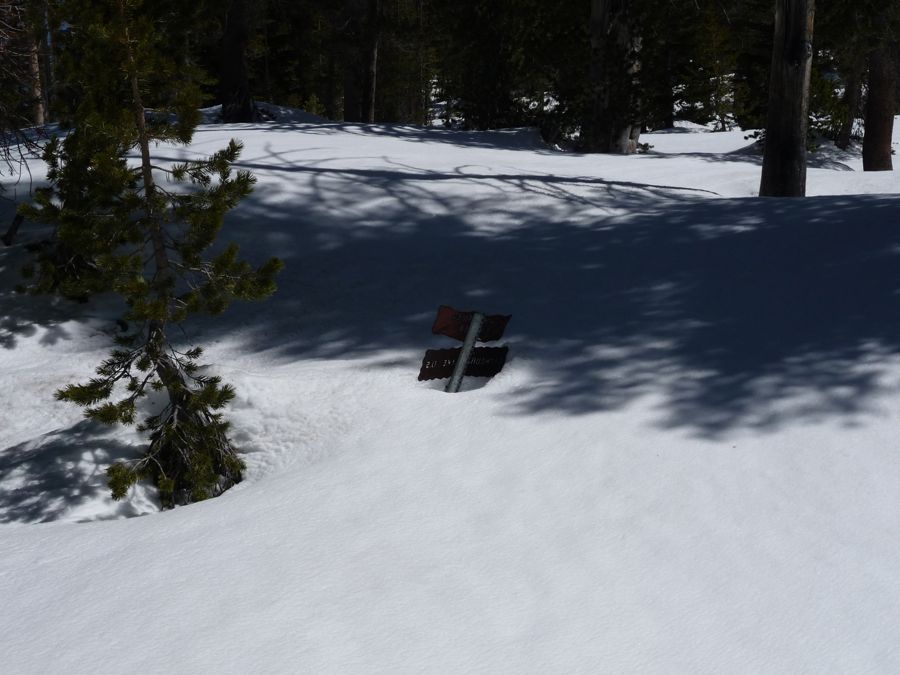
submerged trail sign that gave me a gauge for the depth of the snow. I'd say it was about 2.5 feet deep based upon the average height of one of those signs. When I finally walked out into the
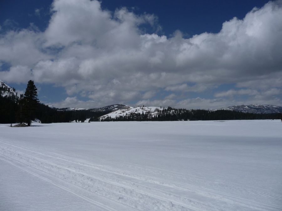
vast openness of Tuolumne Meadows I let out a shout of triumph and basked in the quietness of a place that would have been teeming with life if I was standing there in a month or two.
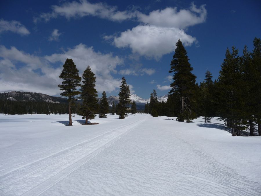
Tioga Pass road was made visible by a plethora of
ski tracks, which I followed contentedly. I made a few stops while I traveled eastward, one of which was at the ski hut that I had read about in various books and on some websites. I had contemplated spending the night inside the hut, seeing as how it would be nice to have some shelter and a place that actually trapped the heat of a fire and my body. But when I opened the door to the hut I found that nearly all of the bunks were populated with people's gear, and the small shelter smelled like a mixture of body odor, musty socks, and overcooked beef. So I decided against that. If you're doing this hike in the winter and you do run up into a nasty storm or you're feeling too damned cold to sleep outside, though, it would be a real godsent.
I made it to the junction of with Rafferty Creek, walked about a mile down the trail along it, and then set up camp for the night. Firewood was a little easier to gather here since there was a ton of exposed driftwood along the creek and I had brought my hatchet to split it up. The
view to the east was quite pleasant, and I enjoyed the early sunset heartily.
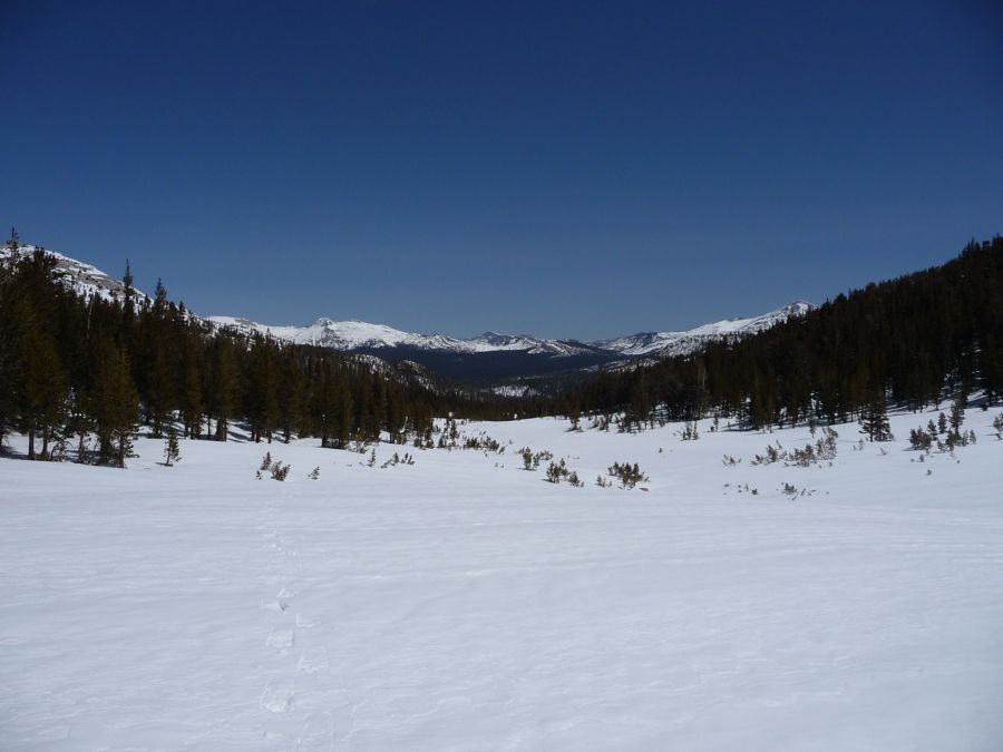
After a very cold breakfast (a result of me being too lazy to collect firewood in the morning), I started on the ascent toward Tuolumne Pass. It was an incredibly gradual climb over
snow filled meadows and

buried trees. Although the scenery looks tranquil from the pictures, the wind was howling in my ears, constantly giving me the feeling that I should keep moving to get to a more quiet place. In fact, the wind and sun were so intense that, despite applying loads of sun cream and keeping my face wrapped in a ski mask, the bottom of my nose was chapped in a way that I didn't think was possible. For the entire week following the trip people were giving me a hard time about my Rudolph-like appearance. So I guess the lesson I learned is that you've gotta really protect the bottom of your nose when you've got light and wind blasting off the snow.
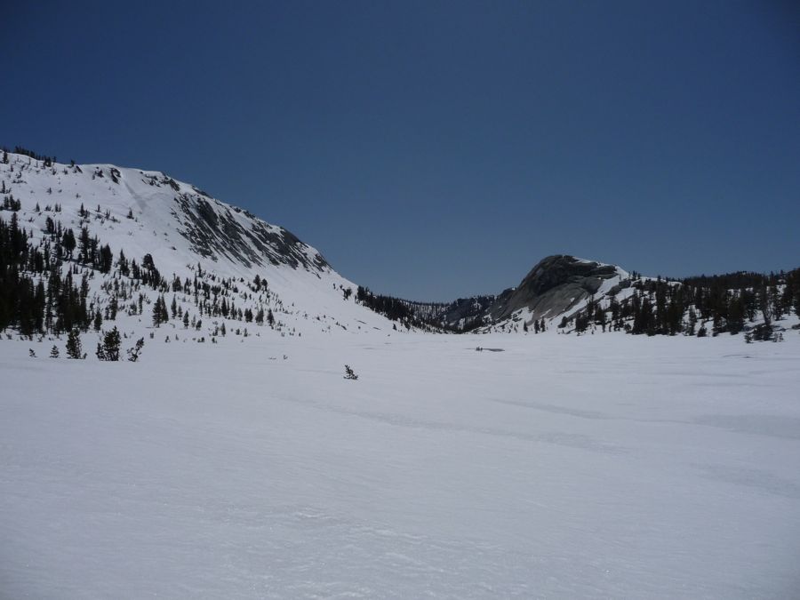
The views from
Tuolumne Pass are nothing to brag home about, but I did soak them in as much as I could. Once over the pass I stopped for lunch and enjoyed the view of Vogelsang Peak for a bit. For the life of me, I don't know why I didn't take any pictures of it. It might have been that I was just too damned cold to think of photography over getting every morsel of heat from my stove to my hands.
When I begin walking again, with my blood flowing and the temperature of the day rising, I started to feel elated. A certain part of me had been apprehensive that I wouldn't be able to make it over one of the passes and that I might have to turn back. But now I was feeling scot-free. As I passed
Boothe Lake, the wind died to a quite whisper and a feeling of peace came over me while I listened to the snow crushing under my footsteps. A little further on, the
towering slopes to the southeast had me entranced, and after not talking to anyone for three days I actually found it soothing to talk to myself a bit.
The transition from Emeric Creek to the falling water of

Fletcher Creek was very cool. And I'd have to say that the remaining section of trail to Merced Lake was probalby the highlight of the trip for me.
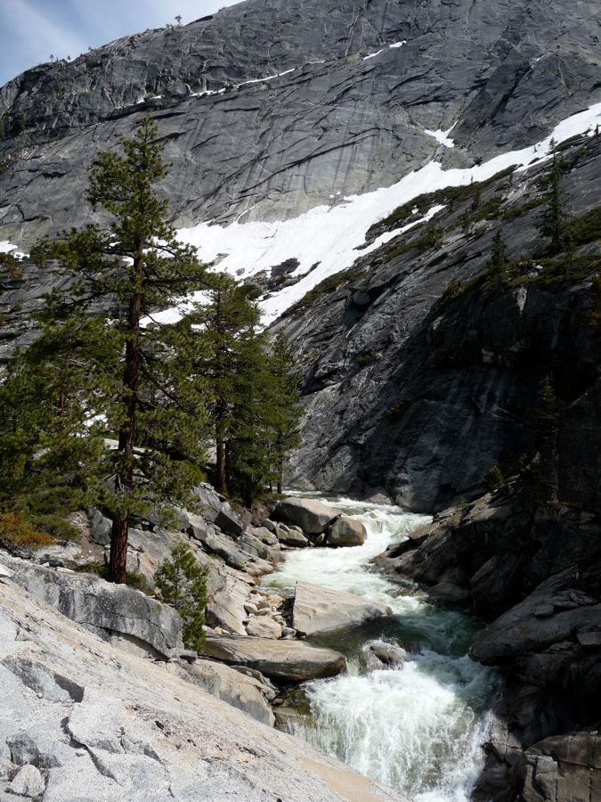
Huge granite banks,
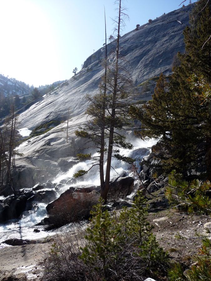
powerful and
elegant wateralls, and
excellent views to the south seem to march toward you in succession. While the hiking was pretty straightforward throughout the rest of the day, there was one section that really tricked the hell out of me. Just before the junction with the trail to Babcock Lake there is an incredibly steep wall to the east. It's fairly easy to follow the trail at the outset because there's really no where else to go if you're not going to jump in the river or climb the face of that wall. But at one point the trail climbs incredibly steeply to the southeast to get over a small notch, and it took me quite a while to figure this out since it was all buried under snow. If you're doing this route in the summer, you shouldn't have to worry about this at all.
When I made it to the Merced Ranger Station I found it completely empty. I had expected to see at least a few people camping there; but no, not a soul. So I made a roaring fire in the official ranger fire pit and enjoyed the hell out of it before I went to sleep.
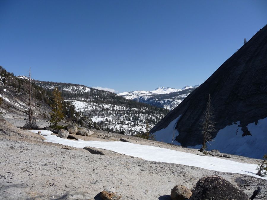
I still had another 3 days before my parents would be calling the Yosemite park rangers and pleading for a search and rescue attempt, but I only had to hike another 13 miles downhill to make it back to my car. So I decided I'd take the day as slowly as possible and really soak in the beauty along the Merced River. And believe me, I had no trouble patiently appreciating the absolute magnificence of the spring run-off along this mighty river. It's every bit as awing as they say it is.
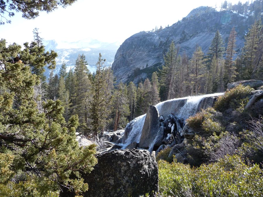
I took a good while just staring at the reflections off
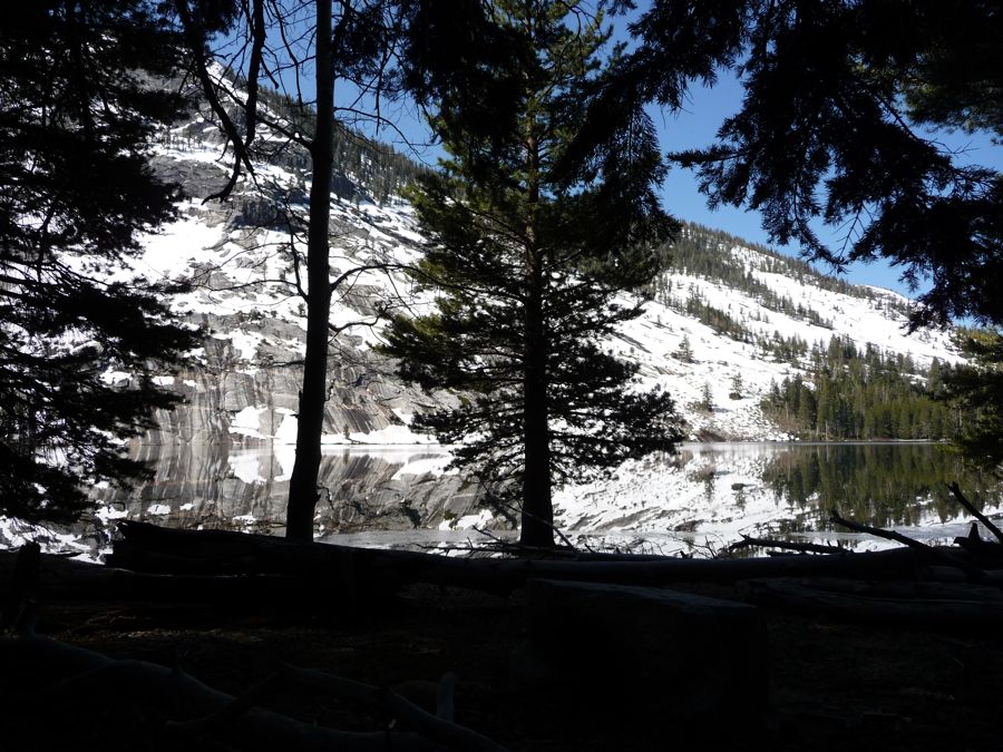
Merced Lake. And then at each
granite deck and
waterfall I would stop to look and listen. I moved slowly enough that I arrived at Little Yosemite Valley to set up
camp just before nightfall. And even without a strenuous day of hiking, I was still sufficiently tired to fall asleep right after I put down some tuna fish and rice for dinner.
Well, the rest of my trip doesn't require much explaining. It was just a straight shot down to Happy Isles from the little valley, again, past Vernal and Nevada Falls. I'd highly recommend doing a spring trip to Tuolumne Meadows out of Happy Isles if you don't mind a bit of cold. Just make sure you've got some snowshoes or skis. For the two passes I mention here you shouldn't need crampons.