


TRIP DETAILS
TRAIL MAP
OVERVIEW
This is actually a description for Sea to the Skyline Trail. We decided it would be more rewarding and easier on our knees to ascend the trial rather than descend it. The elevation gain and mileages below may seem a bit high, but that's because it includes a hike up to Mount McAbee. The vast flow of traffic was going against us, which was nice in a way because we didn't have to deal with passing people up or worrying about people wanting to pass us.
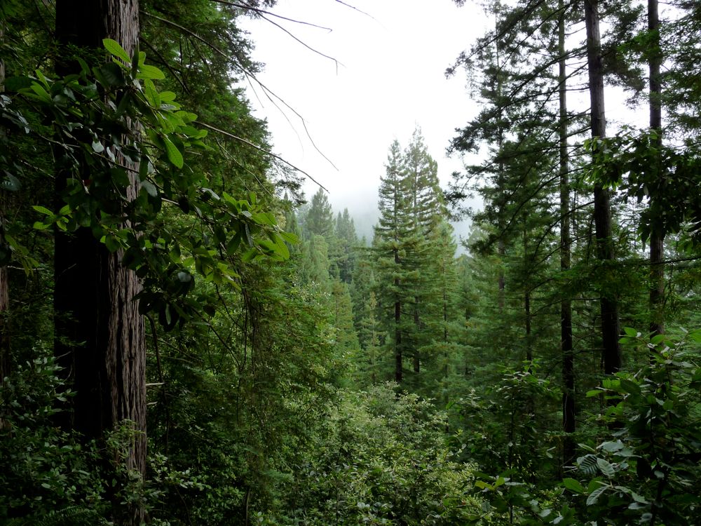
Although Skyline to the Sea isn't the most rugged or wild trail out there (a large portion of it actually follows a highway), the surrounding scenery makes it well worth it. In Castle Rock you have sweeping views to the east and south. And the section that passes through Big Basin, dominated by enormous Redwoods, is particularly enchanting. If you like big trees then this is a hike for you.
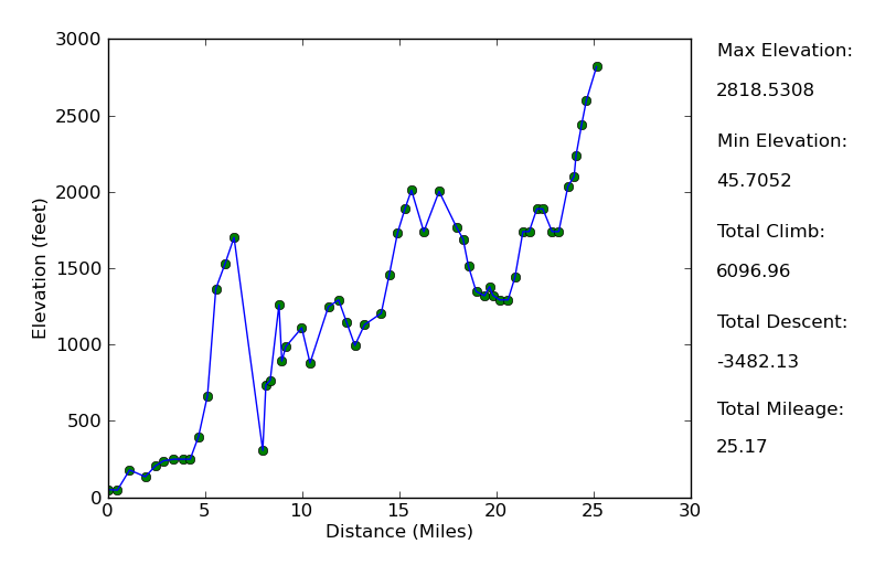
Elevation Profile
TRIP LOG
The first thing that I should point out is that the elevation gains I report for this first day include a little something extra. I took a detour to Mount McAbee halfway along the hike, which was the real brunt of the uphill shown in the elevation profile. Even without this side-trip, the first day would have been spectacular, though.
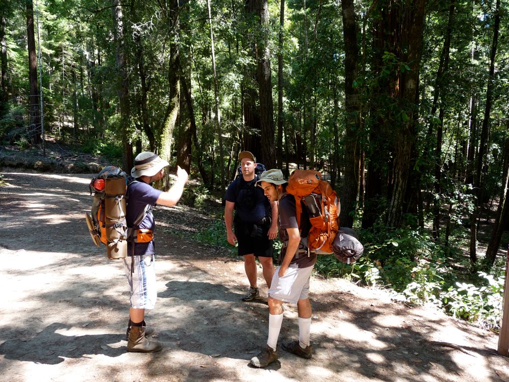
We started the trip off with a rendezvous at the Castle Rock State Park Headquarters parking lot at about 9:30 am. The original plan was to meet there at 9:00, but Khalid and I got slightly lost when we decided to continue south along the 9 when we should have taken a turn off onto the 35. Mark and Eric had driven up separately, and were both going to leave their cars in the lot there. We would take mine down to the opposite trailhead at Del Oso. The big news that Mark greeted us with was that he had forgotten his hiking shoes. Luckily, Eric had brought his pair of steel-toe work boots and was kind enough to lend Mark his gym shoes for the hike.
Mark had already payed for the $15/night permit and $8 campsite reservation fee. And we had to fork over $10 for the other two cars we had in our party (see here for details), bringing the total cost of the trip to $58. The $10 car fees need to be paid in cash, so make sure you've got some. The drive down to Waddel Creek took just about an hour. Well, it would have if Khalid didn't convince us to stop at McDonalds to get some coffee and breakfast in Santa Cruz.
Once we got in the vicinity of Del Oso, finding the trailhead was relatively easy, although we did make a premature turn at the road leading to the nature center while heading north on the 1. After realizing that we weren't going down the right road, we turned around and got back on the 1 and headed a few hundred meters north to the real entrance, which has a gate that you need to open yourself. Once parked, we all geared up, payed the $10 parking fee, and we were off on our way.
The trail started off with some nice, mellow
ups and downs, bringing us through a nice canopy of oaks and big leaf maples. Once it leveled out after a half a mile or so, it actually became a little confusing to navigate. We ended up taking a right at the first major junction we came to (the one at Alder Camp), which in effect turned us right back toward the ocean. After walking a few hundred yards and realizing that we were getting closer to the scent of dead fish, we checked the compass and map and realized we had to backtrack.
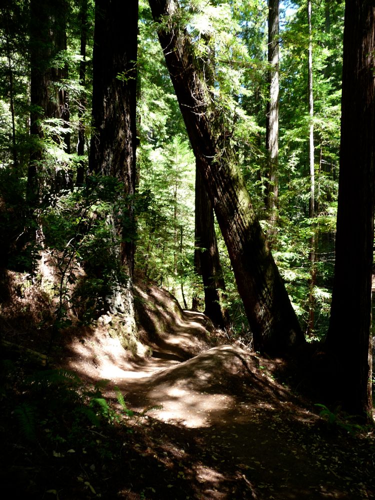
The next three miles or so were not the most exciting by any means. The trail follows an old dirt road and parallels the West Waddell Creek, but the view of the creek is limited. The redwood groves aren't quite there yet, and the highlight is some cool formations of rock to the west. About a half a mile before Berry Creek Falls, it becomes a lot more interesting. Soaring redwoods dot the landscape and the creek has some flow to it. And
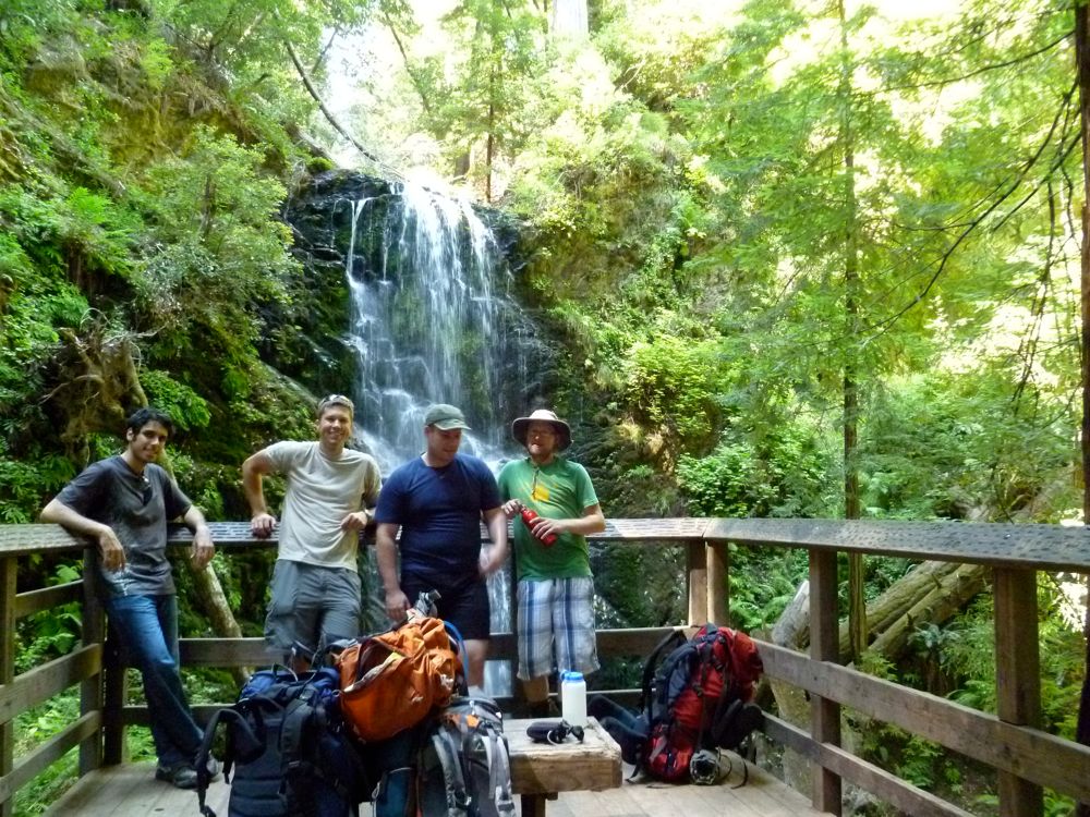
Berry Creek Falls is a quite a beautiful site, enough to be a destination in itself, as indicated by the many day hikers bound for iti.
We hung around the falls for a few minutes and took in the cool breezes and misty air. It was at this point that I decided I'd like to climb up to Mt. McAbee and split up from the rest of the guys. I tried to get them to come along, but they weren't having it. It took me about 2.0 hours to get up to the overlook and back to the falls, and the viewpoint from the overlook was well worth it. Unfortunately, I accidentally deleted my pictures from the first 1.5 days of the trip in an effort to make room for new ones, so I don't have any photos of the view up there. All the shots I'm showing from this portion were taken by Mark.
I was pleasantly surprised by the section of trail from Berry Creek Falls to the Sunset Trail Camp. After climbing above Berry Creek Falls, the trail parallels a quiet, copper-colored stream for a hundred yards and then takes you up and over another dazzling chain of falls. In my opinion, the last cascade you pass is just as impressive than Berry Creek Falls.
It was about 17:30 when I rolled into Sunset Trail Camp, and I found the guys sitting around their tents chewing the fat. They had picked a nice spot right beyond the outhouse, which was a few hundred feet away from the only other group of people at the camp that night. I was out of water because I had neglected to fill up before the trail left the creek, thinking that there would be some sort of easy creek access or water source at the camp. But I was wrong. It's a bit of a hike to get back down to the stream from the camsites, so I recommed filling up before you get there.
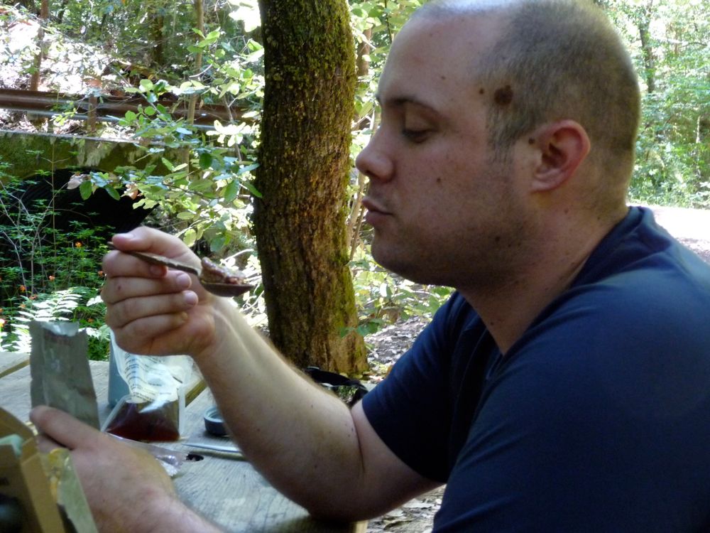
The rest of the evening was a real delight. The highlights began with us watching Mark eat a Spaghetti MRE. He said it wasn't actually that bad, which I'm amazed by. After some nice conversation, we all retired to our tents, and then the second highlight sprang into effect. Some sort of rodents began creeping all around our campsite and rupturing the total silence of the forest with scratching and tearing noises. At one point, it sounded like they managed to infiltrate the trash can next to the outhouse and tear the entire garbabge bag out, but I think that might have been the couple next to us throwing stuff away. When we awoke in the morning, Eric found that a good deal of his food had been abducted by the animals. He found wrappers and packaing scattered around the site. So a word of warning: keep your food in a safe spot at this camp.
Since I'm a two-liter-of-water-guy, I had to fill up on water again when I woke up. I found a bit of a better passage to the creek by heading due west from the camp instead of taking the trail back. But still, it was a good 150 foot descent and return climb to get my two Nalgenes filled.
After breakfast we set off eastward on the Sunset Creek Trail. We decided we'd rather follow this than go back south to the official Skyline to the Sea trail, and I don't have any regrets about this decision. The amount of
towering redwoods was staggering in just this short 2 miles alone. At the very beginning, the dense forest broke for a bit after the first several hundred yards and we had a nice view to the south. It was actually surpising to see how much up and down there was for the first few miles of the day. The trail brings you down to Berry Creek first and then over a 1200 foot ridge, followed by a drops into West Waddell Creek. The latter was flowing well, so we filled up our water bottles there.
We eventually came upon the
first of many trail junctions in Big Basin.
This one actually crossed the Gazos Creek Road at a rather large intersection. We decided we'd make it a decent ways north along Opal Creek before stopping for lunch. There was some heavy foot traffic on the trail at this point in addition to the sound of cars driving on the road to the east of the creek. Not exactly the most tranquil of settings to hike in, but with all the amazing foliage, it's easy to ignore the fact that you're back in civilized territory.
We stopped for lunch at Maddocks Creek where there's a nice couple of picnic tables. Again, the spectacle was
Mark eating an MRE. This time it was some sort of beef patty, and it smelled worse than dog food. He didn't try to conceal his disgust with the main course and said it tasted just about how it smelled. We were all pretty beat at this point, so we decided to
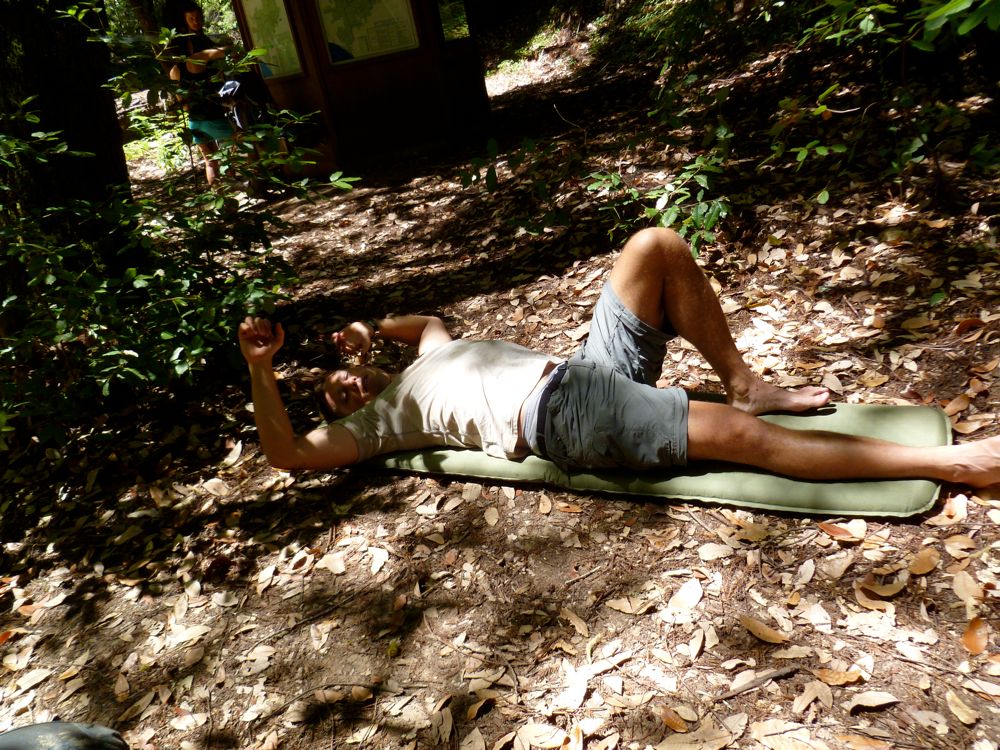
lay out on our sleeping pads and take a
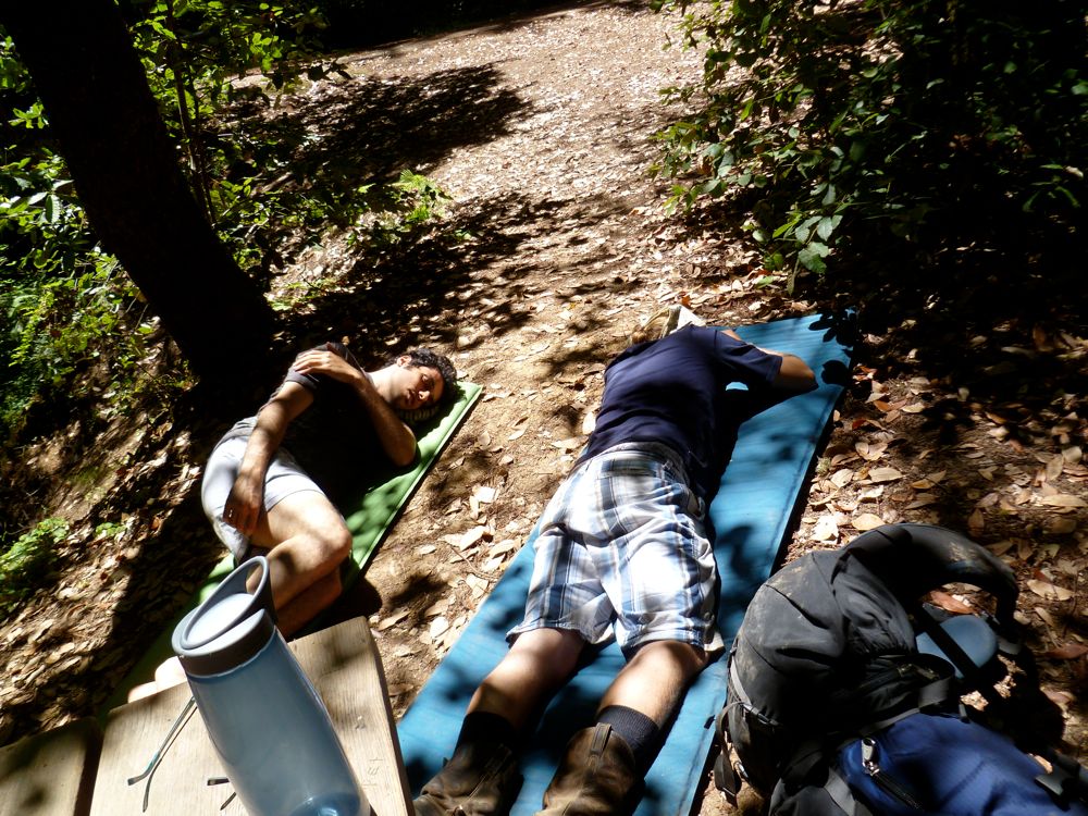
quick nap.
Suitably refreshed with the brief rest, we continued northward. Just before Meteor Creek, we stopped at a magnificent redwood to take some photos. Khalid took the initiative to warm up the camera before Mark snapped a shot of me looking tiny in front of
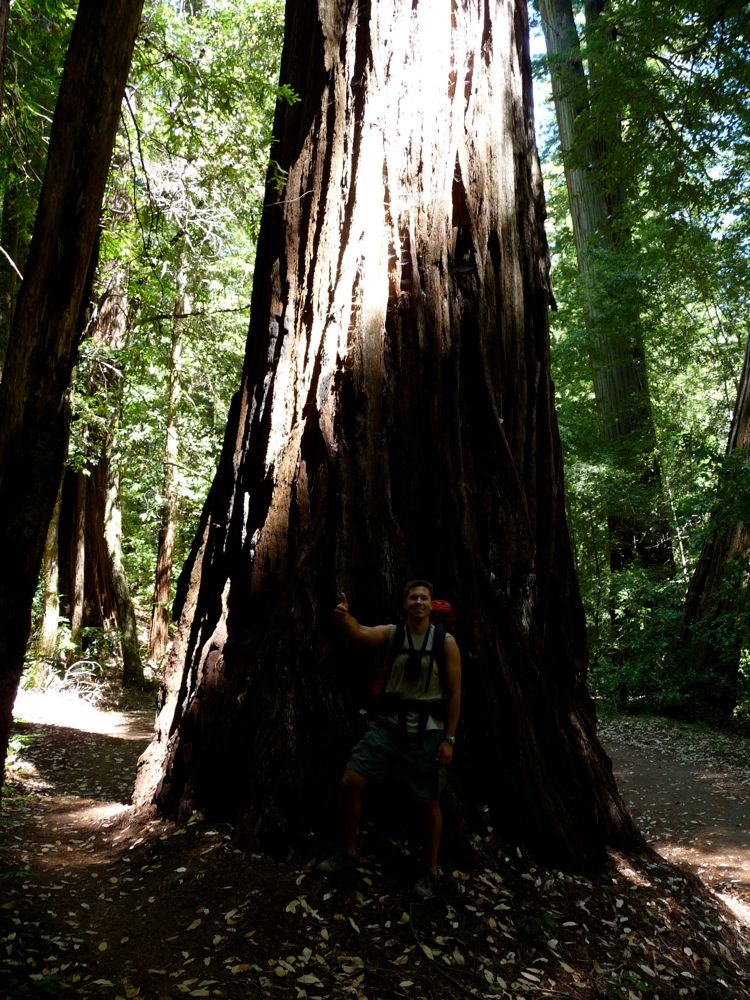
the beast. The next few miles before the trail joins up with China Grade Road were just superb: more giant redwoods, climbs and drops, and beautiful creeks. It got a little hot after we climbed out of the forest and onto the east heading part of the trail, but nothing too bad.
I have to be honest, though. Once the trail joins up reaches China Grade Road, it loses most of its luster. While you're walking, you can see scores of cars gliding along the 236 while you're laboring with a heavy pack. You frequently cross the road as well, which is a bit of a nuisance. I won't say the views aren't pretty. They are. But it just doesn't feel wild in any sense of the word. Still, the ridge that stretches north before Waterman Gap has some spectacular views to the west.
We reached Waterman Gap around 17:15 and found the entire camp empty. There are a few decent flat spots to camp on, but some of the individual sites are pretty sloped and crappy. There was running water and an outhouse, which was nice. I think it was Eric who suggested that since we were right next to a road and had cell service, we could order a pizza and some beers for dinner. We toyed around with that idea for a while, but then decided we were too hungry to wait for the delivery guy to get up there (if there was a pizza joint that would even deliver there).
A group of teenagers eventually showed up, and they were quickly followed by a park ranger who drove up in his pickup truck. He was a pretty serious guy. The dude checked our permits thoroughly and ordered us to move our tents to our numbered site even though we were one of just two parties at Waterman Gap. I told him I'd move it later, and he didn't bother me about it. It seems they take their permits pretty seriously at the site, though. Probably since it's so easy for rangers to drive up to the site. Once he left, we finished our dinners and spent the rest of the night spitting out random movie quotes and other useless but entertaining factoids. This time, there were no nocturnal creatures terrorizing our site. It was kind of cool when a dense fog rolled in right after the sun set. Once it got cool enough, the fog started condensing on the trees and falling on our tents, making it sound like a light drizzle was coming down around us. Absolutely beautiful.
On the third day we decided to wake up early so that we could make it back to our cars and get a decent start for the long drive ahead. We quickly packed up all of our gear and set off on our way north. The early morning traffic on the 9 wasn't that bad, which left a nice quiteness in the air.
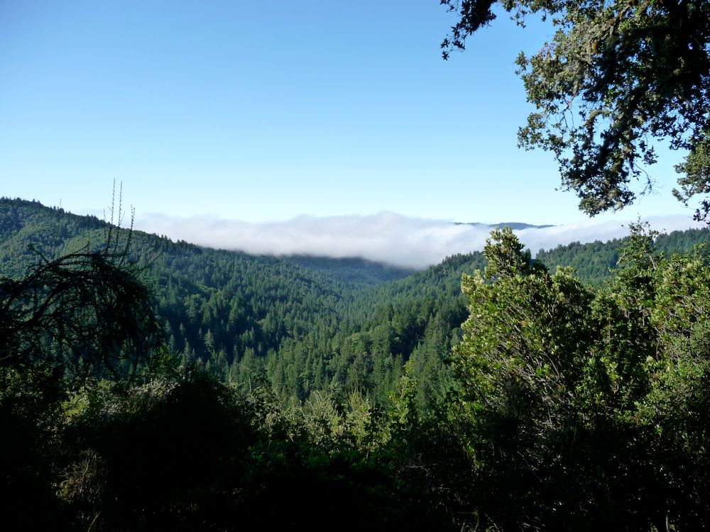
The fog hadn't lifted, giving a mystical feel to the forest that I quite liked. Even though we didn't have a clear shot to the east when we passed out from under the trees, the
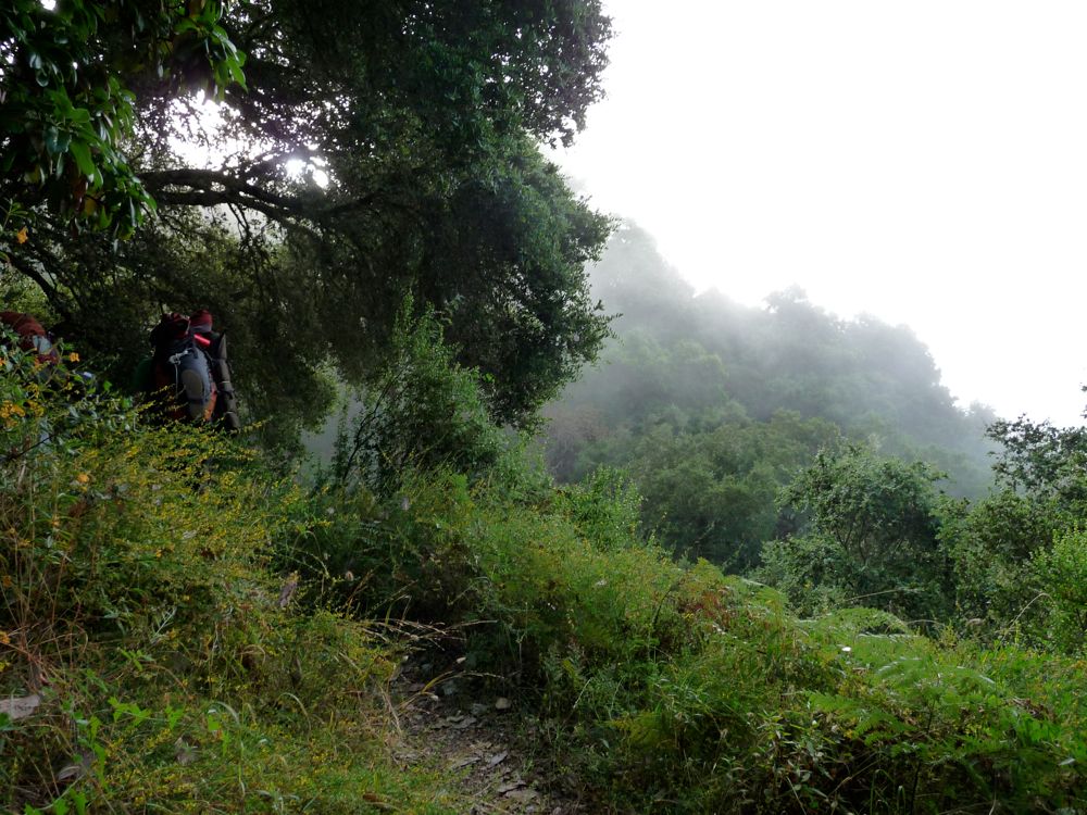
view was into the blanket of condensation was just as impressive.
When we reached the Toll Rd. intersection, we decided that we'd take the shortest route possible to our cars. This amounted to descending the Beekhuis Road trail to the east about 200 feet and then joining up with the Saratoga Toll Road Trail. Once the latter trail joines up with Tin Can Creek, it slices its way through a narrow canyon with decent drop-offs and actually becomes rather beautiful. At the junction with Travertine Springs Trail, we took the right fork to get onto the latter. Once we hit the San Lorenzo River we took a little break to rest and prepare ourselves for the climb ahead.
And it was a decent climb for sure. Once we escaped the switchbacks, we were led out to a nice bed or granite with great
views to the south. It was getting hot, so we didn't spend much time taking them in. And unfortunately, this would be the last of our vistas. From here, it was a matter of willing ourselves out of the park on the service road. We decided to take this route since it was the most direct. But it wasn't the easiest, as it presented us with a good deal of steep switchbacks. After a few breaks, we were finally out on highway 35. From here, we still had about a mile to hike south along the shoulder to get back to our cars, but our eagerness gave us a bit of extra pep in our step. So it didn't take more than a quarter hour to get there.
Getting to the cars and their air-conditioned interiors was a great relief. Nobody got any tickets, so we apparently had followed the instructions correctly. Eric took his car on his way south back to Los Angeles and the rest of us got in Mark's car to head back to Santa Cruz on the 17. During the drive, we agreed that the trip was a success. We saw a bunch of big trees, Mark didn't vomit from eating 3 MREs in their entirety, nobody died or lost and important appendages, and we had perfect weather throughout. Oh, and did I mention that we saw a lotttttaaaaa big trees?