
TRIP DETAILS
TRAIL MAP
OVERVIEW
This is a description for a short hike I did during the spring of 2011. My original intention was to make it to Obelisk Lake through what looks like a pass just south of Quartzite Peak and then circle back around Merced Lake. Unfortunately, my eyes were bigger than my stomach. The snow started at 6600 feet elevation, so my pace was probably just over 1 mph for most of the trip. That prompted me to turn the trip into a reconnaissance mission on the second day. I left my gear where it was and scoped out the area surrounding the pass so that I could try to make it across on a future trip.
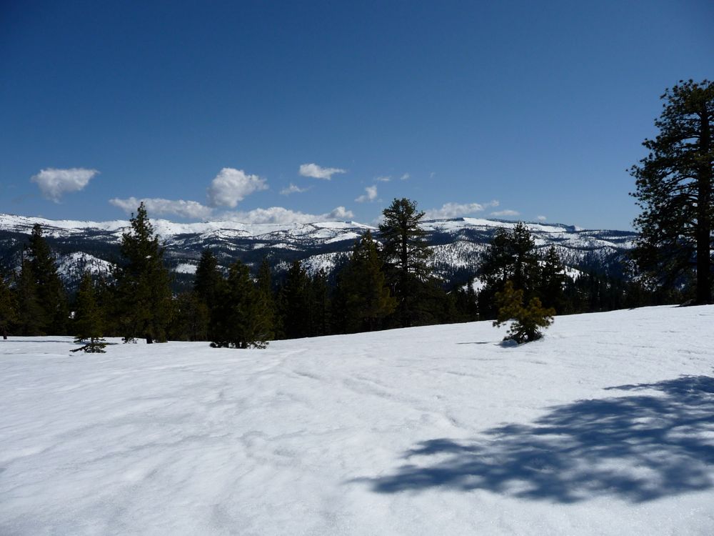
I still really enjoyed seeing Starr King Meadow and the surrounding area, though. And the ridge surrounding Clark Canyon looked incredibly impressive buried under seven feet of snow. So even though it wasn't the route I had planned, it still made for a nice little snowshoe adventure. Plus, I got to watch a black bear that was completely oblivious to my presence for a few minutes.
I'm not 100% certain that the pass that I was attempting to get down to Obelisk Lake from is manageable without technical gear. From the west side it looks like it's pretty easy: maybe class 2 or 3 at most. But the best contour maps I have show that it might be pretty tough descending the 500 feet to Obselisk Lake on the east side. My plan is to make it back starting from the opposite side, heading up to Obelisk Lake from Merced Lake and then trying to ascend to the pass from there. If I can make it up, I know I can make it down to Clark Canyon on the west side.
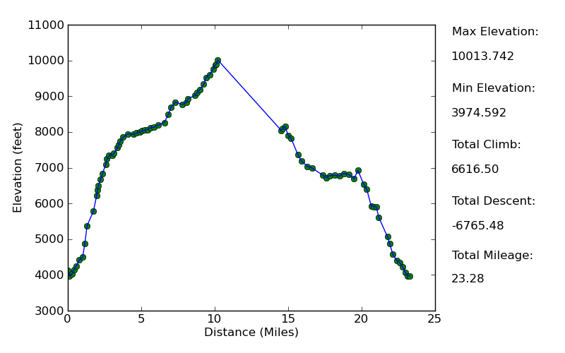
Elevation Profile
TRIP LOG
On a pleasant Friday morning, I set out towards Yosemite at 4:30 am, well before the sun was due to rise. Three and a half hours later I was crusing through Yosemite Valley and taking in the breathtaking structures that line each side of the road. It was the first time I had been on route 41, the route that meanders through the lush Yosemite Valley, before park hours, and the tranquility and lack of people and traffic made it better than I ever remembered it.
I parked in the lot for the visitor center and made my way to the wilderness office. A permit wasn't required since it was outside of the quota season, but two years ago at this same time of year I had gotten back from a hike and found two guys whose car had apparently been stolen. I figured it had been towed by the NPS because it didn't have a permit or something like that. So I was worried that if I didn't register with the rangers that the same thing would happen to me. As it turns out, according to the rangers, the guys probably got their car towed because there was food visible from the outside. They told me that if there's any trace of food that can be seen inside your car, it's gonna wind up in the tow lot.
When I told the four employees working there where I was going they looked at me like I had just stabbed somebody in the throat. The one that was taking my permit information then proceeded to ask me every question imaginable to make sure I was prepared, and after telling them the equipment I had and answering all her questions about food protection, camping away from streams, etc. properly, I think they loosened up a little bit. Their main concern was that this year had a huge amount of late snowfall. So the trail would be buried even before I hit Merced Lake, she said.
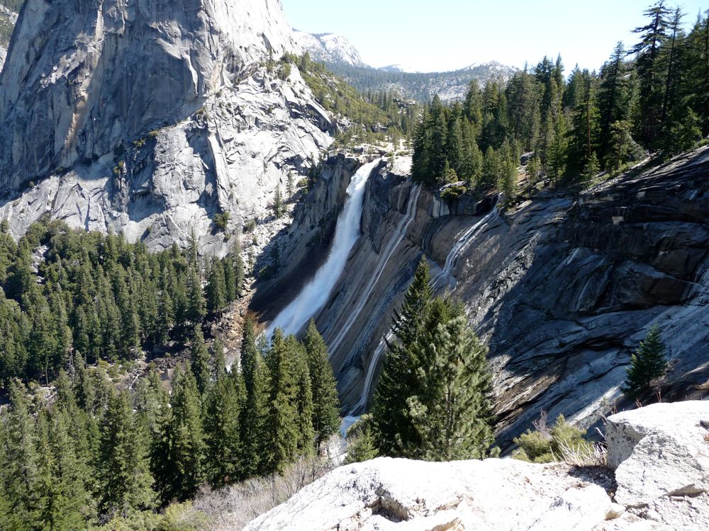
I'd soon found out she was right. After only an hour or so of leaving the Happy Isles Trailhead and turning off for the John Muir Trail, I was greeted by very thick, icy patches of snow. This was the first time I'd taken this section of the JMT, and I was delightlfully surprised by the outstanding views of
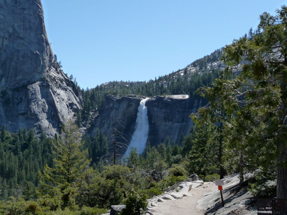
Nevada Falls,
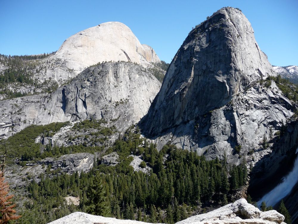
Liberty Cap, Mount Broderick, and Half Dome. If I had to choose one over the other, I'd pick the Mist Trail just because the sights are so stunning. But the nice thing about the JMT route is that it's not swamped with people.
Not long after, I was at the three way junction where I could either head toward
Nevada Falls or continue up the JMT. At the head of the trail to the JMT there was a closed gate with a sign on it that said "Trail closed due to rockfall". But I chose to take my chances anyway. And from what I saw along the way, there was only about 20 yards where there was a legitimate danger of being hit by a rock. I think driving along highway 1 would have probably been a lot more dangerous.
After breaking off at the junction with the Nevada Falls trail, I quickly gave up on trying to follow the actual trail and cut directly up the switchbacks where the ground was dry. The forest along this stretch was
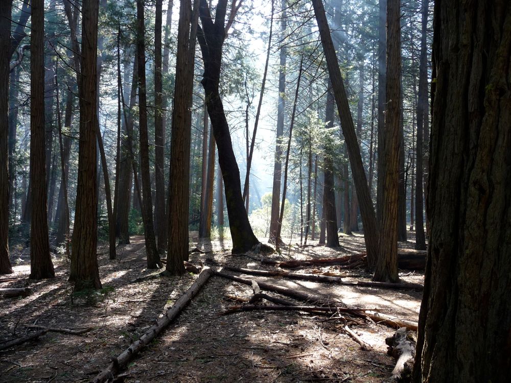
glowing marvelously and it made for very easy going. I cut up my leg pretty good going through some manzanita, but the funny thing was I didn't feel any pain while I was doing it. I just noticed a bunch of blood on my hand when I took a break around 5900 feet. Most of the rest of the switchback avoidance was on dirt and boulders with just a few patches of brush.
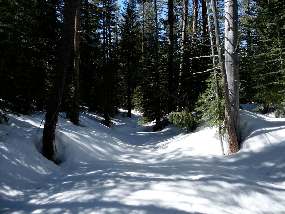
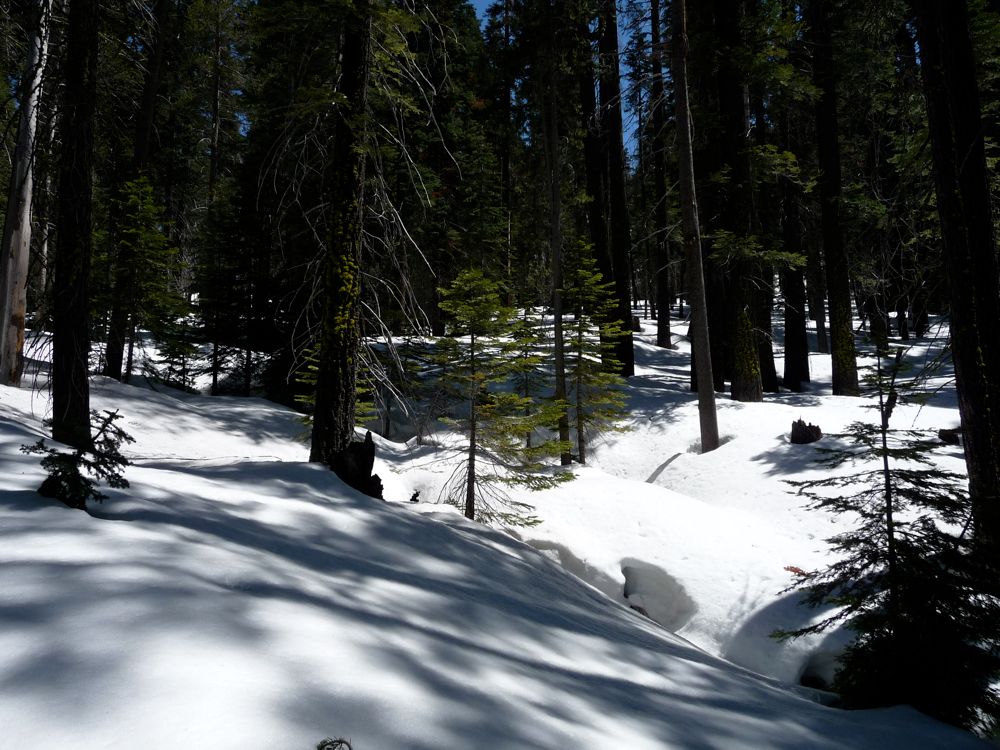
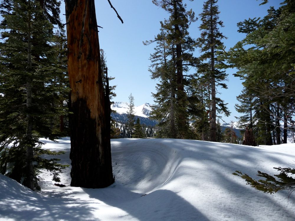
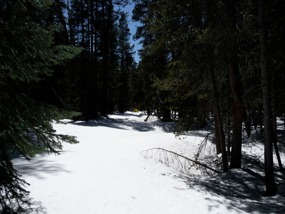
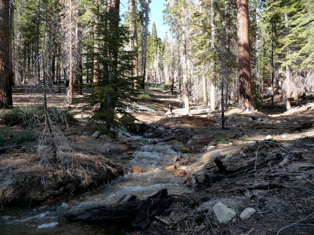
Finally, I reached the flat area at 6600 feet where I had planned to cut east towards Starr King Lake. I had to cross a wide, shallow stream, on the other side of which was a very abundant and constant floor of snow. So I figured I'd break here for lunch before I put on my snowshoes for the remainder of the day. After a nice peanut butter and honey bagel and a Clif Bar, I launched into
the snow for the first time. And I wouldn't see dry, clear ground for the next 36 hours.
My idea was to follow the path of least ascent to the southeast for as long as I could go and then cut east to get the forested valley that leads up to Starr King Meadow. During the first 500 feet of ascent, I was looking back at phenomenal views of
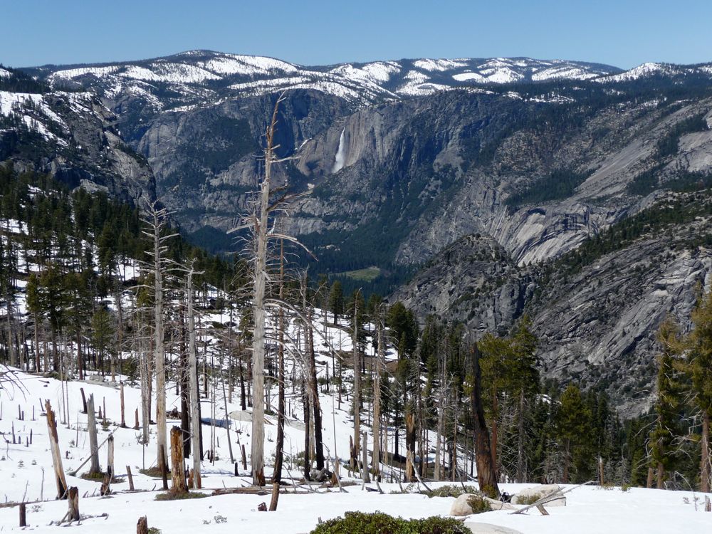
Yosemite Falls. The walking was very steep, but the built-in crampons of my snowshoes made it easy to tackle. Also, the snow was extremely compact, so I didn't do much sinking at all.
When I got to about 7400 feet, it got to be a real bitch trying to head directly east and skirt the steep south-going slant. My right foot was barking pretty badly from all of the pressure it was taking with each step. If I could do it again I would probably have dropped down to 7200 and then followed the very gradual route to the southeast. When I did get to that gradual section, I found myself loving every step. There's a substantial stream not shown on the map at the bottom of that
valley and it was quite safe to walk on top of it. All of the snow bridges were at least 5 or 6 feet in thickness.
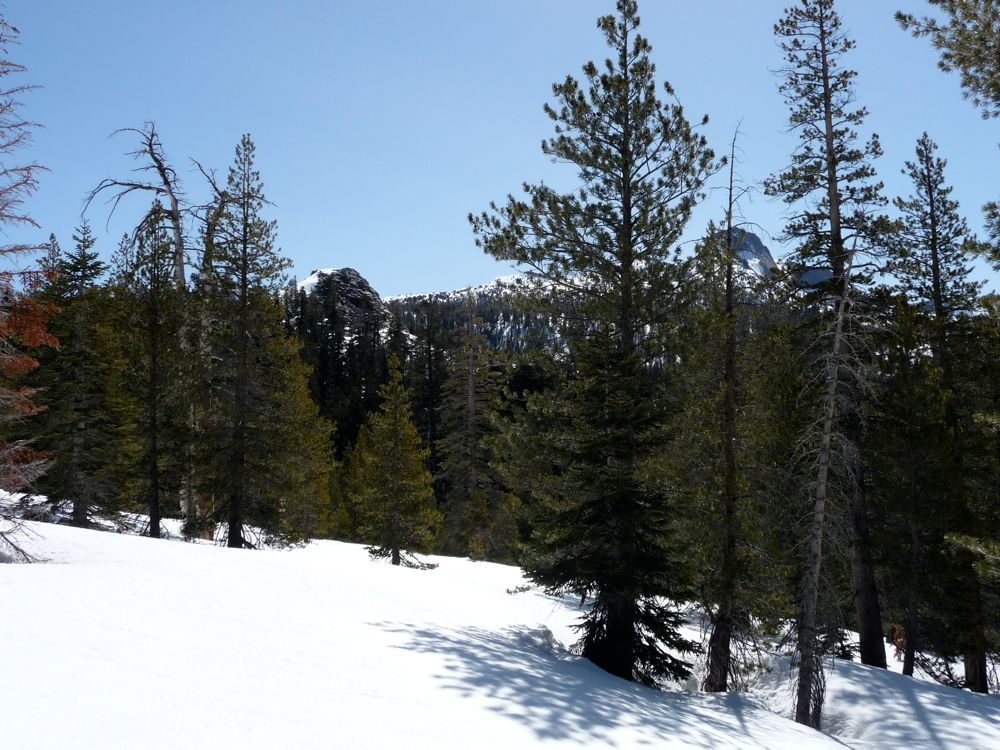
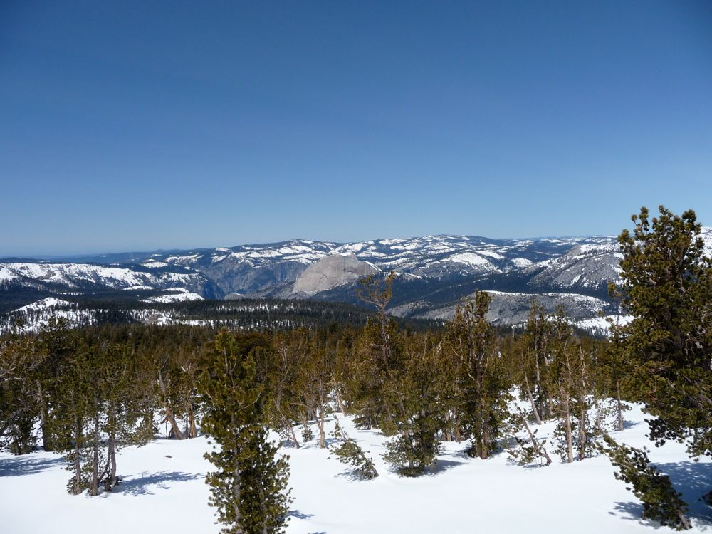
Reaching 8000 feet, I could see
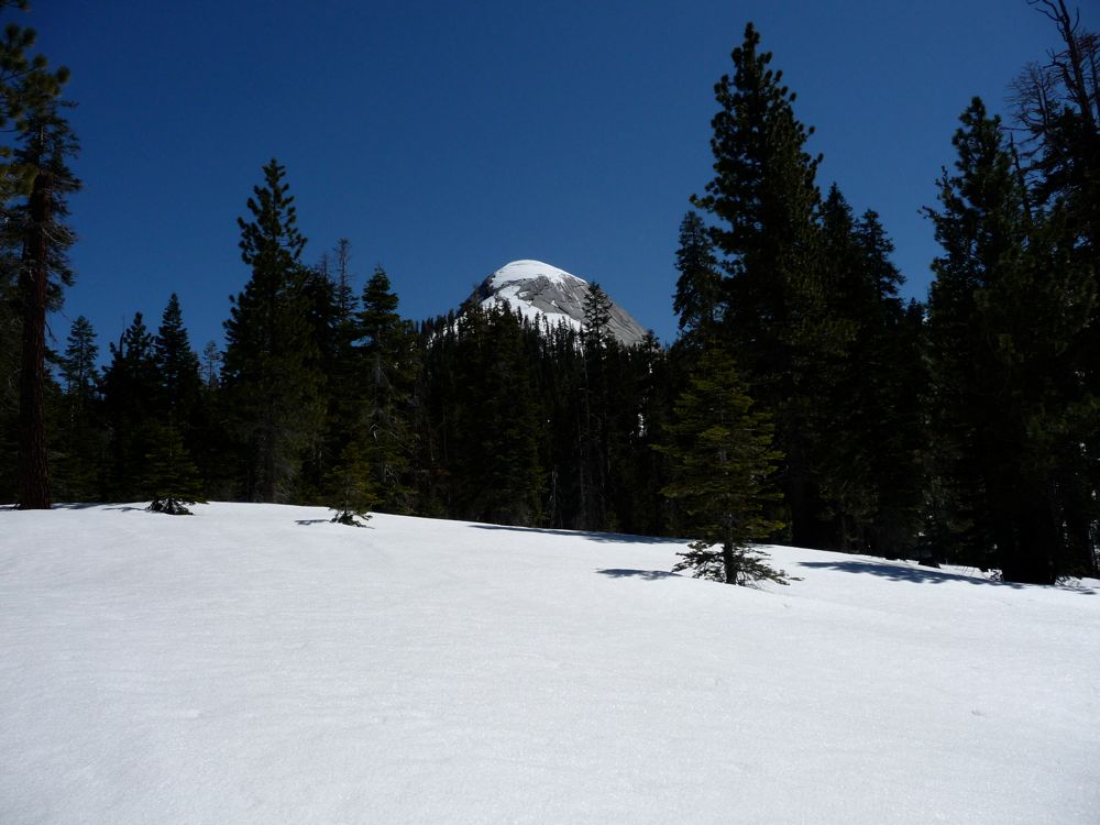
Starr King Dome for the first time when the forest
retreated for a while. When it crept back in, the stream became a veritable
highway: a real paradise for snowshoeing.
When I finally reached the head of the buried stream, the forest
opened up and revealed
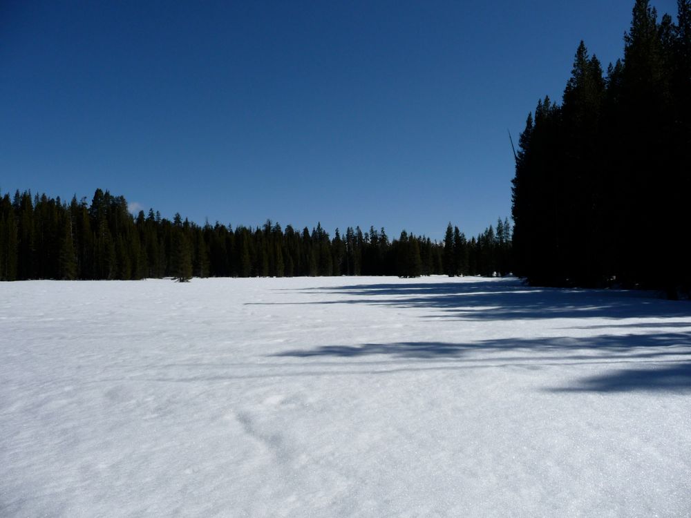
Starr King Meadow. The snow was fairly deep in the meadow, but at the outskirts were pools covered with fragmented chunks of ice. The sun had already taken its toll, unimpaired by the shade of any pines. I took my sweet time walking through the meadow and keeping my eye out for wildlife, but all I saw were a few birds in the surrounding trees. Plenty of coyote and cat tracks covered the ground, but I guess they were out to lunch. I traveled to the very southern edge of the meadow and then cut east in a little sub-clearing. My hope was to follow the stream that flows from the north-east for awhile and then camp somehwere where the water was exposed.
The stream proved to be rather elusive, so I pretty much set my course at 45 degrees and stuck to it. There were plenty of gaps in between the trees, so it wasn't very difficult to walk. When I reached 8200 feet it was about 5:15. My feet were cold as hell, and there was a nice patch of flat ground with a ditch next to it that had running water flowing through it. So I decided I'd set up
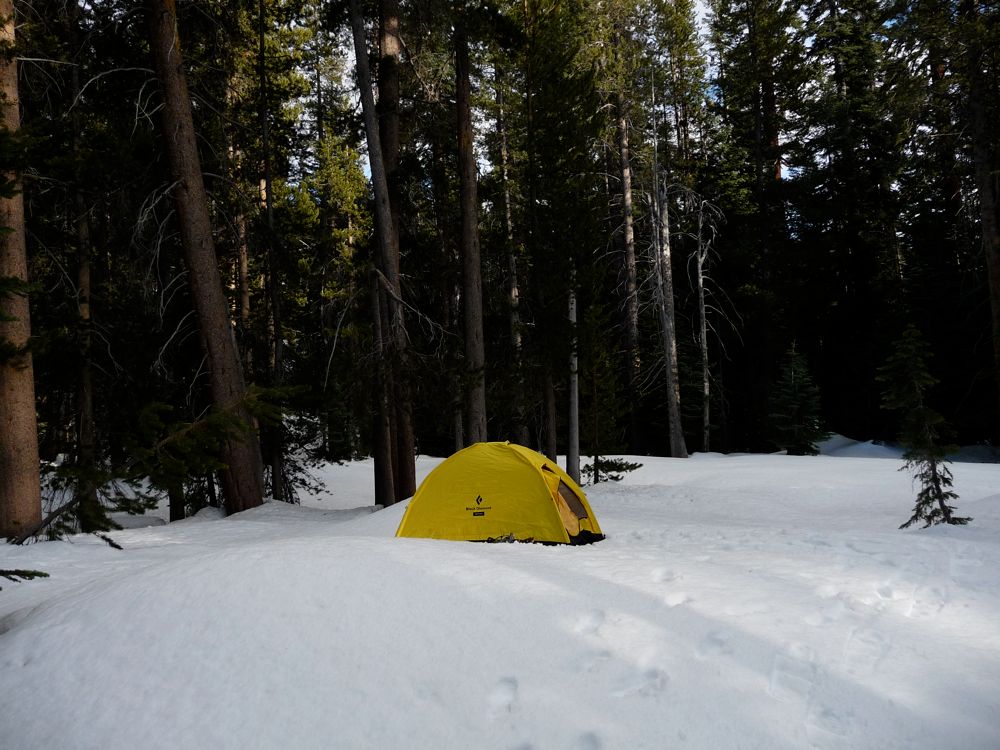
camp here. There was a quaint little section of low ground beneath only a couple of inches of snow, so I made a fire there and warmed up my feet. Once I felt that radiation on my cold feet, all my troubles melted away. A dinner and some hours later, I was inside my sleeping bag on the road to a toasty night's rest.
I woke up to a pair of boots and a tent that were frozen stiff. What a way to start the day. The overnight temperatures had reached 15 degrees according to my watch, cold enough to make me sleep with not only my water bottle and filter, but my GPS so the batteries had a better chance of surviving. I decided I'd eat breakfast in my tent since the sunlight hadn't yet begun to pour down on the earth around me. And while doing so, I came to the realization that I didn't have enough time to make it across the pass, down to Merced Lake and back out before I was expected back. The snow was just too abundant.
I had planned to make it down from Merced Lake to Yosemite Valley by Sunday afternoon, but with snow likely to be lining the route along the Merced River, I just didn't think this was possible. Part of the reason was that I didn't know exactly how I'd cross the Merced River or Lewis Creek when I got down from Obelisk Lake. With the swelling from the spring run-off, it's possible I would have had to hike an extra mile or two to find a decent crossing.
So what I decided was that I'd leave most of my gear here and make it up to the pass to scout it out for a future trip. My tent and sleeping bag needed a good drying anyway. I'm always amazed at how much condensation forms in my tent on a cold night. I think it's from my breath, but I'm not positive about that. It might just be moisture from the air falling out as the temperature drops over night and then turning to liquid as the morning temperatures rise.
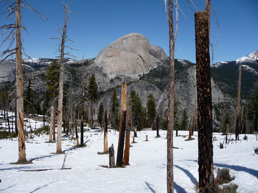
With my mind made up, I started hiking up along
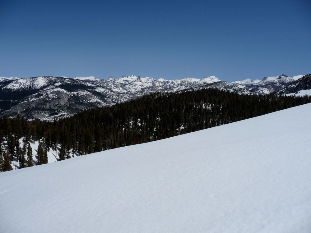
the buried stream that flows the the northeast. This time it wasn't quite as nice; the path seemed to zig-zag and disappear at times. But the snow as nice and compact in the fresh morning chill, so I didn't sink at all. After about an hour of heavy-exertion climbing, I reached the tiny flat at 8900 feet, where I had my first good view of
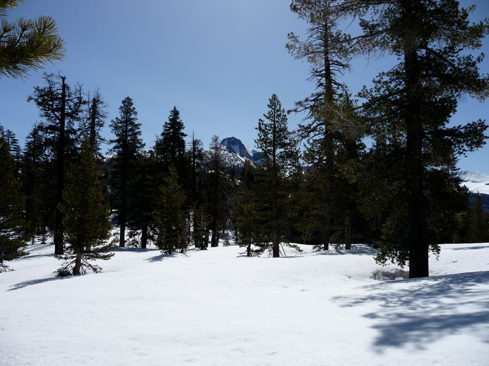
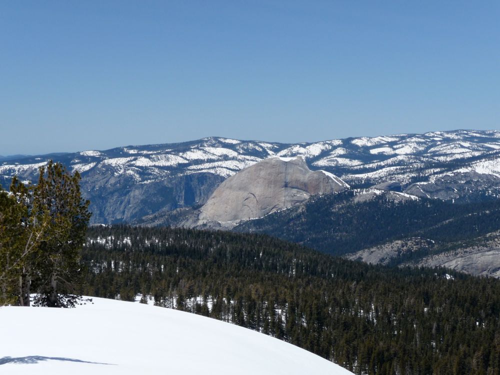
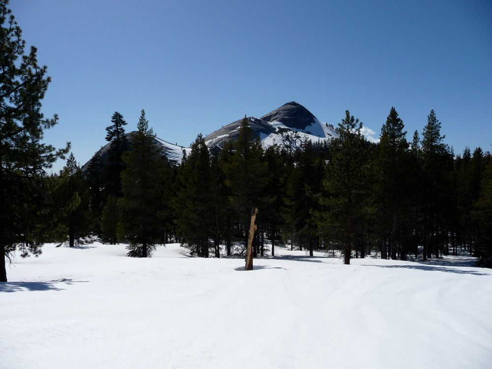
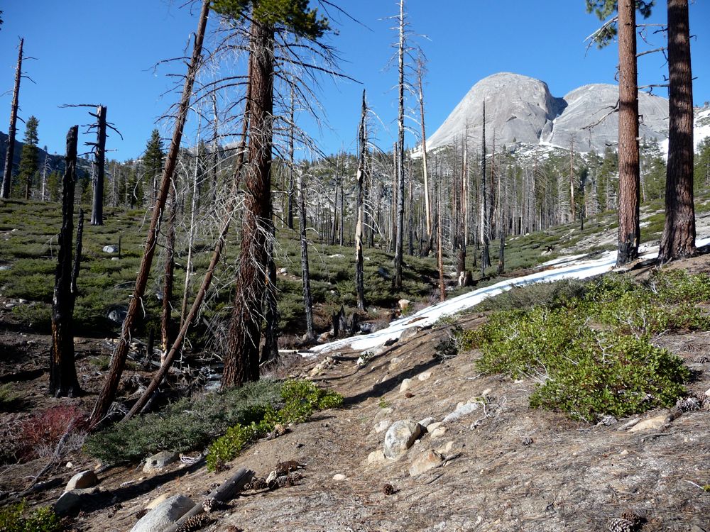
Mount Clark. I took a short break in the
shade before making a 150 foot descent into the
valley that followed.
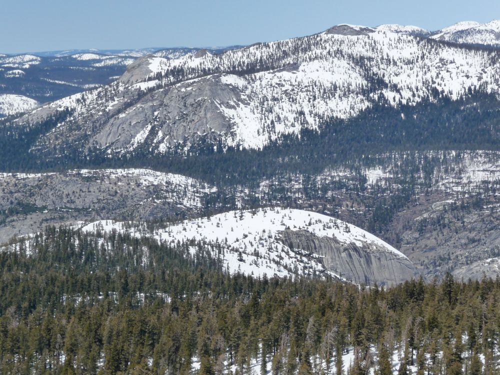
So far I was doing well on my chosen course, but at this point I made a bit of a mistake. If you click on the terrain version of the map above, you'll be able to see where it happened. Just go as far East as possible where there's a dead end in the waypoints. Basically, just before this point, there is a
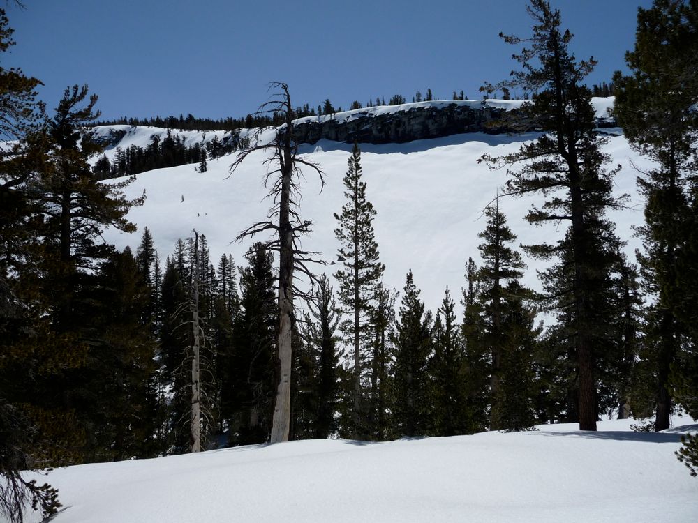
big old wall to overcome. I had planned on going north to get around this at first, but when I finally got there, the idea of descending 200 feet and then climbing back up was as appealing as getting my eyebrows waxed. You can kind of see in
this photo what I'm talking about.
So lazy old me decided I'd try to circle to the south and climb up to the top of the wall. The contour didn't show any major show-stoppers with this plan, so I started on the
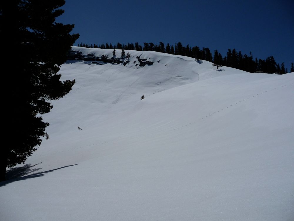
ascent. There were some great
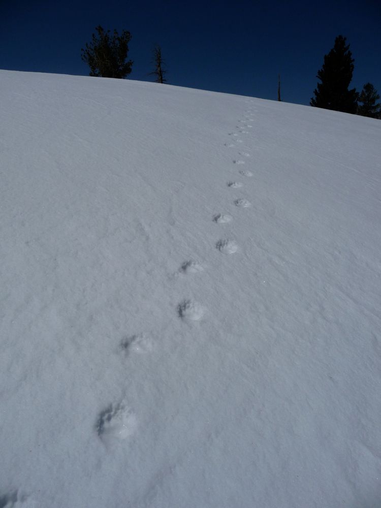
bear tracks going in the same direction as I was headed, which was kind of interesting, and as I got higher and higher, the views got
better and
better. Eventually, I could see
Yosemite Falls way off in the distance.
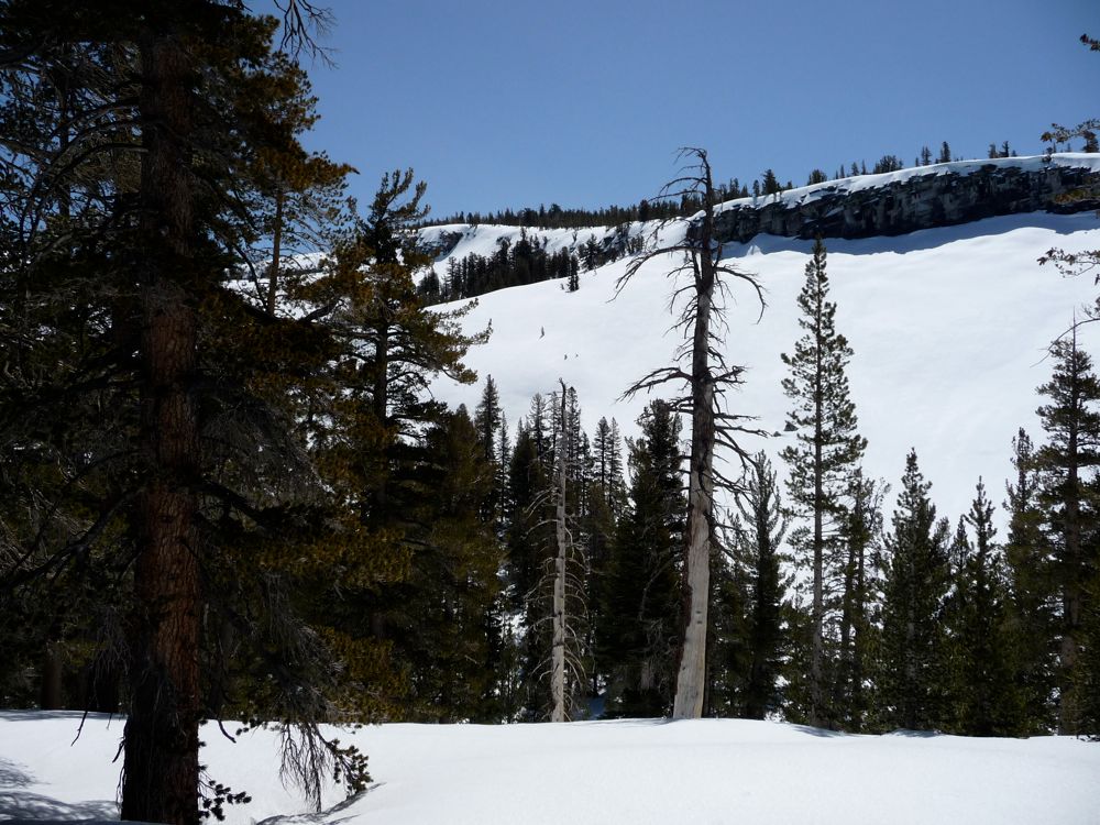
As I continued to climb, I realized that getting to the place where I wanted to attack the pass was going to be impossible. To the north (where I needed to cross) was a sheer 50 or 60 foot cliff that extended all the way up to the Merced River. It bends around to the south in a hairline ridge, making a descent to bowl of Clark Canyon impossible. So I was staring out across a 50 foot drop to the
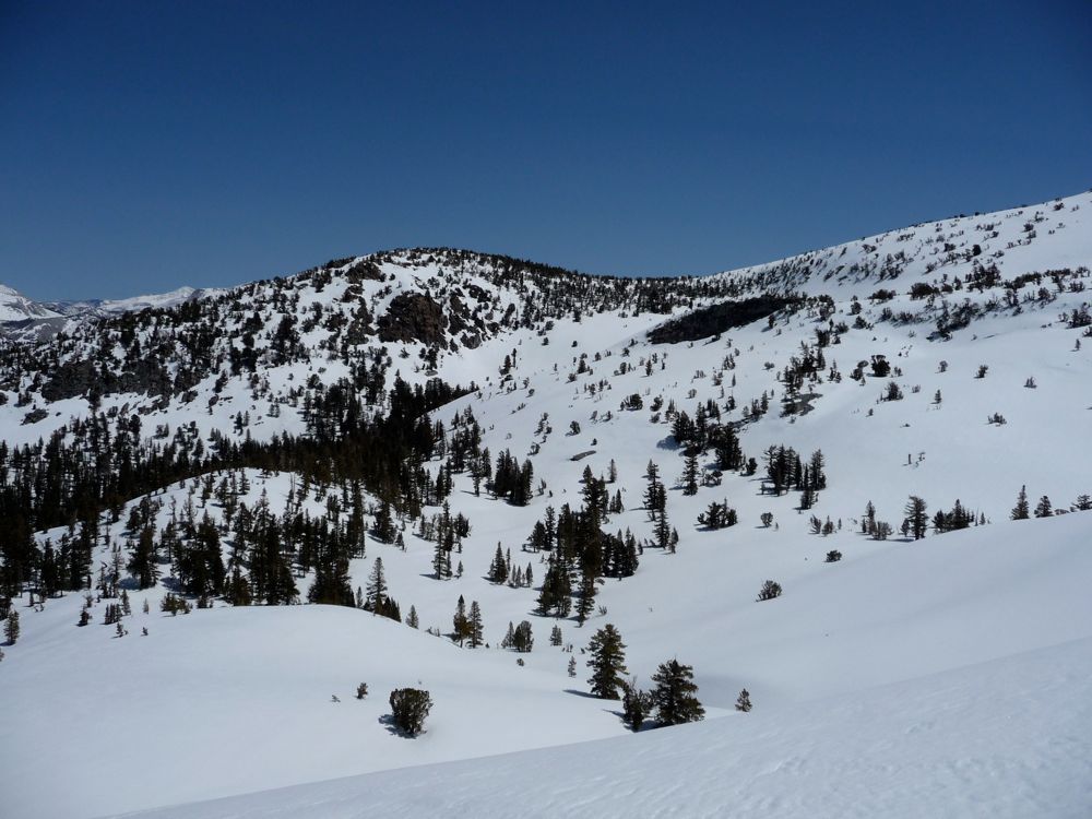
slope I wanted to be on, pretty much trapped. And it was here that I decided to turn back. I was satisfied with my recon work. I knew that next time, I'd have to cross the bowl before that wall on the northern side. And I was to come from Obelisk Lake to the east, I knew the descent down would be doable.
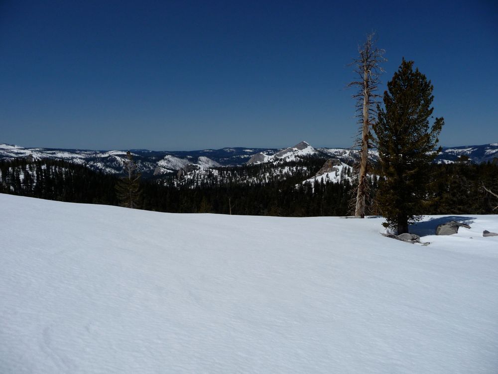
It was around 1:00 pm, so I decided I'd have lunch before I began my try back to the campsite I had used last night. The views back to
the valley and to the
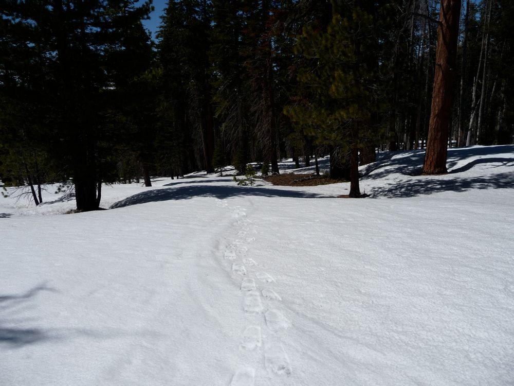
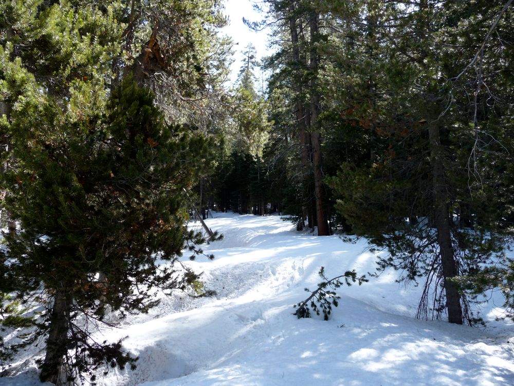
north kept me content while eating. The descent down the slope was easy; the hard part was accepting the defeat I had suffered at the hands of the mountains. But I went about my way knowing that I'd be back to tackle Obelisk Lake in the near future. It was pretty easy to follow my tracks back the way I came. I lost them momentarily when the forest started to shroud the landscape, but within a few minutes after I saw the road back to
my tent. For some reason, finding a "pseudo-trail" like this is one of the most gratifying experiences in backpacking for me. After stepping over boulders and pushing aside branches to make a few feet of progress, a clear, open path like this just makes me feel good.
All of the stuff I had left out at the site was plenty dry. I took a few minutes to stretch and relax, and then began to pack everything up into my bag. I decided I'd take a southern route out of Starr King Meadow. It looked easier-no crazy skirting of slopes in snowshoes like I had to do to get up from the John Muir trail-plus I'd be on the south face, so there would likely be less snow to wade through. I took my time enjoying the spectacular
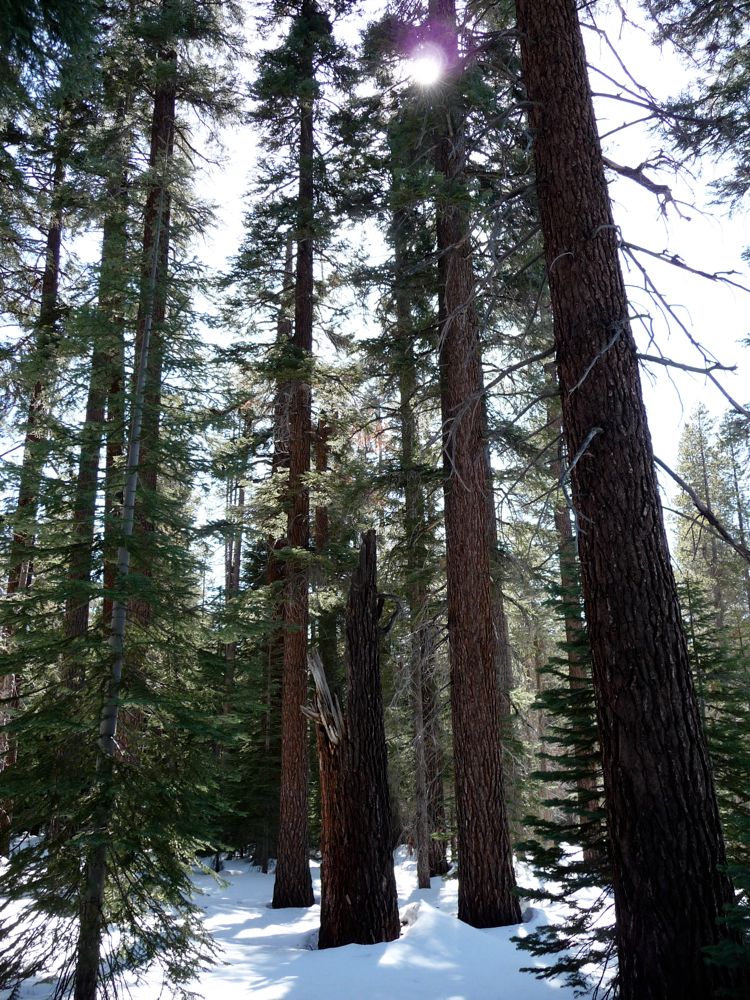
pines and
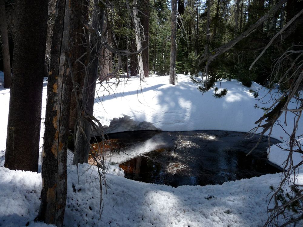
pools along the way. The view of
Starr King Dome was even more impressive on the way back it seemed.
Getting down on the
slope south of the meadow turned out to be far easier than the way I had come up. The snow disappeared around 7700 feet thanks to the direct sunlight this side was receiving on a daily basis. Taking off my snowshoes felt damned good, but I had managed to do a little damage to my right foot. It seemed like the tendons that I work when I point my toes down or pull them up had been overstrained, and every once in awhile my steps reminded me of this with a sharp pain. I'm fairly certain the injury had worked itself up while I was trying to skirt that slope earlier. I didn't feel pain at the time, but I knew my right foot wasn't happy digging in so hard with every step. In the future I plan on avoiding that type of motion at all costs. Better to descend and attack at a nice angle then preserve my elevation for the sake of laziness.
My thoughts on the matter of my foot came to an abrupt halt around 7500 feet when I saw a
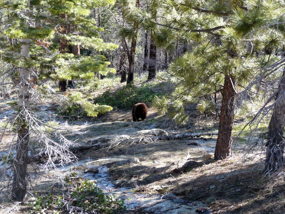
fairly large black bear picking at the ground near the stream I was following. He was maybe 40 yards away from where I was standing, and the sound of the stream was loud enough for him not to sense any of my movements. So I decided I'd get in a little closer, keeping my eye on him and trying not to make any sudden movements. He was preoccupied with whatever he was
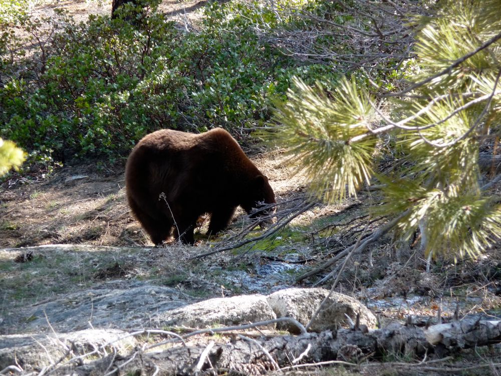
picking at, so I was able to get pretty close without getting in his field of view. When I got to within about 60 or 70 feet of him, I felt that was close enough. So I spent a good two or three minutes just watching him.
Looking back, I wish I had spent more time observing the bear. But I did want to make it a few hundred feet down in elevation before night fall, so I decided it was time to get going. Problem was, he was directly in my path. I figured I'd alert him to my presence and he'd do what all the bears I've run into do: run away. So I yelled out, "Hey Bear!". He didn't hear me, so I did it again. After the third call, he finally picked his head up and
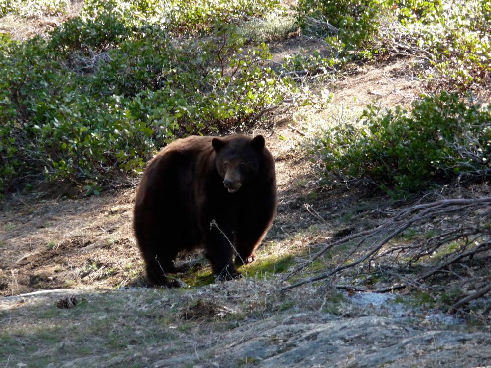
stared at me. He looked around me to the left and right and then fixed his eyes on mine, not moving anything but his head. We stared for a few seconds, and then I thought I'd better make a gesture to show I wasn't after him. And I'll tell ya, the millisecond I lifted my left foot, that bear turned around and bulldozed the forest in front of him. He must have been cooking at 20 miles an hour, and I'll never forget the incredibly loud sound of branches snapping and the mushroom cloud of dust he left behind him. He literally carved out a trail through the forest. All I could think was man, I'm glad he was headed in the other direction.
My heart was pumping a little bit faster than normal throughout the descent to Red Creek. I kept thinking I'd see the bear again, and maybe this time he wouldn't be so pleased that I was following him. But when I reached
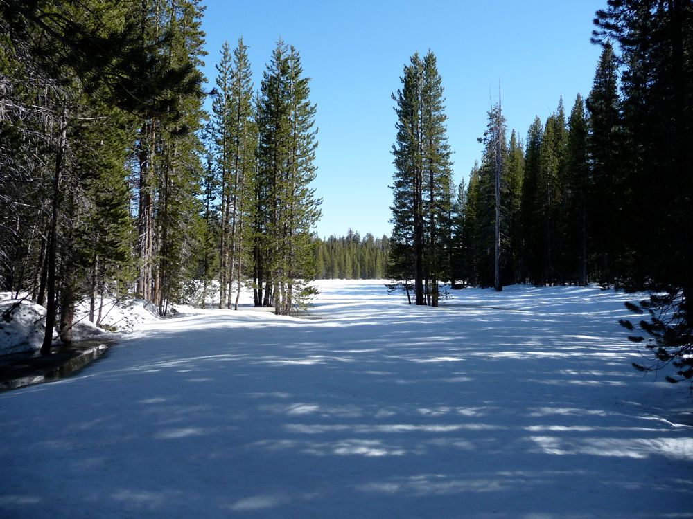
Red Creek, I still hadn't seen any trace of him, and I figured now the chances were much less since there were plenty of options to choose from in where to go. My option was going to take me to the northwest, circling around the southern side of
Mount Starr King. I was able to follow the trail for a good distance, but eventually it become buried in snow, so I sought higher ground. There was one tricky river crossing, but other than that it was easy sailing.
At around 6800 feet, I veered off the trail onto a nice flat bed of granite and set up my
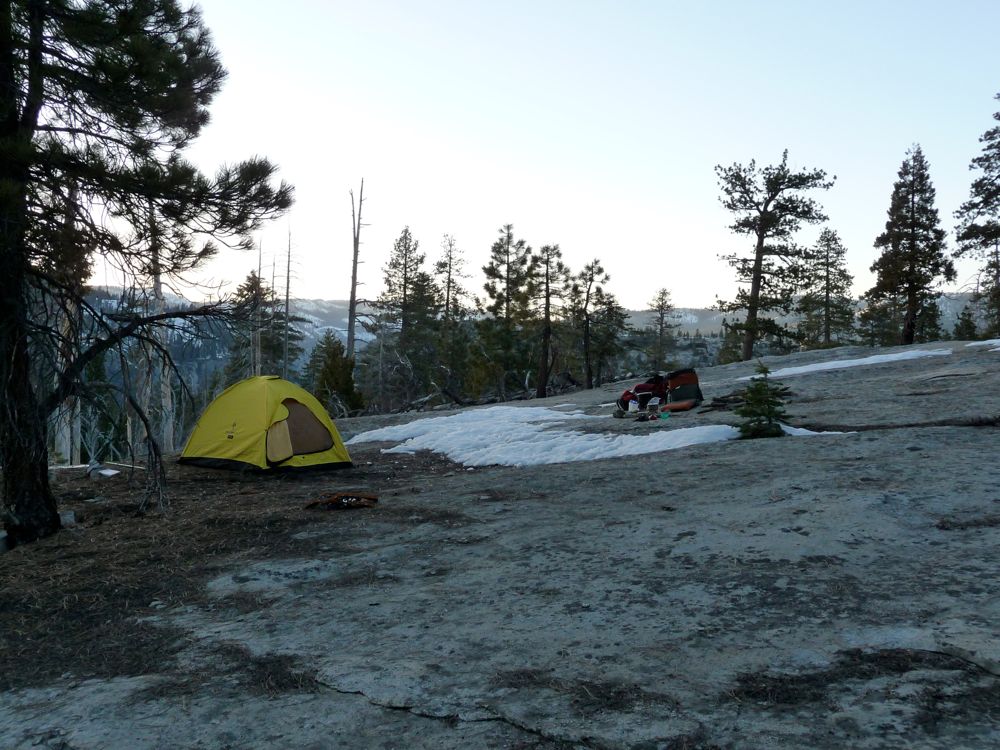
tent. I collected some firewood, got a fire going, and then eased into relaxation just as smoothly as the alpen glow lit up the world to the east of me.
The last day was not worth writing home about. All I did was descend the John Muir Trail back to my car at Happy Isles. But when I got back to my car, boy oh boy did it feel good to unload all of my stuff.