


TRIP DETAILS
TRAIL MAP
OVERVIEW
Broken Top Loop is described as a trip that's got everything. I'd have to agree with that. It's got lush pine forests, pristine alpine lakes, jagged mountaintops, flowing glacial creeks, volcanic craters and boulderfields; it really packs a whallop in 28 miles.
This trip is slightly different than the other ones I found while I was researching the area. It avoids the burned up forest to the north of McArthur Rim on the return part of the journey, which we were extremely happy about. We were very concerned about mosquitos while we were selecting a trip to do in Oregon in July, and our concerns were most definitely warranted. Below about 7200 feet, the mosquitos were pretty relentless. Obviously that threshold will change from year to year depending on conditions, but if you're doing this trip in the summer months and you want to avoid being eaten, I'd try to stay high like we did.
The trailhead isn't far from Sisters, Oregon, which is a very nice place to stop if you're in need of a good meal or some supplies. The Deschutes National Forest office is located there as well if you're looking for information on trail conditions.
Notes:
- Permits for backpacking in Deschutes National Forest are obtained with self-registration at the trailhead.
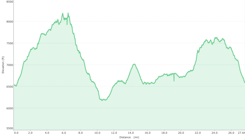
Elevation Profile
TRIP LOG
Let me start off by saying that in the days leading up to this hike, Tina, Juni, and I did a lot of driving. I mean, a lot of driving. We had been in the car for approximately 22 hours over the previous three days slowly making our way through the beautiful reaches of California and Oregon. Needless to say, we got to see some unbelievable things along the way. John Day Fossil Beds Monument, Painted Hills, and Crater Lake were worth every minute we spent buckled up in our seatbelts. But by morning of our hike, I was about as ready to start walking as I've ever been.
But before we could start walking on this first morning, we had to follow our previous pattern with a ~3 hour trek from Salem, Oregon. We had already visited the Deschutes National Forest a day earlier on the drive from John Day to Salem, so we were pretty familiar with the route we had to take. It was quite straightforward to get to the Tam McArthur Rim Trailhead at Three Creeks Lake from Sisters. It's just a straight shot south on Elm St for about 16 miles. The only thing that slowed us down on our way was an onslaught of ravenous butterflies that seemed to cloud the path in front of our car
We arrived at the parking area next to Three Creeks Lake at around 1330 to find that it was packed with cars and people. That wasn't a surprise. After all, it was 4th of July. We figured we'd see plenty of people enjoying the day off.
Even though it was crowded, there was no shortage of places to park along the side of the road leading up to the south shore. When we got out of the car, we found the temperature was a perfect 70 degrees and the sky had a nice touch of overcast that got me very excited to hike. It took us a little while to get packed and down a quick lunch, but by 1415 or so we were on our way.
Unfortunately, we were on our way in the wrong direction. We hiked about 1/8 of a mile to the south end of the road where the campground is located until I realized the Tam McArthur Rim trailhead is towards the northern end of the lake.
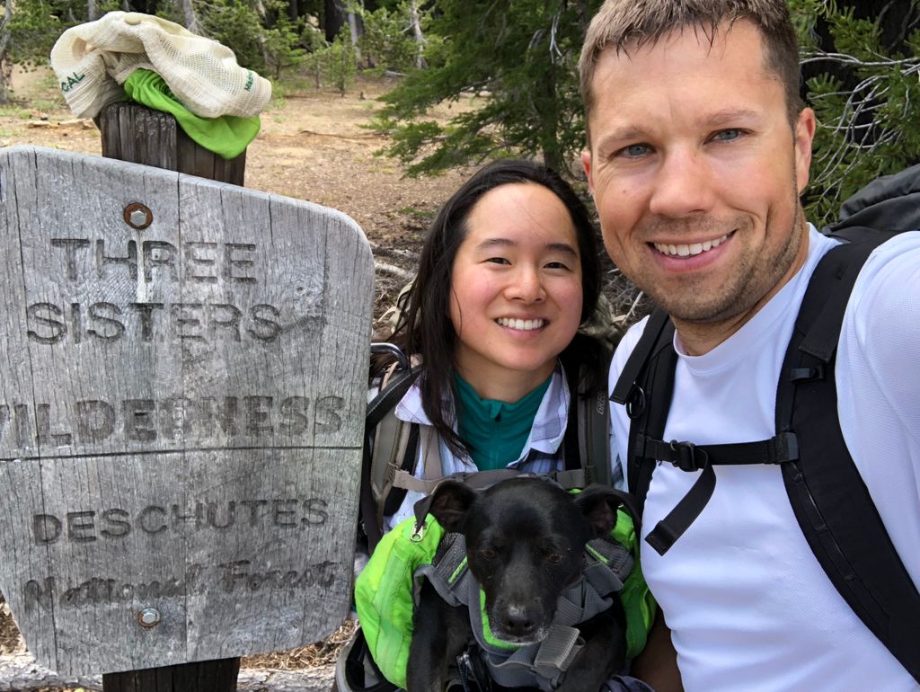
It only took about five minutes to course correct and get to the signpost for the trailhead. There we found the self-registration permits that had been described to us. Interestingly, the forest service doesn't have you leave a stub on your car (although I do believe you have to write down your license plate somewhere on the form).
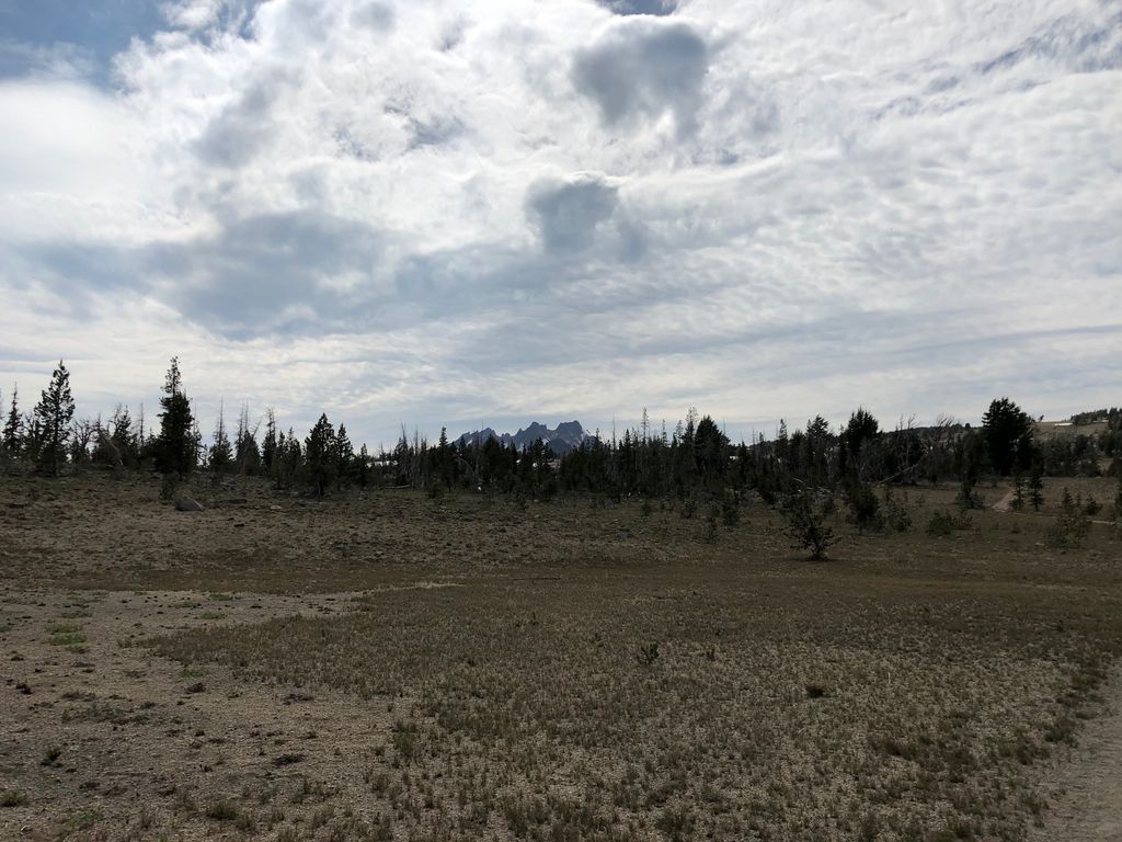
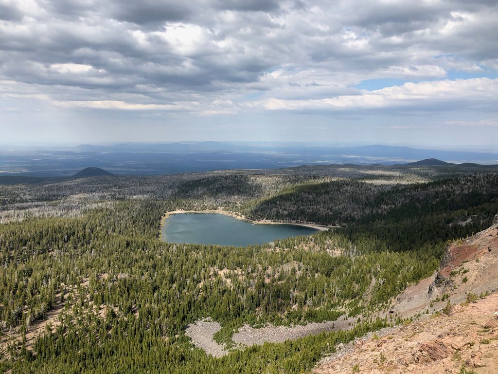
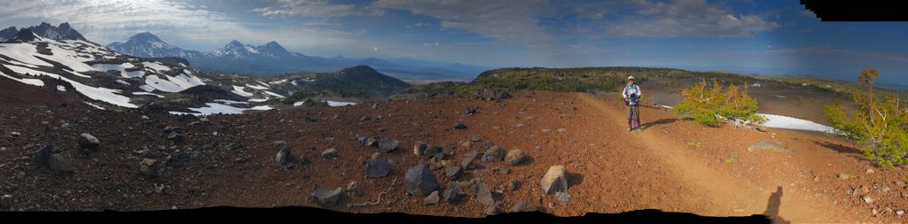
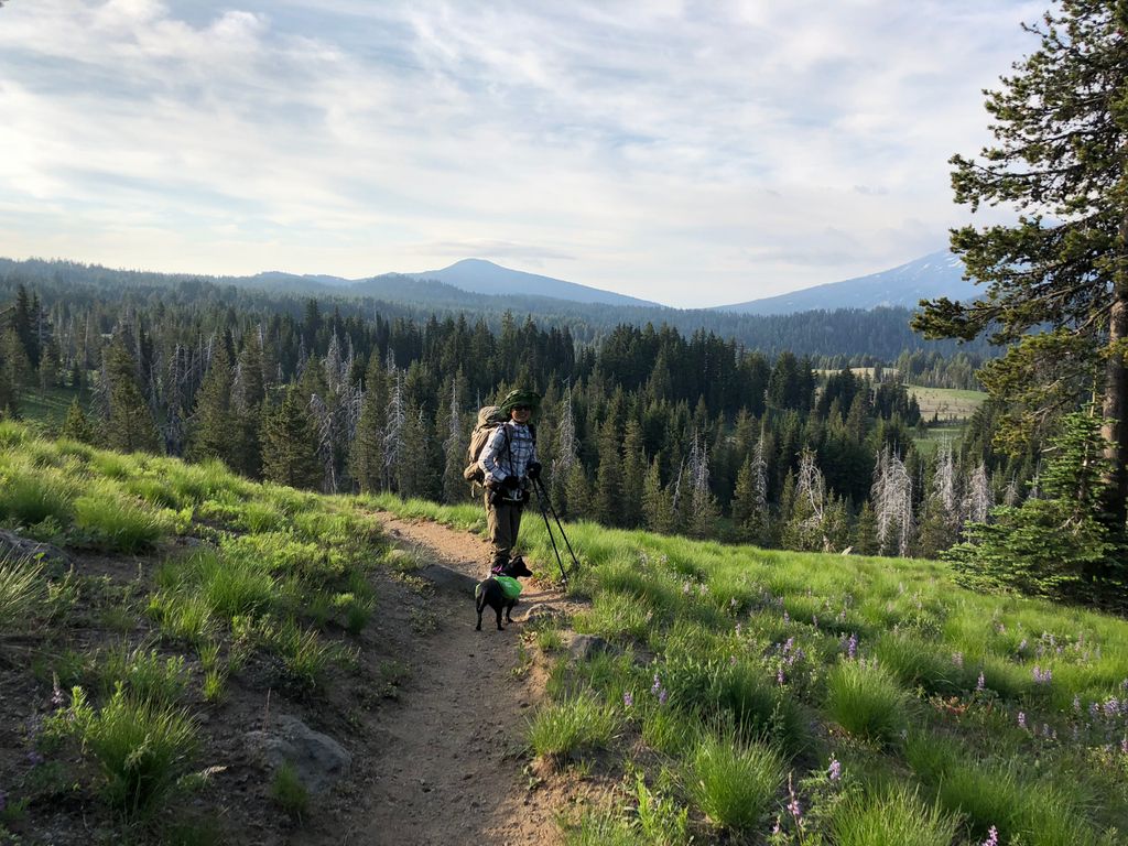
As we got going on the trail, which starts off at around 6500 feet above sea level, we were immediately met with some decent elevation gain. There are a few switchbacks along the continuous climb up to the rim. In very little time, we were treated to some great views of the beautiful lake below.
Within about 45 minutes or so, we got up to the first flat section around 7400 feet where we stopped to let our sweat evaporate a little bit at the edge of the Three Sisters Wilderness.
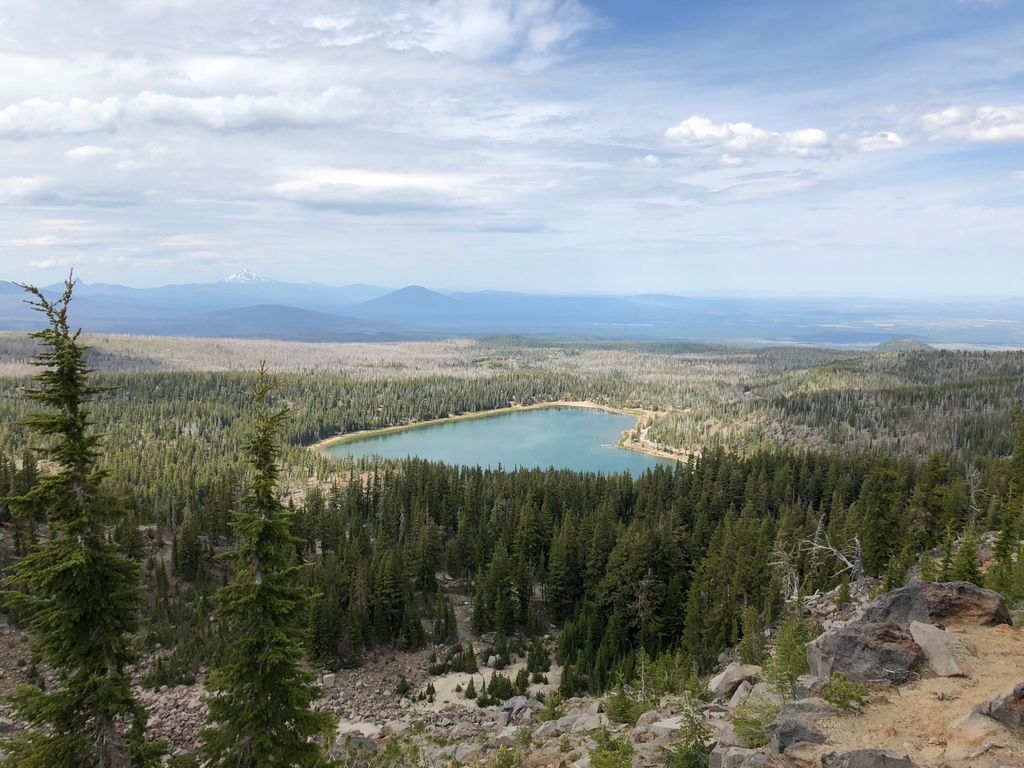
Not long after this, we stopped at a fantastic overlook where we could see the Three Creeks Lake area below where we had just come from.
We also got a pretty good glimpse of Mt. Jefferson off in the distance,
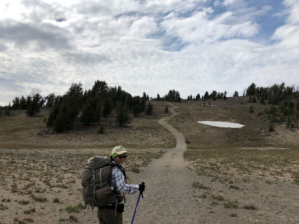
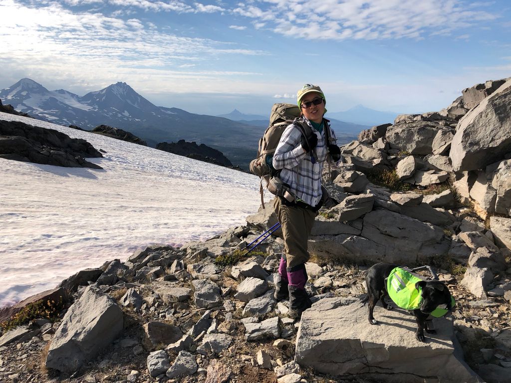
and some good shots of Juni wearing her little backpack. She was quite the hit during the trip. Almost everyone we passed by stopped to greet her.
The next part of the trail is one that I thoroughly enjoyed. It may have had to do with the fact that it flattened out and provided us with a reprieve from the climb we just did, or maybe it was the fact that the clouds had taken on a wonderfully intricate pattern above.
The flatness doesn't last all that long, though. There is a nice solid hill shortly after this patch to make you start sweating again.
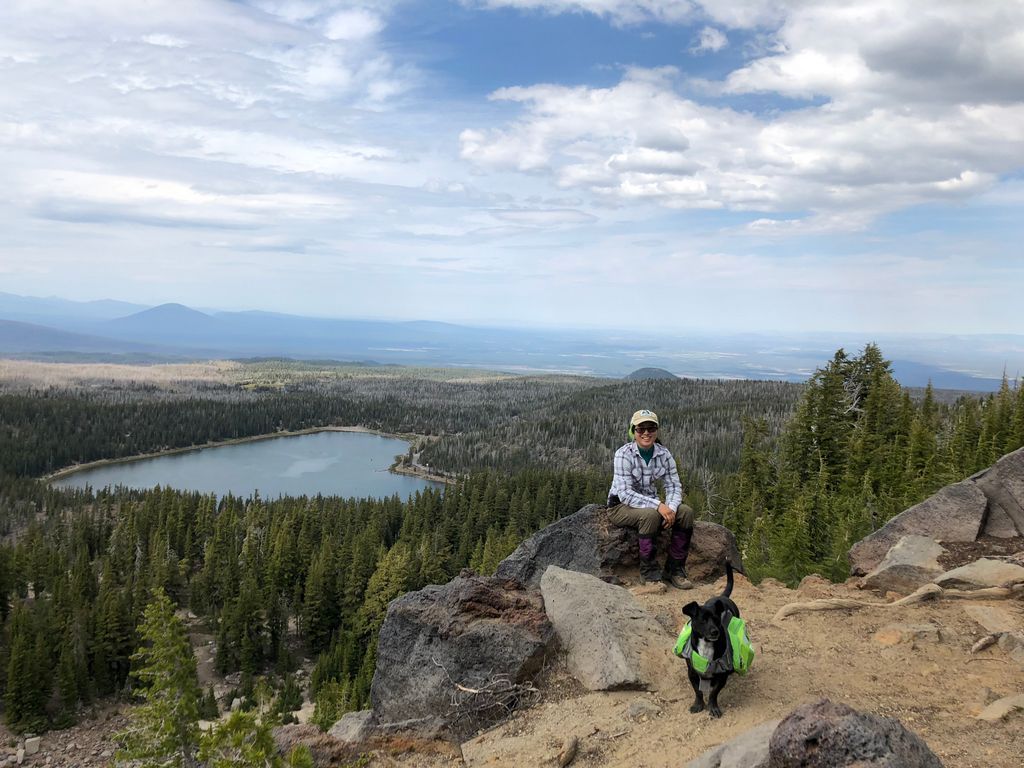
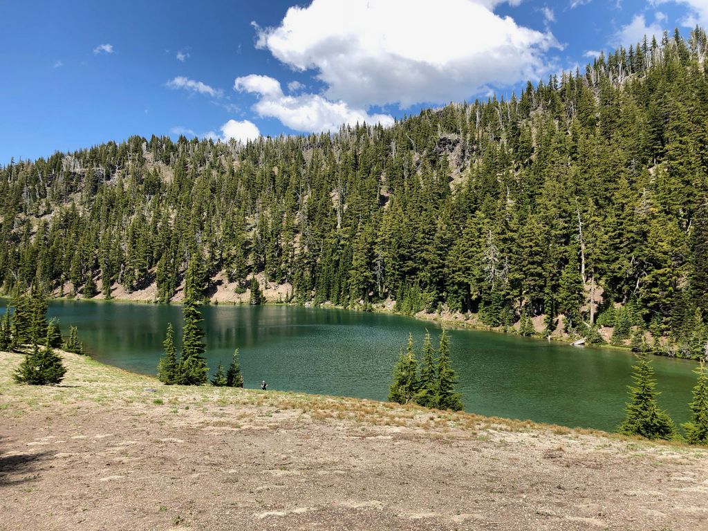
After climbing this hill, you get right up against the edge of the Tam McArthur Rim, giving more great views of the Three Creeks Lake,
as well as NAME THIS LAKE to the north.

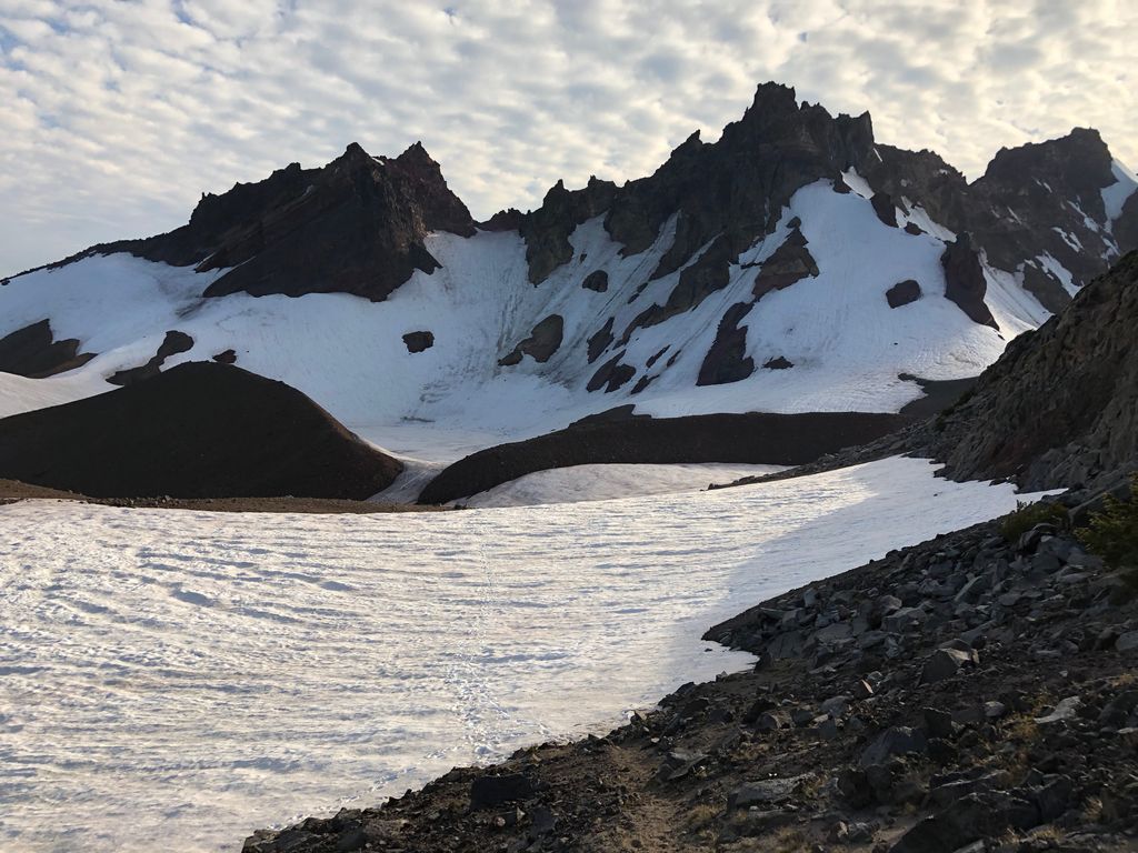
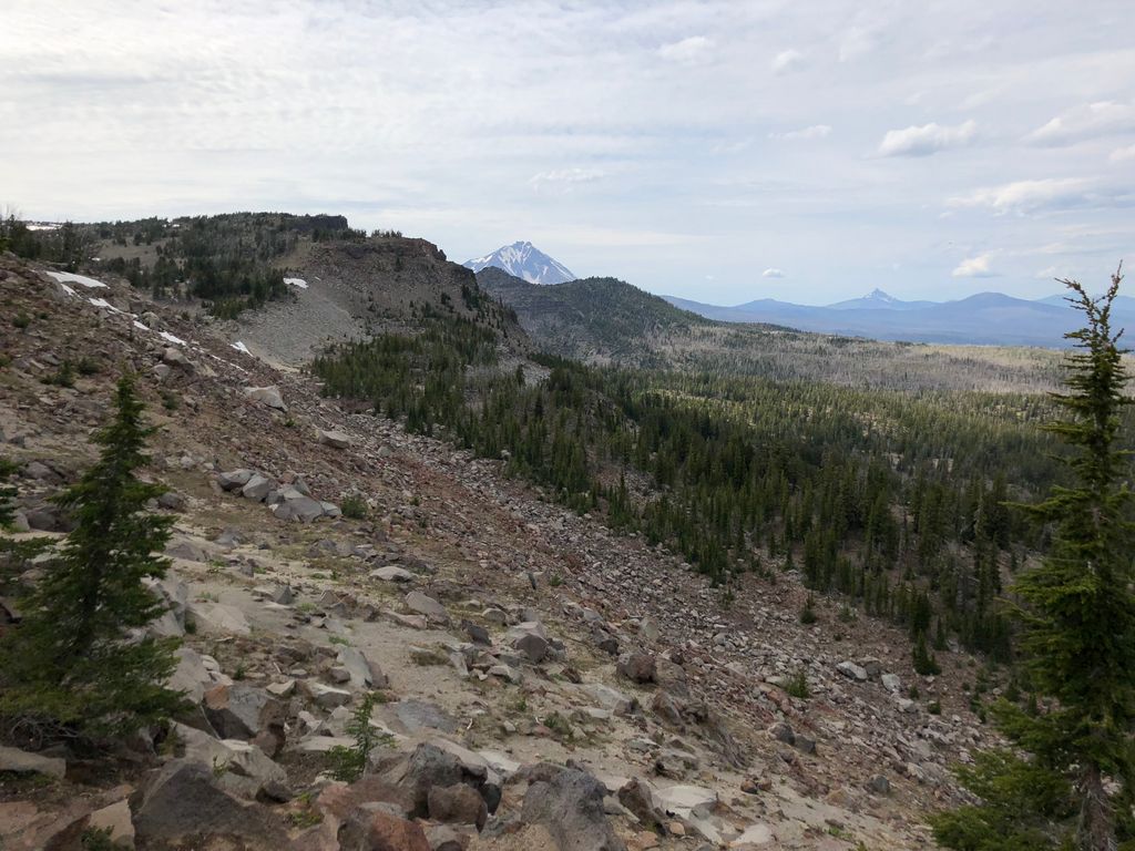
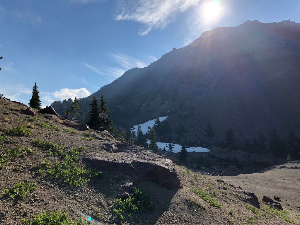
Right around 3.75 miles into the hike, there is a small peninsula in the rim that offers some phenomenal views of Broken Top and the steep, rugged slopes to the north.
Now, if you've read some trip descriptions of the Broken Top Loop, you probably know that the official trail ends right around this time. And what's pretty nice of the National Forest Service is that they give you a very clear indication of this with a sign that says you're entering into an unmaintained trail.
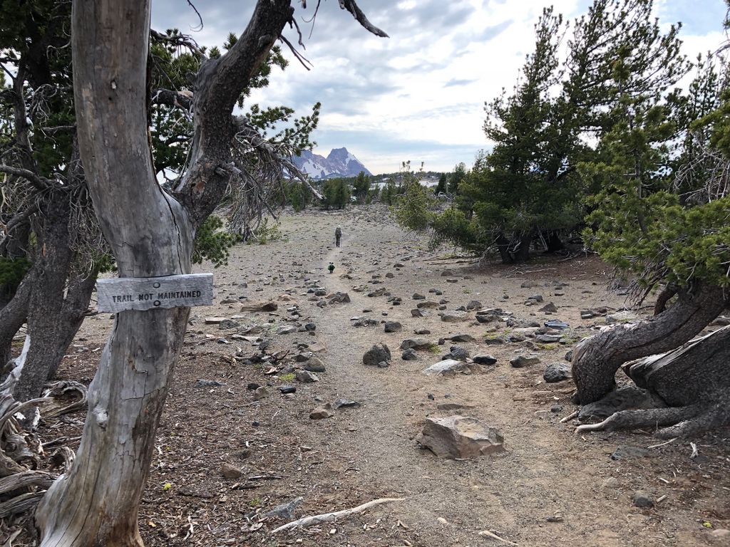
But you may also have read that this "unmaintained" trail is about as well groomed as any maintained trail you'll find out there for the most part. Here is an example of how well worn it is a decent ways beyond the sign.
It is remarkably easy to follow this unofficial trail, so you'll have plenthy of time to enjoy the stunning sights of Broken Top
and the Middle Sister beyond.
Along with the wonderful surroundings, we were also enjoying the hell out of the fact that we had left the mosquitos behind entirely. They had been a bit of a nuisance below about 7300 feet (not nearly as bad as they would be the following day when we got below the treeline), but now they were nonexistent.
I'll admit I may be biased because of this wonderful transition out of mosquito country, but I'd say this was probably my favorite stretch of the entire hike. The rock takes on a brilliant red, volcanic character
and the trail perches you high atop a ridge that gives you magnificent views in almost every direction
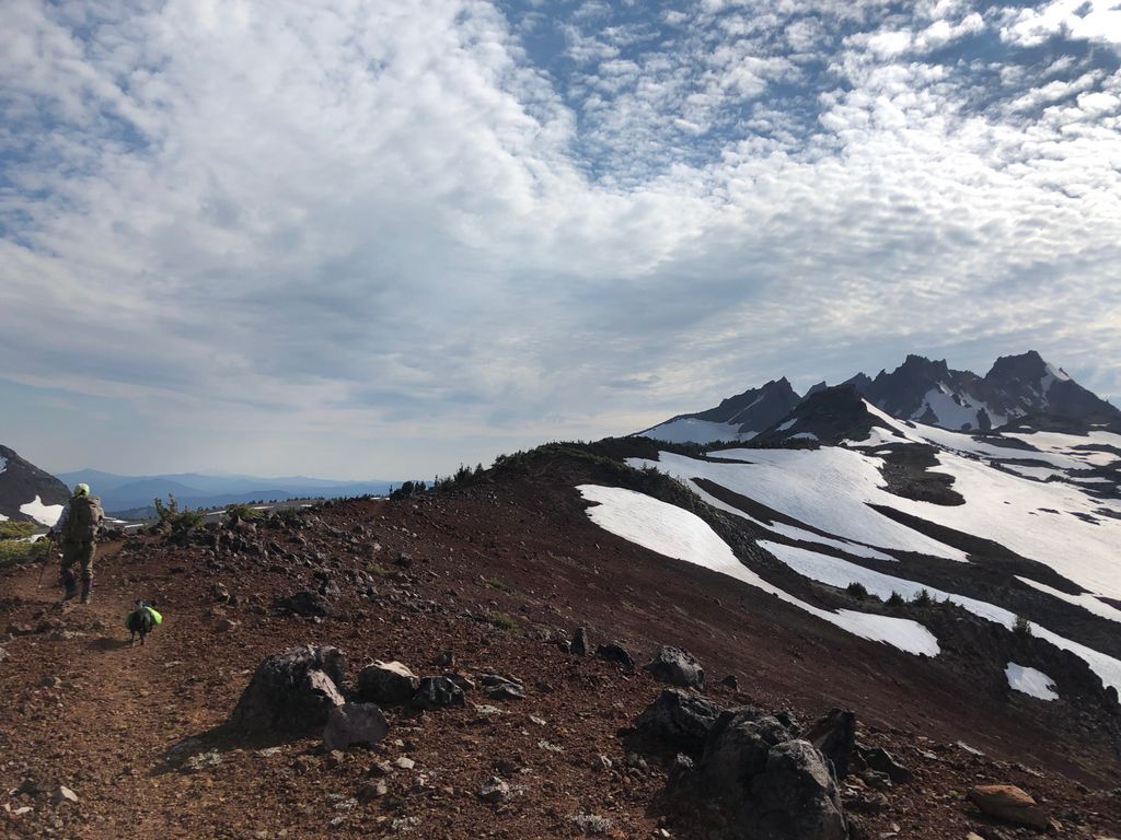
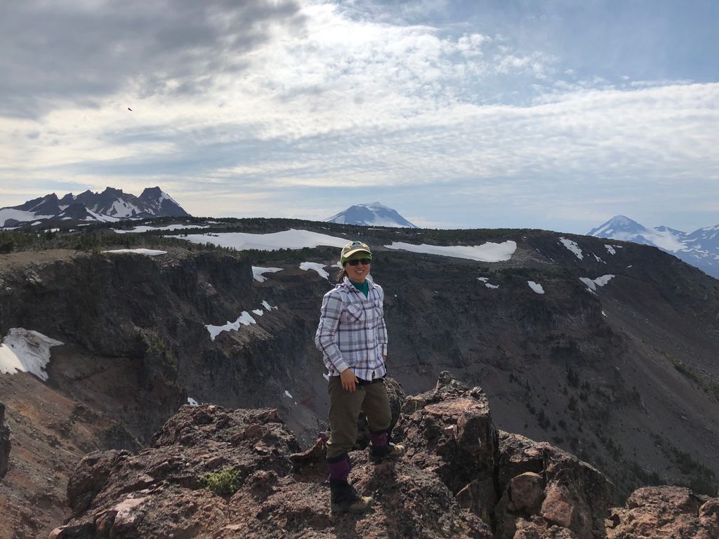
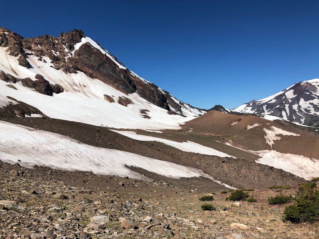
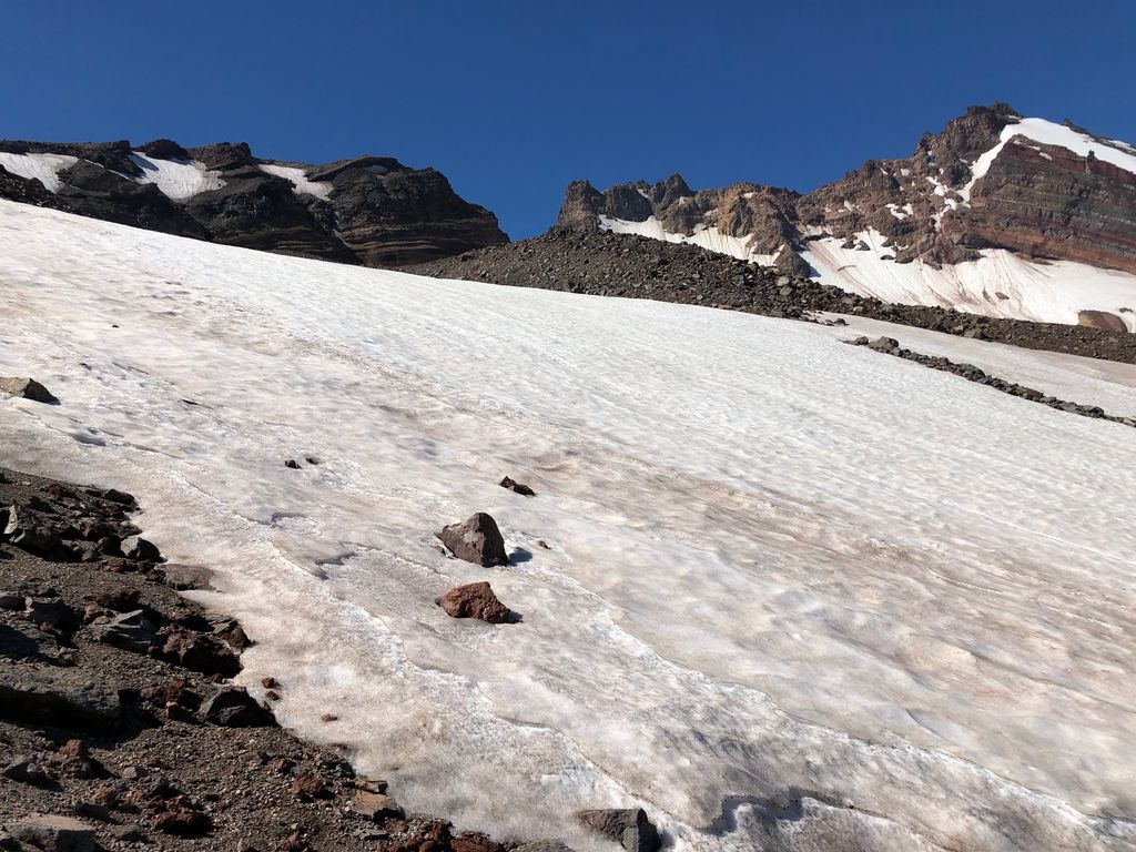
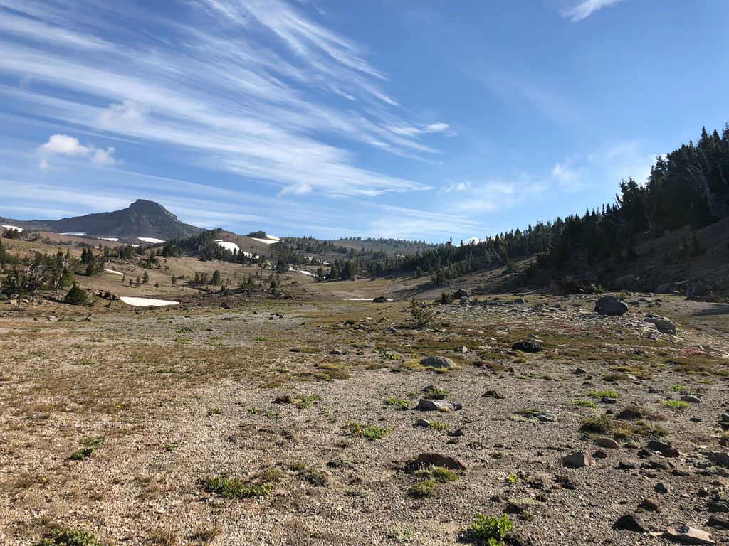
Once you get up to about 8000 feet, the trail does become a little bit harder to follow right below your feet, mostly because the grown is covered by large rocks and boulders. But it's very easy to see it ahead of you in the distance, so getting lost shouldn't be a concern. What may be a concern is the snow, though. Especially when you get near Broken Hand.
When we were within four or five hundred yards of the peak of Broken Hand, we could see that the "standard" trail skirted along a very steep stretch of snow on the north facing slope. I've had enough bad experiences trying to traverse sections like this, so Tina and I decided to lose a little bit of elevation by proceeding northwest to a flatter section and then climbing back up southwest along this slope:
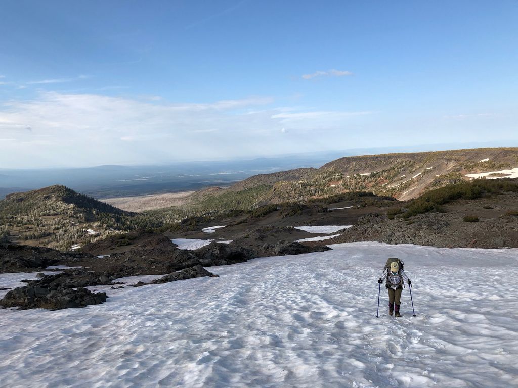
There is a pretty obvious notch between Broken Hand and the adjacent peak that we were aiming for. When we got up to this notch, it was also pretty clear what the easiest way down to the other side would be. You can actually see a lot of worn trails down from this notch if you zoom in on the satellite map at the last blue waypoint (to the west) on the map. There was another large stretch of snow that we had to cross when we got to the bottom, but it was fairly flat and stable.
After crossing the snowfield, we dropped our packs to look for a spot to camp. We had just run into somebody that said it was pretty crowded around the shore of the unnamed lake, which is apparently a pretty popular destination. Interestingly enough, this lake doesn't show up at all on my Garmin 2008 topo map, but it was on our paper map. I climbed up to the wall on the eastern edge of the lake and saw that it was indeed pretty crowded. In addition, it looked like kind of a lousy place to camp. It wasn't hard to see how soggy the ground was down there.
So Tina and I decided we'd pitch our tent at the south end of the snowfield we had just crossed.
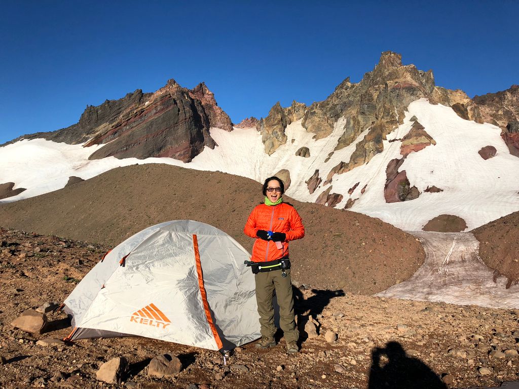
Aside from some decent winds, it was a pretty solid campsite. The ground was perfect for stakes and there was a nice little rock wall that someone built next to a sizeable Juniper tree that we used as our dinner/breakfast spot. And it turns out that the wind was equally bad down by the shore of the lake according to a couple of people that we ran into the next day.
Water was also a slight difficulty. From our campsite, it would be a pretty lengthy up and down to get to the shore of the lake. So I ended up hiking down to the south about a quarter of a mile (and 250 feet in elevation) to get to the point where I met the stream emanating from the southeast side of the lake. It was only a five minute walk, but it felt like a lot more since I was tired.
The end of that evening was quite memorable. After enjoying a delicious meal of ramen noodles and getting prepared for bed, we decided to see if we could observe the fireworks. To our delight, we could see an array of fireworks splashing in the sky to the southeast. It looked like there were at least eight or nine distinct areas having shows...my guess would be the communities around Bend. They were so tiny, though! From our spot they looked like little tiny specks right above the ground. It's amazing how these backpacking trips put so many things in perspective, isn't it?
I can say with absolute certainty that Day 2 would have ranked as a 10/10 on the backpacking enjoyability scale if it hadn't been for those wretched mosquitos. The weather was great, the water was abundant, and the sites we saw were truly astounding. It's just that every time we stopped to take in the views, we were immediately overwhelmed by those infernal creatures. If I had to do it over again, I would have tried to stay about 7200 feet as much as possible to avoid them even if it meant significantly more difficult terrain.
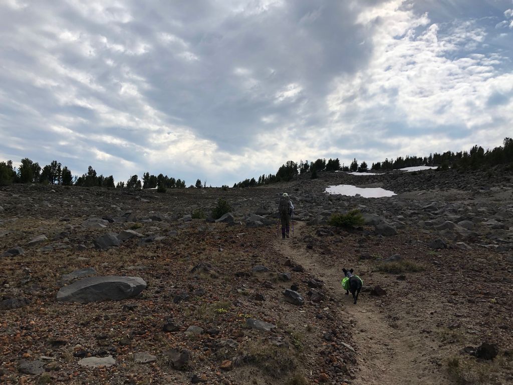
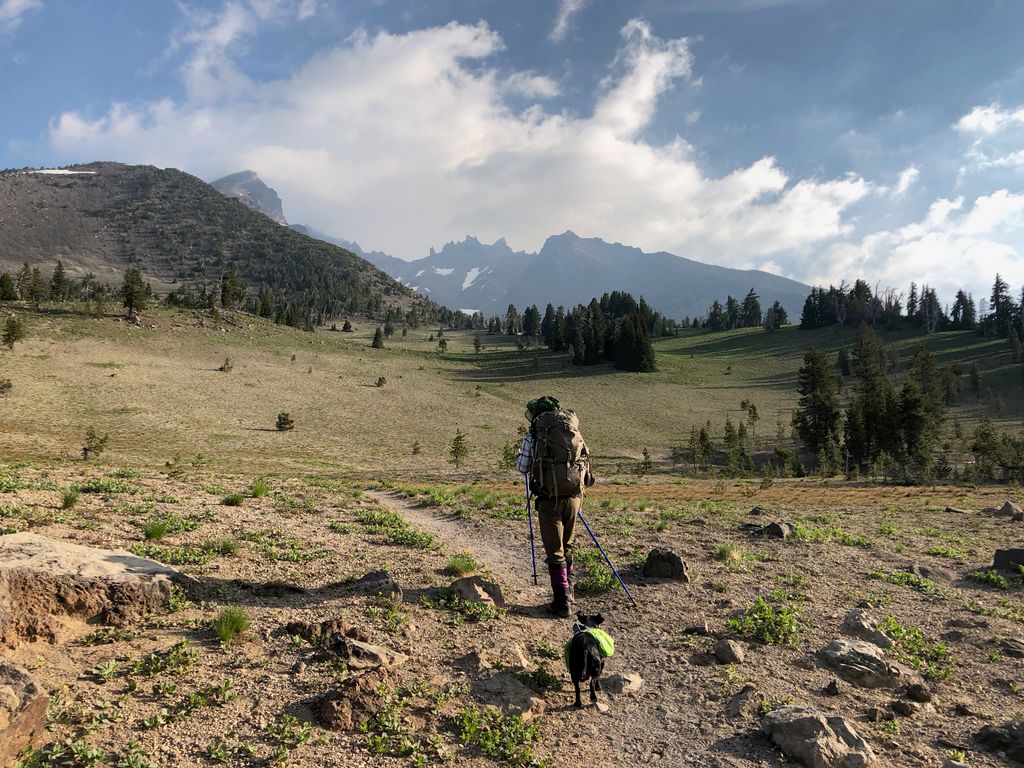
High above that threshold, though, the morning actually started out quite pleasantly. Beautiful temperatures, a clear sky, and calm winds made our breakfast an idyllic one. When we had packed up all our gear, we set out to reach the same exact notch in the ridge to the northeast where we had come from. Once we got over that ridge, the plan we agreed on was to try to go crosscountry in an almost due south fashion in order to descend to Rim Lake, where we'd take a nice snack break and fill up on water. That plan didn't quite come to fruition, though, because of the proverbial wrench those mosquitos threw at it.
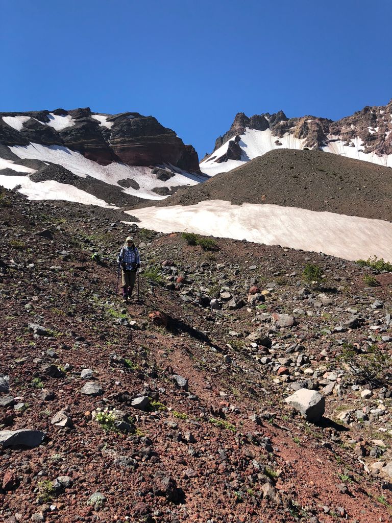
Our descent was pretty easy at first. The terrain is rocky, but gradually sloped, so it makes for a very relaxing off-trail experience. We were aiming towards the left of the prominent spine in this picture since it looked like the most gradual descent.
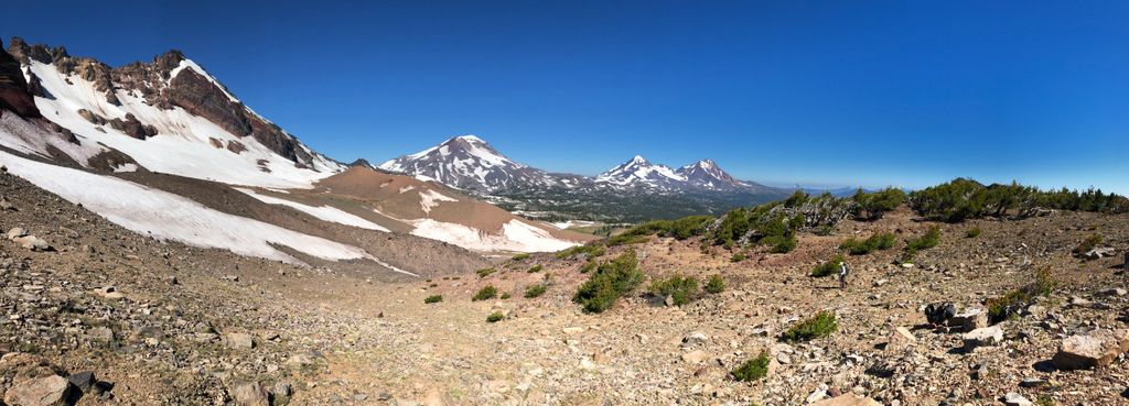
While we moseyed along, we were exposed to a new view of Broken Top
and the Sisters.
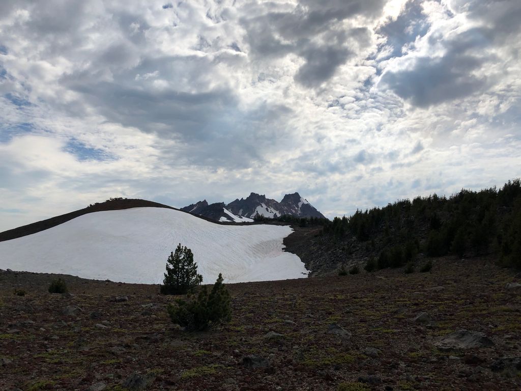
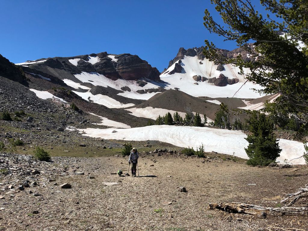
Every once in awhile, we'd have to cross a large snowfield to maintain our course,
but overall it was fairly easy to descend; no steep drop-offs or obstacles that couldn't be easily circumvented. In fact, every once in a while, we'd find something resembling a trail.
When we got down to about 7300 feet, things flattened out quite a bit,
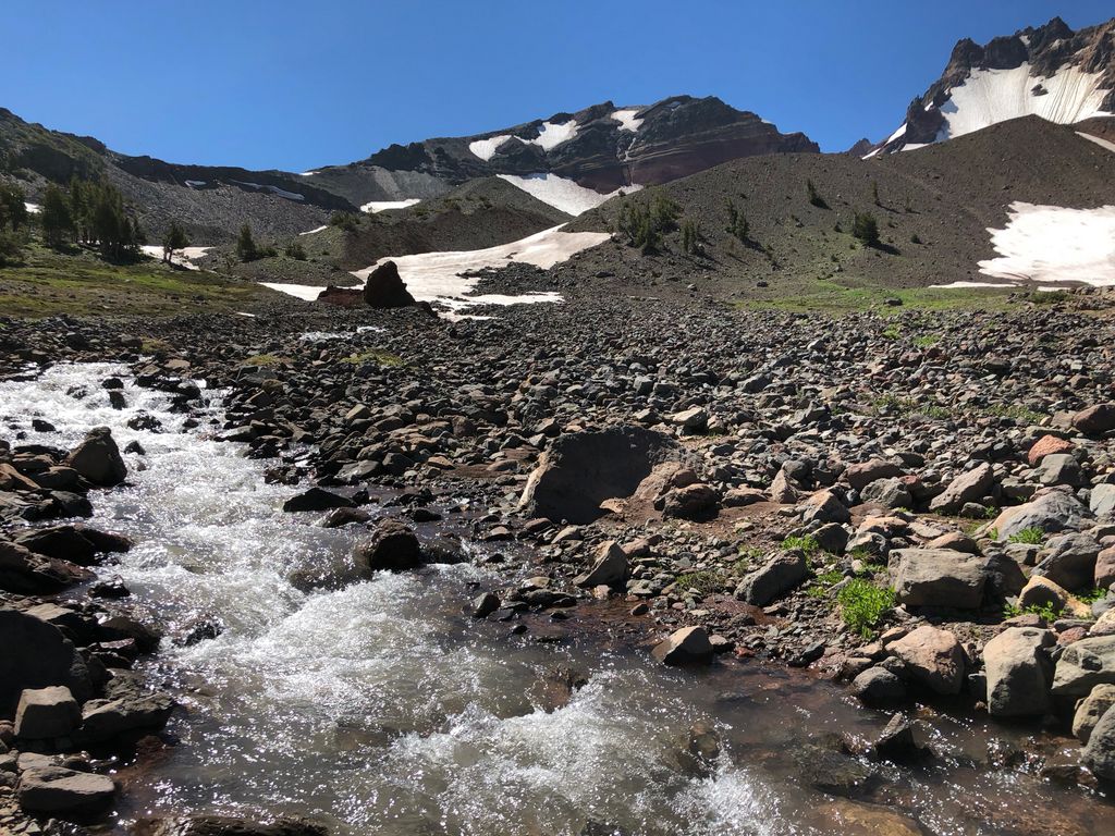
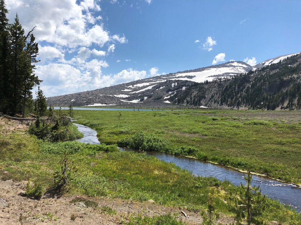
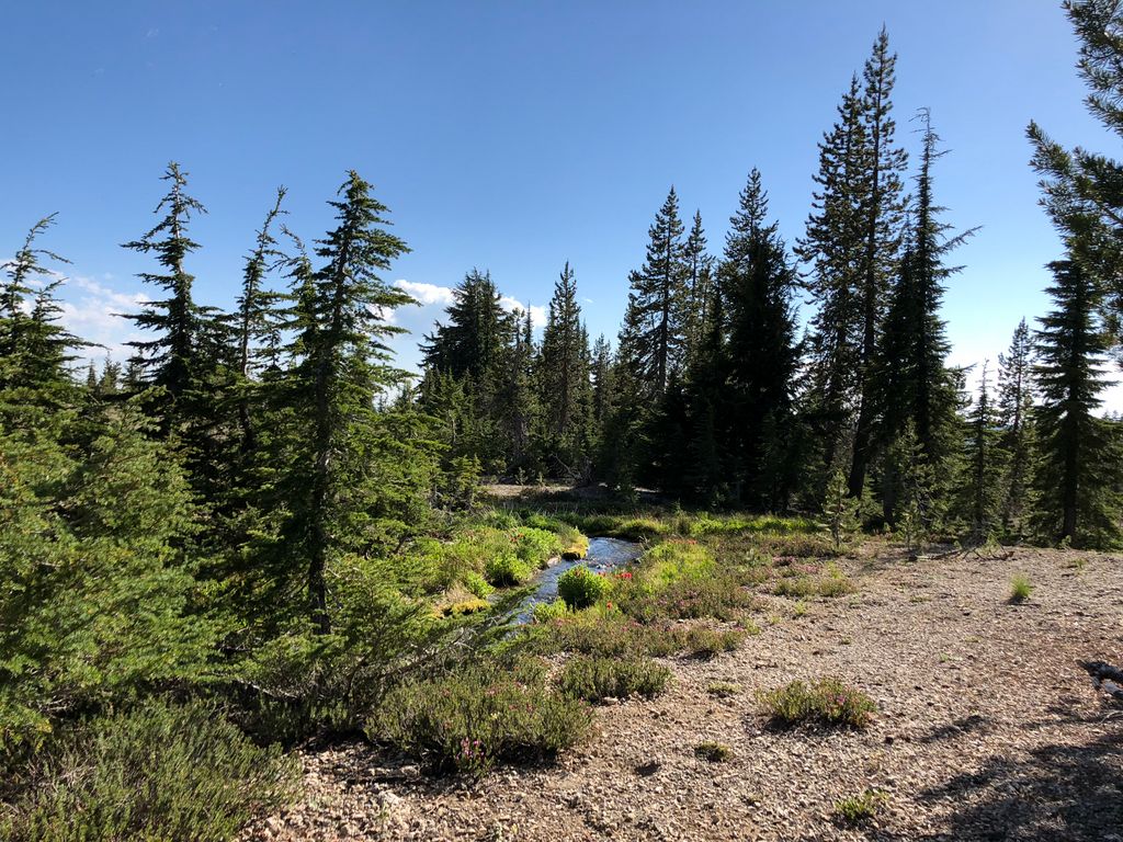
and we came upon a stream that wasn't shown on our map, yet had quite a decent flow. So we decided to fill up on water and mess around a bit:
Shortly after this, we met up with Whychus Creek, the larger creek that flows down from the glacier above (the large quantity of sediment in the water was very indicative of its glacial source) in the flattest stretch of terrain we'd seen all day. And I must say, I found this area to be extremely enchanting.
It was so picture perfect, part of me wanted to just start building a cabin right then and there. And when I say cabin, what I really mean is a bunch of logs piled on top of each other. I don't have the carpentry skills for something like that.
In a true turn of events, this exquisite moment in paradise would be followed by a rather miserable one. For at this point, the mosquitos began to come out in full force. We decided rather quickly that Rim Lake would not be worth the visit. Their abundance would almost certaintly be worse there. So we instead decided to veer to the northwest and try to join up with the trail, hoping we could hike our way out of mosquito country.
I don't have any pictures of this stretch between the lovely valley I just described and the junction of the trail with the East Fork Park Creek--It was simply too uncomfortable to stop and take out my camera. But had it been a bug-free day, I'm sure I would have enjoyed the beauty of this part of the forest. It's just so hard to enjoy anything when you're itching all over your body.
What made things even worse was that we had to deal with two decently large creeks that were not easy to cross. We wanted to be to the west of the one we were following (Whychus Creek), but we were unfortunately on the east side of it. The creek sinks to the bottom of a ravine in some parts, so that complicated things further. Eventually we found a place to cross and then really started striking it to the west.
After an hour or so of walking through this forest (with just a touch of bushwhacking), we finally came upon a gorgeous meadow just to the south of the trail.
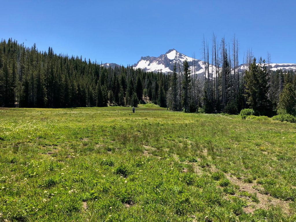
Gosh, if it was only October or November, this would also be paradise!, I thought. But right now, it was a mosquito breeding ground that we tried to cross as quickly as humanly possible. We traversed it as quickly as possible and came upon the southern bank of East Park Fork Creek, which held plenty of water to fill up and wash off with. But as soon as I had washed off my face, the clean feeling was replaced by the smell and feel of DEET. I really doused myself at this point I was being eaten so badly.
It was right about noon at this point, so we decided we'd have a really quick snack. And I mean really quick. We were still chewing when we started heading west on the trail, hoping to keep the mosquitoes at bay with swift movement. The next mile or so was pretty enough, but nothing compared to how beautiful Golden Lake was.
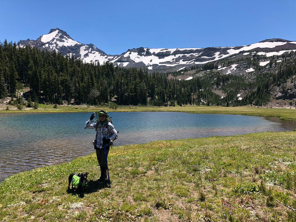
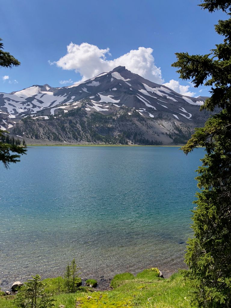
There are a handful of backcountry lakes that stick out in my mind because of how serene they are, and Golden Lake is certainly one of them. The shore is composed of soft, cushy grass, the water has a majestic turqouise color, and it is surrounded by a stunning backdrop of pine forest and snow-capped mountains. Hard to ask for anything better than this.
As soon as I set down my pack, I started to strip down so I could enjoy the refreshing, albeit frigid waters. The sandy bottom made it very easy to get to a sufficient depth to submerge myself completely. God, did it feel good. It was cold enough that when Tina decided to join me, though, I was ready to let the sun warm me up on the shore.
The numbing effect of the water had erased all my aches and pains and itches, and for a moment, I felt perfect sitting there. But within a couple of minutes, the numbness wore off and I started to realize I had accumulated three or four fresh mosquito bites. So it was time for more DEET!
With our clothes and packs donned once more, we got back on the trail. The mile and half of trail between Golden Lake and Green Lakes wasn't bad. We had to gain a few hundred feet, but it was fairly gradual. The temperature was significantly hotter than the day before, though, and the sun was beating down on us without any clouds overhead. With the 3 o'clock heat, the northern edge of the first Green Lake was a welcome sight.
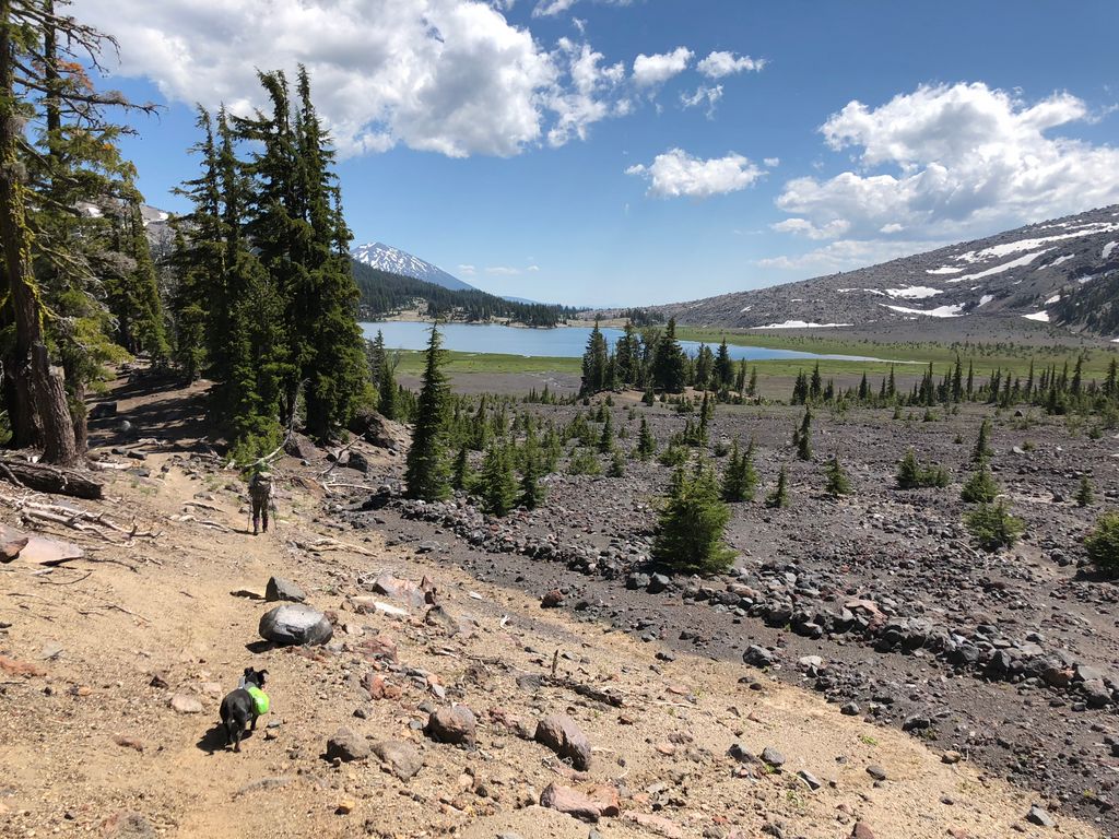
Walking along the trail through Green Lakes, it became immediately clear how they got their name. Even in the pictures I took, the green hue is obvious.
I couldn't help thinking about how great of a spot this would be for a multi-day backcountry campsite. It's ony several miles from the nearest trailhead and there are so many options of places to explore! As I stared across the central lake to the west, I was so tempted by how easy it looked to climb up to the higher elevations above the lake.
It even looked like it would be straightforward to make it to the top of the South Sister.
And sure enough, it looks like it is a beginner-friendly (albeit quite strenuous) climb. As a reward for getting to the top, you get to see Oregon's highest lake: Teardrop Pool. Man, after reading that trip report I want to get in the car and drive back to Deschutes National Forest!
When we had reached the southern end of Green Lakes, we bumped into a friendly ranger. He didn't ask us for our permit (which we did have), but he was curious as to where we were headed. When I told him that we were on our way to Tam McArthur Rim Trailhead, he said, "No you're not." He must have been assuming that we mistakenly thought the trail we were on would take us there, so I told him that we were going cross country to get there. With that cleared up, he pointed us toward the trail that would take us out of the maze of campground trails we were sorting our way through. Once on the proper trail, we were treated to some great views of the opposite side of Broken Top.
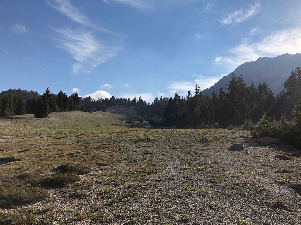
It was about 430 pm at this point, and both Tina and I were pretty tired. It wasn't that the hiking had been all that strenuous; it was just that we hadn't really been able to take a proper break since 9 am because of the mosquito activity. Initially we had talked about making it all the way back up to 7500 feet before we set up camp so we could get to a mosquito free zone, but this would have required us doing another 3 miles or so (if we stuck to our planned course). So we decided we'd set up camp in the flat stretch just west of Cayuse Crater.
It was actually quite a good spot for a campsite. Plenty of flat ground and plenty of water. Would we have to deal with mosquitos? Yes. So many, in fact, that I got four bites when I stepped out of the tent for a brief instant to brush my teeth. But at least we had a tent to protect us. And yes, we were miserable enough that we were willing to risk the possibility of attracting bears by eating in our tent.
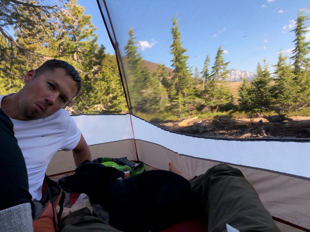
(I'm chewing in that picture; that's not RBF). We hadn't seen any bear scat or tracks for the last day and a half, so weren't that concerned about bears. Honestly, the only concern I had personally was making sure that we didn't let any mossies in the tent!
All things considered, it turned out to be a very nice evening. After putting down our dinner, we played a Lewis and Clark Trivia game that Tina had purchased in John Day. I learned a lot of fascinating facts about their journey (including how mosquitos were the single most troublesome thing that they had to deal with, which made me feel like less of a nagging complainer). Juni was completely tuckered out and all she wanted to do was nestle up beside one of us.
As the sun set, I took a bit of satisfaction watching those diabolical bloodsuckers trying to penetrate the mesh of our tent. We could see clouds of them lit up by the streaks of sunlight filtering through the trees, and it felt so good to be out of their reach.
On the morning of the third day, my alarm was set for 530, but I didn't actually need it. We were both hoping that if we woke up early enough, it would be sufficiently cold that the mosquito activity would be reduced. But the first thing I noticed when I turned on my headlamp were two of those bastards hanging out directly above me.
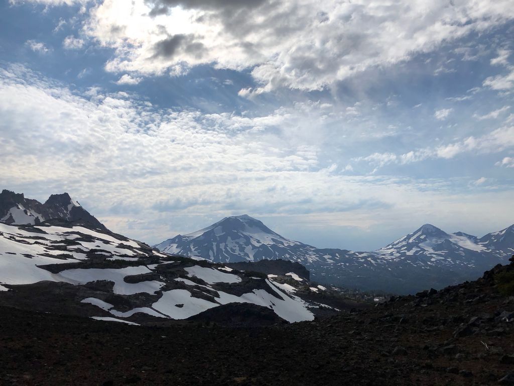
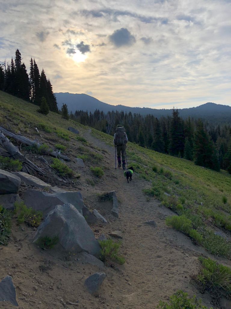
We packed up as quickly as we could and got going. We still had to keep moving to keep from getting bitten, but the conditions of the morning were exceptional otherwise. The mountain ranges to the south made a great backdrop as we got moving,
and the clouds hovering below the sun made everything look really, really cool
I think Tina and I were both in pretty good spirits knowing that in a few hours we'd be at an elevation where we wouldn't have to deal with any bugs.
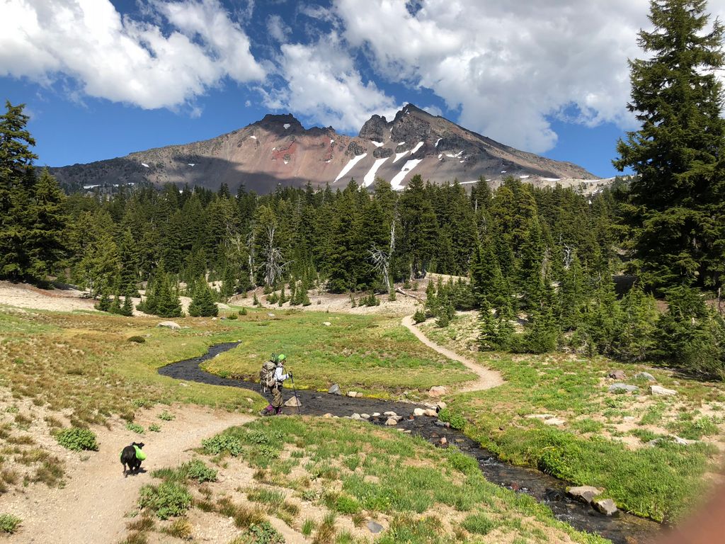
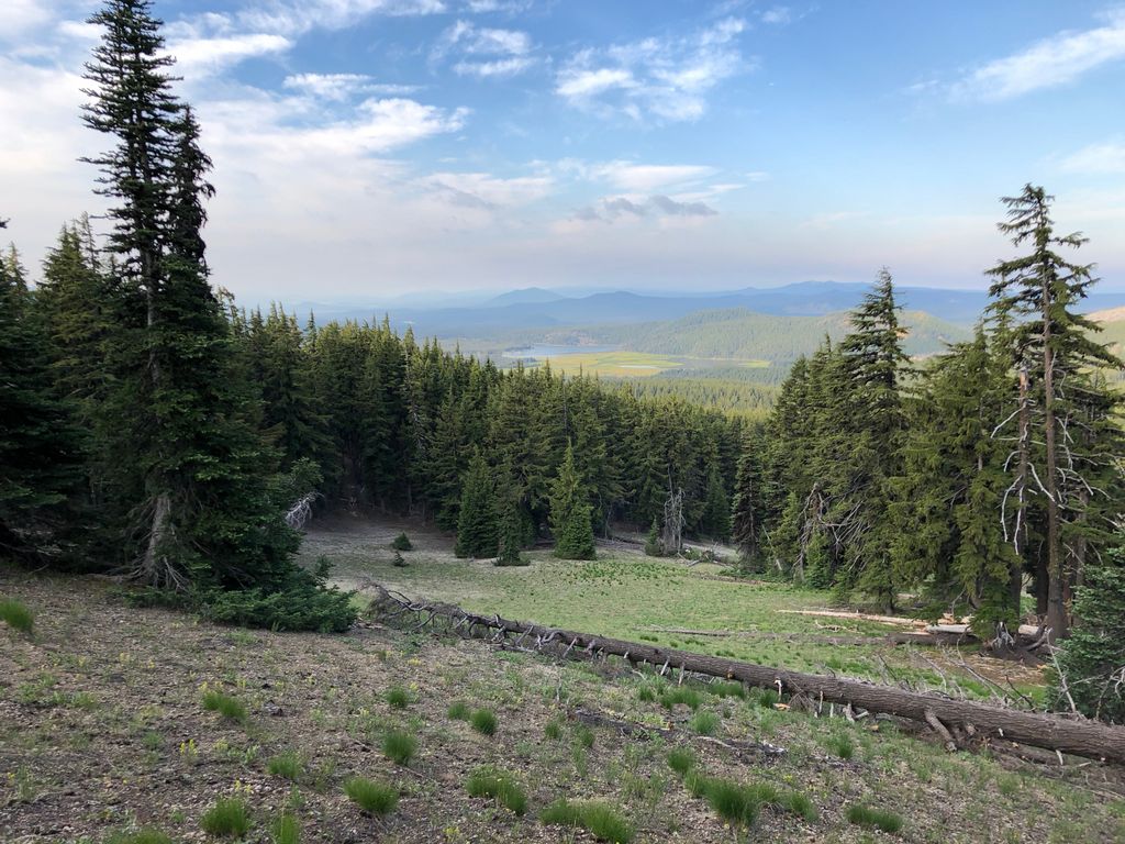
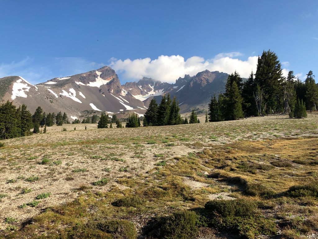
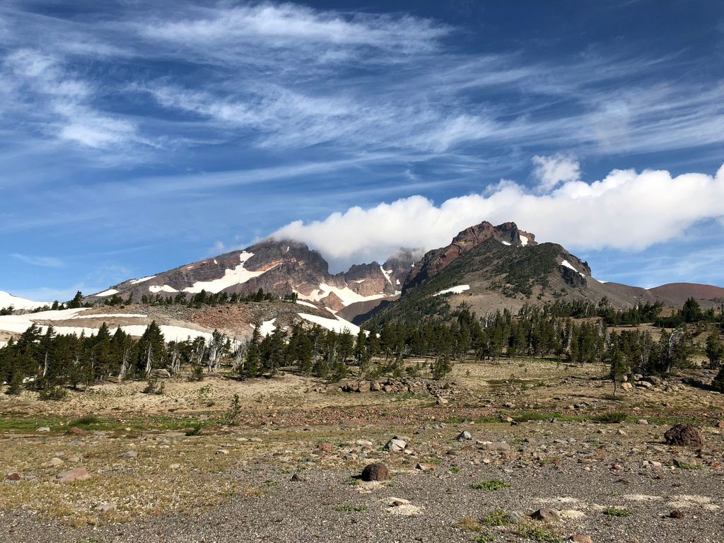
This stretch of the trail was as good as anything we'd seen so far. When we got about a mile east of Cayuse Crater, we could see Broken Top once again.
We realized if we had just gone another mile or so past where we had camped, we'd have come upon another excellent place to set up a tent right where the trail comes upon Little Crater Creek. It looked like this would be a creek that held water year-round, and there is plenty of flat ground.
Now I must admit, I was a little apprehensive about what to expect when we broke off the trail just past Little Crater Creek. The topo map indicated that we weren't going to be scaling any cliffs, but after seeing the ravines and the general terrain around Whychus Creek, I was slightly worried that it would be tough going. So I was quite relieved when I saw what appeared to be an immaculately groomed slope immediately west of Ball Butte (where I had planned on starting the climb back up to Tam McArthur Rim).
It really could not have been a more gentle walk up from 6900 to 7300 feet. And the views of Broken Top just kept getting better with every step.
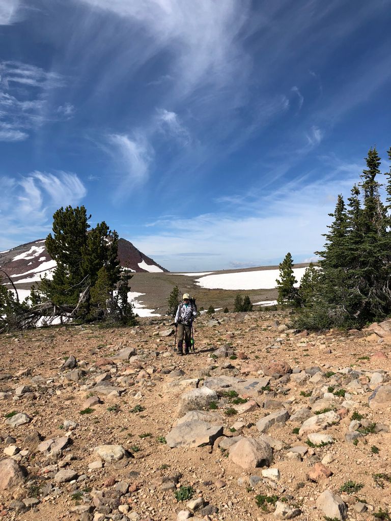
If you plan on following this same route, take comfort in knowing that all you have to do is keep Ball Butte immediately to your right
and you can't go wrong. When we took a break around 7400 feet elevation, we both basked in the perfect tranquility brought about by the absence of mosquitos. I was feeling even better knowing that the terrain was as ideal as anything I could imagine for going cross-country.
Broken Top just seemed to be getting better and better as the clouds did their thing as well.
I can't remember exactly what Tina and I talked about during this stretch of the hike, but I do recall feeling really good about everything. I think both of us were just elated from being free of mosquitos. We didn't really have to follow a precise course here either, since the land was open and free of obstructions.
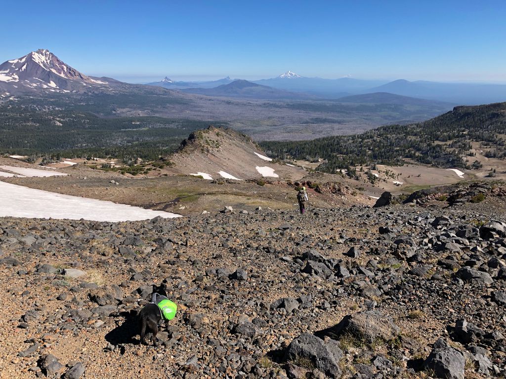
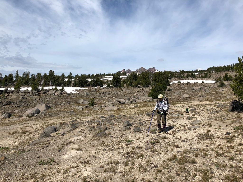
While Tina and I were feeling energized, Juni was starting to lag a bit. That poor little dog had walked 20+ miles over gnarly volcanic rock and dealt with frigid overnight temperatures. She was still moving, but she was very deliberate about her steps. She'd watch me and Tina as we walked, and she'd follow whichever one of us took the easier route.
Those last three miles or so before joining back up with the trail were very, very pleasant. The terrain was very forgiving, making it extremely easy to keep a consistent bearing without any sort of backtracking. It was pleasant enough to erase all the woes from the previous day.
When we joined back up with the trail, we encountered a ton of people were doing day hikes up to Tam McArthur. It's definitely a popular destination. Everyone seemed to get a kick out of Juni and her little backpack. It took us about another 1.5 hours to get back to our car and get all of our gear inside of it. It had been a fabulous trip, but we were both ready to return to the comforts of an environment sealed by walls, windows, and doors.